File:John Martin - Design for a London sewer, 1845 (BL Maps 3485.(7.)).jpg
Jump to navigation
Jump to search
Size of this preview: 800 × 530 pixels. Other resolutions: 320 × 212 pixels | 640 × 424 pixels | 1,024 × 679 pixels | 1,280 × 849 pixels | 2,560 × 1,697 pixels | 4,370 × 2,897 pixels.
Original file (4,370 × 2,897 pixels, file size: 5.5 MB, MIME type: image/jpeg)
Captions
Captions
Add a one-line explanation of what this file represents
Summary[edit]
| Description |
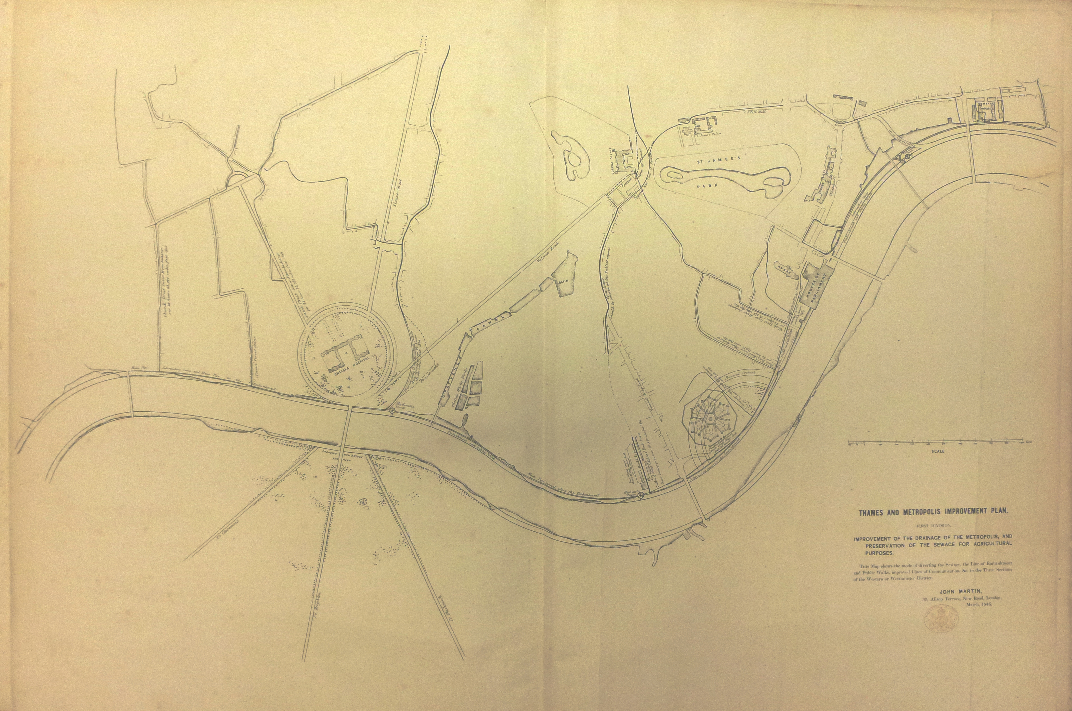
English: "Plan of the London. Connecting Railway and Railway Transit along both banks of the Thames, with an open walk from Hungerford to the Tower and from Vauxhall to Deptford. Metropolis improvement Plan.". By John Martin, 1789-1854. Taken from British Library item Maps 3485.(7.). |
||||
| Date | 1845 | ||||
| Collection | |||||
| Accession number |
Maps 3485.(7.) |
||||
| Source/Photographer |
|
||||
| Permission (Reusing this file) |
|
||||


).jpg&action=edit§ion=1)
File history
Click on a date/time to view the file as it appeared at that time.
| Date/Time | Thumbnail | Dimensions | User | Comment | |
|---|---|---|---|---|---|
| current | 19:47, 4 December 2014 | | 4,370 × 2,897 (5.5 MB) | Andrew Gray (talk | contribs) | =={{int:filedesc}}== {{Artwork |artist = |title = |description = {{en|1="Plan of the London. Connecting Railway and Railway Transit along both banks of the Thames, with an open walk from Hungerford to the Tower and from V... |
You cannot overwrite this file.
File usage on Commons
The following 2 pages use this file:
).jpg)
).jpg&oldid=685347613)