Category:Aberporth
Zur Navigation springen
Zur Suche springen
village and community in Ceredigion, Wales, UK   | |||||
| Medium hochladen | |||||
| Ist ein(e) | |||||
|---|---|---|---|---|---|
| Ort | Ceredigion, Wales | ||||
| Einwohnerzahl |
| ||||
| Fläche |
| ||||
 | |||||
Cymraeg: Pentref a Chymuned yng Ngheredigion, 10km i'r gogledd-ddwyrain o Aberteifi, yw Aberporth. Mae ganddi 2434 o drigolion, a 49% ohonynt yn siarad Cymraeg (Cyfrifiad 2001).
Deutsch: Aberporth ist eine Stadt in Ceredigion an der walisischen Küste, genauer an der Cardigan Bay, bei 52°13' nördlicher Breite und 4°55' westlicher Länge.
Unterkategorien
Es werden 7 von insgesamt 7 Unterkategorien in dieser Kategorie angezeigt:
In Klammern die Anzahl der enthaltenen Kategorien (K), Seiten (S), Dateien (D)
B
C
- Capel Brynmair, Aberporth (2 D)
- Claddfa Hen Gapel Aberporth (3 D)
D
- Dolphin statue, Aberporth (9 D)
S
W
- West Wales Airport (2 D)
Medien in der Kategorie „Aberporth“
Folgende 200 Dateien sind in dieser Kategorie, von 220 insgesamt.
(vorherige Seite) (nächste Seite)-
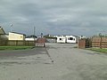
 A sleeper coach on the coastal path - geograph.org.uk - 472487.jpg 640 × 480; 92 KB
-

-
 A487 east out of Blaenporth - geograph.org.uk - 3556375.jpg 640 × 531; 47 KB
-
 Aber-porth NLW3363810.jpg 598 × 408; 44 KB
-
 Aberporth - East beach - geograph.org.uk - 2454946.jpg 1.229 × 922; 287 KB
-
 Aberporth - geograph.org.uk - 2520315.jpg 640 × 480; 60 KB
-
 Aberporth - geograph.org.uk - 4122371.jpg 640 × 480; 83 KB
-
 Aberporth - panoramio (1).jpg 4.000 × 3.000; 4,25 MB
-
 Aberporth - panoramio (10).jpg 4.000 × 3.000; 3,29 MB
-
 Aberporth - panoramio (12).jpg 4.000 × 3.000; 4,17 MB
-
 Aberporth - panoramio (14).jpg 4.000 × 3.000; 4,05 MB
-
 Aberporth - panoramio (2).jpg 4.000 × 3.000; 4 MB
-
 Aberporth - panoramio (3).jpg 4.000 × 3.000; 3,51 MB
-
 Aberporth - panoramio (4).jpg 4.000 × 3.000; 4,05 MB
-
 Aberporth - panoramio (5).jpg 4.000 × 3.000; 4 MB
-
 Aberporth - panoramio (6).jpg 4.000 × 3.000; 3,41 MB
-
 Aberporth - panoramio (8).jpg 4.000 × 3.000; 3,5 MB
-
 Aberporth - panoramio (9).jpg 4.000 × 3.000; 3,33 MB
-
 Aberporth - panoramio.jpg 4.000 × 3.000; 3,36 MB
-
 Aberporth - West beach - geograph.org.uk - 2456457.jpg 1.172 × 878; 243 KB
-
 Aberporth 978623.jpg 640 × 480; 47 KB
-
 Aberporth Airport location.jpg 279 × 326; 54 KB
-
 Aberporth and Cribach Bay - geograph.org.uk - 2842046.jpg 3.264 × 2.448; 3,02 MB
-
 Aberporth beach - geograph.org.uk - 1626163.jpg 640 × 480; 109 KB
-
 Aberporth beach - geograph.org.uk - 2102567.jpg 640 × 480; 63 KB
-
 Aberporth beach - geograph.org.uk - 2520320.jpg 640 × 480; 82 KB
-
 Aberporth Beach - geograph.org.uk - 300972.jpg 640 × 406; 97 KB
-
 Aberporth beach - geograph.org.uk - 4506342.jpg 640 × 480; 75 KB
-
 Aberporth Beach - geograph.org.uk - 54194.jpg 640 × 480; 49 KB
-
 Aberporth Beach - geograph.org.uk - 5776002.jpg 3.888 × 2.592; 3,27 MB
-
 Aberporth beach - geograph.org.uk - 6024982.jpg 2.304 × 1.728; 1,6 MB
-
 Aberporth Beach - geograph.org.uk - 743661.jpg 640 × 430; 83 KB
-
 Aberporth Ceredigion Cymru Wales 03.JPG 4.272 × 2.848; 5,03 MB
-
 Aberporth Ceredigion Cymru Wales 04.JPG 4.272 × 2.848; 3,64 MB
-
 Aberporth Ceredigion Cymru Wales 05.JPG 4.272 × 2.848; 3,79 MB
-
 Aberporth Ceredigion Cymru Wales 06.JPG 2.848 × 4.272; 4,16 MB
-
 Aberporth Ceredigion Cymru Wales 07.JPG 4.272 × 2.848; 4,21 MB
-
 Aberporth Ceredigion Cymru Wales 08.JPG 4.272 × 2.848; 5,18 MB
-
 Aberporth Ceredigion Cymru Wales 09.JPG 4.272 × 2.848; 3,86 MB
-
 Aberporth Ceredigion Cymru Wales 10.JPG 4.272 × 2.848; 5,54 MB
-
 Aberporth Ceredigion Cymru Wales 11.JPG 4.272 × 2.848; 3,36 MB
-
 Aberporth East - geograph.org.uk - 4611899.jpg 5.176 × 2.992; 4,8 MB
-
 Aberporth Highcliffe Hotel - panoramio.jpg 4.000 × 3.000; 3,17 MB
-
 Aberporth NLW3361146.jpg 583 × 440; 44 KB
-
 Aberporth NLW3361147.jpg 585 × 444; 41 KB
-
 Aberporth NLW3363811.jpg 599 × 432; 51 KB
-
 Aberporth Ship inn - panoramio.jpg 4.000 × 3.000; 3,16 MB
-
 Aberporth Sports and Social Club - geograph.org.uk - 4506444.jpg 640 × 480; 64 KB
-
 Aberporth Village Hall - geograph.org.uk - 4506339.jpg 640 × 480; 63 KB
-
 Aberporth, Traeth Dyffryn - geograph.org.uk - 2680414.jpg 3.072 × 2.048; 1,29 MB
-
 Access to Traeth Dyffryn, Aberporth - geograph.org.uk - 5097116.jpg 5.179 × 3.451; 4,12 MB
-
 Admiralty Chart No 1484 Plans in Cardigan Bay, Published 1966 New Edition 1967.jpg 11.056 × 16.232; 38,34 MB
-
 Along the Coastal Path near Mwnt-bâch farm - geograph.org.uk - 2457263.jpg 1.024 × 768; 303 KB
-
 Avenue to Penrallt, Aberporth - geograph.org.uk - 898307.jpg 640 × 468; 129 KB
-
 Beach between Tresaith and Penbryn - geograph.org.uk - 1626110.jpg 640 × 480; 46 KB
-
 Beach scene at Aberporth - geograph.org.uk - 2611828.jpg 640 × 480; 102 KB
-
 Behind Tresaith Road, Aberporth - geograph.org.uk - 4611902.jpg 640 × 432; 100 KB
-
 Boat being removed from the sea at Aberporth Bay - geograph.org.uk - 6240851.jpg 5.182 × 2.915; 4,82 MB
-
 Boats being removed from the sea at Aberporth Bay - geograph.org.uk - 6240849.jpg 4.588 × 3.441; 3,89 MB
-
 Body and Soul - geograph.org.uk - 3812662.jpg 734 × 648; 92 KB
-
-
 Bryhyfryd on the A487 at Blaenannerch - geograph.org.uk - 5551524.jpg 5.179 × 3.451; 4,37 MB
-
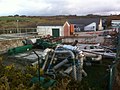
 Buildings and mast on the DERA site, Aberporth - geograph.org.uk - 2456630.jpg 1.280 × 960; 332 KB
-
 Caravan park at Aberporth - geograph.org.uk - 1740199.jpg 640 × 480; 122 KB
-
 Cardigan Coast - geograph.org.uk - 4506950.jpg 640 × 480; 92 KB
-
 Cardigan Coast Path - geograph.org.uk - 4506450.jpg 640 × 480; 152 KB
-
 Cardigan Coast Path - geograph.org.uk - 4506455.jpg 640 × 480; 125 KB
-
 Cardigan Coast Path - geograph.org.uk - 4506461.jpg 640 × 480; 117 KB
-
 Ceredigion Coast Path - geograph.org.uk - 4506627.jpg 640 × 480; 99 KB
-
 Ceredigion Coast Path turns inland - geograph.org.uk - 998270.jpg 480 × 640; 193 KB
-

-
 Clausen rolling platform, Aberporth.jpg 436 × 325; 26 KB
-
 Cliffs and coastal scenery - geograph.org.uk - 2457264.jpg 1.152 × 864; 306 KB
-
 Cliffs at Aberporth - geograph.org.uk - 2459536.jpg 768 × 1.024; 304 KB
-
 Cliffs at Aberporth - geograph.org.uk - 300973.jpg 640 × 427; 120 KB
-
 Cliffs at Fathgarreg - geograph.org.uk - 747431.jpg 480 × 640; 83 KB
-
 Cliffs near Aberporth - geograph.org.uk - 481111.jpg 399 × 600; 102 KB
-
 Cliffs near Aberporth - geograph.org.uk - 6024972.jpg 2.304 × 1.728; 1,78 MB
-
 Coastal Path and footbridge - geograph.org.uk - 2457242.jpg 1.024 × 768; 361 KB
-

-

-
 Coastline near Aberporth - geograph.org.uk - 3623937.jpg 640 × 480; 77 KB
-
 Cottages, Aberporth - geograph.org.uk - 4506341.jpg 640 × 480; 69 KB
-
 Cottages, Aberporth, Ceredigion - geograph.org.uk - 5040813.jpg 640 × 480; 123 KB
-
 Cribach Bay - geograph.org.uk - 54190.jpg 640 × 410; 24 KB
-
 Cribach Bay from the SE - geograph.org.uk - 2459315.jpg 1.152 × 864; 296 KB
-
 Dol-wen.jpg 925 × 463; 110 KB
-
 Dolphin statue at Aberporth - geograph.org.uk - 6241404.jpg 4.929 × 3.696; 5,42 MB
-
 Edge of MoD Aberporth - geograph.org.uk - 998271.jpg 480 × 640; 195 KB
-
 Entrance to Helyg Fach Caravan Park, Aberporth - geograph.org.uk - 2680073.jpg 3.648 × 2.736; 2,35 MB
-
 Erwlas, Aberporth - geograph.org.uk - 4126411.jpg 640 × 360; 39 KB
-
 Evening scene in Aberporth in summer - geograph.org.uk - 4126384.jpg 640 × 360; 43 KB
-
 Fields behind Rhyd, Blaenannerch - geograph.org.uk - 5694636.jpg 5.179 × 3.451; 4,55 MB
-
 First UK flight of Watchkeeper UAV MOD 45151423.jpg 2.000 × 1.328; 1,07 MB
-
 Footbridge in woodland - geograph.org.uk - 2611931.jpg 640 × 480; 125 KB
-
 Footbridge on the Coastal Path - geograph.org.uk - 2456646.jpg 870 × 653; 375 KB
-

-
 Footpath junction on Wales Coast Path - geograph.org.uk - 5695136.jpg 5.179 × 3.451; 5,65 MB
-
 Gate from drive to public footpath - geograph.org.uk - 5695278.jpg 5.179 × 3.440; 5,55 MB
-
 Gate on Wales Coastal Path - geograph.org.uk - 5695253.jpg 5.179 × 3.451; 6,49 MB
-
 Gated entrance to track, Aberporth - geograph.org.uk - 5097346.jpg 5.184 × 3.456; 7,24 MB
-
 Grass track, Trecregyn Farm - geograph.org.uk - 5694713.jpg 5.179 × 3.451; 5,87 MB
-
 Grassy area above and to the east of Aberporth - geograph.org.uk - 6024977.jpg 2.304 × 1.728; 1,83 MB
-
 Headland at Aberporth - geograph.org.uk - 300975.jpg 640 × 410; 69 KB
-
 High above the Allt y Gwrddon - geograph.org.uk - 2456998.jpg 1.152 × 864; 364 KB
-
 Holiday home at Aberporth - geograph.org.uk - 6024962.jpg 2.304 × 1.728; 1,96 MB
-
 House at Cwmhowni - geograph.org.uk - 2611964.jpg 640 × 480; 110 KB
-
 House near Nant Howni, Aberporth - geograph.org.uk - 6075021.jpg 5.179 × 3.451; 4,79 MB
-
 Houses at Fathgarreg - geograph.org.uk - 978626.jpg 640 × 480; 38 KB
-

-
 Incipient cave forming near Aberporth - geograph.org.uk - 2459505.jpg 768 × 1.024; 355 KB
-
 Junction of Bridleway - geograph.org.uk - 37353.jpg 640 × 480; 129 KB
-

-
 Lane to Hendre farm - geograph.org.uk - 2611950.jpg 640 × 480; 83 KB
-

-
 Maes-glas at Llwynbedw - geograph.org.uk - 3556345.jpg 640 × 447; 63 KB
-
 Marine comings and goings - geograph.org.uk - 978629.jpg 640 × 480; 66 KB
-
 Minffordd, Penbryn - geograph.org.uk - 986031.jpg 640 × 469; 91 KB
-

-
 Mmmmm NICE - panoramio.jpg 2.592 × 1.936; 1,76 MB
-
 MOD Aberporth car park 2 (223079992).jpg 1.008 × 1.350; 184 KB
-
 MOD-Qinetiq - geograph.org.uk - 59713.jpg 640 × 495; 46 KB
-
 Muddy track heads inland - geograph.org.uk - 1000781.jpg 480 × 640; 199 KB
-
 Nant Howni, Aberporth - geograph.org.uk - 6074993.jpg 5.179 × 3.451; 5,14 MB
-
 Old chapel conversion in Aberporth - geograph.org.uk - 2611803.jpg 640 × 480; 60 KB
-

-

-
 Older cottage in Aberporth - geograph.org.uk - 4126404.jpg 640 × 360; 59 KB
-
 On the Ceredigion Coastal path - geograph.org.uk - 2456484.jpg 1.280 × 960; 312 KB
-
 On the Ceredigion Coastal Path - geograph.org.uk - 2456642.jpg 710 × 947; 382 KB
-

-
 On the Coastal Path above the Allt y Gwrddon - geograph.org.uk - 2456991.jpg 1.152 × 864; 327 KB
-
 On the Coastal Path, DERA Aberporth beyond - geograph.org.uk - 2457258.jpg 1.152 × 864; 329 KB
-
 On the shoreline at Aberporth - geograph.org.uk - 2611881.jpg 640 × 480; 48 KB
-

-

-

-

-
 Ordnance Survey Flush Bracket (S0554) - geograph.org.uk - 4668527.jpg 480 × 640; 109 KB
-
 Ordnance Survey Flush Bracket S0554 - geograph.org.uk - 3486510.jpg 4.000 × 3.000; 4,06 MB
-
 Ordnance Survey Flush Bracket S7794 - geograph.org.uk - 3486502.jpg 4.000 × 3.000; 4,52 MB
-
 Outside the Qinetiq site - geograph.org.uk - 2456474.jpg 1.229 × 922; 284 KB
-

-
 Parc Aberporth - geograph.org.uk - 54220.jpg 640 × 436; 33 KB
-
 Parcllyn - geograph.org.uk - 4881590.jpg 3.801 × 2.908; 1,15 MB
-

-

-
 Pasture north of Tresaith Road - geograph.org.uk - 5694699.jpg 5.179 × 3.451; 4,32 MB
-
 Pen Traeth-bach - geograph.org.uk - 481095.jpg 399 × 600; 95 KB
-
 Pen-y-Graig - geograph.org.uk - 2680407.jpg 3.072 × 2.048; 1,26 MB
-
 Pencribach - geograph.org.uk - 40159.jpg 640 × 477; 32 KB
-
 Pennar Road - geograph.org.uk - 5695260.jpg 5.179 × 3.451; 4,55 MB
-
 Perimeter Fence - West Wales Airport - geograph.org.uk - 2477413.jpg 1.152 × 864; 453 KB
-
 Picnic tables near Aberporth - geograph.org.uk - 2611793.jpg 640 × 480; 77 KB
-
 Presbyterian Church, Aberporth - geograph.org.uk - 6025012.jpg 2.304 × 1.728; 1,84 MB
-
 Private road, Qinetiq, Parcllyn - geograph.org.uk - 5694809.jpg 5.184 × 3.456; 7,69 MB
-
 Qinetiq site at Parcllyn - geograph.org.uk - 5695080.jpg 5.179 × 3.451; 4,47 MB
-

-
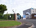
 Qinetiq site entrance at Parcllyn - geograph.org.uk - 4506442.jpg 640 × 480; 64 KB
-
 Radar Serving Aberporth Military Area - geograph.org.uk - 4881586.jpg 1.879 × 1.588; 320 KB
-
 Railway carriage house, Aberporth - geograph.org.uk - 1626176.jpg 640 × 480; 85 KB
-
 Railway carriage house, Aberporth - geograph.org.uk - 1626180.jpg 640 × 480; 70 KB
-
 Railway carriage house, Aberporth - geograph.org.uk - 1626183.jpg 640 × 480; 55 KB
-
 Railway carriage house, Aberporth - geograph.org.uk - 1626188.jpg 640 × 480; 89 KB
-
 Railway carriage houses, Aberporth - geograph.org.uk - 1626170.jpg 640 × 480; 83 KB
-
 Rocks at Aberporth - geograph.org.uk - 2118141.jpg 640 × 480; 69 KB
-
 Rocks at Aberporth - geograph.org.uk - 2118149.jpg 640 × 480; 76 KB
-
 Sea view from the Coastal footpath at Aberporth, Cardigan Bay - panoramio.jpg 2.592 × 1.936; 1,5 MB
-
 Sheep grazing, Helyg-fach - geograph.org.uk - 5551514.jpg 5.184 × 3.456; 7,51 MB
-
 Ship Inn, Aberporth - geograph.org.uk - 978618.jpg 640 × 480; 60 KB
-
 Small business units at Blaenporth - geograph.org.uk - 6085267.jpg 640 × 480; 55 KB
-
 Summer house - geograph.org.uk - 559534.jpg 640 × 480; 111 KB
-
 Tall plant beside the road at Aberporth - geograph.org.uk - 4506358.jpg 480 × 640; 147 KB
-
 The beach, Aberporth - geograph.org.uk - 2118151.jpg 640 × 480; 74 KB
-
 The beaches at Aberporth - geograph.org.uk - 2611809.jpg 640 × 480; 85 KB
-
 The Ship Inn, Aberporth - geograph.org.uk - 6025007.jpg 2.304 × 1.728; 1,81 MB
-

-

-
 The Wales Coast Path near Aberporth - geograph.org.uk - 6024959.jpg 2.304 × 1.728; 1,81 MB
-
 Tipi at Hendre farm - geograph.org.uk - 2611959.jpg 640 × 480; 77 KB
-
 Track from end of Mill Lane, Aberporth - geograph.org.uk - 6075009.jpg 5.179 × 3.451; 4,13 MB
-
 Track to Trecregyn Farm - geograph.org.uk - 5694779.jpg 5.179 × 3.451; 5,46 MB
-
 Tractor on the beach at Aberporth - geograph.org.uk - 6240859.jpg 5.184 × 3.888; 6,21 MB
-
 Traeth Dolwen - geograph.org.uk - 6025009.jpg 2.294 × 1.716; 1,95 MB
-
 Traeth Dolwen ^ Carreg Ogof, Aberporth - geograph.org.uk - 5097290.jpg 5.184 × 3.456; 6,77 MB
-
 Traeth y Gwrddon and the Allt Goch cliffs - geograph.org.uk - 2457252.jpg 864 × 1.152; 352 KB
-
 Tuag at - Towards Aberporth - geograph.org.uk - 4122366.jpg 640 × 480; 89 KB
-
 Undulating landscape on the Coast Path - geograph.org.uk - 4506464.jpg 640 × 480; 107 KB
-
 Varied properties in Aberporth - geograph.org.uk - 2611816.jpg 640 × 480; 74 KB
-
 Very small beach at Aberporth - geograph.org.uk - 2459526.jpg 1.280 × 960; 299 KB
-
 View from the Coast Path - geograph.org.uk - 4506454.jpg 640 × 480; 107 KB
-
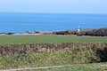
 View over cornfields to Ynys Lochtyn from Aberporth - geograph.org.uk - 5168625.jpg 3.264 × 2.448; 2,1 MB
-
 View over the beach at Aberporth - geograph.org.uk - 6240861.jpg 5.182 × 3.455; 6,14 MB
-
 View over the beach at Aberporth - geograph.org.uk - 6240868.jpg 5.115 × 2.875; 3,56 MB
-

-
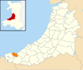 Wales Ceredigion Community Aberporth map.svg 512 × 428; 788 KB
-
 Wales Coast Path west of Parcllyn - geograph.org.uk - 5695092.jpg 5.179 × 3.451; 4,62 MB
-
 Wales Coast Path, near Parcllyn - geograph.org.uk - 5695065.jpg 5.184 × 3.456; 6,8 MB
-
 Waterfall into the sea - geograph.org.uk - 6305307.jpg 3.888 × 5.184; 5,61 MB
-
 Welsh Coast Path at Parcllyn - geograph.org.uk - 4506448.jpg 640 × 480; 81 KB


.jpg)
.jpg)
.jpg)
.jpg)
.jpg)
.jpg)
.jpg)
.jpg)
.jpg)
.jpg)
.jpg)


.jpg)


_-_geograph.org.uk_-_4668527.jpg)


