Category:Adisham
Aller à la navigation
Aller à la recherche
English: Adisham (formerly Adesham) is a village and civil parish in the English county of Kent. The village, six miles south-east of Canterbury, and located on the B2046 road between Wingham and Barham, is known as Edesham in the Domesday Book.
localité britannique du comté anglais du Kent  | |||||
| Téléverser des médias | |||||
| Nature de l’élément | |||||
|---|---|---|---|---|---|
| Lieu | cité de Canterbury, Kent, Angleterre du Sud-Est, Angleterre | ||||
| Superficie |
| ||||
 | |||||
Sous-catégories
Cette catégorie comprend 5 sous-catégories, dont les 5 ci-dessous.
A
- Adisham railway station (16 F)
- Adisham Water Tower (1 F)
H
- Holy Innocents, Adisham (6 F)
O
- Oasts in Adisham (2 F)
Média dans la catégorie « Adisham »
Cette catégorie comprend 329 fichiers, dont les 200 ci-dessous.
(page précédente) (page suivante)-
 2, Pond Cottages, The Street - geograph.org.uk - 5696683.jpg 3 264 × 2 448 ; 3,78 Mio
-
 A signpost near Adisham - geograph.org.uk - 3694131.jpg 913 × 684 ; 177 kio
-
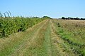
 A strip of wild grass - geograph.org.uk - 4913031.jpg 640 × 426 ; 87 kio
-
 A very large arable field - geograph.org.uk - 4903792.jpg 640 × 353 ; 47 kio
-
 A2 Dover Road to Canterbury - geograph.org.uk - 2058476.jpg 3 072 × 2 304 ; 1,84 Mio
-
 Adams Down Road - geograph.org.uk - 1972754.jpg 1 024 × 683 ; 202 kio
-
 Adisham Baptist Chapel - geograph.org.uk - 1103182.jpg 640 × 480 ; 182 kio
-
 Adisham Baptist Chapel - geograph.org.uk - 4525425.jpg 2 272 × 1 704 ; 923 kio
-
 Adisham Baptist Chapel - geograph.org.uk - 819533.jpg 428 × 640 ; 89 kio
-
 Adisham Church of England Primary School - geograph.org.uk - 3359497.jpg 750 × 562 ; 126 kio
-
 Adisham Church of England Primary School.jpg 640 × 480 ; 124 kio
-
 Adisham Churchyard - geograph.org.uk - 4566004.jpg 4 000 × 3 000 ; 4,18 Mio
-
 Adisham Churchyard - geograph.org.uk - 4566006.jpg 4 000 × 3 000 ; 4,01 Mio
-
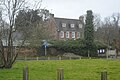
 Adisham Court - geograph.org.uk - 5767367.jpg 640 × 426 ; 77 kio
-
 Adisham Downs Road - geograph.org.uk - 1385593.jpg 640 × 427 ; 59 kio
-
 Adisham Downs Road - geograph.org.uk - 4565985.jpg 4 000 × 3 000 ; 4,31 Mio
-
 Adisham Downs Road - geograph.org.uk - 6196051.jpg 1 024 × 684 ; 226 kio
-
 Adisham Downs Road, Adisham - geograph.org.uk - 2922261.jpg 4 320 × 3 240 ; 3,54 Mio
-
 Adisham Downs Road, Adisham - geograph.org.uk - 2922267.jpg 4 320 × 3 240 ; 4,75 Mio
-
 Adisham Downs Road, near Adisham - geograph.org.uk - 4525381.jpg 2 272 × 1 704 ; 767 kio
-
 Adisham Downs Road, near Adisham - geograph.org.uk - 4525386.jpg 2 272 × 1 704 ; 734 kio
-
 Adisham Downs Road, near Adisham - geograph.org.uk - 4525388.jpg 2 272 × 1 704 ; 818 kio
-
 Adisham Downs Road, near Adisham - geograph.org.uk - 4525392.jpg 2 272 × 1 704 ; 522 kio
-
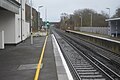
 Adisham Railway Station - geograph.org.uk - 4525892.jpg 2 272 × 1 704 ; 803 kio
-
 Adisham Rd, B2046 - geograph.org.uk - 4913047.jpg 640 × 426 ; 63 kio
-
 Adisham Road, Adisham - geograph.org.uk - 4525900.jpg 2 272 × 1 704 ; 740 kio
-
 Adisham station - geograph.org.uk - 5523352.jpg 640 × 480 ; 143 kio
-
 Adisham Station - geograph.org.uk - 5770525.jpg 640 × 426 ; 75 kio
-
 Adisham Station - geograph.org.uk - 5770530.jpg 640 × 426 ; 64 kio
-
 Adisham Station - geograph.org.uk - 5770544.jpg 640 × 426 ; 69 kio
-
 Adisham Station - geograph.org.uk - 5770552.jpg 640 × 426 ; 75 kio
-
 Adisham Station - geograph.org.uk - 5770557.jpg 640 × 426 ; 71 kio
-
 Adisham Station - geograph.org.uk - 5770558.jpg 640 × 426 ; 87 kio
-
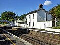 Adisham station building - geograph.org.uk - 5522913.jpg 640 × 480 ; 139 kio
-
 Adisham Village - geograph.org.uk - 5770501.jpg 640 × 426 ; 64 kio
-
 Adisham village hall and recreation ground - geograph.org.uk - 1103198.jpg 640 × 480 ; 199 kio
-
 Adisham Village Sign - geograph.org.uk - 2030261.jpg 3 072 × 2 304 ; 2,86 Mio
-
 Adisham village sign - geograph.org.uk - 4525394.jpg 2 272 × 1 704 ; 800 kio
-
 Adisham Village sign - geograph.org.uk - 5770490.jpg 640 × 426 ; 99 kio
-
 Adisham's wood, Kent, UK - panoramio.jpg 1 023 × 768 ; 294 kio
-
 Alongside Adisham Downs Road - geograph.org.uk - 4565982.jpg 4 000 × 3 000 ; 4,14 Mio
-
 Alongside Bramling Road - geograph.org.uk - 4565973.jpg 4 000 × 3 000 ; 4,1 Mio
-
 Approaching Adisham - geograph.org.uk - 819026.jpg 640 × 428 ; 85 kio
-
 Arable landscape - geograph.org.uk - 4938056.jpg 640 × 426 ; 47 kio
-
 B2046 - geograph.org.uk - 4913045.jpg 640 × 426 ; 77 kio
-
 Barham Downs - geograph.org.uk - 4903736.jpg 640 × 426 ; 46 kio
-
 Barham Downs - geograph.org.uk - 4903737.jpg 640 × 426 ; 58 kio
-
 Barley Field - geograph.org.uk - 1970279.jpg 1 024 × 768 ; 270 kio
-
 Barn and North Downs Way near Upper Digges Farm - geograph.org.uk - 2058107.jpg 3 072 × 2 304 ; 1,91 Mio
-
 Barn at Woodlands Farm - geograph.org.uk - 1972758.jpg 1 024 × 768 ; 214 kio
-
 Barns off Woodlands Road - geograph.org.uk - 1972757.jpg 1 024 × 683 ; 159 kio
-
 Bossington Granary - geograph.org.uk - 2030227.jpg 3 072 × 2 304 ; 2,11 Mio
-
 Bossington Road, Adisham - geograph.org.uk - 4525401.jpg 2 272 × 1 704 ; 858 kio
-
 Brambling Road in the snow. - geograph.org.uk - 316906.jpg 480 × 640 ; 149 kio
-
 Bramling Road - geograph.org.uk - 6197143.jpg 1 024 × 768 ; 321 kio
-
 Bramling Road, Adisham - geograph.org.uk - 4525398.jpg 2 272 × 1 704 ; 889 kio
-
 Bramling Road, near Bekesbourne - geograph.org.uk - 4525363.jpg 2 272 × 1 704 ; 694 kio
-
 Bramling Road, near Bekesbourne - geograph.org.uk - 4525372.jpg 2 272 × 1 704 ; 1,01 Mio
-
 Bridge over Chatham Main Line - geograph.org.uk - 5770555.jpg 640 × 426 ; 72 kio
-
 Bridle gate near Upper Digges Farm - geograph.org.uk - 2058115.jpg 3 072 × 2 304 ; 1,87 Mio
-
 Bridleway and byway junction near Woodlands Farm - geograph.org.uk - 2055801.jpg 3 072 × 2 304 ; 3,48 Mio
-
 Bridleway and farm road on Cooting Down - geograph.org.uk - 1100308.jpg 640 × 480 ; 244 kio
-
 Bridleway and farm track - geograph.org.uk - 1100233.jpg 640 × 480 ; 186 kio
-
 Bridleway and farm track on Cooting Down - geograph.org.uk - 1100316.jpg 640 × 490 ; 297 kio
-
 Bridleway and farm track on Cooting Downs - geograph.org.uk - 1100307.jpg 640 × 480 ; 239 kio
-
 Bridleway and footpath junction beside Oxenden Wood - geograph.org.uk - 2055675.jpg 3 072 × 2 304 ; 3,05 Mio
-
 Bridleway and footpath junction near Woodlands Wood - geograph.org.uk - 2055789.jpg 3 072 × 2 304 ; 2,09 Mio
-
 Bridleway and track junction on the North Downs Way - geograph.org.uk - 2058427.jpg 3 072 × 2 304 ; 2,17 Mio
-
 Bridleway at Oxenden Shaw. - geograph.org.uk - 323044.jpg 640 × 480 ; 239 kio
-
 Bridleway beside Woodlands Wood - geograph.org.uk - 2055782.jpg 3 072 × 2 304 ; 2,37 Mio
-
 Bridleway crosses a byway near Woodlands Manor - geograph.org.uk - 2055703.jpg 3 072 × 2 304 ; 2,72 Mio
-
 Bridleway dividing fields at Squirrel Mills Triangulation Pillar - geograph.org.uk - 4929057.jpg 4 000 × 3 000 ; 2,46 Mio
-
 Bridleway exiting Pitt Wood to Cooting Down - geograph.org.uk - 1100336.jpg 640 × 480 ; 246 kio
-
 Bridleway from Cooting Lane to The Street, Adisham - geograph.org.uk - 6197168.jpg 1 024 × 768 ; 501 kio
-
 Bridleway in Woodlands Wood - geograph.org.uk - 2055740.jpg 3 072 × 2 304 ; 3,37 Mio
-
 Bridleway into Pitt Wood - geograph.org.uk - 1100323.jpg 640 × 480 ; 292 kio
-
 Bridleway junction - geograph.org.uk - 1100311.jpg 640 × 480 ; 243 kio
-
 Bridleway junction near Ileden Cottages - geograph.org.uk - 2055732.jpg 3 072 × 2 304 ; 1,82 Mio
-
 Bridleway junction on the North Downs Way on Barham Downs - geograph.org.uk - 2058391.jpg 3 072 × 2 304 ; 1,97 Mio
-
 Bridleway near Woodlands Farm - geograph.org.uk - 2055669.jpg 3 072 × 2 304 ; 2,26 Mio
-
 Bridleway on Love Lane - geograph.org.uk - 2030308.jpg 3 072 × 2 304 ; 1,92 Mio
-
 Bridleway through Pitt Wood - geograph.org.uk - 1100342.jpg 480 × 640 ; 231 kio
-
 Bridleway to Adisham - geograph.org.uk - 2055627.jpg 3 072 × 2 304 ; 2,63 Mio
-
 Bridleway to Bramling Road - geograph.org.uk - 2055638.jpg 3 072 × 2 304 ; 2,3 Mio
-
 Bridleway to Ileden Farm (2) - geograph.org.uk - 2055717.jpg 3 072 × 2 304 ; 3,07 Mio
-
 Bridleway to Ileden Farm - geograph.org.uk - 2055689.jpg 2 304 × 3 072 ; 2,87 Mio
-
 Bridleway to Ileden Wood - geograph.org.uk - 2058404.jpg 3 072 × 2 304 ; 2,48 Mio
-
 Bridleway to Little Cooting Farm - geograph.org.uk - 1100220.jpg 640 × 492 ; 250 kio
-
 Bridleway towards Bossington - geograph.org.uk - 2030208.jpg 3 072 × 2 304 ; 2,3 Mio
-
 Bridleway, Barham Downs - geograph.org.uk - 4903750.jpg 640 × 379 ; 66 kio
-
 Bridleway, Upper Digges Farm - geograph.org.uk - 4903857.jpg 640 × 426 ; 69 kio
-
 Byway on Cooling Downs - geograph.org.uk - 2055862.jpg 3 072 × 2 304 ; 2,09 Mio
-
 Byway to Woodlands Road - geograph.org.uk - 2055711.jpg 3 072 × 2 304 ; 2,45 Mio
-
 Byway to Woodlands Wood (2) - geograph.org.uk - 2055899.jpg 3 072 × 2 304 ; 1,77 Mio
-
 Byway to Woodlands Wood - geograph.org.uk - 2055875.jpg 3 072 × 2 304 ; 2,02 Mio
-
 Byway to Woodlands Wood - geograph.org.uk - 2059446.jpg 3 072 × 2 304 ; 2,42 Mio
-
 Chatham Main Line, Adisham Station - geograph.org.uk - 5770541.jpg 640 × 426 ; 77 kio
-
 Church Lane, Adisham - geograph.org.uk - 2086090.jpg 640 × 480 ; 156 kio
-
 Church Lane, Adisham - geograph.org.uk - 4525407.jpg 2 272 × 1 704 ; 965 kio
-
 Church of The Holy Innocents - geograph.org.uk - 5767365.jpg 640 × 426 ; 54 kio
-
 Church of The Holy Innocents - geograph.org.uk - 5767368.jpg 640 × 426 ; 68 kio
-
 Church of The Holy Innocents - geograph.org.uk - 5767373.jpg 640 × 426 ; 72 kio
-
 Clearing in Pitt Wood - geograph.org.uk - 1100334.jpg 640 × 480 ; 235 kio
-
 Coldharbour Lane - geograph.org.uk - 1972755.jpg 1 024 × 683 ; 206 kio
-
 Combine Harvester at Bossington Farm - geograph.org.uk - 1974811.jpg 1 024 × 335 ; 104 kio
-
 Cooting Down from Cooting Lane - geograph.org.uk - 1133561.jpg 640 × 480 ; 206 kio
-
 Cooting Lane - geograph.org.uk - 5770511.jpg 640 × 426 ; 72 kio
-
 Cooting Lane, Adisham - geograph.org.uk - 819056.jpg 640 × 428 ; 91 kio
-
 Cooting Lane, Bloodden - geograph.org.uk - 4525433.jpg 2 272 × 1 704 ; 854 kio
-
 Cooting Lane, Bloodden - geograph.org.uk - 4525436.jpg 2 272 × 1 704 ; 673 kio
-
 Cooting Lane, Bloodden - geograph.org.uk - 4525438.jpg 2 272 × 1 704 ; 726 kio
-
 Crops - geograph.org.uk - 5767359.jpg 640 × 426 ; 57 kio
-
 Crops in heavy rain - geograph.org.uk - 5767354.jpg 640 × 426 ; 55 kio
-
 Crossroads near Bossington - geograph.org.uk - 2030242.jpg 3 072 × 2 304 ; 2,09 Mio
-
 Cyclepath near the new bridleway bridge over the A2 Dover Road - geograph.org.uk - 2058503.jpg 3 072 × 2 304 ; 2,01 Mio
-
 Disused chalk pit, Woodlands Road, Adisham. - geograph.org.uk - 323005.jpg 640 × 480 ; 235 kio
-
 Elm House - geograph.org.uk - 5767370.jpg 640 × 426 ; 75 kio
-
 Elm House and Church of The Holy Innocents - geograph.org.uk - 5770497.jpg 640 × 425 ; 51 kio
-
 Enclosed footpath from Twelve Acre Shaw to Woodlands Road - geograph.org.uk - 4929075.jpg 4 000 × 3 000 ; 4,09 Mio
-
 Engine shed, Adisham - geograph.org.uk - 4938047.jpg 640 × 426 ; 120 kio
-
 Entering Adisham - geograph.org.uk - 5767364.jpg 640 × 426 ; 60 kio
-
 Farm track to the Cooling Downs Byway - geograph.org.uk - 2058102.jpg 3 072 × 2 304 ; 1,77 Mio
-
 Farmland at Adisham - geograph.org.uk - 819220.jpg 640 × 428 ; 121 kio
-
 Farmland by the North Downs Way - geograph.org.uk - 4903874.jpg 640 × 426 ; 69 kio
-
 Farmland near Adisham - geograph.org.uk - 819004.jpg 640 × 428 ; 109 kio
-
 Farmland near Adisham - geograph.org.uk - 819343.jpg 640 × 428 ; 144 kio
-
 Farmland, Upper Digges Farm - geograph.org.uk - 4903865.jpg 640 × 426 ; 68 kio
-
 Footbridge, Adisham Station - geograph.org.uk - 5770535.jpg 640 × 426 ; 85 kio
-
 Footpath by Adisham Station - geograph.org.uk - 5770550.jpg 640 × 426 ; 95 kio
-
 Footpath from Adisham - geograph.org.uk - 1103116.jpg 480 × 640 ; 353 kio
-
 Footpath off Station Rd - geograph.org.uk - 5770519.jpg 640 × 426 ; 41 kio
-
 Footpath through Oxenden Wood - geograph.org.uk - 1103132.jpg 640 × 480 ; 315 kio
-
 Footpath to Adisham - geograph.org.uk - 1103112.jpg 640 × 480 ; 285 kio
-
 Footpath to Adisham Station - geograph.org.uk - 5770516.jpg 640 × 426 ; 71 kio
-
 Footpath to Bloodden and Cooting Lane - geograph.org.uk - 1103190.jpg 640 × 480 ; 213 kio
-
 Footpath to Frith Wood - geograph.org.uk - 5767352.jpg 640 × 426 ; 41 kio
-
 Footpath towards the Bramling road bridleway - geograph.org.uk - 2055655.jpg 3 072 × 2 304 ; 2,68 Mio
-
 Footpath towards Woodlands Road - geograph.org.uk - 2055651.jpg 3 072 × 2 304 ; 2,61 Mio
-
 Former goods shed, Adisham station - geograph.org.uk - 5523336.jpg 640 × 480 ; 154 kio
-
 Former goods shed, Adisham Station - geograph.org.uk - 5770533.jpg 640 × 425 ; 50 kio
-
 Former pub, the Moor's Head Inn - geograph.org.uk - 322981.jpg 640 × 480 ; 238 kio
-
 Former site of the Bulls Head, 9, The Street - geograph.org.uk - 5695556.jpg 3 264 × 2 448 ; 3,81 Mio
-
 Frith Wood in heavy rain - geograph.org.uk - 5767351.jpg 640 × 426 ; 38 kio
-
 Frosty afternoon on Cooting Down - geograph.org.uk - 1100315.jpg 640 × 480 ; 227 kio
-
 Gently rolling farmland scenery - geograph.org.uk - 5770517.jpg 640 × 426 ; 47 kio
-
 Grassland, Upper Digges Farm - geograph.org.uk - 4903859.jpg 640 × 426 ; 72 kio
-
 Heap of muck - geograph.org.uk - 6197148.jpg 1 024 × 768 ; 325 kio
-
 House on Station Rd - geograph.org.uk - 5770506.jpg 640 × 425 ; 77 kio
-
 House on The Street, Adisham. - geograph.org.uk - 1103167.jpg 640 × 480 ; 302 kio
-
 Houses along Bossington Road - geograph.org.uk - 3359454.jpg 1 011 × 758 ; 185 kio
-
 Houses along The Street, Adisham - geograph.org.uk - 1103147.jpg 640 × 480 ; 165 kio
-
 Ileden Wood - geograph.org.uk - 4903744.jpg 640 × 426 ; 74 kio
-
 Ileden Wood - geograph.org.uk - 4903776.jpg 640 × 426 ; 94 kio
-
 Ileden Wood - geograph.org.uk - 4903784.jpg 640 × 426 ; 81 kio
-
 Immature Male Common Darter Dragonfly - geograph.org.uk - 2030327.jpg 3 072 × 2 304 ; 1,21 Mio
-
 In Adisham Churchyard - geograph.org.uk - 4565993.jpg 4 000 × 3 000 ; 4,45 Mio
-
 Isolated farm house near Ileden - geograph.org.uk - 335542.jpg 640 × 480 ; 293 kio
-
 Junction of Coldharbour Lane and Brambling Road. - geograph.org.uk - 323094.jpg 640 × 480 ; 230 kio
-
 Lane at Bramling Gap - geograph.org.uk - 5767349.jpg 640 × 426 ; 50 kio
-
 Lane to Adisham - geograph.org.uk - 5767353.jpg 640 × 426 ; 36 kio
-
 Large arable field - geograph.org.uk - 4903786.jpg 640 × 426 ; 61 kio
-
 Leafy track in Pitt Wood - geograph.org.uk - 1100374.jpg 640 × 480 ; 315 kio
-
 Little Bossington Farm House - geograph.org.uk - 2030236.jpg 3 072 × 2 304 ; 1,78 Mio
-
 Looking east along Dorman Avenue North - geograph.org.uk - 4631074.jpg 3 264 × 2 448 ; 1,81 Mio
-
 Looking east from bridleway - geograph.org.uk - 1100226.jpg 640 × 480 ; 210 kio
-
 Looking N along Brambling Road. - geograph.org.uk - 323068.jpg 640 × 480 ; 231 kio
-
 Looking up towards Adisham Church - geograph.org.uk - 4566009.jpg 4 000 × 3 000 ; 4,3 Mio
-
 Looking W across farmland towards Pitt Wood - geograph.org.uk - 1100302.jpg 640 × 480 ; 195 kio
-
 Looking W from Pitt Wood - geograph.org.uk - 1100382.jpg 640 × 480 ; 172 kio
-
 Looking W to Pitt Wood - geograph.org.uk - 1100278.jpg 640 × 480 ; 206 kio
-
 Manor Farm on The Street, Adisham - geograph.org.uk - 1113831.jpg 640 × 480 ; 207 kio
-
 Manor Farmhouse - geograph.org.uk - 5770493.jpg 640 × 426 ; 69 kio
-
 Muddy track in Pitt Wood - geograph.org.uk - 1100365.jpg 640 × 480 ; 319 kio
-
 Near Upper Digges Farm - geograph.org.uk - 4903849.jpg 640 × 426 ; 80 kio
-
 New Bridleway bridge over the A2 Dover Road - geograph.org.uk - 2058443.jpg 3 072 × 2 304 ; 1,56 Mio
-
 North Downs fingerpost - geograph.org.uk - 4913040.jpg 426 × 640 ; 69 kio
-
 North Downs Way - geograph.org.uk - 4903741.jpg 640 × 426 ; 75 kio
-
 North Downs Way - geograph.org.uk - 4903745.jpg 640 × 426 ; 68 kio
-
 North Downs Way - geograph.org.uk - 4903780.jpg 640 × 426 ; 85 kio
-
 North Downs Way - geograph.org.uk - 4903790.jpg 640 × 426 ; 84 kio
-
 North Downs Way - geograph.org.uk - 4903795.jpg 640 × 426 ; 80 kio
-
 North Downs Way - geograph.org.uk - 4903797.jpg 640 × 426 ; 77 kio
-
 North Downs Way - geograph.org.uk - 4903807.jpg 640 × 426 ; 91 kio
-
 North Downs Way - geograph.org.uk - 4903861.jpg 640 × 426 ; 75 kio
-
 North Downs Way - geograph.org.uk - 4903868.jpg 640 × 426 ; 64 kio
-
 North Downs Way - geograph.org.uk - 4903872.jpg 640 × 426 ; 85 kio
-
 North Downs Way near Upper Digges Farm - geograph.org.uk - 2058241.jpg 3 072 × 2 304 ; 1,5 Mio
-
 North Downs Way on Barham Downs - geograph.org.uk - 2058361.jpg 3 072 × 2 304 ; 2,13 Mio
-
 North Downs Way to Upper Digges Farm - geograph.org.uk - 2058074.jpg 3 072 × 2 304 ; 2,53 Mio
-
 North Downs Way to Upper Digges Farm - geograph.org.uk - 2058374.jpg 3 072 × 2 304 ; 2,05 Mio
-
 North Downs Way towards Bramling Road - geograph.org.uk - 2058381.jpg 3 072 × 1 728 ; 1,2 Mio
-
 Number 138 The Street, Adisham - geograph.org.uk - 1103174.jpg 640 × 480 ; 204 kio
-
 On Pond Hill - geograph.org.uk - 5767366.jpg 640 × 425 ; 46 kio
-
 On the edge of Fitzwalter Wood, near Adisham - geograph.org.uk - 156388.jpg 640 × 426 ; 139 kio
-
 Pasture near Adisham - geograph.org.uk - 5767361.jpg 640 × 426 ; 37 kio
-
 Path from the church into Adisham - geograph.org.uk - 2086080.jpg 480 × 640 ; 168 kio
-
 Pond Hill - geograph.org.uk - 5767371.jpg 640 × 426 ; 63 kio
-
 Poppies and rape - geograph.org.uk - 6197160.jpg 1 024 × 768 ; 485 kio
-
 Poppy and rape - geograph.org.uk - 819239.jpg 428 × 640 ; 53 kio
-
 Railway between Bekesbourne and Adisham - geograph.org.uk - 4525375.jpg 2 272 × 1 704 ; 851 kio


_-_geograph.org.uk_-_2055717.jpg)


_-_geograph.org.uk_-_2055899.jpg)


