Category:Aintree
Hopp til navigering
Hopp til søk
village in Aintree Village civil parish in the Metropolitan Borough of Sefton, Merseyside, England, UK  | |||||
| Last opp mediefiler | |||||
| Forekomst av | |||||
|---|---|---|---|---|---|
| Plassering | Aintree Village, Sefton, Merseyside, Nordvest-England, England | ||||
| Folketall |
| ||||
 | |||||

Underkategorier
Denne kategorien har følgende 29 underkategorier, av totalt 29.
- Post boxes in Aintree (9 filer)
- Aintree Village signs (5 filer)
!
- Valued images of Aintree (8 filer)
A
- Aintree Conny Club (2 filer)
- Aintree Picture Framing (3 filer)
B
- Bull Bridge, Aintree (9 filer)
C
H
- Heysham Road bridge, Aintree (3 filer)
L
M
- Mill Square, Aintree (4 filer)
O
- Old Roan bridge (LLC) (6 filer)
- Old Roan Post Office (2 filer)
- Old Roan railway bridge (LLC) (5 filer)
- Old Roan war memorial garden (3 filer)
- Ormskirk Road bridge, Old Roan (4 filer)
P
- Paradox, Aintree (5 filer)
R
- River Alt railway bridge, Aintree (3 filer)
W
- Wango Lane bridge (9 filer)
Filer i kategorien «Aintree»
Følgende 182 filer er i denne kategorien, av totalt 182.
-
 A jockey's eye view of the Grand National course - geograph.org.uk - 4113079.jpg 4 127 × 2 747; 6,41 MB
-
 A well disguised pole - geograph.org.uk - 5600562.jpg 1 024 × 768; 402 KB
-
 Abutment of HTS62.jpg 4 746 × 2 847; 7,19 MB
-
 After the passage - geograph.org.uk - 3410429.jpg 1 280 × 853; 350 KB
-
 Aintree Conservative club - geograph.org.uk - 5244534.jpg 3 648 × 2 736; 2,76 MB
-
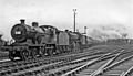
 Aintree Grand National Race Special in Sidings 2035693 1430455f.jpg 640 × 365; 102 KB
-
 Aintree Lane - geograph.org.uk - 5385644.jpg 640 × 427; 356 KB
-
 Aintree Lane, Aintree - geograph.org.uk - 6185501.jpg 1 600 × 1 064; 367 KB
-
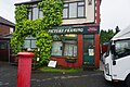 Aintree Picture Framing - geograph.org.uk - 6185494.jpg 1 600 × 1 064; 659 KB
-
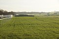 Aintree Race Course - geograph.org.uk - 4297318.jpg 1 024 × 681; 172 KB
-
 Aintree racecourse - geograph.org.uk - 5600617.jpg 1 024 × 768; 153 KB
-
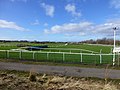
 Aintree Racecourse - geograph.org.uk - 6138670.jpg 800 × 600; 70 KB
-
 Aintree Racecourse at Becher's Brook - geograph.org.uk - 3857486.jpg 1 600 × 1 200; 477 KB
-
 Aintree racecourse looking NE - geograph.org.uk - 3950477.jpg 2 592 × 1 944; 708 KB
-
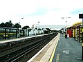
 Aintree railway station - geograph.org.uk - 4378393.jpg 900 × 675; 616 KB
-
 Aintree Retail Park - geograph.org.uk - 2643358.jpg 640 × 480; 59 KB
-
 Aintree Royal British Legion.jpg 4 320 × 3 240; 3,22 MB
-
-
 Aintree Sorting Sidings geograph-2148242.jpg 1 024 × 739; 162 KB
-
 Aintree Station - geograph.org.uk - 2471283.jpg 1 600 × 1 200; 364 KB
-
 Aintree station - Merseyrail train - geograph.org.uk - 5600628.jpg 1 024 × 768; 151 KB
-
 Aintree station - sidings - geograph.org.uk - 5600631.jpg 1 024 × 768; 167 KB
-
 Aintree station entrance - geograph.org.uk - 5600624.jpg 1 024 × 768; 134 KB
-

-
 Aintree, Eton Drive - geograph.org.uk - 5385654.jpg 640 × 427; 374 KB
-
 Aintree, Old Roan Methodist Church - geograph.org.uk - 5385659.jpg 640 × 480; 460 KB
-
 Altway, Aintree.JPG 4 320 × 3 240; 2,58 MB
-
 Approaching The Old Roan Bridge - geograph.org.uk - 4611385.jpg 2 560 × 1 920; 2,25 MB
-
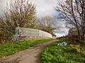
 Aqueduct over the River Alt - geograph.org.uk - 3410386.jpg 1 280 × 853; 520 KB
-
 Aqueduct over the River Alt - geograph.org.uk - 3410394.jpg 1 280 × 853; 261 KB
-
 Arriva building, Ormskirk Road, Aintree.jpg 4 320 × 3 240; 3,25 MB
-
 ASDA supermarket at Aintree - geograph.org.uk - 5115384.jpg 5 184 × 3 888; 6,52 MB
-
 Asda Superstore, Aintree - geograph.org.uk - 5385664.jpg 640 × 427; 331 KB
-
 At Aintree - geograph.org.uk - 4799521.jpg 1 451 × 937; 660 KB
-
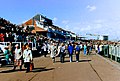 At the Grand National - geograph.org.uk - 4576007.jpg 1 358 × 920; 550 KB
-
 Blue Anchor Bridge No 8 - geograph.org.uk - 5158775.jpg 800 × 568; 158 KB
-
 Blue Anchor public house - geograph.org.uk - 6185500.jpg 1 600 × 1 064; 468 KB
-
 Boundary fence at Aintree Racecourse - geograph.org.uk - 3857484.jpg 1 600 × 1 200; 404 KB
-
 Brick Dust - geograph.org.uk - 2130520.jpg 1 518 × 997; 1,25 MB
-
 Bridge to Helsby Road - geograph.org.uk - 5600554.jpg 1 024 × 768; 374 KB
-
 Bright Lights - geograph.org.uk - 2130587.jpg 2 024 × 1 084; 2,51 MB
-
 Bull Bridge carries Spencer's Lane over the River Alt - geograph.org.uk - 2161927.jpg 1 600 × 1 198; 410 KB
-
 Bull Bridge, Aintree - geograph.org.uk - 3411011.jpg 1 280 × 890; 373 KB
-
 Bull Lane bridge - geograph.org.uk - 5600543.jpg 1 024 × 768; 269 KB
-

-
 Business Park in Aintree, Liverpool - geograph.org.uk - 3068020.jpg 3 070 × 2 302; 2,51 MB
-
 C.C.Bull Bridge - geograph.org.uk - 3411024.jpg 1 280 × 852; 326 KB
-
 Cottages on Melling Road, Aintree.jpg 5 119 × 3 310; 17,53 MB
-
 Curved path, NCN62 - geograph.org.uk - 5600557.jpg 1 024 × 768; 196 KB
-
 Disused garages, Oriel Drive, Aintree - geograph.org.uk - 5244521.jpg 3 200 × 1 953; 1,89 MB
-
 Disused library - geograph.org.uk - 5244530.jpg 3 018 × 1 901; 1,99 MB
-
 Entrance to Aintree Racecourse - geograph.org.uk - 5146987.jpg 800 × 567; 114 KB
-
 Exit from Golf Course, Aintree - geograph.org.uk - 2601240.jpg 640 × 480; 58 KB
-
 Fence on the Aintree Racecourse - geograph.org.uk - 6143989.jpg 800 × 767; 59 KB
-
 Former railway bridge at Aintree - geograph.org.uk - 5600565.jpg 1 024 × 768; 299 KB
-
 Former railway land at Aintree - geograph.org.uk - 5600572.jpg 1 024 × 768; 133 KB
-

-
 George V postbox on School Lane, Aintree - geograph.org.uk - 6139074.jpg 2 320 × 4 359; 2,27 MB
-
 Half way round^ - geograph.org.uk - 4576014.jpg 1 400 × 910; 732 KB
-
 Hancock's Swing Bridge - geograph.org.uk - 4611351.jpg 2 347 × 1 543; 2,03 MB
-
 Handcock's Bridge - geograph.org.uk - 3410405.jpg 1 280 × 853; 448 KB
-
 Handcock's Bridge - geograph.org.uk - 3410417.jpg 1 280 × 853; 280 KB
-
 Handcock's Bridge closed to road traffic - geograph.org.uk - 3410409.jpg 1 280 × 853; 388 KB
-
 Handcock's Bridge from the north - geograph.org.uk - 3410402.jpg 1 280 × 853; 434 KB
-
 Handcock's Bridge from the south - geograph.org.uk - 3410370.jpg 1 280 × 840; 373 KB
-
 Handcock's Bridge, Wango Lane, Aintree - geograph.org.uk - 3580195.jpg 1 024 × 681; 174 KB
-
 Handcock's Swing Bridge No 9 - geograph.org.uk - 5158802.jpg 800 × 513; 131 KB
-
 Hawthorn Shieldbug at Old Roan Station - geograph.org.uk - 5499697.jpg 1 024 × 766; 354 KB
-
 Heron in flight on Leeds Liverpool Canal - geograph.org.uk - 3518678.jpg 1 767 × 1 783; 1,38 MB
-
 Heron In Yoga Pose - geograph.org.uk - 4611373.jpg 2 311 × 1 298; 1,55 MB
-
 Heron on Leeds and Liverpool Canal - geograph.org.uk - 3518673.jpg 489 × 751; 295 KB
-
 Heysham Road bridge abutment (HTS).jpg 5 168 × 2 810; 7,25 MB
-
 Houses on Bull Bridge Lane, Aintree - geograph.org.uk - 6143985.jpg 800 × 476; 57 KB
-

-
 Lancing Drive, Aintree - geograph.org.uk - 5395880.jpg 640 × 480; 75 KB
-
 Leeds and Liverpool Canal at Aintree - geograph.org.uk - 5158749.jpg 800 × 600; 176 KB
-
 Leeds ^ Liverpool Canal - geograph.org.uk - 6185407.jpg 1 600 × 1 065; 561 KB
-
 Leeds ^ Liverpool Canal - geograph.org.uk - 6185411.jpg 1 600 × 1 065; 629 KB
-
 Leeds ^ Liverpool Canal - geograph.org.uk - 6185414.jpg 1 600 × 1 065; 631 KB
-
 Leeds ^ Liverpool Canal - geograph.org.uk - 6185461.jpg 1 600 × 1 065; 590 KB
-
 Leeds ^ Liverpool Canal - geograph.org.uk - 6185464.jpg 1 600 × 1 065; 613 KB
-
 Leeds ^ Liverpool Canal - geograph.org.uk - 6185467.jpg 1 600 × 1 065; 451 KB
-
 Leeds ^ Liverpool Canal - geograph.org.uk - 6185468.jpg 1 600 × 1 065; 441 KB
-
 Leeds ^ Liverpool Canal - geograph.org.uk - 6185470.jpg 1 600 × 1 065; 583 KB
-
 Leeds ^ Liverpool Canal - geograph.org.uk - 6185473.jpg 1 600 × 1 065; 591 KB
-
 Leeds ^ Liverpool Canal - geograph.org.uk - 6185487.jpg 1 600 × 1 065; 549 KB
-
 Leeds ^ Liverpool Canal - geograph.org.uk - 6185492.jpg 1 600 × 1 064; 850 KB
-
 Leeds ^ Liverpool Canal - geograph.org.uk - 6185507.jpg 1 600 × 1 064; 712 KB
-
 Leeds ^ Liverpool Canal - geograph.org.uk - 6185511.jpg 1 600 × 1 064; 629 KB
-
 Leeds ^ Liverpool Canal - geograph.org.uk - 6185518.jpg 1 600 × 1 064; 474 KB
-
 Leeds ^ Liverpool Canal - geograph.org.uk - 6185520.jpg 1 600 × 1 064; 489 KB
-
 Leeds ^ Liverpool Canal - geograph.org.uk - 6185522.jpg 1 600 × 1 064; 591 KB
-
 Leeds ^ Liverpool Canal - geograph.org.uk - 6185524.jpg 1 600 × 1 064; 833 KB
-
 Leeds ^ Liverpool Canal - geograph.org.uk - 6185525.jpg 1 600 × 1 064; 826 KB
-
 Leeds ^ Liverpool Canal - geograph.org.uk - 6185529.jpg 1 600 × 1 064; 735 KB
-
 Leeds ^ Liverpool Canal - geograph.org.uk - 6185531.jpg 1 600 × 1 064; 827 KB
-
 Leeds ^ Liverpool Canal - geograph.org.uk - 6185535.jpg 1 600 × 1 064; 698 KB
-
 Leeds ^ Liverpool Canal - geograph.org.uk - 6185539.jpg 1 600 × 1 064; 765 KB
-

-
 Leeds-Liverpool Canal - geograph.org.uk - 3020172.jpg 1 708 × 1 280; 415 KB
-
 Leeds-Liverpool canal - geograph.org.uk - 3020174.jpg 2 560 × 1 920; 879 KB
-

-
 Liverpool, Railway line near Aintree - geograph.org.uk - 472418.jpg 640 × 480; 127 KB
-
 Lytham Close off Sherwood's Lane - geograph.org.uk - 2161966.jpg 1 600 × 1 198; 352 KB
-
 M57 looking east - geograph.org.uk - 2459140.jpg 640 × 480; 48 KB
-

-
 M57 motorway - the final mile - geograph.org.uk - 2884639.jpg 638 × 450; 101 KB
-
 Maghull, Liverpool - geograph.org.uk - 3068028.jpg 3 026 × 2 240; 2,24 MB
-
 Melling Road bridge - geograph.org.uk - 5395875.jpg 640 × 480; 114 KB
-
 Melling Road, Aintree - geograph.org.uk - 4297327.jpg 1 024 × 681; 136 KB
-
 Melling Road, Aintree - geograph.org.uk - 6143988.jpg 800 × 600; 82 KB
-

-
 Merseyrail train leaving Aintree - geograph.org.uk - 5600592.jpg 1 024 × 768; 206 KB
-
 Milepost on Leeds-Liverpool Canal - geograph.org.uk - 3020134.jpg 2 560 × 1 920; 1,3 MB
-
 Milepost on Leeds-Liverpool Canal - geograph.org.uk - 3020165.jpg 2 560 × 1 920; 1 006 KB
-
 Molyneux Way Shopping Centre, Aintree.JPG 4 320 × 3 240; 2,91 MB
-
 Mowing, Aintree Racecourse - geograph.org.uk - 5395838.jpg 640 × 480; 78 KB
-
 Narrow boat passing Handcock's Bridge - geograph.org.uk - 3410413.jpg 1 280 × 853; 360 KB
-
 NCN62 north of Aintree - geograph.org.uk - 5600633.jpg 1 024 × 768; 158 KB
-
 Northbound Northern Line Merseyrail train in Aintree.jpg 4 320 × 3 240; 3,9 MB
-
 Old Roan - geograph.org.uk - 3489363.jpg 2 433 × 1 824; 1,54 MB
-
 Old Roan Baptist Church (Hope Centre) - geograph.org.uk - 5385456.jpg 640 × 427; 379 KB
-
 Old Roan Methodist Church, Aintree - geograph.org.uk - 5385661.jpg 480 × 640; 505 KB
-
 Old Roan Railway Bridge No 7C - geograph.org.uk - 5157426.jpg 800 × 588; 130 KB
-
 Old Roan Railway Station, Aintree - geograph.org.uk - 5395833.jpg 640 × 480; 62 KB
-
 Old Roan railway station, Merseyside - geograph.org.uk - 3266711.jpg 1 024 × 768; 168 KB
-
 Old Roan railway station, Merseyside - geograph.org.uk - 3266717.jpg 1 024 × 768; 133 KB
-
 Old Roan Station - geograph.org.uk - 5562190.jpg 2 048 × 1 536; 831 KB
-
 Oriel Drive, Aintree - geograph.org.uk - 5244525.jpg 2 562 × 1 752; 1,4 MB
-
 Ormskirk bound Mersey Rail Service departing Old Roan - geograph.org.uk - 6150133.jpg 2 400 × 1 350; 2,83 MB
-
 Ormskirk Road at Aintree - geograph.org.uk - 3857435.jpg 1 024 × 768; 169 KB
-
 Overgrown railway cutting, Aintree - geograph.org.uk - 5600548.jpg 1 024 × 768; 353 KB
-
 Path leading to Leeds ^ Liverpool Canal - geograph.org.uk - 6185504.jpg 1 600 × 1 064; 926 KB
-

-
 Railway bridge over the River Alt - geograph.org.uk - 3410390.jpg 1 280 × 832; 465 KB
-
 Railway bridge over Wango Lane - geograph.org.uk - 2161937.jpg 1 600 × 1 198; 389 KB
-
 Railway crosses the M57 - geograph.org.uk - 3145304.jpg 3 839 × 2 073; 1,65 MB
-
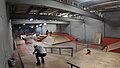 Rampworx skatepark.jpg 1 259 × 717; 144 KB
-
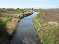
 River Alt - geograph.org.uk - 406444.jpg 600 × 450; 130 KB
-
 River Alt - geograph.org.uk - 6185409.jpg 1 600 × 1 065; 600 KB
-
 River Alt at Aintree - geograph.org.uk - 3580202.jpg 1 024 × 682; 131 KB
-
 River Alt at Aintree - geograph.org.uk - 3580204.jpg 1 024 × 681; 131 KB
-
-
 River Alt near Aintree - geograph.org.uk - 3411018.jpg 1 280 × 853; 346 KB
-

-
 School Lane, Aintree - geograph.org.uk - 6185498.jpg 1 600 × 1 064; 554 KB
-
 Scrub clearance off Wango Lane - geograph.org.uk - 3410347.jpg 1 280 × 853; 528 KB
-
 Second convoy - geograph.org.uk - 3410419.jpg 1 280 × 853; 326 KB
-
 Shop on School Lane, Aintree - geograph.org.uk - 6139078.jpg 640 × 480; 75 KB
-
 Sign for the Blue Anchor, Aintree - geograph.org.uk - 6138666.jpg 481 × 800; 61 KB
-
 Signpost on NCN62, Aintree - geograph.org.uk - 5600550.jpg 1 024 × 768; 241 KB
-
 St Giles Anglican Church - geograph.org.uk - 5244536.jpg 2 695 × 2 057; 1,78 MB
-
 Swing bridge on B5194 at Aintree - geograph.org.uk - 4113817.jpg 1 024 × 768; 254 KB
-
 The Aintree Mound on Grand National day - geograph.org.uk - 2902159.jpg 640 × 447; 163 KB
-
 The approach to Handcock's Bridge - geograph.org.uk - 3410366.jpg 1 280 × 853; 421 KB
-
 The Blue Anchor - geograph.org.uk - 5395830.jpg 640 × 480; 53 KB
-
 The Blue Anchor, Aintree - geograph.org.uk - 6138665.jpg 800 × 504; 61 KB
-
 The Hope Centre, Aintree - geograph.org.uk - 5395835.jpg 640 × 474; 63 KB
-
 The Leeds and Liverpool Canal - geograph.org.uk - 3046488.jpg 4 592 × 3 056; 6,37 MB
-
 The Leeds and Liverpool Canal, Aintree - geograph.org.uk - 6138668.jpg 800 × 600; 101 KB
-

-
 The morning of the 2012 Grand National - geograph.org.uk - 2902168.jpg 640 × 480; 216 KB
-
 The Old Roan Methodist Church, Altway - geograph.org.uk - 4113283.jpg 4 090 × 2 459; 7,56 MB
-
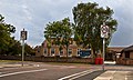
 The Old Roan Public House, Aintree - geograph.org.uk - 5029189.jpg 1 024 × 682; 132 KB
-
 The Princess Royal Stand at Aintree Racecourse - geograph.org.uk - 3857442.jpg 1 024 × 768; 192 KB
-

-
 The River Alt near Aintree - geograph.org.uk - 5158821.jpg 800 × 519; 126 KB
-
 The River Alt, Aintree - geograph.org.uk - 6143984.jpg 800 × 600; 87 KB
-
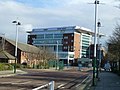
 Thoms and Dolan Business Centre, Aintree.jpg 4 320 × 3 240; 2,96 MB
-

-
 Train at Old Roan Station, Aintree - geograph.org.uk - 4706184.jpg 1 024 × 681; 146 KB
-
 Train leaving Old Roan Station, Aintree - geograph.org.uk - 4706187.jpg 1 024 × 681; 182 KB
-
 Trans-Pennine Trail signpost, Ormskirk Road, Aintree.jpg 2 955 × 4 596; 7,8 MB
-
 View from The Mound at Aintree - geograph.org.uk - 2902175.jpg 640 × 480; 213 KB
-
 View of the Aintree race course - geograph.org.uk - 2902171.jpg 640 × 480; 212 KB
-
 Waiting for the bridge to open - geograph.org.uk - 3410375.jpg 1 280 × 853; 504 KB
-
 Wango Lane bridge - geograph.org.uk - 3046468.jpg 4 592 × 3 056; 6,28 MB
-
 Wango Lane sign.jpg 4 983 × 3 356; 24,35 MB
-
 Wango Lane swing bridge - geograph.org.uk - 2161947.jpg 640 × 479; 117 KB
-
 Wango Lane, Aintree - geograph.org.uk - 3489319.jpg 3 648 × 2 736; 2,38 MB
-
 Welcome sign on Wango Lane - geograph.org.uk - 2162620.jpg 1 600 × 1 198; 394 KB
-
 Winners enclosure at Aintree - geograph.org.uk - 2902165.jpg 640 × 480; 188 KB


.jpg)


_-_geograph.org.uk_-_5385456.jpg)


