Category:Ashurst, Hampshire
Zur Navigation springen
Zur Suche springen
Dorf im District New Forest von Hampshire, England  | |||||
| Medium hochladen | |||||
| Ist ein(e) | |||||
|---|---|---|---|---|---|
| Liegt in Schutzgebiet | |||||
| Ort | Ashurst and Colbury, New Forest, Hampshire, Südostengland, England | ||||
 | |||||
Deutsch: Ashurst ist ein Dorf im District New Forest von Hampshire, England, das zusammen mit Colbury Hamlet das Parish Ashurst and Colbury bildet. Ashurst liegt an der A35 in der Nähe der Konurbation Southampton. Der Volkszählung aus dem Jahre 2001 zufolge hatte das Parish eine Einwohnerzahl von 2.011. Das Parish liegt an der Grenze zum geplanten New-Forest-Nationalpark. Das Dorf hat einen Campingplatz, einige Läden und einen Bahnhof. Es gibt drei Kneipen: The Happy Cheese, The New Forest Hotel und The Forest Inn.
English: Ashurst is a village in the New Forest district of Hampshire, England, which together with Colbury hamlet makes the parish of Ashurst and Colbury. Ashurst is on the A35 road near the Southampton conurbation. According to the 2001 census the parish had a population of 2,011. The parish is on the edge of the designated New Forest National Park area. The village has a campsite, some shops and a railway station. There are three pubs called The Happy Cheese, The New Forest Hotel and The Forest Inn. There used to be another pub by the name of the Angry cheese, opposite the Happy cheese, on the other side of the road, but this was destroyed by a fire sometime before 1989.
Unterkategorien
Diese Kategorie enthält folgende Unterkategorie:
In Klammern die Anzahl der enthaltenen Kategorien (K), Seiten (S), Dateien (D)
A
Medien in der Kategorie „Ashurst, Hampshire“
Folgende 24 Dateien sind in dieser Kategorie, von 24 insgesamt.
-
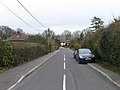
 A35 - geograph.org.uk - 159844.jpg 640 × 480; 47 KB
-
 Ashurst Hospital - geograph.org.uk - 210558.jpg 640 × 416; 151 KB
-
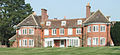
 Ashurst Lodge.jpg 250 × 191; 30 KB
-
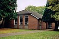
 Ashurst shopping centre - geograph.org.uk - 3921360.jpg 640 × 370; 84 KB
-
 Ashurst, Hampshire, England.jpg 3.614 × 2.593; 2,91 MB
-
 Ashurstcampusarielview.jpg 300 × 182; 63 KB
-
 Ashurstlodge.jpg 346 × 159; 82 KB
-
 Beech Road, Ashurst - geograph.org.uk - 1860540.jpg 640 × 480; 109 KB
-
 Cecil Avenue, Ashurst - geograph.org.uk - 1860516.jpg 640 × 480; 94 KB
-
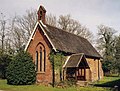
 Church Hall at Colbury - geograph.org.uk - 2047679.jpg 640 × 427; 201 KB
-
 Dene Road, Ashurst - geograph.org.uk - 1860523.jpg 640 × 480; 94 KB
-
 Former Workhouse Chapel, Ashhurst - geograph.org.uk - 1508153.jpg 640 × 488; 142 KB
-
 Grazing ponies, Ashurst, New Forest - geograph.org.uk - 68726.jpg 640 × 480; 126 KB
-
 New Road, Ashurst - geograph.org.uk - 1860529.jpg 640 × 480; 88 KB
-
 Playground by Whartons Lane - geograph.org.uk - 1063666.jpg 640 × 480; 124 KB
-
 St Joseph, Ashurst - geograph.org.uk - 1868159.jpg 1.600 × 1.070; 544 KB
-
 Stream across a lawn - geograph.org.uk - 1306646.jpg 640 × 480; 319 KB
-
 The New Forest, Ashurst - geograph.org.uk - 1062400.jpg 640 × 480; 101 KB
-
 Whartons Close, Ashurst - geograph.org.uk - 1766236.jpg 640 × 480; 66 KB
-
 Whartons Lane, Ashurst - geograph.org.uk - 1766246.jpg 640 × 480; 104 KB
-
 Wood Road, Ashurst - geograph.org.uk - 1860535.jpg 640 × 480; 101 KB
-
 Ashurst Hospital, New Forest - geograph.org.uk - 68795.jpg 640 × 480; 120 KB
-
 Field - geograph.org.uk - 159842.jpg 640 × 480; 47 KB
-


