Category:Aylestone, Leicestershire
Jump to navigation
Jump to search
English: Aylestone is a suburb of Leicester, England. It is south-west of Leicester City Centre, but to the east of the River Soar.

suburb of Leicester, United Kingdom  | |||||
| Upload media | |||||
| Instance of | |||||
|---|---|---|---|---|---|
| Location | Leicester, City of Leicester, Leicestershire, East Midlands, England | ||||
| Different from | |||||
 | |||||
Subcategories
This category has the following 6 subcategories, out of 6 total.
A
- Aylestone Meadows (52 F)
- Aylestone Mill Lock (6 F)
- Aylestone Packhorse Bridge (16 F)
H
- Aylestone Hall (5 F)
Media in category "Aylestone, Leicestershire"
The following 200 files are in this category, out of 615 total.
(previous page) (next page)-
 'Beach' on the River Biam - geograph.org.uk - 5592700.jpg 544 × 800; 176 KB
-
 106 Pack Horse Bridge - geograph.org.uk - 2120933.jpg 800 × 531; 167 KB
-
 106 Pack Horse Bridge - geograph.org.uk - 2120962.jpg 800 × 531; 156 KB
-
 15th-century Aylestone packhorse bridge - geograph.org.uk - 4712378.jpg 800 × 607; 204 KB
-
 7536 Aylestone 6-72.jpg 837 × 528; 115 KB
-
 A cold and foggy day along Milligan Road - geograph.org.uk - 4305798.jpg 1,600 × 1,143; 351 KB
-
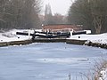 A cold and frozen Aylestone Mill Lock - geograph.org.uk - 2811730.jpg 3,264 × 2,448; 2.87 MB
-
 A flooded Braunstone Lane East - geograph.org.uk - 676629.jpg 640 × 432; 77 KB
-
 A flooded City Cleansing Football Club - geograph.org.uk - 3276007.jpg 3,025 × 2,089; 1.38 MB
-
 A flooded City Cleansing Football Club pavilion - geograph.org.uk - 3276119.jpg 2,995 × 1,821; 1.47 MB
-
 A flooded River Biam - geograph.org.uk - 6309156.jpg 800 × 610; 106 KB
-
 A frozen Grand Union Canal - geograph.org.uk - 3308222.jpg 3,981 × 2,879; 3.6 MB
-
 A May evening on Milligan Road - geograph.org.uk - 5786316.jpg 1,024 × 682; 829 KB
-
 A snowy and frozen Aylestone Mill Lock - geograph.org.uk - 2811609.jpg 3,264 × 2,448; 2.68 MB
-
 A sunny Sunday afternoon at Grace Road - geograph.org.uk - 5362049.jpg 1,024 × 732; 689 KB
-

-
 A426 Lutterworth Road towards Leicester - geograph.org.uk - 3675086.jpg 1,600 × 1,178; 528 KB
-
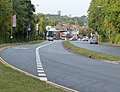 A426 Lutterworth Road towards Leicester - geograph.org.uk - 3675090.jpg 1,600 × 1,225; 507 KB
-
 Aldi Park in Aylestone - geograph.org.uk - 5278985.jpg 800 × 492; 135 KB
-

-
 Alleyway to Grace Road - geograph.org.uk - 2792641.jpg 3,264 × 2,448; 2.97 MB
-
 Alleyway to Grace Road - geograph.org.uk - 5562107.jpg 656 × 800; 201 KB
-

-
 Atop the Middleton Street bridge - geograph.org.uk - 1175097.jpg 640 × 580; 84 KB
-
 Autumn along the towpath of the Grand Union Canal - geograph.org.uk - 3750713.jpg 1,500 × 1,600; 1.3 MB
-
 Autumn colours on the Aylestone Meadows - geograph.org.uk - 3746690.jpg 1,600 × 1,322; 339 KB
-

-
 Aylestone Drive in Aylestone - geograph.org.uk - 4329320.jpg 1,600 × 1,073; 377 KB
-
 Aylestone Globe (detail) in Leicester - geograph.org.uk - 5907115.jpg 835 × 1,280; 1.3 MB
-
 Aylestone Globe (detail) in Leicester - geograph.org.uk - 5907116.jpg 1,280 × 960; 1.54 MB
-
 Aylestone Globe (detail) in Leicester - geograph.org.uk - 5907117.jpg 1,280 × 960; 1.67 MB
-

-
 Aylestone Globe and bench - geograph.org.uk - 3750653.jpg 1,600 × 1,274; 830 KB
-
 Aylestone Globe in Leicester - geograph.org.uk - 5906919.jpg 1,280 × 960; 1.61 MB
-
 Aylestone Globe in the snow - geograph.org.uk - 2811755.jpg 2,607 × 2,189; 2.2 MB
-
 Aylestone Globe in the snow - geograph.org.uk - 2812027.jpg 3,194 × 2,345; 2.55 MB
-
 Aylestone Globe in the snow - geograph.org.uk - 5626644.jpg 800 × 431; 123 KB
-
 Aylestone Globe next to the towpath - geograph.org.uk - 5530674.jpg 800 × 600; 168 KB
-
 Aylestone Hall Gardens - geograph.org.uk - 2057542.jpg 2,935 × 1,882; 2.19 MB
-
 Aylestone Hall Gardens - geograph.org.uk - 5326752.jpg 800 × 535; 156 KB
-
 Aylestone Hall Gardens - geograph.org.uk - 5597265.jpg 800 × 482; 137 KB
-
 Aylestone Hall Gardens Sun Dial - geograph.org.uk - 5436871.jpg 465 × 800; 105 KB
-
 Aylestone Health Centre - geograph.org.uk - 3672007.jpg 3,765 × 2,623; 3.09 MB
-
 Aylestone Lock, Leicester - geograph.org.uk - 4528219.jpg 1,920 × 1,080; 587 KB
-
 Aylestone Mill Bridge - geograph.org.uk - 2811985.jpg 3,264 × 2,260; 3.38 MB
-
 Aylestone Mill Bridge in Leicester - geograph.org.uk - 5906916.jpg 1,280 × 960; 1.43 MB
-
 Aylestone Mill Bridge No 108 - geograph.org.uk - 5626638.jpg 800 × 488; 124 KB
-
 Aylestone Mill Bridge No 108 - geograph.org.uk - 5635924.jpg 800 × 475; 156 KB
-
 Aylestone Mill Bridge No 108 - geograph.org.uk - 6392473.jpg 800 × 490; 135 KB
-

-
 Aylestone Mill Lock - geograph.org.uk - 2120831.jpg 800 × 531; 164 KB
-
 Aylestone Mill Lock - geograph.org.uk - 2812025.jpg 3,264 × 2,448; 2.41 MB
-
 Aylestone Mill Lock - geograph.org.uk - 3308217.jpg 3,562 × 2,673; 2.73 MB
-
 Aylestone Mill Lock in the snow - geograph.org.uk - 2811968.jpg 3,264 × 2,448; 2.47 MB
-
 Aylestone Mill Lock No 39 - geograph.org.uk - 2515794.jpg 4,000 × 3,000; 2.88 MB
-
 Aylestone Mill Lock No 39 - geograph.org.uk - 5240855.jpg 800 × 588; 132 KB
-
 Aylestone Mill Lock No 39 - geograph.org.uk - 5443937.jpg 800 × 485; 101 KB
-

-

-

-
 Aylestone Mill Lock on the River Soar in Leicester - geograph.org.uk - 5906429.jpg 1,440 × 958; 1.56 MB
-
 Aylestone Mill Lock on the River Soar in Leicester - geograph.org.uk - 5906512.jpg 1,440 × 979; 1.53 MB
-
 Aylestone Mill Lock on the River Soar in Leicester - geograph.org.uk - 5906912.jpg 1,280 × 960; 1.37 MB
-
 Aylestone Mill Lock under water - geograph.org.uk - 3250726.jpg 3,456 × 2,468; 2.52 MB
-
 Aylestone Park - geograph.org.uk - 2121331.jpg 800 × 531; 120 KB
-
 Aylestone Park Post Office - geograph.org.uk - 732778.jpg 640 × 428; 65 KB
-
 Aylestone Playing Fields - geograph.org.uk - 441780.jpg 640 × 456; 108 KB
-
 Aylestone Road - geograph.org.uk - 2792643.jpg 3,001 × 2,123; 2.73 MB
-
 Aylestone Road at the Raw Dykes - geograph.org.uk - 2678003.jpg 2,358 × 1,445; 1.91 MB
-
 Aylestone Road away from Leicester - geograph.org.uk - 5018194.jpg 640 × 430; 75 KB
-

-
 Aylestone Road in Aylestone, Leicester - geograph.org.uk - 5638352.jpg 800 × 551; 148 KB
-

-
 Aylestone Road towards Leicester City centre - geograph.org.uk - 2678010.jpg 2,256 × 2,122; 1.51 MB
-
 Aylestonians badge 2.jpg 300 × 240; 14 KB
-
 Barriers on Middleton Street, Aylestone - geograph.org.uk - 6393413.jpg 800 × 517; 141 KB
-

-
 Belvoir Drive in Aylestone - geograph.org.uk - 5460064.jpg 800 × 450; 103 KB
-

-
 Blossom along Grace Road in Aylestone - geograph.org.uk - 5345972.jpg 800 × 472; 179 KB
-

-

-
 Boardwalk across the Aylestone Meadows - geograph.org.uk - 5263518.jpg 800 × 554; 132 KB
-

-

-
 Bowling green in Aylestone Hall Gardens - geograph.org.uk - 2057590.jpg 2,414 × 2,976; 3.37 MB
-
 BP petrol station on Aylestone Road - geograph.org.uk - 5402272.jpg 800 × 419; 64 KB
-
 Braunstone Lane East at night - geograph.org.uk - 676772.jpg 640 × 565; 78 KB
-
 Braunstone Lane East bridge - geograph.org.uk - 5367383.jpg 800 × 597; 122 KB
-
 Braunstone Lane East flooding - geograph.org.uk - 484719.jpg 640 × 480; 136 KB
-
 Braunstone Lane East in Aylestone - geograph.org.uk - 4229911.jpg 1,600 × 1,156; 588 KB
-
 Braunstone Lane East in Aylestone - geograph.org.uk - 5394036.jpg 800 × 489; 147 KB
-
 Braunstone Lane East in Aylestone - geograph.org.uk - 5586967.jpg 649 × 800; 206 KB
-
 Bridge 104 - geograph.org.uk - 2355208.jpg 640 × 427; 85 KB
-
 Bridge 106 - Freestone Bridge - geograph.org.uk - 1042054.jpg 640 × 463; 129 KB
-
 Bridge 106 - Freestone Bridge - geograph.org.uk - 1166078.jpg 640 × 481; 117 KB
-
 Bridge over Grand Union Canal - geograph.org.uk - 100853.jpg 640 × 480; 100 KB
-
 Bridge over the Grand Union Canal - geograph.org.uk - 2121319.jpg 800 × 531; 126 KB
-

-
 Bungalows at Montrose Road South - geograph.org.uk - 5261864.jpg 800 × 600; 146 KB
-
 Burgess Road in Aylestone - geograph.org.uk - 5267962.jpg 800 × 638; 131 KB
-
 Burgess Road in Aylestone Park - geograph.org.uk - 5479724.jpg 800 × 498; 88 KB
-
 Burnt out car under the viaduct - geograph.org.uk - 6385549.jpg 800 × 450; 107 KB
-

-
 Canal Bridge near Aylestone Mill Lock - geograph.org.uk - 2120818.jpg 800 × 531; 158 KB
-
 Canal Bridge over the Grand Union Canal - geograph.org.uk - 2120881.jpg 800 × 531; 166 KB
-

-
 Canal Street in Aylestone - geograph.org.uk - 3262370.jpg 3,755 × 2,727; 3.19 MB
-

-
 Church of St Andrew, Aylestone - geograph.org.uk - 2515817.jpg 4,000 × 3,000; 2.93 MB
-
 Church of St Edward the Confessor, Aylestone - geograph.org.uk - 2515778.jpg 4,000 × 3,000; 2.91 MB
-
 Church Road in Aylestone - geograph.org.uk - 5627312.jpg 800 × 536; 116 KB
-

-

-
 Close up of the Aylestone Globe - geograph.org.uk - 5443940.jpg 800 × 450; 133 KB
-
 Clubhouse under construction - geograph.org.uk - 3248471.jpg 1,802 × 1,323; 680 KB
-
 Coach on Aylestone Road - geograph.org.uk - 5530663.jpg 800 × 571; 90 KB
-
 Conaglen Road - geograph.org.uk - 3768215.jpg 640 × 478; 46 KB
-

-
 Construction of a new medical centre - geograph.org.uk - 3275996.jpg 3,219 × 2,430; 2.49 MB
-
 Construction of a new medical centre - geograph.org.uk - 3276139.jpg 4,000 × 3,000; 3.35 MB
-
-

-

-

-

-

-

-

-
 County cricket at Grace Road - geograph.org.uk - 5362000.jpg 1,024 × 732; 712 KB
-
 Cowslips on the Aylestone Meadows - geograph.org.uk - 5349922.jpg 800 × 544; 152 KB
-
 Culverts under Canal Street - geograph.org.uk - 1166071.jpg 640 × 471; 110 KB
-

-
 Cygnets on the Grand Union Canal - geograph.org.uk - 2120969.jpg 800 × 531; 92 KB
-

-

-

-
 Depth gauge on the River Biam - geograph.org.uk - 5367398.jpg 800 × 609; 172 KB
-

-

-

-

-
 Disraeli Street in Aylestone - geograph.org.uk - 2918480.jpg 2,827 × 2,149; 2.02 MB
-
 Disraeli Street in Aylestone - geograph.org.uk - 5264242.jpg 800 × 651; 100 KB
-
 Dragonfly Walk in Aylestone, Leicester - geograph.org.uk - 5414517.jpg 800 × 450; 105 KB
-
 Duncan Road and Milligan Road in the snow - geograph.org.uk - 356153.jpg 640 × 480; 166 KB
-
 Duncan Road in Aylestone - geograph.org.uk - 2918482.jpg 2,447 × 1,811; 1.54 MB
-
 Duncan Road in the snow - geograph.org.uk - 2792634.jpg 2,156 × 1,772; 1.32 MB
-
 Duncan Road, Aylestone Park - geograph.org.uk - 3157407.jpg 640 × 480; 57 KB
-
 Electricity pylons on the Aylestone Meadows - geograph.org.uk - 3508627.jpg 2,512 × 1,682; 1.13 MB
-
 Elston Fields - geograph.org.uk - 4923843.jpg 1,920 × 1,080; 600 KB
-
 Elton John on stage - geograph.org.uk - 4990783.jpg 800 × 764; 140 KB
-

-
 Factories next to the Grand Union Canal - geograph.org.uk - 5311659.jpg 800 × 600; 107 KB
-
 Factory on Vaughan Road - geograph.org.uk - 5503738.jpg 800 × 450; 96 KB
-
 Family of swans on the Grand Union Canal - geograph.org.uk - 5245058.jpg 800 × 702; 157 KB
-
 Family of swans on the Grand Union Canal - geograph.org.uk - 5507037.jpg 800 × 560; 174 KB
-
-
 Farmyard at the Village Farm, Aylestone - geograph.org.uk - 5262755.jpg 800 × 583; 188 KB
-
 Fire damage on the Aylestone Meadows - geograph.org.uk - 2678410.jpg 3,264 × 2,448; 4.01 MB
-

-
 Fischer County Ground, Grace Road - geograph.org.uk - 5366314.jpg 800 × 625; 83 KB
-
 Flats under construction - geograph.org.uk - 4072202.jpg 1,600 × 1,212; 444 KB
-
 Flooded Aylestone Playing Fields - geograph.org.uk - 676678.jpg 640 × 458; 125 KB
-
 Flooded Aylestone Playing Fields - geograph.org.uk - 676684.jpg 640 × 449; 90 KB
-
 Flooded clubhouse under construction - geograph.org.uk - 3276092.jpg 3,239 × 2,402; 2.44 MB
-

-
 Flooded horse paddocks on the Aylestone Meadows - geograph.org.uk - 3728918.jpg 1,600 × 1,200; 721 KB
-
 Flooded path on the Aylestone Meadows - geograph.org.uk - 3276106.jpg 2,975 × 2,207; 1.97 MB
-
 Flooded playground - geograph.org.uk - 3276087.jpg 3,277 × 2,435; 2.42 MB
-

-
 Flooded Spearwort Fields - geograph.org.uk - 3248839.jpg 2,646 × 2,329; 1.2 MB
-
 Flooded towpath at Aylestone Mill Lock - geograph.org.uk - 3250703.jpg 4,000 × 3,000; 4.85 MB
-
 Flooded towpath at Aylestone Mill Lock - geograph.org.uk - 3275984.jpg 3,762 × 2,805; 2.51 MB
-
 Flooding along Braunstone Lane East - geograph.org.uk - 3042210.jpg 2,925 × 2,123; 1.59 MB
-
 Flooding along Braunstone Lane East - geograph.org.uk - 3042223.jpg 3,200 × 2,325; 3.92 MB
-
 Flooding along Braunstone Lane East - geograph.org.uk - 3262355.jpg 3,987 × 2,803; 3.38 MB
-
 Flooding along Braunstone Lane East - geograph.org.uk - 3262359.jpg 4,000 × 3,000; 3.71 MB
-
 Flooding along Braunstone Lane East - geograph.org.uk - 3276063.jpg 4,000 × 3,000; 3.59 MB
-
 Flooding along Middleton Street - geograph.org.uk - 6285884.jpg 800 × 429; 116 KB
-

-
 Flooding along the Grand Union Canal - geograph.org.uk - 3248832.jpg 2,157 × 1,571; 631 KB
-
 Flooding along the Grand Union Canal - geograph.org.uk - 6285820.jpg 800 × 461; 130 KB
-
 Flooding along the Grand Union Canal - geograph.org.uk - 6393411.jpg 800 × 595; 217 KB
-

-
 Flooding along the River Biam - geograph.org.uk - 3248810.jpg 2,875 × 1,958; 1.85 MB
-

-
 Flooding at 105 Pack Horse Bridge - geograph.org.uk - 3248760.jpg 4,000 × 3,000; 3.59 MB
-
 Flooding at Aylestone Mill Lock - geograph.org.uk - 3250574.jpg 3,402 × 2,372; 2.52 MB
-
 Flooding at Aylestone Mill Lock - geograph.org.uk - 3250721.jpg 4,000 × 3,000; 3.43 MB
-
 Flooding at Aylestone Mill Lock - geograph.org.uk - 3250722.jpg 4,000 × 3,000; 3.47 MB
-
 Flooding at the Packhorse Bridge - geograph.org.uk - 3248737.jpg 2,919 × 1,694; 1.55 MB
-
 Flooding at the Packhorse Bridge - geograph.org.uk - 3248761.jpg 4,000 × 3,000; 4.92 MB
-
 Flooding at the Packhorse Bridge - geograph.org.uk - 3248803.jpg 4,000 × 3,000; 4.52 MB
-
 Flooding near the Packhorse Bridge - geograph.org.uk - 3248821.jpg 3,264 × 2,448; 1.92 MB
-
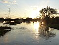
 Flooding on the Aylestone Meadows - geograph.org.uk - 3042215.jpg 2,121 × 1,922; 773 KB
-
 Flooding on the Aylestone Meadows - geograph.org.uk - 3042222.jpg 2,933 × 2,032; 1.2 MB
-
 Flooding on the Aylestone Meadows - geograph.org.uk - 3248743.jpg 4,000 × 3,000; 3.47 MB
-
 Flooding on the Aylestone Meadows - geograph.org.uk - 3248806.jpg 3,343 × 2,478; 2.61 MB
-
 Flooding on the Aylestone Meadows - geograph.org.uk - 6286234.jpg 800 × 450; 112 KB


_in_Leicester_-_geograph.org.uk_-_5907115.jpg)
_in_Leicester_-_geograph.org.uk_-_5907116.jpg)
_in_Leicester_-_geograph.org.uk_-_5907117.jpg)


.jpg)


