Category:Bad Sobernheim
Salti al navigilo
Salti al serĉilo
komunumo en Rejnlando-Palatinato, Germanio  _COA.svg)  | |||||
| Alŝuti plurmedion | |||||
| Estas |
| ||||
|---|---|---|---|---|---|
| Loko | distrikto Bad Kreuznach, Rejnlando-Palatinato, Germanio | ||||
| Loĝantaro |
| ||||
| Areo |
| ||||
| Supermara alteco |
| ||||
| oficiala retejo | |||||
 | |||||
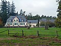
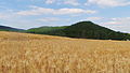
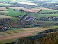
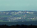
Deutsch: Die Stadt Sobernheim liegt an der mittleren Nahe im Landkreis Bad Kreuznach in Rheinland-Pfalz (Deutschland).
English: Bad Sobernheim is a town and a municipality in the district of Bad Kreuznach, in Rhineland-Palatinate, Germany.
Subkategorioj
Ĉi tiu kategorio havas la 16 jenajn subkategoriojn, el 16 entute.
A
B
- Barfußpfad Bad Sobernheim (16 D)
E
F
J
N
- Nahe in Bad Sobernheim (1 D)
- Naturschutzgebiet Maasberg (6 D)
P
S
- Stolpersteine in Bad Sobernheim (18 D)
W
Dosieroj en kategorio “Bad Sobernheim”
La jenaj 129 dosieroj estas en ĉi tiu kategorio, el 129 entute.
-
 DEU Bad Sobernheim (1924) COA.svg 512 × 771; 26 KB
-
 DEU Bad Sobernheim COA.svg 702 × 742; 140 KB
-
 Wappen bad sobernheim.jpg 191 × 208; 16 KB
-
 20160328 121205960 iOS.jpg 3 264 × 2 448; 2,28 MB
-
 2019 Bad Sobernheim 01.jpg 5 808 × 3 872; 4,83 MB
-
 2019 Bad Sobernheim Marktplatz 01.jpg 8 453 × 5 241; 9,2 MB
-
 Ausblick auf Sobernheim 1.jpg 4 160 × 3 120; 2,57 MB
-
 Ausblick auf Sobernheim 2.jpg 4 160 × 3 120; 3,81 MB
-
 Ausblick auf Sobernheim.jpg 4 160 × 3 120; 2,28 MB
-
 Bad Sobernheim - Barfußpfad - panoramio.jpg 4 000 × 3 000; 3,78 MB
-
 Bad Sobernheim - Bei BollAnt's im Park - 1 - panoramio.jpg 4 000 × 3 000; 3,83 MB
-
 Bad Sobernheim - Bei BollAnt's im Park - 4 - panoramio.jpg 4 000 × 3 000; 3,98 MB
-
 Bad Sobernheim - ehemaliges Kasernengelände Dörndich - panoramio.jpg 4 000 × 3 000; 4,36 MB
-
 Bad Sobernheim - ehemaliges Kurhaus "Neues Leben" - panoramio.jpg 3 191 × 2 317; 3,42 MB
-
 Bad Sobernheim - Herbst an der B 41 - 07.10.08 - panoramio.jpg 3 456 × 2 592; 777 KB
-
 Bad Sobernheim - Herbst an der Nahe - panoramio.jpg 1 600 × 1 200; 436 KB
-
 Bad Sobernheim - Kettensägekunst Boris Beuscher - panoramio.jpg 4 000 × 3 000; 3,95 MB
-
 Bad Sobernheim - Kreuzstraße - panoramio.jpg 3 000 × 4 000; 3,6 MB
-
 Bad Sobernheim - Leinenborn - panoramio - giggel.jpg 3 456 × 2 592; 4,09 MB
-
 Bad Sobernheim - Leinenborn - panoramio.jpg 1 600 × 1 200; 414 KB
-
 Bad Sobernheim - Leinenborner Weg und Leinenborn - panoramio.jpg 1 600 × 1 200; 415 KB
-
 Bad Sobernheim - Morgenstimmung - panoramio.jpg 4 000 × 3 000; 4,15 MB
-
 Bad Sobernheim - panoramio (1).jpg 11 183 × 3 894; 6,13 MB
-
 Bad Sobernheim - panoramio (2).jpg 4 000 × 3 000; 1,85 MB
-
 Bad Sobernheim - panoramio.jpg 1 845 × 921; 639 KB
-
 Bad Sobernheim - Tal östlich von Leinenborn - panoramio.jpg 1 600 × 1 200; 433 KB
-
 Bad Sobernheim - Von Leinenborn Richtung Domberg - panoramio.jpg 1 600 × 1 200; 740 KB
-
 Bad Sobernheim - Wilde Nahe am Barfußpfad - panoramio.jpg 4 000 × 3 000; 4,14 MB
-
 Bad Sobernheim am frühen Morgen - panoramio.jpg 4 000 × 3 000; 5,34 MB
-
 Bad Sobernheim in KH.svg 276 × 276; 210 KB
-
 Bad Sobernheim um 1600.png 3 904 × 1 254; 4,89 MB
-

-
 Bad Sobernheim – Bonsai-Tiger beim Sonnenbad..... - panoramio.jpg 4 320 × 3 240; 4,12 MB
-

-
 Bad Sobernheim – hungriger Bonsai-Tiger ..... - panoramio.jpg 4 320 × 3 240; 3,89 MB
-
 Bad Sobernheim – Hängebrücke am Barfußpfad über die Nahe - panoramio.jpg 4 000 × 3 000; 8,81 MB
-
 Bad Sobernheim-Leinenborn - panoramio (1).jpg 11 103 × 2 535; 6,16 MB
-
 Bad Sobernheim-Leinenborn - panoramio (2).jpg 4 320 × 3 240; 5,25 MB
-
 Bad Sobernheim-Leinenborn - panoramio.jpg 4 000 × 3 000; 7,48 MB
-
 Bad Sobernheim-Steinhardt - panoramio (1).jpg 4 000 × 3 000; 4,38 MB
-
 Bad Sobernheim-Steinhardt - panoramio (2).jpg 4 320 × 1 849; 1,98 MB
-
 Bad Sobernheim-Steinhardt - panoramio.jpg 4 000 × 3 000; 4,12 MB
-
 Bad Sobernheim-Steinhardt – Bundesstraße 41 - panoramio.jpg 4 320 × 3 240; 3,82 MB
-
 Bad-sobernheim neues-leben runde-mauer.jpg 4 000 × 3 000; 2,95 MB
-
 Bad-Sobernheim-Ansicht-Nord-Ost.jpg 2 816 × 2 112; 415 KB
-
 Bad-Sobernheim-Fussgängerzone.jpg 2 816 × 2 112; 518 KB
-
 Bad-Sobernheim.jpg 2 032 × 893; 1,1 MB
-
 BadSobernheim BarefootPark kerscher01.jpg 1 920 × 1 627; 490 KB
-
 Bauvorhaben Bad Sobernheim.jpg 4 000 × 2 000; 3,65 MB
-
 Blick auf Staudernheim - panoramio (1).jpg 4 000 × 3 000; 9,5 MB
-
 Blick auf Staudernheim - panoramio.jpg 3 399 × 2 079; 5,5 MB
-
 Blick vom Aussichtspunkt Heimberg in Merxheim nach Bad Sobernheim und Duchroth - panoramio.jpg 11 716 × 2 937; 7,43 MB
-

-

-
 Blick vom Langenthaler Steinbruch zum Soonwald von Ellerspring bis Opel - panoramio.jpg 10 388 × 3 155; 6,16 MB
-
 Blick von der Alteburg im Soonwald in den Pfälzer Wald - panoramio.jpg 6 299 × 2 356; 1,86 MB
-
 Blick von der Alteburg in Richtung Dickenschied - panoramio.jpg 11 513 × 2 560; 2,85 MB
-

-

-
 Blick von Leinenborn über Bad Sobernheim nach Meddersheim - panoramio.jpg 4 000 × 3 000; 14,48 MB
-
 Blick zur Ellerspring - 10.10.08 - panoramio.jpg 3 456 × 2 592; 4,21 MB
-
 Blick über die Wintergerstenfelder zum Gonrather Hof - panoramio.jpg 4 320 × 3 240; 2,66 MB
-
 Blumengruß aus Eckweiler - panoramio.jpg 1 308 × 988; 312 KB
-

-

-
De-Bad Sobernheim.ogg 2,4 s; 23 KB
-
 Der Fuchs und die Elstern - panoramio.jpg 3 560 × 2 299; 1,19 MB
-
 DetBurSob.JPG 1 686 × 1 488; 348 KB
-
 Donnersberg in der Pfalz – von der Alteburg im Soonwald aus gesehen - panoramio.jpg 4 320 × 3 240; 4,69 MB
-
 Eckweiler - 30. August 2015 - panoramio (1).jpg 4 000 × 3 000; 3,29 MB
-
 Eckweiler - 30. August 2015 - panoramio (2).jpg 4 000 × 3 000; 3,63 MB
-
 Eckweiler - 30. August 2015 - panoramio (3).jpg 2 626 × 2 992; 1,49 MB
-
 Eckweiler - 30. August 2015 - panoramio (5).jpg 4 000 × 3 000; 3,49 MB
-
 Eckweiler - 30. August 2015 - panoramio (6).jpg 4 000 × 3 000; 1,99 MB
-
 Eckweiler - 30. August 2015 - panoramio (7).jpg 4 000 × 3 000; 3,13 MB
-
 Eckweiler - 30. August 2015 - panoramio (8).jpg 4 000 × 3 000; 3,66 MB
-
 Eckweiler - 30. August 2015 - panoramio.jpg 4 000 × 3 000; 2,28 MB
-
 Eckweiler - Abendsonne (HDR) - panoramio.jpg 960 × 1 205; 415 KB
-
 Eckweiler – 31. August 2014 - panoramio (1).jpg 4 320 × 3 240; 3,02 MB
-
 Eckweiler – 31. August 2014 - panoramio.jpg 4 320 × 3 240; 2,42 MB
-
 Eckweiler – 31. August 2014 – Panorama vom Soonwald bis Eckweiler - panoramio.jpg 24 305 × 2 564; 9,14 MB
-
 Eckweiler – 31. August 2014 – Panorama von Alt-Rehbach, Rehbach, Daubach bis Auen - panoramio.jpg 28 207 × 2 572; 10,71 MB
-
 Eckweiler – Die Trauerweide, alter und neuer Treffpunkt (HDR) - panoramio.jpg 960 × 1 280; 348 KB
-
 Entenpfuhl - Forstamt Soonwald - panoramio.jpg 4 000 × 3 000; 4,07 MB
-
 Former electric power station.jpg 3 712 × 5 568; 10,29 MB
-
 Germany - Bad Sobernheim - Marktplatz - panoramio.jpg 4 000 × 3 000; 6,9 MB
-
 Germany - Boos an der Nahe - panoramio.jpg 2 854 × 1 629; 917 KB
-

-
 Henau – von der Alteburg aus gesehen - panoramio.jpg 3 736 × 1 866; 1,95 MB
-
 Herbstgarten in Bad Sobernheim - panoramio.jpg 4 000 × 3 000; 3,9 MB
-

-
 Hängebrücke über die Nahe - panoramio.jpg 4 000 × 3 000; 5,7 MB
-
 Immentanz auf dem Sonnenhut - panoramio.jpg 4 000 × 3 000; 4,87 MB
-
 Kirche von Osten - panoramio.jpg 2 048 × 1 536; 890 KB
-
 Landschaft zwischen Seesbach und Gonratherhof - panoramio.jpg 4 320 × 3 240; 3,72 MB
-
 Leinenborn - Pferdsfelder Straße - panoramio.jpg 2 048 × 1 536; 1,04 MB
-
 Leinenborn - West (Ausschnitt) - panoramio.jpg 1 600 × 1 200; 432 KB
-
 Leinenborn - West - panoramio.jpg 1 600 × 1 200; 403 KB
-
 Leinenborn - Wildes Tal in der Mitte - panoramio.jpg 1 600 × 1 200; 453 KB
-
 Meddersheim - panoramio (1).jpg 13 700 × 3 398; 6,6 MB
-
 Meddersheim – 16.10.2009 - panoramio.jpg 3 456 × 2 592; 5,03 MB
-
 Monzingen und Merxheim - panoramio.jpg 4 320 × 3 240; 1,98 MB
-
 Nahetal bei Meddersheim - panoramio.jpg 4 320 × 3 240; 4,41 MB
-
 Naturschutzgebiet Maasberg Blick Richtung Süden.jpg 4 032 × 3 024; 5,23 MB
-
 Naturschutzgebiet- Maasberg.JPG 4 608 × 2 592; 4,34 MB
-
 Neubaugebiet Bad Sobernheim-Leinenborn ll - panoramio.jpg 3 996 × 2 007; 5,67 MB
-
 Nußbaum – Ricke mit Kitz beim Abendausflug - panoramio.jpg 4 320 × 3 240; 3,82 MB
-
 Palatinatus Rheni (Merian) 178.jpg 2 000 × 1 501; 455 KB
-
 Panorama – zwischen Eckweiler und Daubach - panoramio.jpg 18 521 × 2 627; 6,06 MB
-
 Rehbach - 10.10.08 - panoramio - giggel.jpg 3 456 × 2 592; 3,71 MB
-
 Rehbach - 10.10.08 - panoramio.jpg 3 456 × 2 592; 4,35 MB
-
 Rehbach - panoramio (1).jpg 4 000 × 3 000; 4,58 MB
-
 Rohrbach – von der Alteburg aus gesehen - panoramio.jpg 7 179 × 2 525; 1,89 MB
-
 Schweißhundegrab an der Ippenschieder Trift - panoramio.jpg 4 000 × 3 000; 4,37 MB
-
 Schöne Wanderwege im Soonwald - panoramio.jpg 1 600 × 1 200; 446 KB
-
 Sechspunkt Widderchen - Bad Sobernheim September 2006 - panoramio.jpg 1 600 × 1 200; 429 KB
-
-
 Soonwald an der Alteburg - panoramio.jpg 3 240 × 4 320; 4,31 MB
-
 Soonwald – Wanderparkplatz Rennweg - Ellerspring - panoramio.jpg 3 240 × 4 320; 4,98 MB
-
 Spall – Gebroth – Allenfeld – Winterbach - Ippenschied (von links) - panoramio.jpg 3 254 × 1 342; 1,83 MB
-
 Staudernheim von Leinenborn aus - panoramio - giggel.jpg 2 048 × 1 536; 1,22 MB
-
 Tagpfauenauge - panoramio (1).jpg 2 142 × 2 242; 1,89 MB
-

-

-

-
 Weingut Steinhardter Hof - panoramio (1).jpg 3 208 × 2 365; 3,14 MB
-
 Weingut Steinhardter Hof - panoramio.jpg 3 000 × 4 000; 4,71 MB
-
 Weingut Tullius - panoramio.jpg 4 000 × 1 981; 2,88 MB
-
 Womrath – von der Alteburg aus gesehen - panoramio.jpg 7 773 × 2 991; 2,33 MB


.jpg)


_Der_Lehmpastor_wirkte_von_1896_bis_1914_in_Repelen_bei_Moers_und_von_1915_bis_1925_hier_in_Bad_Sobernheim_-_panoramio.jpg)


.jpg)

.jpg)
.jpg)


.jpg)


_-_panoramio.jpg)


.jpg)
.jpg)
.jpg)
.jpg)
.jpg)
.jpg)
.jpg)

_-_panoramio.jpg)
.jpg)

_-_panoramio.jpg)


_-_panoramio.jpg)


_178.jpg)


.jpg)


.jpg)
.jpg)
.jpg)

.jpg)


.jpg)
.jpg)
.jpg)
_-_panoramio.jpg)