Category:Baja California
Hoppa till navigering
Hoppa till sök
delstat i Mexiko      | |||||
| Ladda upp media | |||||
| Instans av |
| ||||
|---|---|---|---|---|---|
| Plats | Mexiko | ||||
| Ligger i eller vid vattenområde | |||||
| Centralort | |||||
| Lagstiftande församling |
| ||||
| Regeringschef |
| ||||
| Datum för grundande eller skapande |
| ||||
| Betydande händelse | |||||
| Folkmängd |
| ||||
| Area |
| ||||
| Höjd över havet |
| ||||
| Föregås av |
| ||||
| Ersätter |
| ||||
| Ej samma som | |||||
| officiell webbplats | |||||
 | |||||
English: Baja California state is the most northern and western state of México, located in the northern portion of the Baja California Peninsula.
For the whole peninsula, see Category: Baja California Peninsula - and for the southern state, see Category: Baja California Sur.
For the whole peninsula, see Category: Baja California Peninsula - and for the southern state, see Category: Baja California Sur.
Underkategorier
Denna kategori har följande 25 underkategorier (av totalt 25).
!
C
E
F
G
H
M
P
R
- Rancho El Cipres (11 f)
S
T
- The Flying Samaritans (3 f)
V
- Videos from Baja California (4 f)
Sidor i kategorin ”Baja California”
Följande 2 sidor (av totalt 2) finns i denna kategori.
Media i kategorin ”Baja California”
Följande 39 filer (av totalt 39) finns i denna kategori.
-
 (Mapa-2) Las Californias.jpg 684 × 855; 80 kbyte
-
 Alberto Oviedo Mota (Reacomodo).jpg 1 024 × 576; 92 kbyte
-
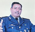 Alfonso Duarte Múgica.jpg 810 × 739; 50 kbyte
-
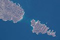
 AS09-19-3009 (21899767942).jpg 4 400 × 4 600; 1,19 Mbyte
-
 AS09-21-3262 (21904102772).jpg 4 400 × 4 600; 1,34 Mbyte
-
 AS09-21-3289 (21925804101).jpg 4 400 × 4 600; 1,2 Mbyte
-
 AS09-22-3359 (21846993278).jpg 4 400 × 4 600; 1,55 Mbyte
-
 AS16-118-18859 (21077929424).jpg 4 275 × 4 275; 8 Mbyte
-
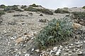 Astragalus anemophilus el socorro dunes.jpg 2 048 × 1 365; 630 kbyte
-
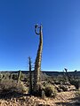
 Cirio Fouquieria columnaris 03.jpg 3 024 × 4 032; 4,37 Mbyte
-
 Cirio Fouquieria columnaris 04.jpg 3 024 × 4 032; 2,46 Mbyte
-
 Cirio Fouquieria columnaris 08.jpg 3 024 × 4 032; 3,66 Mbyte
-
 Cirio Fouquieria columnaris 10.jpg 3 024 × 4 032; 1,05 Mbyte
-
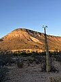 Cirio Fouquieria columnaris al atardecer.jpg 3 024 × 4 032; 3,1 Mbyte
-
 Cirio Fouquieria columnaris al caer la tarde.jpg 3 024 × 4 032; 1,85 Mbyte
-
 Cirio zona apical.jpg 3 024 × 4 032; 4,21 Mbyte
-
 Diving in Mexico Banner.png 2 864 × 410; 1,15 Mbyte
-
 Dudleya crassifolia.jpg 2 048 × 1 365; 921 kbyte
-
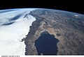
 Earth observation taken by Expedition 68 crew (iss068e025025).jpeg 5 568 × 3 712; 1,8 Mbyte
-
 Entrega de tierras al Rancho 40 (Actual ejido hermosillo).jpg 3 072 × 4 608; 2,99 Mbyte
-
 Escudo de SSC Baja California.jpg 587 × 567; 56 kbyte
-
 Escudo FESC SSC Baja California.png 829 × 829; 645 kbyte
-
 Escudo San Felipe Baja California.png 499 × 768; 583 kbyte
-
 Familia reunida en el día de muertos.jpg 1 900 × 1 267; 1,32 Mbyte
-
 FGE-logo.jpg 1 485 × 1 485; 111 kbyte
-
 Hot-Springs-Puertecitos.jpg 3 024 × 4 032; 3,18 Mbyte
-
 ISS002-E-6416 - View of Mexico.jpg 3 060 × 2 092; 1,08 Mbyte
-
 ISS061-E-101164 - View of Earth (Cropped).jpg 3 712 × 4 463; 2,11 Mbyte
-
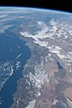 ISS061-E-101164 - View of Earth.jpg 3 712 × 5 568; 2,2 Mbyte
-
 Logo de la UABC.svg 412 × 596; 88 kbyte
-
 LOGO GOBBC CEE.png 1 024 × 366; 118 kbyte
-
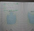 Mexico Baja California passport stamp.jpg 359 × 335; 181 kbyte
-
 Niebla arenaria.jpg 2 048 × 1 365; 754 kbyte
-
 Puertecitos-Baja-California.jpg 4 032 × 3 024; 3,33 Mbyte
-
 Puertecitos-BajaCalifornia.jpg 3 024 × 4 032; 2,59 Mbyte
-
 Puertecitos-Hot-Springs.jpg 4 032 × 3 024; 3,41 Mbyte
-
 Tijuana en el tiempo.jpg 1 920 × 1 080; 292 kbyte
-
 Tronco del árbol Cirio.jpg 1 980 × 3 520; 2,32 Mbyte
-
 Utilería Titanic Rosarito.jpg 960 × 720; 44 kbyte
_Las_Californias.jpg)
.jpg)

.jpg)
.jpg)
.jpg)
.jpg)
.jpg)


.jpeg)
.jpg)


.jpg)


