Category:Barnsley
ナビゲーションに移動
検索に移動

イングランドの都市  | |||||
| メディアをアップロード | |||||
| 分類 | |||||
|---|---|---|---|---|---|
| 場所 | メトロポリタン・バラ・オブ・バーンズリー, サウス・ヨークシャー, ヨークシャー・アンド・ザ・ハンバー, イングランド | ||||
| 人口 |
| ||||
| 面積 |
| ||||
 | |||||
English: Barnsley is a town in South Yorkshire, England.
NB Many of the images in this category have been miscategorised and should be in subcategories of the Metropolitan Borough of Barnsley, please remove this message once fixed
下位カテゴリ
このカテゴリに属する 29 個のサブカテゴリのうち、 29 個を表示しています。
- Postcards of Barnsley (2ファイル)
- Views of Barnsley (1ファイル)
A
B
- Barnsley and District Hospital (4ファイル)
- Barnsley Building Society (2ファイル)
- Barnsley Main Colliery (1ファイル)
C
K
L
M
- Monckton Coke Works (10ファイル)
O
- Old Moor RSPB reserve (67ファイル)
S
- Smithies, South Yorkshire (3ファイル)
W
- Wharncliffe Woods (7ファイル)
カテゴリ「Barnsley」にあるメディア
このカテゴリに属する 1,086 個のファイルのうち、 200 個を表示しています。
(前のページ) (次のページ)-
De-Barnsley.ogg 1.7秒;17キロバイト
-
 "Potential" Address Harthill Road - geograph.org.uk - 479852.jpg 640 × 480;79キロバイト
-

-
 18th Century Waymarking - geograph.org.uk - 922030.jpg 480 × 640;118キロバイト
-

-
 75 CaCannon Hall gardensnnonHallGuideBook 2052-gardens (9605441681).jpg 3,872 × 2,592;986キロバイト
-

-
 A bleak lunchtime at Cannon Hall Country Park - geograph.org.uk - 708530.jpg 640 × 480;107キロバイト
-
 A carpet of blue - geograph.org.uk - 786566.jpg 524 × 640;166キロバイト
-
 A lonely bunch of daffodils - geograph.org.uk - 785155.jpg 512 × 640;77キロバイト
-
 A61 Roadworks - geograph.org.uk - 1145994.jpg 640 × 480;69キロバイト
-
 A616 Trunk Road Layby - geograph.org.uk - 385121.jpg 640 × 480;66キロバイト
-
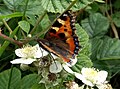 Aglais urticae - geograph.org.uk - 471826.jpg 640 × 476;78キロバイト
-
 Alongside the A629 Thurgoland - geograph.org.uk - 1194967.jpg 640 × 424;69キロバイト
-
 Amphitheatre - geograph.org.uk - 310194.jpg 640 × 480;97キロバイト
-
 An Irish homestead, Bray. (NBY 443416).jpg 3,600 × 2,333;911キロバイト
-
 An Unforgetable Sunset at Barnsley.jpg 976 × 549;41キロバイト
-
 An Urban Allotment.JPG 3,872 × 2,592;3.11メガバイト
-
 Another Colourful Barnsley Sunset.JPG 6,000 × 4,000;7.64メガバイト
-
 Artist (7699286274).jpg 2,482 × 3,248;6.33メガバイト
-
 Asda Barnsley Car Park - geograph.org.uk - 1382673.jpg 640 × 480;53キロバイト
-
 Athersley Rec 1.jpg 2,592 × 1,944;933キロバイト
-
 Athersley Rec 2.jpg 2,592 × 1,944;1.36メガバイト
-
 Athersley Rec 3.jpg 2,592 × 1,944;1.06メガバイト
-
 Athersley village, 16 September 2014.jpg 2,592 × 1,456;988キロバイト
-
 Backs of 34 to 22 Cope Street - geograph.org.uk - 966561.jpg 640 × 436;68キロバイト
-
 Baled for Winter - geograph.org.uk - 531668.jpg 640 × 475;114キロバイト
-
 BandQ DIY Stairfoot, Barnsley - geograph.org.uk - 1748786.jpg 800 × 558;98キロバイト
-
 Banks Bottom Dike - geograph.org.uk - 680755.jpg 480 × 640;124キロバイト
-
 Barnby Furnace area - geograph.org.uk - 131568.jpg 426 × 640;157キロバイト
-
 Allotment fencing - geograph.org.uk - 730225.jpg 640 × 413;72キロバイト
-
 Barnsley (35910032933).jpg 5,184 × 3,888;4.52メガバイト
-
 Barnsley (36549922052).jpg 3,888 × 5,184;7.67メガバイト
-

-
-
 Barnsley Ambulance centre - geograph.org.uk - 583548.jpg 640 × 374;67キロバイト
-
 Barnsley Archives Searchroom.jpg 330 × 330;24キロバイト
-
 Barnsley at Night).jpg 6,000 × 4,000;8.09メガバイト
-
 Barnsley Banner.jpg 3,862 × 552;498キロバイト
-
 Barnsley Belles (6843369410).jpg 4,447 × 2,964;2.13メガバイト
-
 Barnsley Chronicle logo.png 280 × 50;6キロバイト
-
 Barnsley Dial-a-Ride, BarnsleyMay 2004 (13626159445).jpg 1,280 × 960;386キロバイト
-
 Barnsley dot.png 417 × 599;122キロバイト
-
 Barnsley full of glory - geograph.org.uk - 1654875.jpg 640 × 480;69キロバイト
-
 Barnsley Market (15772497296).jpg 5,054 × 3,369;1.11メガバイト
-
 Barnsley Municipal Offices.JPG 3,390 × 2,267;978キロバイト
-
 Barnsley New Collage.jpg 3,264 × 3,264;9.44メガバイト
-
 Barnsley new digital campus - geograph.org.uk - 1168042.jpg 640 × 473;60キロバイト
-

-

-
 Barnsley UK ward map 2022.svg 1,425 × 981;420キロバイト
-
 Barnsley UK ward map 2023.svg 1,425 × 981;420キロバイト
-
 Barnsley War Emergency Committee 1940.jpg 398 × 516;21キロバイト
-
 Barnsley wards 2012.png 1,424 × 981;199キロバイト
-
 Barnsley wards 2014.png 1,425 × 981;199キロバイト
-
 Barnsley wards 2015.png 1,425 × 981;216キロバイト
-
 Barnsley's very own Glastonbury (5874932706).jpg 4,032 × 3,024;1.99メガバイト
-
 BarnsleyCentralGraph-2.png 900 × 440;121キロバイト
-
 BarnsleyCentralGraph.png 945 × 520;47キロバイト
-
 BarnsleyDearneValleyBUA2011.png 1,037 × 850;1.27メガバイト
-
 BarnsleyEastGraph.png 945 × 520;16キロバイト
-
 BarnsleyEastGraph.svg 512 × 282;17キロバイト
-
 BarnsleyFreightCar2021.jpg 3,264 × 2,448;2.8メガバイト
-
 BarnsleyWestGraph.png 945 × 520;15キロバイト
-
 Barugh Bridge and the River Dearne - geograph.org.uk - 654374.jpg 640 × 480;108キロバイト
-
 Barugh hill pylons - geograph.org.uk - 1099064.jpg 640 × 426;32キロバイト
-
 Beatson Clark Glass Works - geograph.org.uk - 484382.jpg 640 × 426;106キロバイト
-
 Birdwell obelisk. - geograph.org.uk - 562191.jpg 640 × 481;84キロバイト
-
 Blah blah blah........ - geograph.org.uk - 548042.jpg 640 × 479;159キロバイト
-
 Bloomhouse Lane - geograph.org.uk - 599343.jpg 640 × 480;103キロバイト
-
 Bloomhouse Lane - geograph.org.uk - 722084.jpg 640 × 480;121キロバイト
-
 Bloomhouse Lane barns - geograph.org.uk - 722090.jpg 640 × 467;68キロバイト
-
 Bloomhouse Lane with Mole - geograph.org.uk - 599361.jpg 640 × 480;111キロバイト
-
 Blooming Yellow - geograph.org.uk - 410273.jpg 640 × 480;92キロバイト
-
 Bollards and Pylons - geograph.org.uk - 134851.jpg 480 × 640;52キロバイト
-
 Boundary Wall - geograph.org.uk - 374775.jpg 640 × 480;99キロバイト
-
 Brassicas above Penistone - geograph.org.uk - 110228.jpg 640 × 426;105キロバイト
-
 Braun office block - geograph.org.uk - 605634.jpg 640 × 490;79キロバイト
-
 Broad-bodied Chaser (Dragonfly) - geograph.org.uk - 890391.jpg 640 × 480;55キロバイト
-
 Butterfield's Drapery Market (7604456106).jpg 3,205 × 2,631;4.37メガバイト
-
 Car park at Dorothy Hyman stadium. - geograph.org.uk - 522834.jpg 640 × 480;87キロバイト
-
 CarleCotes (Brook Bridge) - geograph.org.uk - 18972.jpg 640 × 480;89キロバイト
-
 Carltoncclogo.png 1,029 × 399;21キロバイト
-
 Cawthorne Park and Upper Field Lane - geograph.org.uk - 180462.jpg 640 × 480;156キロバイト
-
 Celia Wray protest 1910.jpg 377 × 605;28キロバイト
-
 Century business park. - geograph.org.uk - 528390.jpg 640 × 480;79キロバイト
-
 Chapel Farm - geograph.org.uk - 161440.jpg 640 × 480;170キロバイト
-
 Chaplain the Reverand Charles Edward Dixon (7365233272).jpg 580 × 800;46キロバイト
-
 Cheapside Barnsley - geograph.org.uk - 1609339.jpg 640 × 480;101キロバイト
-
 Chicago Rock Cafe - geograph.org.uk - 807865.jpg 640 × 473;86キロバイト
-
 Church Street Bridge over the River Dearne - geograph.org.uk - 477623.jpg 640 × 480;114キロバイト
-
 Civic disaster.jpg 980 × 636;139キロバイト
-

-
 College Fields - geograph.org.uk - 174664.jpg 640 × 480;72キロバイト
-
 Comma butterfly on thistle - geograph.org.uk - 1411235.jpg 640 × 478;93キロバイト
-
 Community heating. - geograph.org.uk - 548016.jpg 640 × 338;59キロバイト
-
 Cottages at Hoyle Mill - geograph.org.uk - 484297.jpg 640 × 426;130キロバイト
-
 Covered terracing stand at shaw lane fc.jpg 3,443 × 2,304;2.16メガバイト
-
 Cows grazing on River Dearne bank. - geograph.org.uk - 521765.jpg 618 × 640;176キロバイト
-

-
 Cut Gate Track on Hingcliff Common - geograph.org.uk - 1386952.jpg 640 × 480;145キロバイト
-
 Danger deep mud and a hubble bubble - geograph.org.uk - 806318.jpg 480 × 640;80キロバイト
-
 DARFIELD FIELDS - panoramio.jpg 2,048 × 1,536;420キロバイト
-
 Days gone by - geograph.org.uk - 1161427.jpg 640 × 446;75キロバイト
-
 Dearne and Dove Canal near Stairfoot - geograph.org.uk - 183119.jpg 640 × 480;47キロバイト
-
 Dearne Valley Country Park - geograph.org.uk - 486245.jpg 640 × 426;103キロバイト
-
 Demolition of College - geograph.org.uk - 1209815.jpg 640 × 464;62キロバイト
-
 Disused tank - geograph.org.uk - 806325.jpg 640 × 480;84キロバイト
-
 Donkey rides in Barnsley. (7043023471).jpg 4,576 × 3,056;1.51メガバイト
-
 Dwellings at Haigh (geograph 5263974).jpg 4,344 × 3,063;2.53メガバイト
-
 East Lancs Flyte 2.jpg 1,434 × 993;380キロバイト
-
 Environment Agency at work. - geograph.org.uk - 535291.jpg 640 × 353;74キロバイト
-
 Farmland at Parkhouse - geograph.org.uk - 136346.jpg 640 × 480;221キロバイト
-
 Fields Farm and Pylons - geograph.org.uk - 402550.jpg 640 × 480;105キロバイト
-
 File0057 The Old Bath Buildings.jpg 1,656 × 1,098;217キロバイト
-
 Finger licking good - geograph.org.uk - 583312.jpg 640 × 292;71キロバイト
-
 Fishing in the rain. - geograph.org.uk - 513155.jpg 640 × 480;79キロバイト
-
 Follow your father and keep up ^ - geograph.org.uk - 717914.jpg 640 × 427;51キロバイト
-
 Footpath adjacent to sewage works. - geograph.org.uk - 521713.jpg 640 × 623;206キロバイト
-
 Footpath to Huddersfield Road - geograph.org.uk - 679953.jpg 640 × 480;118キロバイト
-
 Former Barnsley Main Colliery head frame - geograph.org.uk - 480767.jpg 640 × 480;84キロバイト
-
 Former railway line. - geograph.org.uk - 493078.jpg 640 × 401;127キロバイト
-
 From the series 'Life in the North' (6843368056).jpg 4,576 × 3,056;2.5メガバイト
-
 From the series 'Life in the North' (6843368728).jpg 3,954 × 2,636;1.91メガバイト
-
 From the series 'Life in the North' (6989475135).jpg 4,256 × 2,832;1.15メガバイト
-
 From the series 'Life in the North' (6989479343).jpg 3,848 × 2,565;1.66メガバイト
-
 From the series 'Life in the North' (6989479953).jpg 4,256 × 2,832;1.86メガバイト
-
 From the series 'Life in the North' (6989481955).jpg 3,980 × 2,653;1.2メガバイト
-
 From the series 'Life in the North' (6989486817).jpg 3,763 × 2,509;1.52メガバイト
-
 Gate and chimneys - geograph.org.uk - 675966.jpg 640 × 480;116キロバイト
-
-
 Hanging Trees - geograph.org.uk - 398014.jpg 415 × 640;158キロバイト
-
 Hartcliff Tower from Hartcliff Road - geograph.org.uk - 479817.jpg 480 × 640;50キロバイト
-
 Head (7699276140).jpg 1,900 × 3,022;4.15メガバイト
-
 Hickleton Colliery - geograph.org.uk - 611695.jpg 640 × 426;50キロバイト
-
 Holgate Grammar School 1912.jpg 584 × 360;42キロバイト
-
 House at Barnsley.jpg 2,266 × 1,538;853キロバイト
-
 How did that get there^ - geograph.org.uk - 1059252.jpg 480 × 640;65キロバイト
-
 International Women's Day, Barnsley (13015608553).jpg 4,821 × 3,214;1.25メガバイト
-
 J-1000 - NARA - 131496326 (page 4).jpg 3,796 × 5,576;7.8メガバイト
-
 Junction on Hingcliff Hill - geograph.org.uk - 1102826.jpg 640 × 480;65キロバイト
-
 Kale with Poppies - geograph.org.uk - 531661.jpg 640 × 480;124キロバイト
-
 Kendray Hospital, Barnsley (geograph 4327191).jpg 640 × 480;61キロバイト
-
 Land awaiting redevelopment - geograph.org.uk - 1382750.jpg 640 × 480;74キロバイト
-
 Langsett Woods - geograph.org.uk - 458392.jpg 640 × 480;132キロバイト
-
 Leaves from a hunting diary in Essex (Page 393) BHL20366252.jpg 2,407 × 3,878;946キロバイト
-

-
 Loftshaw Brook - geograph.org.uk - 360088.jpg 640 × 426;116キロバイト
-
 Longfields picnic site flooded - geograph.org.uk - 469169.jpg 640 × 480;102キロバイト
-
 Looking to Darton Lane from the River Dearne - geograph.org.uk - 890363.jpg 640 × 480;120キロバイト
-
 Low Mill - geograph.org.uk - 422502.jpg 640 × 480;81キロバイト
-
 Lower Maythorn Farm - geograph.org.uk - 165994.jpg 640 × 480;89キロバイト
-

-
 Marles bridge trig point. - geograph.org.uk - 1771461.jpg 480 × 640;129キロバイト
-
 Massed child minders (9317076654).jpg 4,608 × 3,072;1.89メガバイト
-
 Methodist Chapel, South Hiendley (18348805358).jpg 2,725 × 2,725;6メガバイト
-
 Metrodome Leisure Centre, Barnsley (geograph 3477208).jpg 640 × 480;128キロバイト
-
 Midland Street - Barnsley.jpg 5,261 × 3,500;9.62メガバイト
-
 Midnight Walk for Barnsley Hospice - geograph.org.uk - 1353933.jpg 640 × 405;49キロバイト
-
 Mill Lane Darton Flooded - geograph.org.uk - 469164.jpg 640 × 480;138キロバイト
-
 Mill Lane Flooded - geograph.org.uk - 469175.jpg 640 × 474;143キロバイト
-
 Monckton Coking Plant - geograph.org.uk - 442347.jpg 427 × 640;107キロバイト
-
 Monckton Colliery site - geograph.org.uk - 442364.jpg 640 × 427;109キロバイト
-
 Mr Kiplings bakery - geograph.org.uk - 675962.jpg 640 × 480;57キロバイト
-
 Mural on climbing wall in Phoenix Park - geograph.org.uk - 480757.jpg 640 × 351;84キロバイト
-
 Nabs Wood - geograph.org.uk - 380984.jpg 640 × 480;63キロバイト
-
 Nanny Marr Road. - geograph.org.uk - 524607.jpg 640 × 480;95キロバイト
-
 Natwest Bank, Market Hill, Barnsley - geograph.org.uk - 1713084.jpg 640 × 464;91キロバイト
-
 New housing - geograph.org.uk - 806341.jpg 640 × 480;55キロバイト
-

-
 New Street^ - geograph.org.uk - 502186.jpg 640 × 445;98キロバイト
-
 New Town Square, Barnsley.jpg 4,160 × 3,120;2.78メガバイト
-
 Newlyn Drive - geograph.org.uk - 1382722.jpg 640 × 480;71キロバイト
-
 Night Lights of Barnsley.jpg 6,000 × 4,000;8.98メガバイト
-
 No parking - geograph.org.uk - 583291.jpg 640 × 318;70キロバイト
-
 North America, Barnsley - geograph.org.uk - 1102642.jpg 640 × 480;94キロバイト
-
 North America, Barnsley ^2 - geograph.org.uk - 1102888.jpg 640 × 482;84キロバイト
-
 Not all of them will be^ - geograph.org.uk - 562185.jpg 640 × 365;123キロバイト
-
 Not the best architecture in Barnsley - geograph.org.uk - 596037.jpg 640 × 346;37キロバイト
-
 Nowt bah't beef (6989471977).jpg 4,288 × 2,848;1.43メガバイト
-
 Numbers 22 to 34 Cope Street - geograph.org.uk - 966558.jpg 640 × 437;92キロバイト
-
 Oaks Colliery Disaster Memorial.jpg 640 × 458;102キロバイト
-
 Ocean fresh from Barnsley (5874922100).jpg 4,032 × 3,024;1.37メガバイト
-
 Old and New - geograph.org.uk - 1560210.jpg 640 × 480;55キロバイト
-
 Old Mill Lane at Night.JPG 4,288 × 2,848;4.49メガバイト
-

-
 Old tank tracks on Range Moor - geograph.org.uk - 634661.jpg 640 × 480;72キロバイト
-
 On the Barnsley boundary walk - geograph.org.uk - 1744134.jpg 640 × 480;72キロバイト
-
 On the Trans Pennine Trail, Royston - geograph.org.uk - 442387.jpg 640 × 427;149キロバイト
-

-
 Ordnance Survey One-Inch Sheet 102 Huddersfield, Published 1947.jpg 10,947 × 12,839;16.3メガバイト
-
 Ordnance Survey One-Inch Sheet 102 Huddersfield, Published 1954.jpg 8,309 × 9,958;12.83メガバイト
-
 Ordnance Survey One-Inch Sheet 102 Huddersfield, Published 1961.jpg 8,206 × 9,874;14.02メガバイト
-
 Ordnance Survey One-Inch Sheet 37 Barnsley & Sheffield, Published 1924.jpg 12,120 × 8,403;44.51メガバイト
-
 Out with the old and in with the new - geograph.org.uk - 1560183.jpg 640 × 480;62キロバイト
-
 Overflow lake. - geograph.org.uk - 493084.jpg 640 × 480;100キロバイト
-
 Parting of the ways at Stairfoot - geograph.org.uk - 1531592.jpg 640 × 480;70キロバイト
-
 Path On Snailsden Moor - geograph.org.uk - 595244.jpg 640 × 480;111キロバイト
-
 Peak District as we depart (8269943635) (2).jpg 3,888 × 2,592;2.98メガバイト
-
 Peel Square Barnsley.JPG 3,872 × 2,592;1.52メガバイト


.jpg)


.jpg)


.jpg)


.jpg)
.jpg)


.jpg)
.jpg)
.jpg)


.jpg)


_Dow_Passage_leading_to_Eastgate_-_geograph.org.uk_-_1168045.jpg)


.jpg)


_-_geograph.org.uk_-_890391.jpg)
.jpg)

_-_geograph.org.uk_-_18972.jpg)


.jpg)


.jpg)
.jpg)


.jpg)
.jpg)
.jpg)
.jpg)
.jpg)
.jpg)
.jpg)


.jpg)


.jpg)
.jpg)


.jpg)


_BHL20366252.jpg)


.jpg)
.jpg)
.jpg)


.jpg)


.jpg)


.jpg)


_(2).jpg)
