Category:Barnston, Essex
Jump to navigation
Jump to search
English: Barnston is a village and civil parish in Essex, England. It is located 2 miles southeast from Great Dunmow and is 9 miles north-northwest from the county town of Chelmsford. The village is in the district of Uttlesford and in the parliamentary constituency of Saffron Walden. The village has its own Parish Council and local football team Barnston A.F.C.
village and civil parish in Essex, England, UK  Eglwys y Santes Fair, Barnston | |||||
| Upload media | |||||
| Instance of | |||||
|---|---|---|---|---|---|
| Location | Uttlesford, Essex, East of England, England | ||||
| Population |
| ||||
| Said to be the same as | Barnston (Wikimedia duplicated page, civil parish) | ||||
 | |||||
Subcategories
This category has the following 5 subcategories, out of 5 total.
Media in category "Barnston, Essex"
The following 23 files are in this category, out of 23 total.
-
 Ambulance station - geograph.org.uk - 407203.jpg 640 × 427; 96 KB
-
 Broadgroves Farm, Barnston, Essex - geograph.org.uk - 221970.jpg 640 × 480; 87 KB
-
 Churchyard fence - geograph.org.uk - 1304045.jpg 640 × 419; 90 KB
-
 Churchyard gateway - geograph.org.uk - 1304059.jpg 640 × 417; 102 KB
-
 Dunmow South road junction - geograph.org.uk - 407208.jpg 640 × 427; 87 KB
-
 Eyes on The Byway - geograph.org.uk - 389784.jpg 432 × 640; 132 KB
-
 Footpath to Sallets Farm - geograph.org.uk - 3518241.jpg 640 × 480; 116 KB
-
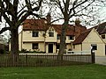 Garnett's House, Felsted, Essex - geograph.org.uk - 159635.jpg 640 × 480; 108 KB
-
 High Easter Road, Barnston - geograph.org.uk - 2592145.jpg 640 × 480; 110 KB
-
 Indian restaurant, Barnston - geograph.org.uk - 3519841.jpg 4,156 × 3,010; 3.1 MB
-
 Medhurst - geograph.org.uk - 2592166.jpg 640 × 480; 76 KB
-
 Onslow Green - geograph.org.uk - 2592196.jpg 640 × 480; 101 KB
-

-
 Power lines towards Lawn Hall - geograph.org.uk - 2592195.jpg 640 × 480; 97 KB
-
 Primrose Path - geograph.org.uk - 383367.jpg 426 × 640; 162 KB
-
 Private road to Martels Manor - geograph.org.uk - 3993051.jpg 1,600 × 1,064; 334 KB
-
 River Chelmer - geograph.org.uk - 6198275.jpg 678 × 1,024; 277 KB
-
 Smaller Pond at Onslow Green Nature Reserve - geograph.org.uk - 4060649.jpg 3,648 × 2,736; 5.1 MB
-
 Bridleway to Roffley - geograph.org.uk - 400611.jpg 640 × 428; 298 KB
-
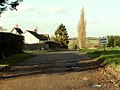
 Hills Kiln Farm, Barnston, Essex - geograph.org.uk - 140797.jpg 640 × 480; 84 KB
-
 Houseground, near to Garnetts, Essex - geograph.org.uk - 242463.jpg 640 × 480; 62 KB
-
 The track that leads to Martel Manor - geograph.org.uk - 312791.jpg 640 × 480; 74 KB
-
 Twisted Tree - geograph.org.uk - 389860.jpg 426 × 640; 164 KB


