Category:Bell-mouth spillways
Zur Navigation springen
Zur Suche springen
English: Bell-mouth spillway, morning glory spillway, plughole spillway
日本語: ダム穴
trichterförmige Vorrichtung zur Hochwasserentlastung  | |||||
| Medium hochladen | |||||
| Unterklasse von | |||||
|---|---|---|---|---|---|
| |||||
Unterkategorien
Es werden 16 von insgesamt 16 Unterkategorien in dieser Kategorie angezeigt:
In Klammern die Anzahl der enthaltenen Kategorien (K), Seiten (S), Dateien (D)
H
L
M
W
Medien in der Kategorie „Bell-mouth spillways“
Folgende 54 Dateien sind in dieser Kategorie, von 54 insgesamt.
-
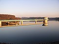
 Batlave,Kosovo-sifon - panoramio.jpg 2.816 × 1.880; 1,87 MB
-

-
 Burnhope Reservoir overflow - geograph.org.uk - 984005.jpg 640 × 428; 73 KB
-
 Conduit diversion by Redmires Road - geograph.org.uk - 1387804.jpg 640 × 480; 84 KB
-

-
 Covão dos conchos.jpg 1.200 × 770; 250 KB
-
 Dhünntalsperre5.jpg 2.288 × 1.712; 577 KB
-
 Digley Reservoir Overflow - geograph.org.uk - 498304.jpg 640 × 428; 339 KB
-
 Dovestone Reservoir Overflow - geograph.org.uk - 985833.jpg 640 × 480; 92 KB
-
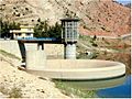 Duhok Dam Spillway USACE NWD.jpg 642 × 482; 69 KB
-
 Dukan Dam Spillway USACE NWD.jpg 657 × 494; 50 KB
-
 Entlastung dhünntalsperre.png 409 × 511; 6 KB
-
 Errwood reservoir overflow.jpg 3.884 × 2.587; 2,64 MB
-
 Geehi Dam Spillway.jpg 16.384 × 4.753; 69,46 MB
-
 Geehi Dam.jpg 3.840 × 1.602; 8,52 MB
-
 Goyt Valley 2018 036.jpg 5.184 × 3.456; 10,3 MB
-
 Goyt Valley 2018 037.jpg 5.184 × 3.456; 9,61 MB
-
 Goyt Valley 2018 038.jpg 5.184 × 3.456; 9,82 MB
-
 Goyt Valley 2018 039.jpg 5.184 × 3.456; 14,96 MB
-
 Goyt Valley 2018 041.jpg 5.184 × 3.456; 11,39 MB
-
 Goyt Valley 2018 042.jpg 3.456 × 5.184; 10,02 MB
-
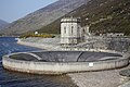
 Hochwasserentlastungsturm Biggesee qtl1.jpg 3.992 × 2.809; 5,1 MB
-
 HRBGlashütte-Neubau2007.jpg 1.024 × 768; 534 KB
-
 Längentalspeicher Kühtai.jpg 3.872 × 2.592; 6,17 MB
-
 Naturpark Ötscher-Tormäuer - Erlaufstausee Überlauf.jpg 3.000 × 2.250; 3,49 MB
-
 Niddastausee.jpg 2.240 × 1.488; 637 KB
-
 O famoso funil!.jpg 3.008 × 2.000; 3,27 MB
-
 O Funil Dos Conchos.jpg 6.000 × 4.000; 6,69 MB
-
 Osborne spillway.jpg 990 × 693; 187 KB
-

-

-
 Plughole - geograph.org.uk - 34682.jpg 640 × 480; 81 KB
-
 Pöppelsche HRB Überlauf.JPG 4.000 × 3.000; 1,32 MB
-
 Silent Valley Reservoir - geograph.org.uk - 1152768.jpg 640 × 413; 56 KB
-
 Silent Valley Reservoir panorama.jpg 4.976 × 1.360; 1,8 MB
-
 Silent Valley Reservoir, bell-mouth spillway.jpg 2.592 × 3.872; 2,09 MB
-
 Silent Valley, County Down, April 2011 (12).JPG 4.272 × 2.848; 5,43 MB
-
 Silent Valley, County Down, April 2011 (13).JPG 4.272 × 2.848; 5,78 MB
-
 Silent Valley, County Down, April 2011 (14).JPG 4.272 × 2.848; 6,3 MB
-
 Silent Valley, County Down, April 2011 (19).JPG 4.272 × 2.848; 5,76 MB
-
 SilentValley.jpg 1.600 × 1.200; 556 KB
-
 Small bell-mouth spillway, Great Meadows, Concord, Massachusetts.jpg 3.504 × 2.336; 5,03 MB
-
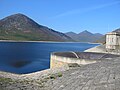
 Staudamm und Überlauf des Erlauf-Stausees.jpg 3.228 × 2.961; 5,72 MB
-
 Sugar Loaf Dam.JPG 5.903 × 3.887; 16,58 MB
-
 Talsperre Josefsthal 1.jpg 1.800 × 1.200; 840 KB
-
 The Silent Valley Reservoir - geograph.org.uk - 1638226.jpg 640 × 480; 234 KB
-
 The Silent Valley reservoir - geograph.org.uk - 340731.jpg 640 × 426; 149 KB
-
 Trinkwasserspeicher-Frauenau.jpg 650 × 402; 44 KB
-
 TWS Frauenau 1.jpg 2.048 × 1.536; 606 KB
-
 Ueberlauftrichter-Schevelingertalsperre.jpg 2.485 × 1.848; 6,1 MB
-
 Watauga (9255421593).jpg 3.216 × 2.136; 3,48 MB
-
 Wuppertalsperre - Wiebach-Vorsperre 07 ies.jpg 2.048 × 1.536; 1.001 KB
-
 Überlauftrichter und Staumauer Längentalspeicher.jpg 3.872 × 2.592; 8,01 MB
-
 猫ヶ洞池 - ダム穴? Nekogahora Pond - Glory hole - Panoramio 52352600.jpg 2.560 × 1.920; 1.001 KB


.JPG)
.JPG)
.JPG)
.JPG)


.jpg)


