Category:Billings, Montana
Aller à la navigation
Aller à la recherche
ville du Montana     | |||||
| Téléverser des médias | |||||
| Nature de l’élément | |||||
|---|---|---|---|---|---|
| Nommé(e) en référence à | |||||
| Lieu | comté de Yellowstone, Montana, É.-U. | ||||
| Chef ou cheffe de l'exécutif |
| ||||
| Date de fondation ou de création |
| ||||
| Population |
| ||||
| Superficie |
| ||||
| Altitude |
| ||||
| À ne pas confondre avec | |||||
| site officiel | |||||
 | |||||
English: Media related to Billings, Montana, a city in and the county seat of Yellowstone County, Montana, United States, that located along the Yellowstone River and is the largest city in the state.
Sous-catégories
Cette catégorie comprend 13 sous-catégories, dont les 13 ci-dessous.
Média dans la catégorie « Billings, Montana »
Cette catégorie comprend 178 fichiers, dont les 178 ci-dessous.
-
 20210808 03 Montana Rail Link RR, Billings, Montana (2).jpg 3 364 × 1 378 ; 675 kio
-
 24th Street, Billings, MT.jpg 3 264 × 2 448 ; 1,99 Mio
-
 350 MEGAWATT POWER PLANT UNDER CONSTRUCTION AT COLSTRIP - NARA - 549127.jpg 3 000 × 2 037 ; 1,1 Mio
-
 350 MEGAWATT POWER PLANT UNDER CONSTRUCTION AT COLSTRIP - NARA - 549128.jpg 2 031 × 3 000 ; 941 kio
-

-

-

-

-

-
-
 Altana FCU logo.png 184 × 65 ; 7 kio
-

-
 Billings Briarwood Subdivision-South Hills.JPG 3 888 × 2 592 ; 3,5 Mio
-
 Billings West Side School (AKA Broadwater Elementary School) NRHP 02000214 Montana1.jpg 4 000 × 3 000 ; 5,61 Mio
-
 Billings West Side School (AKA Broadwater Elementary School) NRHP 02000214 Montana4.jpg 4 000 × 3 000 ; 4,23 Mio
-
 Billings West Side School (AKA Broadwater Elementary School) NRHP 02000214 Montana5.jpg 4 000 × 3 000 ; 4,13 Mio
-
 Billings, Montana Four Dances Natural Area.JPG 1 381 × 1 931 ; 1,32 Mio
-
 Billings, Montana in 1972 (39075274141).jpg 2 261 × 1 500 ; 2,47 Mio
-
 Billings, Montana Swords Park Trail.JPG 3 888 × 2 592 ; 4,81 Mio
-
 Billings, Montana the Yellowstone River.JPG 3 888 × 2 592 ; 4,38 Mio
-
 Billings, Montana-Swords Park Trail.JPG 1 114 × 742 ; 405 kio
-
 Billings, Montana-The Terrace.jpg 2 479 × 2 380 ; 2,08 Mio
-
 Billings, United States (Unsplash 83FN3i0cSNU).jpg 5 194 × 3 463 ; 3,96 Mio
-
 Billings, United States (Unsplash gjS0pm MM08).jpg 4 924 × 3 283 ; 7,56 Mio
-
 Billings, United States (Unsplash HW3A 6RN2Jc).jpg 5 472 × 3 648 ; 5,97 Mio
-
 Billings, United States (Unsplash LWbhkfpJeSs).jpg 5 218 × 3 479 ; 6,42 Mio
-
 Billings, United States (Unsplash Pk5IA7eUvCM).jpg 4 766 × 3 177 ; 5,63 Mio
-
 Billings, United States (Unsplash).jpg 2 918 × 3 648 ; 3,13 Mio
-
 Billings, view from above (25208777008).jpg 2 249 × 1 500 ; 4,29 Mio
-

-

-

-
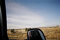 CarMirror on the way to Yellowstone.jpg 3 087 × 2 048 ; 1,67 Mio
-
 Christmas Prep (Unsplash).jpg 5 760 × 3 840 ; 18,58 Mio
-
 City of Billings, Montana in June 1972 (38193646835).jpg 2 169 × 1 452 ; 3,88 Mio
-

-

-
-

-

-

-

-
-
 Conversation table (Unsplash).jpg 5 184 × 3 456 ; 8,95 Mio
-
 Coulson, Montana.jpg 1 286 × 853 ; 462 kio
-

-
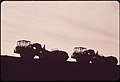
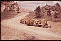
 Decker Coal Company strip mine, 06-1973 (7065921413).jpg 3 000 × 2 032 ; 681 kio
-
 Decker Coal Company strip mine, 06-1973 (7065943159).jpg 2 012 × 3 000 ; 583 kio
-

-

-

-
 Downtown Billings Montana in the fall.jpg 4 032 × 3 024 ; 3,18 Mio
-
 Faith Chapel, Billings, United States (Unsplash DiciRhpnv2U).jpg 5 549 × 3 699 ; 8,87 Mio
-
 Faith Chapel, Billings, United States (Unsplash IO2jnhWzgD0).jpg 5 760 × 3 840 ; 17,07 Mio
-
 Faith Chapel, Billings, United States (Unsplash mibCiPnj-B8).jpg 5 760 × 3 840 ; 10,85 Mio
-
 Faith Chapel, Billings, United States (Unsplash).jpg 5 760 × 3 840 ; 12,38 Mio
-
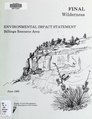 Final wilderness environmental impact statement for the Billings Resource Area, Billings, Montana (IA finalwildernesse00unit).pdf 1 439 × 1 868, 162 pages ; 24,1 Mio
-

-
 Flag of Billings, Montana.png 950 × 570 ; 25 kio
-
 Flowers amid the prairie grasses on the Crow Indian reservation, 06-1973 (6919834768).jpg 2 003 × 3 000 ; 535 kio
-
 Flowers amid the prairie grasses on the Crow Indian reservation, 06-1973 (7065916283).jpg 3 000 × 2 043 ; 440 kio
-
 Flowers and rock formations at the Roy Fly ranch in Sarpy Basin, 06-1973 (6919833784).jpg 2 030 × 3 000 ; 484 kio
-
 Frozen Bubble, Billings, Montana (Unsplash).jpg 5 302 × 3 535 ; 6,58 Mio
-

-
-

-

-
 HAY FIELD AT THE JOHN REDDING RANCH IN SARPY BASIN - NARA - 549237.jpg 3 000 × 1 983 ; 758 kio
-

-
 Hfhnndhhndnhdndnhdcnhc.jpg 4 032 × 3 024 ; 1,59 Mio
-

-

-

-

-

-
 JFK greets crowd in Billings 1963-09-25.jpg 760 × 517 ; 517 kio
-
 John F Kennedy addressing a crowd in Billings, Montana.jpg 1 000 × 665 ; 100 kio
-
 Late afternoon view of Billings, MT. 2008 (38193679345).jpg 2 250 × 1 500 ; 2,25 Mio
-
 Lightning over Billings Airport April 2007.jpg 1 600 × 1 200 ; 495 kio
-
 LokBillings94.jpg 1 536 × 1 024 ; 921 kio
-
 Midland Bank, Billings, Montana, weather beacon.png 913 × 913 ; 641 kio
-
 Mountain View Cemetery, Billings, Montana LCCN2017706597.tif 5 155 × 3 535 ; 104,32 Mio
-
 NILE office sign.jpg 3 571 × 2 381 ; 5,85 Mio
-
 Nordberg HP400 Cone Crusher.jpg 1 813 × 1 664 ; 439 kio
-

-

-
 One of the draft horses at Billings Farm. - panoramio.jpg 2 048 × 1 536 ; 687 kio
-
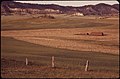
 Open range land near Custer Battlefield National Monument, 06-1973. (6919711080).jpg 3 000 × 2 032 ; 565 kio
-
 Peabody Coal Company strip mine, south of Colstrip, 06-1973 (6919738246).jpg 3 000 × 2 033 ; 488 kio
-
 Peabody Coal Company strip mine, south of Colstrip, 06-1973 (7065851699).jpg 3 000 × 2 033 ; 358 kio
-
 Peabody Coal Company strip mine, south of Colstrip, 06-1973 (7065852481).jpg 3 000 × 2 031 ; 351 kio
-
 Peabody Coal Company strip mine, south of Colstrip, 06-1973 (7065859107).jpg 3 000 × 2 044 ; 320 kio
-
 Peabody Coal Company strip mine, south of Colstrip, 06-1973. (7065771641).jpg 2 017 × 3 000 ; 641 kio
-
 Peabody Coal Company strip mine, south of Colstrip, 06-1973. (7065795331).jpg 2 033 × 3 000 ; 476 kio
-

-

-
 Peabody Coal Company strip mine, south of Colstrip..., 06-1973. (6919694554).jpg 3 000 × 2 031 ; 710 kio
-
 Peace (Unsplash wW1c9bc58Go).jpg 2 897 × 3 621 ; 2,82 Mio
-

-

-

-

-

-

-
 Plane Underside (Unsplash).jpg 4 718 × 3 145 ; 6,92 Mio
-

-

-

-
 Race and ethnicity 2020 Billings, MT.png 2 400 × 2 404 ; 998 kio
-

-

-

-
 Rimrocks overlooking Billings.jpg 2 048 × 1 536 ; 1,17 Mio
-
 Rimrocks.JPG 1 524 × 2 032 ; 857 kio
-
 ROAD LEADS TO THE BUD AND JOHN REDDING RANCHES IN SARPY BASIN - NARA - 549257.jpg 3 000 × 2 015 ; 586 kio
-

-

-

-

-
 Sacrifice Cliff Coulson.JPG 3 326 × 1 518 ; 1,3 Mio
-

-
 Seal of Billings, Montana.png 239 × 257 ; 21 kio
-

-

-
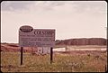
 SIGN AT THE WESTMORELAND COAL COMPANY MINE SITE IN SARPY BASIN - NARA - 549129.jpg 3 000 × 2 034 ; 971 kio
-

-

-

-

-

-
 Steel wool lightpainting in a train tunnel (Unsplash).jpg 5 472 × 3 648 ; 21,09 Mio
-

-

-
 Supersonic Car Wash, Billings, Montana LCCN2017707632.tif 3 675 × 5 211 ; 109,63 Mio
-
 Swords Rimrock Park Billings Montana1.jpg 4 000 × 3 000 ; 4,15 Mio
-
 Swords Rimrock Park Billings Montana2.jpg 3 000 × 4 000 ; 5,74 Mio
-

-

-
 THE BUD REDDING RANCH AT SUNSET - NARA - 549248.jpg 3 000 × 2 046 ; 619 kio
-
 THE BUD REDDING RANCH IN SARPY BASIN - NARA - 549247.jpg 3 000 × 2 038 ; 944 kio
-
 THE BUD REDDING RANCH IN SARPY BASIN - NARA - 549261.jpg 3 000 × 2 020 ; 579 kio
-
 The first and second rise of the Billings Rimrocks.JPG 1 534 × 1 246 ; 803 kio
-

-

-
-

-

-

-

-

-
 U.S. Navy Ceremonial Guard Drill Team perform during Navy Week Montana. (35799121513).jpg 2 000 × 1 332 ; 1,78 Mio
-
 Urban31 (38365320444).jpg 2 145 × 1 425 ; 4,07 Mio
-
 Urban46 (38365242884).jpg 2 241 × 1 500 ; 3,82 Mio
-
 Urban47 (38365244944).jpg 2 307 × 1 500 ; 2,33 Mio
-
 Urban51 (24214013637).jpg 2 241 × 1 500 ; 3 Mio
-
 US-87 Billings Heights.JPG 3 693 × 1 871 ; 2,9 Mio
-

-

-
 WestBillings.jpeg 2 032 × 1 524 ; 697 kio
-
 Western Energy strip mine and spoil piles, south of Colstrip, 06-1973. (7065793643).jpg 3 000 × 2 033 ; 622 kio
-

-

-

-

-

-

-
 WHEAT FIELD ON THE REDDING RANCH IN SARPY BASIN - NARA - 549251.jpg 1 997 × 3 000 ; 1,09 Mio
-
 Wheat field on the Redding ranch in Sarpy Basin, 06-1973 (7065929249).jpg 1 997 × 3 000 ; 614 kio
-
 Yellowstone Kellys Grave on Black Otter Trail NRHP 06001224 Montana1.jpg 4 000 × 3 000 ; 5,29 Mio
-
 Yellowstone Kellys Grave on Black Otter Trail NRHP 06001224 Montana2.jpg 3 681 × 3 000 ; 3,89 Mio
-
 Yellowstone Kellys Grave on Black Otter Trail NRHP 06001224 Montana3.jpg 3 581 × 3 000 ; 3,58 Mio
-
 Yellowstone Kellys Grave on Black Otter Trail NRHP 06001224 Montana4.jpg 4 000 × 3 000 ; 4,59 Mio
-
 Yellowstone Kellys Grave on Black Otter Trail NRHP 06001224 Montana5.jpg 3 603 × 3 000 ; 4,14 Mio
-
 Yellowstone Kellys Grave on Black Otter Trail NRHP 06001224 Montana6.jpg 3 000 × 4 000 ; 3,44 Mio
-
 Yellowstone Kellys Grave on Black Otter Trail NRHP 06001224 Montana7.jpg 3 000 × 4 000 ; 3,99 Mio
-
 Yibil 2b (7681135902).jpg 1 777 × 2 391 ; 661 kio
-
 Yibil 3b (7681137262).jpg 1 753 × 2 330 ; 845 kio
-
 Zimmermanplot.jpg 1 524 × 2 032 ; 789 kio


.png)

_NRHP_02000214_Montana1.jpg)
_NRHP_02000214_Montana4.jpg)
_NRHP_02000214_Montana5.jpg)

.jpg)


.jpg)
.jpg)
.jpg)
.jpg)
.jpg)
.jpg)
.jpg)


.jpg)
.jpg)

.jpg)

.png)
.jpg)
.jpg)

.jpg)
.jpg)
.jpg)
.jpg)
.png)
.jpg)
.jpg)
.jpg)
.jpg)


.jpg)
.jpg)

.jpg)


.jpg)


.jpg)
.jpg)
.jpg)
.jpg)
.jpg)
.jpg)
.jpg)
.jpg)
.jpg)
.jpg)
.jpg)
.jpg)

.jpg)


.jpg)
.jpg)

.png)
.jpg)
.jpg)


.jpg)
.jpg)
.jpg)
.jpg)
.jpg)
.jpg)


.jpg)

.jpg)

.jpg)

.jpg)

.jpg)


.jpg)
.jpg)

.jpg)
.jpg)
.jpg)
.jpg)
Catégories :
- Cities in Montana
- Populated places in Yellowstone County, Montana
- County seats in Montana
- Yellowstone River
- Locations along Interstate 90 in Montana
- Locations along U.S. Route 87 in Montana
- Locations along U.S. Route 212 in Montana
- Locations along Montana Highway 3
- Locations along Montana Secondary Highway 302
- Locations along Montana Secondary Highway 372
- Locations along Montana Secondary Highway 416