Category:Borough of King's Lynn and West Norfolk
Jump to navigation
Jump to search
local government district and borough in Norfolk, England  | |||||
| Upload media | |||||
| Instance of | |||||
|---|---|---|---|---|---|
| Location | Norfolk, East of England, England | ||||
| Capital | |||||
| Legislative body |
| ||||
| Inception |
| ||||
| Population |
| ||||
| Area |
| ||||
| official website | |||||
 | |||||
Subcategories
This category has the following 23 subcategories, out of 23 total.
Media in category "Borough of King's Lynn and West Norfolk"
The following 200 files are in this category, out of 1,424 total.
(previous page) (next page)-
 "Lest we forget" - geograph.org.uk - 4415999.jpg 1,024 × 768; 512 KB
-
 17, Littleport St - geograph.org.uk - 5795524.jpg 640 × 426; 112 KB
-
-
 2016, a year on Geograph (Day 299) - geograph.org.uk - 5168564.jpg 640 × 480; 52 KB
-
 A crop of maize - geograph.org.uk - 1559274.jpg 640 × 480; 123 KB
-
 A fenland bush - geograph.org.uk - 5842952.jpg 1,024 × 681; 98 KB
-
 A multitude of silos - geograph.org.uk - 5030864.jpg 640 × 410; 26 KB
-
 A new estate, West Lynn - geograph.org.uk - 5144588.jpg 640 × 426; 65 KB
-
 A peaceful scene - geograph.org.uk - 5231722.jpg 640 × 480; 43 KB
-
 A series of tubes - geograph.org.uk - 1454253.jpg 3,072 × 2,304; 2.34 MB
-
 A stormy sky over The River Great Ouse in King's Lynn - geograph.org.uk - 5658408.jpg 5,184 × 3,888; 3.87 MB
-
-
 A1048 - geograph.org.uk - 5217205.jpg 640 × 426; 59 KB
-
 A1078 - geograph.org.uk - 5217196.jpg 640 × 426; 68 KB
-
 A1078 - geograph.org.uk - 5217199.jpg 640 × 426; 77 KB
-
 A1078 - geograph.org.uk - 5220637.jpg 640 × 426; 62 KB
-
 A1078 at Bergen Way junction - geograph.org.uk - 3616481.jpg 640 × 480; 58 KB
-
 A1078 at South Wootton boundary - geograph.org.uk - 3616496.jpg 640 × 481; 62 KB
-
 A1078 Edward Benefer Way in South Wootton - geograph.org.uk - 4276911.jpg 1,600 × 1,287; 563 KB
-
 A1078 Low Road in South Wootton - geograph.org.uk - 4276904.jpg 1,600 × 1,205; 621 KB
-
 A1078, A148 junction - geograph.org.uk - 5220634.jpg 640 × 426; 72 KB
-
 A148 - geograph.org.uk - 5217230.jpg 640 × 490; 73 KB
-
 A148 - geograph.org.uk - 5217232.jpg 640 × 386; 54 KB
-
 A148 - geograph.org.uk - 5795513.jpg 640 × 426; 61 KB
-
 A148 bridges over A47, South Lynn - geograph.org.uk - 5982007.jpg 1,600 × 1,143; 732 KB
-
 A149 approaching roundabout - geograph.org.uk - 5027016.jpg 1,882 × 1,236; 1.48 MB
-
 A149 heading north - geograph.org.uk - 5685221.jpg 640 × 428; 98 KB
-
 A149 heading north - geograph.org.uk - 5685243.jpg 640 × 428; 96 KB
-
 A149 Queen Elizabeth Way - geograph.org.uk - 3841871.jpg 1,600 × 1,086; 283 KB
-
 A149 towards Hunstanton - geograph.org.uk - 5556620.jpg 640 × 480; 62 KB
-
 A17 approaching A47 junction roundabout - geograph.org.uk - 4996383.jpg 2,256 × 1,496; 854 KB
-
 A47 - geograph.org.uk - 5144540.jpg 640 × 557; 69 KB
-
 A47 approaches junction with A149 and A10 - geograph.org.uk - 4996648.jpg 2,028 × 1,280; 1.56 MB
-
 A47 approaching roundabout at Constitution Hill - geograph.org.uk - 4996653.jpg 2,256 × 1,496; 901 KB
-
 A47 bridge and Pine Paper - geograph.org.uk - 5373543.jpg 5,202 × 3,465; 3.12 MB
-
 A47 Bridge over the River Great Ouse - geograph.org.uk - 5144569.jpg 640 × 426; 36 KB
-
 A47 on the southern edge of King's Lynn - geograph.org.uk - 5471387.jpg 800 × 619; 136 KB
-

-
 A47 Road Bridge, King's Lynn - geograph.org.uk - 5410180.jpg 640 × 480; 56 KB
-
 A47 towards A148 roundabout - geograph.org.uk - 4996641.jpg 2,008 × 1,344; 1.27 MB
-
 A47-A148 Junction at King's Lynn - geograph.org.uk - 4962087.jpg 640 × 480; 407 KB
-
 Abbey Farm - geograph.org.uk - 5842949.jpg 1,024 × 681; 98 KB
-
 Abbey Farm in the mist - geograph.org.uk - 5030844.jpg 640 × 426; 29 KB
-
 Above the water - geograph.org.uk - 1422824.jpg 2,000 × 3,008; 2.23 MB
-
 Access bridge to White House Farm - geograph.org.uk - 5470024.jpg 800 × 500; 117 KB
-
 Across the stubble - geograph.org.uk - 1546505.jpg 640 × 480; 76 KB
-
 Agricultural graffiti - geograph.org.uk - 1558986.jpg 640 × 480; 94 KB
-
 Albert St - geograph.org.uk - 5220612.jpg 640 × 426; 69 KB
-
 All Saints' St - geograph.org.uk - 5217213.jpg 640 × 426; 51 KB
-
-

-

-
 Allotments by the Fen Line - geograph.org.uk - 5030868.jpg 640 × 426; 74 KB
-
 Allotments, South Lynn - geograph.org.uk - 5842991.jpg 1,024 × 681; 205 KB
-
 Allotments, South Lynn - geograph.org.uk - 5843021.jpg 1,024 × 681; 204 KB
-
 Almost submerged - geograph.org.uk - 1520214.jpg 640 × 480; 109 KB
-
 Alms Houses, Goodwins Road 1 - geograph.org.uk - 5375080.jpg 4,918 × 2,961; 3.12 MB
-
 Alms Houses, Goodwins Road 2 - geograph.org.uk - 5375083.jpg 5,202 × 3,465; 4.06 MB
-
 Alongside the Marsh Lane building site, King's Lynn - geograph.org.uk - 5356842.jpg 3,648 × 2,736; 3.92 MB
-
 An open gate on the by-pass - geograph.org.uk - 1999059.jpg 2,848 × 2,136; 3.07 MB
-
 An unusual combination on a memorial - geograph.org.uk - 5142372.jpg 1,688 × 2,250; 1.79 MB
-
 An unusual house in London Road, King's Lynn - geograph.org.uk - 5981988.jpg 1,600 × 1,200; 732 KB
-
 Another Bridge - geograph.org.uk - 2887363.jpg 812 × 544; 220 KB
-
 Anti-tank hairpins beside the West Lynn Drain - geograph.org.uk - 4427616.jpg 1,024 × 768; 603 KB
-
 Approaching Porters Fen - geograph.org.uk - 1390676.jpg 640 × 480; 79 KB
-
 Approaching Saturday Market - geograph.org.uk - 6232245.jpg 1,024 × 768; 174 KB
-
 Arable field - geograph.org.uk - 5033491.jpg 640 × 426; 32 KB
-

-
 Arable land - geograph.org.uk - 5206923.jpg 640 × 426; 56 KB
-
 Arable landscape - geograph.org.uk - 5033494.jpg 640 × 426; 33 KB
-
 Arbortec Corporate House - geograph.org.uk - 5556374.jpg 1,600 × 1,200; 216 KB
-
 Archilense - geograph.org.uk - 4365714.jpg 1,848 × 2,466; 2.6 MB
-
 Archilense - geograph.org.uk - 4365903.jpg 2,448 × 3,264; 4.38 MB
-
 Archilense at Purfleet Quay - geograph.org.uk - 5372159.jpg 5,202 × 3,465; 3.89 MB
-
 Art and architecture on Purfleet Quay, King's Lynn - geograph.org.uk - 6100860.jpg 4,032 × 3,024; 4.7 MB
-
 ATS Euromaster, Oldmedow Road - geograph.org.uk - 5556326.jpg 1,600 × 1,194; 334 KB
-
 Austin St, A1078 - geograph.org.uk - 5824053.jpg 1,024 × 681; 154 KB
-
-
 B1144 (the beginning or end) - geograph.org.uk - 5144520.jpg 640 × 426; 52 KB
-
 B1144 - geograph.org.uk - 5030877.jpg 640 × 340; 63 KB
-
 B1144 - geograph.org.uk - 5033475.jpg 640 × 426; 52 KB
-
 B1144 - geograph.org.uk - 5843003.jpg 1,024 × 681; 182 KB
-
 B1145 heading west towards King's Lynn - geograph.org.uk - 4259429.jpg 1,600 × 1,181; 714 KB
-
 Back on the bank looking west - geograph.org.uk - 1526392.jpg 640 × 480; 112 KB
-
 Baltika, North Street - geograph.org.uk - 5228331.jpg 640 × 480; 40 KB
-
 Bandstand, Vancouver Garden, King's Lynn - geograph.org.uk - 5410379.jpg 640 × 480; 111 KB
-
 Bank House, King's Lynn - geograph.org.uk - 6222950.jpg 4,032 × 3,024; 3.54 MB
-
 Bankside gate and fence. - geograph.org.uk - 5373479.jpg 5,202 × 3,465; 5.2 MB
-
 Bankside, West Lynn - geograph.org.uk - 5373467.jpg 5,202 × 3,465; 2.87 MB
-
 Barge on The Nar Loop in King's Lynn - geograph.org.uk - 5886547.jpg 4,032 × 3,024; 2.87 MB
-
 Baroque Dance in the Assembly Room - geograph.org.uk - 4659214.jpg 1,200 × 1,600; 329 KB
-
 Beales closing down, King's Lynn - geograph.org.uk - 5295840.jpg 1,600 × 1,200; 477 KB
-
 Beales closing down, King's Lynn - geograph.org.uk - 5295844.jpg 1,600 × 1,200; 408 KB
-
 Bench commemorating Margery Kempe - geograph.org.uk - 6232248.jpg 1,024 × 768; 176 KB
-
 Bergen Way - geograph.org.uk - 5824019.jpg 1,024 × 681; 109 KB
-
 Bespak - geograph.org.uk - 5824022.jpg 1,024 × 681; 150 KB
-
 Bespak - geograph.org.uk - 5824024.jpg 1,024 × 681; 229 KB
-
 Bespak - geograph.org.uk - 5824025.jpg 1,024 × 681; 137 KB
-
 Beware^ This is a dangerous pavement - geograph.org.uk - 5985066.jpg 1,600 × 1,200; 1.16 MB
-
 Bilney Coachworks - geograph.org.uk - 5824010.jpg 1,024 × 681; 170 KB
-
 Biosolids Treatment Centre, Kings Lynn - geograph.org.uk - 6124404.jpg 3,456 × 2,592; 1.96 MB
-
 Bird Bath - geograph.org.uk - 2328988.jpg 2,560 × 1,920; 1.81 MB
-
 Bird box - geograph.org.uk - 4326030.jpg 1,200 × 1,600; 758 KB
-
 Blockbuster Video, King's Lynn - geograph.org.uk - 5295850.jpg 1,600 × 1,200; 447 KB
-
 Blossom - geograph.org.uk - 5202923.jpg 640 × 426; 112 KB
-
 Boal Street, Late October 2016 - geograph.org.uk - 5231721.jpg 640 × 480; 55 KB
-
 Box junction, A148 - geograph.org.uk - 5217207.jpg 640 × 356; 57 KB
-
 Brewers, Kings Lynn - geograph.org.uk - 5556322.jpg 1,600 × 1,200; 252 KB
-
 Bridge at Marsh Common - geograph.org.uk - 1045417.jpg 640 × 427; 88 KB
-
 Bridge on Magdalen Road - geograph.org.uk - 1146738.jpg 640 × 480; 60 KB
-
 Bridge over River Great Ouse - geograph.org.uk - 6122326.jpg 1,024 × 768; 155 KB
-
 British Legion, Kings Lynn - geograph.org.uk - 5372058.jpg 5,202 × 3,465; 3.02 MB
-
 Broad Street, King's Lynn - geograph.org.uk - 6232027.jpg 1,024 × 755; 140 KB
-
 Building by the Great Ouse - geograph.org.uk - 5206914.jpg 640 × 389; 48 KB
-
 Bungalows on Hall Road - geograph.org.uk - 5576647.jpg 640 × 480; 109 KB
-
 Buoy maintenance area on Purfleet Quay in King's Lynn - geograph.org.uk - 6100966.jpg 4,032 × 3,024; 4.01 MB
-
 Buoy repair yard and The River Great Ouse in King's Lynn - geograph.org.uk - 6100948.jpg 4,032 × 3,024; 4.14 MB
-
 Burma Campaign Memorial at Tower Gardens, Kings Lynn - geograph.org.uk - 4416007.jpg 3,456 × 2,592; 3.64 MB
-
 Burney Rd - geograph.org.uk - 5144714.jpg 604 × 640; 59 KB
-
 Bus garage, Vancouver Avenue, King's Lynn - geograph.org.uk - 5985026.jpg 1,600 × 1,200; 688 KB
-
 Bush - geograph.org.uk - 5824015.jpg 1,024 × 681; 123 KB
-
 Buttercups on the sea bank - geograph.org.uk - 3598403.jpg 2,977 × 3,634; 3.47 MB
-
 By the Peter Scott Walk - geograph.org.uk - 5206951.jpg 640 × 426; 61 KB
-
 Cafe Roasta, Kings Lynn - geograph.org.uk - 5372065.jpg 4,289 × 3,158; 2.74 MB
-
 Canopies, King's Lynn Bus Station - geograph.org.uk - 6231618.jpg 1,024 × 768; 156 KB
-
 Captain Vancouver on Purfleet Quay in King's Lynn - geograph.org.uk - 5658344.jpg 3,644 × 4,878; 2.88 MB
-
 Car dealership on Bergen Way - geograph.org.uk - 5576644.jpg 640 × 480; 54 KB
-
 Car park in Nicholas Street - geograph.org.uk - 5228355.jpg 640 × 480; 87 KB
-
 Chapel Court - geograph.org.uk - 5220588.jpg 640 × 458; 75 KB
-
 Chapel Court - geograph.org.uk - 5220604.jpg 640 × 426; 82 KB
-
 Chapel Court, Chapel St - geograph.org.uk - 5220601.jpg 640 × 426; 79 KB
-

-
 Chapel St - geograph.org.uk - 5220585.jpg 640 × 447; 77 KB
-
 Chemical Works - geograph.org.uk - 5206849.jpg 640 × 426; 79 KB
-
 Chemical works beyond the carpark - geograph.org.uk - 5977001.jpg 3,456 × 2,592; 2.22 MB
-
 Chinese takeaway on Wootton Road - geograph.org.uk - 5585079.jpg 2,848 × 2,136; 1.46 MB
-
 Chips, mash or roast ^ - geograph.org.uk - 1559063.jpg 640 × 480; 119 KB
-
 Citroen Salesroom - geograph.org.uk - 5824016.jpg 1,024 × 681; 136 KB
-
 Claire Ann heading upstream along the River Great Ouse - geograph.org.uk - 4277198.jpg 1,600 × 1,261; 493 KB
-
 Clenchwarton Rd - geograph.org.uk - 5144571.jpg 640 × 283; 48 KB
-
 Clenchwarton Rd - geograph.org.uk - 5144572.jpg 640 × 426; 65 KB
-
 Clenchwarton Rd - geograph.org.uk - 5144577.jpg 640 × 426; 46 KB
-
 Clenchwarton Rd - geograph.org.uk - 5144580.jpg 640 × 426; 62 KB
-
 Clenchwarton Rd - geograph.org.uk - 5144590.jpg 640 × 379; 56 KB
-
 Clenchwarton Rd - geograph.org.uk - 5144592.jpg 640 × 426; 58 KB
-
 Clenchwarton Rd, West Lynn - geograph.org.uk - 5144587.jpg 640 × 367; 58 KB
-
 Clenchwarton Road - geograph.org.uk - 4721407.jpg 640 × 480; 45 KB
-
 Clenchwarton Road towards West Lynn - geograph.org.uk - 3605899.jpg 3,119 × 2,366; 2.31 MB
-
 Close up, Elizabeth II postbox on Wootton Road - geograph.org.uk - 5585084.jpg 1,160 × 2,408; 529 KB
-

-
 Consistory Court, St Nicholas' Chapel, King's Lynn - geograph.org.uk - 5291337.jpg 4,272 × 2,848; 4.06 MB
-
 Cooper Roller Bearings, Wisbech Road - geograph.org.uk - 5373553.jpg 5,202 × 3,465; 2.81 MB
-
 Courtyard off King Street, King's Lynn - geograph.org.uk - 6233674.jpg 768 × 1,024; 141 KB
-
 Cowslips on the Great Ouse flood bank - geograph.org.uk - 5355628.jpg 3,648 × 2,736; 3.99 MB
-
 Creeks in The Breast Sand, The Wash - geograph.org.uk - 1491906.jpg 640 × 480; 85 KB
-
 Cromer 40 Miles - geograph.org.uk - 5556625.jpg 640 × 480; 56 KB
-
 Crops - geograph.org.uk - 5033496.jpg 640 × 503; 30 KB
-
 Cross Bank Rd - geograph.org.uk - 5795559.jpg 640 × 331; 40 KB
-
 Crossing the "creeky" bridge in The Wash - geograph.org.uk - 1526457.jpg 640 × 480; 112 KB
-
 Custom House - geograph.org.uk - 5297204.jpg 1,024 × 683; 165 KB
-
 Custom House, King's Lynn - geograph.org.uk - 5410328.jpg 480 × 640; 59 KB
-
 Custom House, Purfleet Quay, King's Lynn, Norfolk - geograph.org.uk - 5985059.jpg 1,600 × 1,200; 828 KB
-
 Customs House Kings Lynn - geograph.org.uk - 5319069.jpg 1,333 × 2,000; 1.53 MB
-

-
 Cycle path alongside Palm Paper mill - geograph.org.uk - 5444058.jpg 3,648 × 2,736; 2.95 MB
-
-

-
 Cycle Route 1 approaching King's Lynn - geograph.org.uk - 5355637.jpg 3,648 × 2,736; 4.04 MB
-
 Cycle Route 1 crossing Gaywood River - geograph.org.uk - 5356830.jpg 3,648 × 2,736; 4.06 MB
-
 Cycle Route 1 leaving the centre of King's Lynn - geograph.org.uk - 5356823.jpg 3,648 × 2,736; 4.14 MB
-
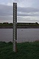 Depth gauge by the Great Ouse - geograph.org.uk - 2710106.jpg 2,592 × 3,872; 2.8 MB
-

-
 Disembarking at Kings Lynn - geograph.org.uk - 5030884.jpg 640 × 426; 61 KB
-
 Distant sandbank - geograph.org.uk - 1454323.jpg 3,072 × 2,304; 1.68 MB
-

-

-

-
 Ditch off Low Road south of King's Lynn - geograph.org.uk - 2293733.jpg 2,848 × 2,136; 2.98 MB
-
 Dobby Drive - geograph.org.uk - 5824041.jpg 1,024 × 587; 129 KB
-
 Docks entrance - geograph.org.uk - 5206962.jpg 640 × 426; 42 KB
-
 Dogwoods and The Red Mount Chapel - geograph.org.uk - 3299585.jpg 4,320 × 3,240; 6.11 MB
-
 Downstream along the Gaywood River - geograph.org.uk - 4255182.jpg 1,600 × 1,200; 562 KB
-
 Downstream along the River Great Ouse - geograph.org.uk - 3600270.jpg 4,000 × 3,000; 3.48 MB
-
-

-
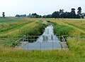
 Drain beside Edward Benefer Way - geograph.org.uk - 5576643.jpg 640 × 480; 78 KB
-
 Drain next to the River Nar - geograph.org.uk - 5467959.jpg 800 × 588; 111 KB
-
 Drainage channel at West Winch - geograph.org.uk - 2229639.jpg 640 × 480; 132 KB
-
 Drainage channel, North Lynn - geograph.org.uk - 1519602.jpg 640 × 480; 114 KB
-
 Drainage ditch - geograph.org.uk - 5033492.jpg 640 × 353; 30 KB
-
 Drainage ditch - geograph.org.uk - 877004.jpg 426 × 640; 104 KB
-

-
 East bank of the River Great Ouse - geograph.org.uk - 4721421.jpg 640 × 480; 34 KB
-
 East Coast Business Park - geograph.org.uk - 5144573.jpg 640 × 430; 70 KB
-
 Eastgate Academy - geograph.org.uk - 5220641.jpg 640 × 426; 56 KB
-
 Eastgate Academy - geograph.org.uk - 5795453.jpg 640 × 426; 67 KB
-
 Edinburgh Court - geograph.org.uk - 5220639.jpg 640 × 426; 91 KB
-
 Edward Benefer Way (A1078) - geograph.org.uk - 5583556.jpg 640 × 480; 61 KB
-
 Edward Benefer Way (A1078) - geograph.org.uk - 5583561.jpg 640 × 480; 66 KB
-
 Edward Benefer Way - geograph.org.uk - 5576642.jpg 640 × 480; 90 KB


_-_geograph.org.uk_-_5168564.jpg)


_-_geograph.org.uk_-_5180458.jpg)
_-_geograph.org.uk_-_5180461.jpg)
_-_geograph.org.uk_-_5180462.jpg)


_-_The_Walks,_King%27s_Lynn_-_geograph.org.uk_-_4350582.jpg)
_-_geograph.org.uk_-_5144520.jpg)


_Route_1_through_the_%27Vancouver_Quarter%27_of_King%27s_Lynn_-_geograph.org.uk_-_5356873.jpg)


_-_geograph.org.uk_-_5583556.jpg)
_-_geograph.org.uk_-_5583561.jpg)
