Category:Bradford Abbas
Naar navigatie springen
Naar zoeken springen
English: Bradford Abbas is a village in north west Dorset, England, three miles south east of Yeovil and five miles south west of Sherborne. The village has a population of 936 (2001).
plaats in Dorset  | |||||
| Media uploaden | |||||
| Is een | |||||
|---|---|---|---|---|---|
| Locatie | Dorset (district), Dorset, Zuidwest-Engeland, Engeland | ||||
| Inwonertal |
| ||||
| Oppervlakte |
| ||||
| Naar verluidt hetzelfde als | Bradford Abbas (Wikimedia-doublure, civil parish) | ||||
 | |||||
Ondercategorieën
Deze categorie bevat de volgende 3 subcategorieën, van de 3 in totaal.
R
- Rose and Crown, Bradford Abbas (14 B)
S
- Smith's Bridge, Dorset (2 B)
Media in categorie "Bradford Abbas"
Deze categorie bevat de volgende 82 bestanden, van in totaal 82.
-

-
 Allotments, Bradford Abbas - geograph.org.uk - 1566275.jpg 640 × 480; 142 kB
-
 Allotments, Bradford Abbas - geograph.org.uk - 1566287.jpg 640 × 480; 173 kB
-
 Arable land on Tilly's Hill - geograph.org.uk - 6031604.jpg 1.024 × 768; 183 kB
-
 Barns. - geograph.org.uk - 959641.jpg 640 × 480; 108 kB
-
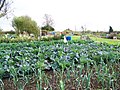
 Bean Planting at Bradford Abbas - geograph.org.uk - 2306797.jpg 640 × 480; 63 kB
-
 Bradford Abbas intersection bridge (2019).JPG 1.366 × 910; 443 kB
-

-

-
 Bradford Abbas, Mill Lane - geograph.org.uk - 3040411.jpg 640 × 427; 421 kB
-

-

-
 Bradford Abbas, red telephone box - geograph.org.uk - 3905413.jpg 640 × 480; 77 kB
-
 Bradford Abbas, thatched cottage - geograph.org.uk - 3040380.jpg 640 × 427; 373 kB
-
 Bradford Abbas, the village hall - geograph.org.uk - 3905433.jpg 640 × 480; 63 kB
-
 Bradford Abbas, the village store - geograph.org.uk - 3905423.jpg 640 × 480; 81 kB
-

-
 Bradford Hollow - geograph.org.uk - 1712400.jpg 640 × 480; 131 kB
-
 Church Road through Bradford Abbas - geograph.org.uk - 4730694.jpg 640 × 469; 156 kB
-
 Churchwell Street, Bradford Abbas - geograph.org.uk - 1567170.jpg 640 × 480; 127 kB
-
 Climbing a coombe to Coombe Cottages - geograph.org.uk - 3879056.jpg 3.776 × 2.520; 4,17 MB
-
 Cross roads north of Bradford Abbas - geograph.org.uk - 4730684.jpg 640 × 454; 281 kB
-
 Entrance to the 5th Tee - geograph.org.uk - 1454092.jpg 640 × 480; 238 kB
-
 Farm Road, Bradford Abbas - geograph.org.uk - 1768698.jpg 640 × 444; 59 kB
-
 Footpath, Bradford Abbas - geograph.org.uk - 1566313.jpg 480 × 640; 197 kB
-
 Footpath, Bradford Abbas - geograph.org.uk - 1567305.jpg 640 × 480; 144 kB
-
 Goods train, at Yeovil Railway Centre - geograph.org.uk - 2402034.jpg 1.024 × 768; 167 kB
-
 Hollow lane north of Bradford Abbas - geograph.org.uk - 3879076.jpg 3.776 × 2.520; 4,25 MB
-
 Lane junction - geograph.org.uk - 1899611.jpg 640 × 480; 216 kB
-
 Lines at Yeovil Junction - geograph.org.uk - 3391972.jpg 640 × 480; 49 kB
-
 Longford Bridge - geograph.org.uk - 452891.jpg 640 × 480; 155 kB
-
 Meadows by the Yeo - geograph.org.uk - 1555353.jpg 640 × 480; 87 kB
-
 Moss Growing on Bridport Sands - geograph.org.uk - 765242.jpg 640 × 426; 107 kB
-
 Ordnance Survey Cut Mark - geograph.org.uk - 3930033.jpg 4.000 × 3.000; 4,86 MB
-
 Ordnance Survey Flush Bracket 10809 - geograph.org.uk - 3929983.jpg 4.000 × 3.000; 3,94 MB
-
 Path, Bradford Abbas - geograph.org.uk - 1768554.jpg 640 × 480; 123 kB
-

-
 Post Office, Bradford Abbas - geograph.org.uk - 1566305.jpg 640 × 480; 154 kB
-
 Postbox, Bradford Abbas - geograph.org.uk - 1566308.jpg 480 × 640; 129 kB
-
 Railway bridge, Bradford Abbas - geograph.org.uk - 1768685.jpg 640 × 480; 106 kB
-
 Railway Bridge, Bradford Abbas - geograph.org.uk - 6031609.jpg 1.024 × 768; 237 kB
-
 Railway Cutting Bradford Abbas - geograph.org.uk - 763884.jpg 426 × 640; 113 kB
-
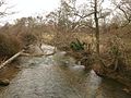 River Yeo at Bradford Abbas - geograph.org.uk - 1768516.jpg 640 × 480; 120 kB
-
 Road sign on Babylon Hill, A30 - geograph.org.uk - 4830747.jpg 1.600 × 1.200; 181 kB
-

-
 The Forge, Bradford Abbas - geograph.org.uk - 6031612.jpg 1.024 × 768; 283 kB
-
 The north slope of Babylon Hill, on the A30 (geograph 4830745).jpg 1.600 × 1.200; 191 kB
-

-

-
 The Peel Centre, Yeovil - geograph.org.uk - 1555346.jpg 640 × 480; 95 kB
-
 The Stables, Coombe - geograph.org.uk - 6031606.jpg 1.024 × 749; 177 kB
-
 The Stables, Coombe, Bradford Abbas - geograph.org.uk - 3879013.jpg 3.776 × 2.520; 4,15 MB
-
 Train for Weymouth at Two Bridges - geograph.org.uk - 3423153.jpg 640 × 480; 139 kB
-
 Tree, Bradford Abbas - geograph.org.uk - 1566316.jpg 480 × 640; 218 kB
-
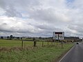
 Turning for Bradford Abbas - geograph.org.uk - 6031737.jpg 1.024 × 760; 202 kB
-
 Two Bridges with train - geograph.org.uk - 3393890.jpg 640 × 480; 191 kB
-
 Underdown Hollow - geograph.org.uk - 1454080.jpg 480 × 640; 214 kB
-
 Underdown Hollow - geograph.org.uk - 1768711.jpg 640 × 480; 88 kB
-
 Underdown Hollow - geograph.org.uk - 6031596.jpg 1.024 × 768; 274 kB
-
 Used car dealer, Sherborne Road, Yeovil - geograph.org.uk - 4830743.jpg 1.600 × 1.200; 216 kB
-
 View towards Bradford Abbas - geograph.org.uk - 5632379.jpg 1.024 × 768; 194 kB
-
 Village shop and Post Office, Bradford Abbas - geograph.org.uk - 6031729.jpg 1.024 × 828; 159 kB
-
 War Memorial, Bradford Abbas - geograph.org.uk - 1567134.jpg 480 × 640; 129 kB
-
 Westbound Railway - geograph.org.uk - 1454068.jpg 480 × 640; 233 kB
-
 Woods in Broad Lane - geograph.org.uk - 431061.jpg 640 × 480; 178 kB
-
 Yeovil Bridge Toll House (geograph 6114853).jpg 640 × 454; 150 kB
-
 Yeovil Bridge Tollhouse - geograph.org.uk - 1736158.jpg 640 × 461; 69 kB
-
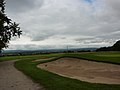
 Yeovil Golf Course - geograph.org.uk - 6031593.jpg 1.024 × 768; 256 kB
-

-
 Bradford Viaduct - geograph.org.uk - 447694.jpg 640 × 480; 104 kB
-
 Bunker with a view. - geograph.org.uk - 1454101.jpg 640 × 480; 171 kB
-
 Clifton Road Bridge - geograph.org.uk - 452848.jpg 640 × 480; 107 kB
-
 Copse north of Bradford Abbas - geograph.org.uk - 447675.jpg 640 × 480; 90 kB
-
 Court Lane Stoford - geograph.org.uk - 356710.jpg 640 × 480; 98 kB
-
 Farm Buildings, Clifton Maybank - geograph.org.uk - 452842.jpg 640 × 480; 96 kB
-
 Flood Marker at Bradford Abbas - geograph.org.uk - 765274.jpg 640 × 426; 85 kB
-
 Flooding at Bradford Abbas - geograph.org.uk - 458333.jpg 429 × 640; 67 kB
-
 Holloway at Little Covert, Bradford Abbas - geograph.org.uk - 764656.jpg 640 × 426; 144 kB
-
 Holloway at Little Covert, Bradford Abbas - geograph.org.uk - 765176.jpg 640 × 426; 148 kB
-
 Meadows north of Longford Bridge - geograph.org.uk - 452902.jpg 640 × 480; 91 kB
-

-
 Sewage Works, Thornford - geograph.org.uk - 452852.jpg 640 × 480; 111 kB


.JPG)


.jpg)
_-_geograph.org.uk_-_3033709.jpg)
_-_geograph.org.uk_-_3033714.jpg)


.jpg)


