Category:Bricklehampton
Naar navigatie springen
Naar zoeken springen
plaats in Worcestershire  | |||||
| Media uploaden | |||||
| Is een | |||||
|---|---|---|---|---|---|
| Locatie | Wychavon, Worcestershire, West Midlands, Engeland | ||||
| Inwonertal |
| ||||
| Oppervlakte |
| ||||
 | |||||
Ondercategorieën
Deze categorie bevat alleen de volgende subcategorie.
Media in categorie "Bricklehampton"
Deze categorie bevat de volgende 66 bestanden, van in totaal 66.
-
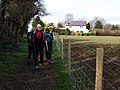
 A thatched cottage, The Lane, Bricklehampton - geograph.org.uk - 5996644.jpg 1.600 × 1.200; 366 kB
-

-
 Bank Cottage, The Lane, Bricklehampton - geograph.org.uk - 2420075.jpg 640 × 480; 100 kB
-
 Barn conversion in Bricklehampton - geograph.org.uk - 851149.jpg 640 × 480; 82 kB
-
 Black sheep at Bricklehampton - geograph.org.uk - 6007539.jpg 1.024 × 768; 378 kB
-
 Bricklehampton - geograph.org.uk - 852182.jpg 640 × 480; 85 kB
-
 Bricklehampton Road - geograph.org.uk - 4350599.jpg 800 × 450; 199 kB
-
 Bricks and St Michael's church - geograph.org.uk - 4200501.jpg 1.024 × 768; 176 kB
-
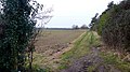
 Course of a footpath - geograph.org.uk - 4350603.jpg 800 × 450; 191 kB
-

-
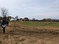
 Farmland near Bricklehampton - geograph.org.uk - 5556941.jpg 3.056 × 1.436; 433 kB
-
 Farmland near Cropthorne - geograph.org.uk - 850201.jpg 640 × 480; 112 kB
-
 Fields below Bredon Hill - geograph.org.uk - 5453835.jpg 3.064 × 1.911; 1,32 MB
-
 Footbridge near Bricklehampton - geograph.org.uk - 5453800.jpg 3.072 × 2.048; 1,29 MB
-
 Footpath junction - geograph.org.uk - 4340690.jpg 800 × 450; 191 kB
-
 Footpath straight on - geograph.org.uk - 4350604.jpg 800 × 450; 187 kB
-
 Gate and Windmill Hill - geograph.org.uk - 4200494.jpg 1.024 × 768; 289 kB
-
 Half-timbered cottage, Bricklehampton - geograph.org.uk - 851139.jpg 480 × 640; 120 kB
-
 Hall Farm, Bricklehampton - geograph.org.uk - 2420118.jpg 640 × 480; 77 kB
-
 Oaklands Fruit Farm, Wick - geograph.org.uk - 6243491.jpg 1.920 × 1.280; 1,17 MB
-
 Ordnance Survey Cut Mark - geograph.org.uk - 6119177.jpg 1.024 × 576; 237 kB
-
 Pastures on the Avon floodplain - geograph.org.uk - 4350602.jpg 800 × 450; 191 kB
-
 Phone box in Bricklehampton - geograph.org.uk - 4855586.jpg 640 × 480; 73 kB
-
 Pond and trees, Bricklehampton - geograph.org.uk - 5451031.jpg 3.072 × 2.048; 1,93 MB
-
 Poplars Farm, near Cropthorne - geograph.org.uk - 1095071.jpg 640 × 426; 109 kB
-
 Redug ditch, near Bricklehampton - geograph.org.uk - 851154.jpg 640 × 480; 91 kB
-
 Road to Bricklehampton - geograph.org.uk - 851194.jpg 640 × 480; 94 kB
-

-
 Sign at road junction - geograph.org.uk - 851185.jpg 640 × 480; 87 kB
-
 St Michael, Bricklehampton, altar - geograph.org.uk - 4888081.jpg 640 × 480; 92 kB
-

-

-

-
-

-

-
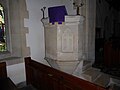
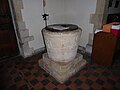 St Michael, Bricklehampton, font - geograph.org.uk - 4888016.jpg 640 × 480; 47 kB
-
 St Michael, Bricklehampton, lectern - geograph.org.uk - 4888084.jpg 640 × 480; 51 kB
-
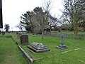
 St Michael, Bricklehampton, lych gate - geograph.org.uk - 4888001.jpg 640 × 480; 126 kB
-

-

-

-

-

-

-

-

-

-

-
 St Michael, Bricklehampton, pulpit - geograph.org.uk - 4888079.jpg 640 × 480; 43 kB
-

-

-

-

-

-

-

-
 Stoney ground - geograph.org.uk - 1095076.jpg 426 × 640; 109 kB
-
 Straw bales near Old Fallow Farm - geograph.org.uk - 1095081.jpg 640 × 426; 112 kB
-
 The B4084, Wick - geograph.org.uk - 6243493.jpg 1.848 × 1.162; 1,01 MB
-
 The road into Bricklehampton - geograph.org.uk - 883828.jpg 640 × 480; 122 kB
-
 Towards Bredon Hill - geograph.org.uk - 5450884.jpg 3.066 × 1.902; 1,21 MB
-
 Towards Hall Farm, Bricklehampton - geograph.org.uk - 5450996.jpg 2.570 × 1.440; 885 kB
-
 Track across the Avon floodplain - geograph.org.uk - 4340689.jpg 800 × 450; 200 kB
-
 Track and footpath - geograph.org.uk - 4350268.jpg 800 × 450; 205 kB
-
 Trees along parish boundary near Bricklehampton - geograph.org.uk - 5453851.jpg 3.072 × 2.048; 1,18 MB


_-_geograph.org.uk_-_4888003.jpg)
_-_geograph.org.uk_-_4888007.jpg)
_-_geograph.org.uk_-_4888009.jpg)
_-_geograph.org.uk_-_4888012.jpg)


_-_geograph.org.uk_-_4888017.jpg)
_-_geograph.org.uk_-_4888018.jpg)
_-_geograph.org.uk_-_4888019.jpg)
_-_geograph.org.uk_-_4888020.jpg)
_-_geograph.org.uk_-_4888026.jpg)
_-_geograph.org.uk_-_4888027.jpg)
_-_geograph.org.uk_-_4888033.jpg)
_-_geograph.org.uk_-_4888028.jpg)
_-_geograph.org.uk_-_4888031.jpg)
_-_geograph.org.uk_-_4888029.jpg)

_-_geograph.org.uk_-_4888038.jpg)
_-_geograph.org.uk_-_4888070.jpg)
_-_geograph.org.uk_-_4888072.jpg)
_-_geograph.org.uk_-_4888073.jpg)
_-_geograph.org.uk_-_4888074.jpg)
_-_geograph.org.uk_-_4888077.jpg)
_-_geograph.org.uk_-_4888078.jpg)


