Category:Bulkworthy
Naar navigatie springen
Naar zoeken springen
English: Bulkworthy is a village and civil parish in the Torridge district of Devon, England, about 9 miles southwest of Great Torrington, and on the River Torridge. According to the 2001 census it had a population of 83.
plaats in Devon  | |||||
| Media uploaden | |||||
| Is een | |||||
|---|---|---|---|---|---|
| Locatie | Torridge, Devon, Zuidwest-Engeland, Engeland | ||||
 | |||||
Ondercategorieën
Deze categorie bevat alleen de volgende subcategorie.
B
Media in categorie "Bulkworthy"
Deze categorie bevat de volgende 41 bestanden, van in totaal 41.
-
 Barley near Bulkworthy - geograph.org.uk - 5790627.jpg 3.465 × 2.040; 1,01 MB
-
 Bridge over Cleave Lake - geograph.org.uk - 5803760.jpg 4.288 × 2.848; 2,72 MB
-

-
 Bulkworthy, birds and stubble - geograph.org.uk - 590973.jpg 640 × 427; 152 kB
-
-
 Bulkworthy, chapel at Haytown - geograph.org.uk - 590976.jpg 640 × 427; 134 kB
-
 Bulkworthy, dilapilated barn - geograph.org.uk - 590966.jpg 640 × 427; 247 kB
-
 Bulkworthy, lane near Haytown - geograph.org.uk - 37312.jpg 640 × 431; 107 kB
-
 Bulkworthy, lane to Downmoor Cross - geograph.org.uk - 590969.jpg 640 × 427; 281 kB
-
 Bulkworthy, on Eastacott Moor - geograph.org.uk - 590971.jpg 640 × 427; 249 kB
-

-
 Eastacott Farm - geograph.org.uk - 721049.jpg 640 × 480; 95 kB
-
 Entrance to Waffapool Farm - geograph.org.uk - 1186550.jpg 640 × 480; 118 kB
-
 Farmland near Bulkworthy - geograph.org.uk - 5803654.jpg 3.807 × 2.692; 1,83 MB
-
 Farmland near Bulkworthy Moor - geograph.org.uk - 5803648.jpg 4.288 × 2.848; 2,03 MB
-
 Field near Bulkworthy Moor - geograph.org.uk - 5803622.jpg 4.266 × 2.713; 2,05 MB
-
 Field near Bulkworthy Moor - geograph.org.uk - 5803639.jpg 640 × 425; 124 kB
-
 Field near Stowford - geograph.org.uk - 3703690.jpg 640 × 480; 65 kB
-
 Fields near Bulkworthy Moor - geograph.org.uk - 5803617.jpg 640 × 361; 85 kB
-
 Fork in the lane from Bulkworthy - geograph.org.uk - 5803738.jpg 2.848 × 4.288; 2,34 MB
-
 Haytown Bridge - geograph.org.uk - 1821246.jpg 1.024 × 768; 295 kB
-
 Haytown Bridge - geograph.org.uk - 1821247.jpg 1.024 × 768; 325 kB
-
 Haytown Bridge as seen from downstream - geograph.org.uk - 1821249.jpg 1.024 × 768; 370 kB
-
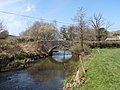 Haytown Bridge as seen from Upstream - geograph.org.uk - 1821250.jpg 1.024 × 768; 239 kB
-
 Lane from Bulkworthy - geograph.org.uk - 5803729.jpg 4.288 × 2.848; 2,14 MB
-
 Lane to Bulkworthy - geograph.org.uk - 5803672.jpg 2.848 × 4.288; 2,18 MB
-
 Lane to Bulkworthy Moor - geograph.org.uk - 5803550.jpg 4.288 × 2.848; 2,27 MB
-
 Lane to Bulkworthy Moor - geograph.org.uk - 5803602.jpg 4.288 × 2.700; 2,45 MB
-
 Lane to Bulkworthy Moor - geograph.org.uk - 5803658.jpg 640 × 392; 54 kB
-
 Meadow by Cleave Lake - geograph.org.uk - 979718.jpg 640 × 480; 130 kB
-
 Plaque on former chapel, Haytown, Bulkworthy - geograph.org.uk - 1814369.jpg 1.285 × 2.000; 410 kB
-
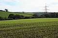
 Pylons crossing Binworthy Moor - geograph.org.uk - 4565188.jpg 800 × 531; 79 kB
-
 Stowford Cross - geograph.org.uk - 721022.jpg 640 × 480; 145 kB
-
-
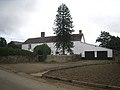
 The green at Haytown, Bulkworthy - geograph.org.uk - 1814373.jpg 2.000 × 1.397; 727 kB
-

-
 The view downstream from Haytown Bridge - geograph.org.uk - 1821252.jpg 1.024 × 768; 272 kB
-
 Tilled field northeast of Bulkworthy - geograph.org.uk - 5803668.jpg 4.288 × 2.848; 2,27 MB
-
 Tilled field northeast of Bulkworthy - geograph.org.uk - 5803669.jpg 4.288 × 2.848; 2,28 MB
-
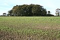
 Trees, Bulkworthy Moor - geograph.org.uk - 5790604.jpg 4.288 × 2.848; 2,18 MB
-
 Valley east of Bulkworthy - geograph.org.uk - 5803663.jpg 640 × 425; 86 kB


