Category:Caerphilly County Borough
둘러보기로 이동
검색으로 이동
principal area in south-east Wales, United Kingdom    | |||||
| 미디어 올리기 | |||||
| 다음 종류에 속함 |
| ||||
|---|---|---|---|---|---|
| 위치 | 웨일스 | ||||
| 관광청 |
| ||||
| 정부 소재지 | |||||
| 인구 수 |
| ||||
| 면적 |
| ||||
| 다음에서 이어받음 | |||||
| 공식 웹사이트 | |||||
 | |||||

Caerphilly County Borough is a principal area and part of the preserved county of Gwent, south Wales.
"Caerphilly County Borough" 분류에 속하는 미디어
다음은 이 분류에 속하는 파일 193개 가운데 193개입니다.
-

-
 A4048 approaches The Rock - geograph.org.uk - 1731301.jpg 640 × 528; 108 KB
-

-

-
 Bedwas Junior School, Church Street - geograph.org.uk - 1162236.jpg 640 × 480; 143 KB
-
 Bedwas Police Station - geograph.org.uk - 1167084.jpg 640 × 480; 109 KB
-
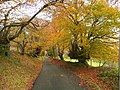 Beech-lined lane near Machen - geograph.org.uk - 1041376.jpg 640 × 480; 174 KB
-
 Beeches on the hillside 1 - geograph.org.uk - 1041343.jpg 640 × 480; 116 KB
-

-
 Bridge across the River Rhymney, Bedwas - geograph.org.uk - 1167060.jpg 640 × 480; 177 KB
-

-

-
 Brynteg Crescent - geograph.org.uk - 940217.jpg 640 × 480; 99 KB
-
 Caerphilly children on the logan-stone (12118310394).jpg 441 × 606; 70 KB
-

-
 Caerphilly UK ward map (Council Election 2012).svg 894 × 1,266; 528 KB
-

-

-
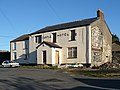 Castle Hotel, Rhymney - geograph.org.uk - 1119738.jpg 640 × 480; 83 KB
-
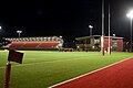 CCB Centre for Sporting Excellence Rugby Pitch.jpg 800 × 533; 51 KB
-
 Celtic Trail.jpg 3,264 × 2,448; 2.8 MB
-
 Chartist Bridge (detail) - geograph.org.uk - 871813.jpg 640 × 640; 77 KB
-

-
 Chris Waite car sales, Rock Garage - geograph.org.uk - 1735054.jpg 640 × 480; 83 KB
-
 Church Street, Bedwas (2) - geograph.org.uk - 1167072.jpg 640 × 480; 102 KB
-
 Colourful mural alongside A4048 - geograph.org.uk - 1735089.jpg 640 × 508; 102 KB
-
 Corner of Asda superstore, Blackwood - geograph.org.uk - 1731700.jpg 640 × 368; 50 KB
-
-
-
-
 Cwrt-y-Bella, Gwrhay - geograph.org.uk - 1734303.jpg 640 × 480; 95 KB
-

-
-
 Darran Road, Risca - geograph.org.uk - 1759000.jpg 640 × 480; 64 KB
-
 Detached house, Rhymney High Street - geograph.org.uk - 1119734.jpg 640 × 480; 119 KB
-
 Eastern edge of Cwm-Corrwg - geograph.org.uk - 1734808.jpg 640 × 621; 139 KB
-

-
 Emmanuel Baptist Church, Rhymney - geograph.org.uk - 1112590.jpg 640 × 480; 66 KB
-
 Entrance road to Argoed Fawr farm - geograph.org.uk - 1731313.jpg 640 × 480; 91 KB
-
 Factory area, Rhymney - geograph.org.uk - 1120768.jpg 640 × 480; 145 KB
-
-
 Farmland, Gwrhay - geograph.org.uk - 1734293.jpg 640 × 480; 94 KB
-

-

-
 Footpath in Rhymney Park - geograph.org.uk - 1119743.jpg 640 × 480; 186 KB
-
 Footpath to Sarn Place, Risca - geograph.org.uk - 1758932.jpg 640 × 480; 98 KB
-
 Four houses on New Park Road, Risca - geograph.org.uk - 1759899.jpg 640 × 447; 56 KB
-
 Foxes Lane, Oakdale - geograph.org.uk - 1733958.jpg 640 × 302; 45 KB
-
 Frank Ware Motors, Risca - geograph.org.uk - 1757319.jpg 640 × 480; 61 KB
-
 Gelli Avenue railway bridge, Risca - geograph.org.uk - 1756455.jpg 640 × 480; 78 KB
-
 Gelligroes mill - geograph.org.uk - 736957.jpg 638 × 475; 60 KB
-
 Grove Road, Risca - geograph.org.uk - 1757562.jpg 640 × 447; 64 KB
-

-
 Hairpin bend near Abertysswg - geograph.org.uk - 1196681.jpg 640 × 480; 110 KB
-
 Havards Row - geograph.org.uk - 1633401.jpg 640 × 480; 104 KB
-
 Hill Street - geograph.org.uk - 1069272.jpg 640 × 480; 79 KB
-
 Hillside, Risca - geograph.org.uk - 1756472.jpg 640 × 480; 87 KB
-
 Houses, High Street, Argoed - geograph.org.uk - 1731109.jpg 640 × 418; 65 KB
-
 Jerusalem Street, Rhymney - geograph.org.uk - 1120223.jpg 640 × 480; 89 KB
-

-

-
 Llanover Colliery Pumping Station - geograph.org.uk - 1055839.jpg 640 × 414; 62 KB
-
 Lloyds TSB Blackwood - geograph.org.uk - 1732153.jpg 640 × 480; 66 KB
-
-
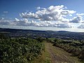
 Looking towards Twmbarlwm - geograph.org.uk - 1041411.jpg 640 × 480; 89 KB
-
 Medart Place houses, Crosskeys - geograph.org.uk - 1759290.jpg 640 × 603; 93 KB
-
 Michaelstone Bridge - geograph.org.uk - 736333.jpg 639 × 479; 204 KB
-
 Mill Lane - geograph.org.uk - 736590.jpg 638 × 475; 75 KB
-
 Moriah Chapel, Rhymney - geograph.org.uk - 1100968.jpg 640 × 480; 62 KB
-
 Moriah Street (1), Rhymney - geograph.org.uk - 1100941.jpg 640 × 480; 90 KB
-
 Moriah Street (2), Rhymney - geograph.org.uk - 1100945.jpg 640 × 480; 82 KB
-
 Moving mountains (1), Rhymney Valley - geograph.org.uk - 1032685.jpg 640 × 480; 141 KB
-
-
 Nant yr Helyg from the Man-moel Road - geograph.org.uk - 930003.jpg 640 × 427; 163 KB
-
 New Foresters, Blackwood - geograph.org.uk - 1732168.jpg 640 × 596; 88 KB
-
 New Park Road crossing boundary - geograph.org.uk - 1759796.jpg 640 × 480; 58 KB
-
 New Tredegar industrial estate - geograph.org.uk - 1095024.jpg 640 × 480; 249 KB
-
 Old pit wheels at Rhymney - geograph.org.uk - 1259508.jpg 640 × 480; 86 KB
-
-
 Pentwynmawr village - geograph.org.uk - 777838.jpg 640 × 480; 78 KB
-
 Pet shop, Bedwas - geograph.org.uk - 1162197.jpg 640 × 476; 77 KB
-

-
 Picnic tables at Cwm Carn - geograph.org.uk - 1158595.jpg 640 × 480; 131 KB
-
 Platform at Rhymney Station - geograph.org.uk - 1080634.jpg 640 × 480; 79 KB
-
 Play area, Rhymney Park - geograph.org.uk - 1119798.jpg 640 × 477; 126 KB
-
 Post Office, Church Street, Bedwas - geograph.org.uk - 1162223.jpg 640 × 480; 104 KB
-
 Puddlers Arms, Rhymney - geograph.org.uk - 1101062.jpg 640 × 480; 56 KB
-
-

-

-
 Rhymney High Street (1) - geograph.org.uk - 1118800.jpg 640 × 480; 87 KB
-
 Rhymney High Street (2) - geograph.org.uk - 1118807.jpg 640 × 480; 122 KB
-
 Rhymney River - geograph.org.uk - 1083058.jpg 640 × 480; 145 KB
-
 Rhymney Social Club - geograph.org.uk - 1104685.jpg 640 × 480; 80 KB
-
 Rhymney Station - geograph.org.uk - 1080783.jpg 640 × 481; 63 KB
-

-
 Risca Citizens Advice Bureau - geograph.org.uk - 1756333.jpg 640 × 455; 73 KB
-
-
 River Ebbw looking downriver - geograph.org.uk - 756027.jpg 640 × 480; 183 KB
-
 River Ebbw looking upriver - geograph.org.uk - 756031.jpg 640 × 481; 134 KB
-
 River footbridge, Risca - geograph.org.uk - 1757531.jpg 640 × 480; 118 KB
-
 River Rhymney and allotments - geograph.org.uk - 1025187.jpg 640 × 479; 151 KB
-
 River Rhymney near Waterloo - geograph.org.uk - 979211.jpg 640 × 480; 152 KB
-
 Road Bridge over River Rhymney - geograph.org.uk - 1514400.jpg 640 × 480; 144 KB
-
 Road Bridge over the River Rhymney - geograph.org.uk - 1514396.jpg 640 × 480; 102 KB
-
-
 Road into the Country Park - geograph.org.uk - 1041851.jpg 640 × 480; 148 KB
-
 Rooftop view, Rhymney - geograph.org.uk - 1120244.jpg 640 × 480; 146 KB
-
 Rugby pitches, New Park Road - geograph.org.uk - 1759762.jpg 640 × 480; 54 KB
-

-
 Severn Close, Risca - geograph.org.uk - 1749385.jpg 640 × 560; 83 KB
-
 Side view of river footbridge, Risca - geograph.org.uk - 1757547.jpg 640 × 480; 105 KB
-
 Sirhowy River, Ynysddu - geograph.org.uk - 1772087.jpg 640 × 480; 145 KB
-
 Sirhowy Valley - geograph.org.uk - 871812.jpg 640 × 480; 160 KB
-
 Sirhowy Valley Country Park - geograph.org.uk - 1041824.jpg 640 × 480; 144 KB
-
 Sirhowy Valley Country Park Path - geograph.org.uk - 1418227.jpg 480 × 640; 298 KB
-

-
 Snowy woodland on Rhymney Valley Ridgeway Walk. - geograph.org.uk - 1728724.jpg 768 × 1,024; 353 KB
-

-
 St Lukes church, Abercarn - geograph.org.uk - 1176139.jpg 640 × 480; 80 KB
-
 St Lukes church, Abercarn - geograph.org.uk - 1176147.jpg 640 × 480; 40 KB
-
 St Lukes church, Abercarn - geograph.org.uk - 1176150.jpg 640 × 480; 80 KB
-
 St Lukes church, Abercarn - geograph.org.uk - 1176160.jpg 640 × 480; 62 KB
-
 St Lukes church, Abercarn - geograph.org.uk - 1176166.jpg 640 × 480; 47 KB
-
 St Margaret's Church, Blackwood - geograph.org.uk - 1732249.jpg 640 × 583; 92 KB
-

-
-
 Steps in river bank, Risca - geograph.org.uk - 1757557.jpg 640 × 480; 92 KB
-
 Sunnybank Road, Blackwood - geograph.org.uk - 1732265.jpg 640 × 496; 62 KB
-
 Sunset at Penyfan Pond - geograph.org.uk - 1150108.jpg 640 × 480; 35 KB
-

-

-
 Tai'rheol and Railway Tavern.jpg 8,000 × 6,000; 8.96 MB
-

-
 The country park car park - geograph.org.uk - 1041831.jpg 640 × 480; 115 KB
-
 The Cross Inn, Gelligaer - geograph.org.uk - 736965.jpg 638 × 500; 105 KB
-
 The Meadows, Crosskeys - geograph.org.uk - 1759297.jpg 640 × 546; 63 KB
-

-

-

-

-
 Track over Cefn Onn - geograph.org.uk - 1728718.jpg 1,024 × 768; 193 KB
-
 Track traversing Mynydd Fochriw - geograph.org.uk - 896811.jpg 640 × 480; 65 KB
-
 Tre-York Street, Rhymney - geograph.org.uk - 1159383.jpg 640 × 480; 123 KB
-
 Treowen - geograph.org.uk - 486287.jpg 640 × 480; 96 KB
-
 Twmbarlwm trig point and motte. - geograph.org.uk - 1184545.jpg 640 × 480; 77 KB
-
 Twyn y Waun - geograph.org.uk - 484314.jpg 640 × 480; 73 KB
-
 Ty Darran, Risca - geograph.org.uk - 1759148.jpg 640 × 625; 82 KB
-
 Tyla-du plantation - geograph.org.uk - 735991.jpg 638 × 475; 104 KB
-
 Van Road Lime Kiln, Caerphilly. Larger charging hole.jpg 4,896 × 2,953; 5.51 MB
-
 Van Road Lime Kiln, Caerphilly. Small charging hole.jpg 4,896 × 3,344; 6 MB
-
 Victorian postbox, Rhymney Station - geograph.org.uk - 1080636.jpg 640 × 480; 115 KB
-
 View across the Sirhowy Valley - geograph.org.uk - 1111518.jpg 640 × 479; 106 KB
-
 View from Arthur Street, Abertysswg - geograph.org.uk - 1150846.jpg 640 × 480; 117 KB
-
 View from the Parish Road - geograph.org.uk - 654713.jpg 640 × 480; 127 KB
-
 View from Twyn yr Oerfel - geograph.org.uk - 736440.jpg 639 × 479; 220 KB
-
 View into Cwm Bargoed - geograph.org.uk - 896816.jpg 640 × 480; 79 KB
-
 View of Cwmfelinfach - geograph.org.uk - 1418263.jpg 640 × 640; 328 KB
-
 View over the Sirhowy valley - geograph.org.uk - 736888.jpg 638 × 475; 74 KB
-

-
 War Memorial and Memorial Garden - geograph.org.uk - 942346.jpg 640 × 481; 99 KB
-
 Waterfall by the country park road - geograph.org.uk - 1041839.jpg 480 × 640; 177 KB
-
 Waunfawr Gardens, Crosskeys - geograph.org.uk - 1759783.jpg 640 × 480; 60 KB
-
 Welcome to Crosskeys - geograph.org.uk - 1759287.jpg 640 × 427; 66 KB
-

-
 Western Valley Models, Risca - geograph.org.uk - 1759195.jpg 640 × 521; 63 KB
-
 White Rose Way, New Tredegar - geograph.org.uk - 578917.jpg 640 × 480; 98 KB
-
 White Rose Way, New Tredegar - geograph.org.uk - 578931.jpg 640 × 640; 158 KB
-

-
 Woodfieldside - geograph.org.uk - 1690332.jpg 640 × 480; 220 KB
-
 Ant Field Coed Y Garn - geograph.org.uk - 114159.jpg 640 × 480; 221 KB
-
 Brecon DVOR (aircraft navigation beacon) - geograph.org.uk - 88540.jpg 640 × 480; 129 KB
-
 Celynen roundabout A472 - A467 - geograph.org.uk - 199983.jpg 640 × 480; 109 KB
-
 Coal Bing from Carnedd Lwyd - geograph.org.uk - 247788.jpg 640 × 480; 123 KB
-
 Coal tips above Senghenydd. - geograph.org.uk - 247826.jpg 640 × 480; 109 KB
-
 Country Road near Ystrad Mynach - geograph.org.uk - 235490.jpg 640 × 480; 72 KB
-
 Former Chapel, Senghenydd - geograph.org.uk - 247981.jpg 640 × 480; 98 KB
-
 Gwent Abattoir - geograph.org.uk - 76961.jpg 1,036 × 1,472; 512 KB
-

-
 Moorland Path above Senghenydd - geograph.org.uk - 247969.jpg 640 × 480; 108 KB
-
 Mynydd Eglwysilan, South Side of Summit - geograph.org.uk - 248695.jpg 640 × 480; 137 KB
-
 On Mynydd Eglwysilan - geograph.org.uk - 247834.jpg 640 × 480; 138 KB
-
 Pylon near Rudry - geograph.org.uk - 74366.jpg 640 × 480; 157 KB
-
 Rhymney Valley Ridgeway above Caermoel - geograph.org.uk - 247819.jpg 640 × 480; 133 KB
-
 Rhymney Valley Ridgeway at Carnedd Lwyd - geograph.org.uk - 247801.jpg 640 × 480; 118 KB
-
 Rhymney Valley Ridgeway by Twyn Hywel - geograph.org.uk - 247812.jpg 640 × 480; 130 KB
-
 Senghenydd Dyke - geograph.org.uk - 235416.jpg 640 × 480; 61 KB
-
 Sign on Brecon DVOR - geograph.org.uk - 88542.jpg 640 × 480; 161 KB
-
 Spoil Heaps near Llanbradach - geograph.org.uk - 235486.jpg 640 × 480; 61 KB
-
 The Abattoir, Gellihaf - geograph.org.uk - 215682.jpg 844 × 552; 106 KB
-
 Tor on Mynydd Eglwysilan - geograph.org.uk - 247851.jpg 640 × 480; 137 KB
-
 View from Twmbarlwm summit - geograph.org.uk - 221832.jpg 640 × 480; 56 KB
-
 Wireless Station, Mynydd y Lan - geograph.org.uk - 146274.jpg 640 × 426; 105 KB


.jpg)

.svg)


_-_geograph.org.uk_-_871813.jpg)


_-_geograph.org.uk_-_1167072.jpg)


_-_geograph.org.uk_-_1749029.jpg)


,_Rhymney_-_geograph.org.uk_-_1100941.jpg)
,_Rhymney_-_geograph.org.uk_-_1100945.jpg)
,_Rhymney_Valley_-_geograph.org.uk_-_1032685.jpg)


_-_geograph.org.uk_-_1118800.jpg)
_-_geograph.org.uk_-_1118807.jpg)


_-_geograph.org.uk_-_88540.jpg)