Category:Christ Church, Port Sunlight
Jump to navigation
Jump to search
| Object location | | View all coordinates using: OpenStreetMap |
|---|
church in Wirral, UK   | |||||
| Upload media | |||||
| Instance of | |||||
|---|---|---|---|---|---|
| Named after | |||||
| Dedicated to | |||||
| Location | Wirral, Merseyside, North West England, England | ||||
| Architectural style | |||||
| Heritage designation |
| ||||
| official website | |||||
 | |||||
Subcategories
This category has the following 4 subcategories, out of 4 total.
Media in category "Christ Church, Port Sunlight"
The following 10 files are in this category, out of 10 total.
-

-

-
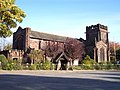 Christ church in Port Sunlight - geograph.org.uk - 1019180.jpg 640 × 479; 93 KB
-
 Christ Church sits on a carpet of leaves at Port Sunlight.jpg 5,986 × 3,991; 17.97 MB
-
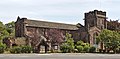
 Christ Church, Port Sunlight (1).JPG 4,608 × 3,456; 3.54 MB
-
 Christ Church, Port Sunlight (2).JPG 4,608 × 3,456; 3.5 MB
-
 Christ Church, Port Sunlight.jpg 4,638 × 2,282; 13.79 MB
-
 Porch of Christ Church, Port Sunlight.jpg 3,158 × 4,008; 14.42 MB
-
 Port Sunlight - DSC04723.JPG 3,648 × 2,736; 3.64 MB
-
 Port Sunlight - DSC04728.JPG 3,648 × 2,736; 3.6 MB
_-_geograph.org.uk_-_3064834.jpg)
_-_geograph.org.uk_-_3064814.jpg)


.JPG)
.JPG)


Categories:
- 1900s Gothic Revival churches in England
- 20th-century churches in Merseyside
- Arts and Crafts churches in England
- Christ churches in Merseyside
- Churches in England built in 1904
- Churches in Port Sunlight
- Cruciform churches in Merseyside
- Former Congregationalist churches in England
- Gothic Revival churches in Merseyside
- Grade II* listed churches in the Metropolitan Borough of Wirral
- United Reformed churches in the Metropolitan Borough of Wirral
- Architectural basilicas in Merseyside