Category:Cley next the Sea
Jump to navigation
Jump to search
village in Norfolk, North Norfolk, England, UK  ,_Cley_-_geograph.org.uk_-_3895351.jpg)  | |||||
| Upload media | |||||
| Instance of | |||||
|---|---|---|---|---|---|
| Location | Cley Next the Sea, North Norfolk, Norfolk, East of England, England | ||||
| Area |
| ||||
 | |||||
Subcategories
This category has the following 9 subcategories, out of 9 total.
Media in category "Cley next the Sea"
The following 200 files are in this category, out of 654 total.
(previous page) (next page)-
 'Welcome to Blakeney Point' sign, Cley Eye car park - geograph.org.uk - 2587607.jpg 3,990 × 2,660; 3.99 MB
-
 'WH272' washed up, Cley Channel - geograph.org.uk - 2586276.jpg 4,129 × 2,741; 3.76 MB
-
 'WH272' washed up, Cley Channel - geograph.org.uk - 2586286.jpg 4,288 × 2,848; 5.37 MB
-
 1 ^ 2 Long House Yard, Cley next the Sea - geograph.org.uk - 6274315.jpg 3,264 × 2,448; 5.11 MB
-
 A new family at Cley Marshes - geograph.org.uk - 4037508.jpg 1,600 × 1,029; 851 KB
-
 A vast shingle beach - geograph.org.uk - 980971.jpg 640 × 448; 178 KB
-

-
 A149 by Cley Marshes - geograph.org.uk - 3618246.jpg 640 × 481; 40 KB
-
 A149 Coast Road at Cley-next-the-Sea - geograph.org.uk - 5689611.jpg 640 × 480; 68 KB
-
 A149 Coast Road at Cley-next-the-Sea - geograph.org.uk - 5689614.jpg 640 × 480; 82 KB
-

-
 A149 past Snipes Marsh - geograph.org.uk - 5102520.jpg 1,600 × 1,200; 726 KB
-
 A149 past Walsey Hills - geograph.org.uk - 5102519.jpg 1,600 × 1,200; 502 KB
-
 Access to The Old Rectory - geograph.org.uk - 4991420.jpg 1,200 × 1,600; 1,024 KB
-
 After the harvest, Cley - geograph.org.uk - 2555924.jpg 637 × 640; 123 KB
-
 Albert Goodwin - Cley from Wiveton Bridge’ - Goodwin-96229.jpg 1,800 × 1,425; 1.46 MB
-
 Allan Williams turret in Cley - geograph.org.uk - 3962623.jpg 640 × 480; 119 KB
-
 Allan Williams turret in Cley - interior - geograph.org.uk - 3962626.jpg 640 × 480; 176 KB
-
 Allan Williams turret in Cley - interior - geograph.org.uk - 3962627.jpg 480 × 640; 148 KB
-

-

-
 Allan-Williams Turret - geograph.org.uk - 3885461.jpg 640 × 430; 99 KB
-
 Along the cut to Salthouse - geograph.org.uk - 4158812.jpg 1,074 × 1,600; 545 KB
-
 Along the low water line on Blakeney beach - geograph.org.uk - 5125412.jpg 1,632 × 1,224; 599 KB
-
 Anglers on the beach at Cley Eye - geograph.org.uk - 5606443.jpg 800 × 499; 112 KB
-
 Approaching Cley - geograph.org.uk - 2336086.jpg 2,560 × 1,920; 1.93 MB
-

-

-
 Arnold's Marsh - geograph.org.uk - 3147611.jpg 1,024 × 768; 277 KB
-
 Arnold's Marsh - geograph.org.uk - 5930814.jpg 1,600 × 1,200; 476 KB
-
 Arnold's Marsh - geograph.org.uk - 5930817.jpg 1,600 × 1,200; 377 KB
-
 Attenborough Walk, Cley Marshes - geograph.org.uk - 4808514.jpg 1,600 × 1,200; 927 KB
-
 Avocet Hide, Cley Marshes - geograph.org.uk - 5102480.jpg 1,600 × 1,200; 916 KB
-
 Beach and shingle bank near Cley Eye - geograph.org.uk - 5606405.jpg 800 × 553; 90 KB
-
 Beach at Cley - geograph.org.uk - 5574299.jpg 1,600 × 1,187; 964 KB
-
 Beach at Cley next the Sea - geograph.org.uk - 3913124.jpg 640 × 480; 72 KB
-
 Beach at Salthouse - geograph.org.uk - 3900648.jpg 640 × 430; 51 KB
-
 Beach at Salthouse - geograph.org.uk - 3900650.jpg 640 × 430; 42 KB
-
 Beach between Cley and Salthouse - geograph.org.uk - 3900639.jpg 640 × 430; 40 KB
-
 Beach east of Cley Eye - geograph.org.uk - 4808532.jpg 1,920 × 1,225; 742 KB
-
 Beach heading to Blakeney Point - geograph.org.uk - 5633185.jpg 640 × 425; 76 KB
-
 Beach heading up towards Cley Eye - geograph.org.uk - 5636394.jpg 640 × 425; 65 KB
-
 Beach Rd - geograph.org.uk - 3885523.jpg 640 × 430; 37 KB
-
 Beach Rd - geograph.org.uk - 3885525.jpg 640 × 430; 38 KB
-
 Beach Rd - geograph.org.uk - 3885530.jpg 640 × 430; 35 KB
-
 Beach Rd - geograph.org.uk - 4031044.jpg 640 × 374; 27 KB
-
 Beach Road - geograph.org.uk - 980822.jpg 640 × 460; 92 KB
-
 Beach Road crossing the Cley Marshes - geograph.org.uk - 5607285.jpg 800 × 528; 100 KB
-
 Beach road, Cley - geograph.org.uk - 1257561.jpg 640 × 425; 35 KB
-
 Beach Road, Cley-next-the-Sea - geograph.org.uk - 5689622.jpg 640 × 480; 70 KB
-
 Beau Rivage, Cley - geograph.org.uk - 4809107.jpg 2,399 × 1,654; 641 KB
-
 Beau Rivage, Cley-next-the-Sea - geograph.org.uk - 5685151.jpg 640 × 480; 76 KB
-
 Beer Garden, The George - geograph.org.uk - 4031050.jpg 640 × 430; 47 KB
-
 Bench on the seawall - geograph.org.uk - 3885529.jpg 640 × 430; 50 KB
-
 Berms on Blakeney Point - geograph.org.uk - 4821002.jpg 1,600 × 1,200; 1.12 MB
-
 Big sky over harvested fields, Cley - geograph.org.uk - 2555927.jpg 640 × 480; 126 KB
-
 Bird hide ^ shelter on Arnold's Marsh - geograph.org.uk - 6249901.jpg 3,264 × 2,448; 4.93 MB
-
 Bird hides, Cley Marshes Nature Reserve - geograph.org.uk - 3010231.jpg 640 × 480; 110 KB
-
 Bird sightings board, NWT Cley Marshes - geograph.org.uk - 3146141.jpg 1,372 × 1,372; 296 KB
-
 Birdwatchers at Cley - geograph.org.uk - 5450513.jpg 640 × 423; 67 KB
-
 Birdwatchers on the beach at Cley Eye - geograph.org.uk - 5606452.jpg 800 × 482; 120 KB
-
 Birdwatching at Cley - geograph.org.uk - 5930812.jpg 1,600 × 1,249; 536 KB
-
 Bishop's Hide, Cley Marshes - geograph.org.uk - 4808539.jpg 1,600 × 1,200; 892 KB
-
 Bits and pieces of masonry - geograph.org.uk - 980982.jpg 640 × 480; 181 KB
-
 Black Headed Gull, Cley Eye, Norfolk - geograph.org.uk - 5374344.jpg 1,817 × 1,439; 1.17 MB
-
 Blakeney Eye - geograph.org.uk - 2336045.jpg 2,560 × 1,920; 1.74 MB
-
 Blakeney Eye - geograph.org.uk - 3888373.jpg 640 × 430; 33 KB
-
 Blakeney Eye - geograph.org.uk - 3888374.jpg 640 × 430; 32 KB
-
 Blakeney Eye - geograph.org.uk - 3888383.jpg 640 × 374; 41 KB
-
 Blakeney Eye Salt Marsh - geograph.org.uk - 2336061.jpg 2,560 × 1,920; 1.91 MB
-
 Blakeney Fresh marsh flooded - geograph.org.uk - 4057306.jpg 4,000 × 3,000; 3.72 MB
-
 Blakeney Freshes - geograph.org.uk - 2336021.jpg 2,560 × 1,920; 1.82 MB
-
 Blakeney Point - geograph.org.uk - 3989356.jpg 1,600 × 1,200; 556 KB
-
 Blakeney Point rolling inland - geograph.org.uk - 4057320.jpg 1,600 × 1,200; 631 KB
-
 Blakeney Point rolling inland - geograph.org.uk - 4057333.jpg 1,600 × 1,200; 502 KB
-
 Boardwalk to hides, Cley marshes - geograph.org.uk - 4808508.jpg 1,600 × 1,200; 876 KB
-
 Boat on Blakeney Point - geograph.org.uk - 4957664.jpg 1,600 × 1,200; 713 KB
-
 Boat on saltmarsh north of Blakeney - geograph.org.uk - 2165432.jpg 1,600 × 1,200; 386 KB
-
 Boat on shingle ridge, Blakeney Point - geograph.org.uk - 313758.jpg 640 × 480; 93 KB
-
 Boats at Cley Eye - geograph.org.uk - 4810863.jpg 789 × 495; 86 KB
-
 Boats moored by their jetties - geograph.org.uk - 842804.jpg 480 × 640; 172 KB
-
 Boats on the shingle beach at Cley Eye - geograph.org.uk - 5606484.jpg 800 × 549; 129 KB
-
 Bracken growing on The Hangs - geograph.org.uk - 2555884.jpg 640 × 480; 140 KB
-
 Breach in the seawall - geograph.org.uk - 3881687.jpg 640 × 430; 53 KB
-
 Breach in the shingle ridge - geograph.org.uk - 3147596.jpg 1,024 × 768; 308 KB
-
 Breaking Waves at Cley Eye, Norfolk - geograph.org.uk - 5374337.jpg 3,973 × 2,894; 2.1 MB
-
 Brent Geese (Branta bernicla) - geograph.org.uk - 6021500.jpg 1,600 × 1,200; 443 KB
-
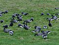 Brent Geese (Branta bernicla) - geograph.org.uk - 6021506.jpg 1,600 × 1,218; 461 KB
-
 Brent Geese near Snipes Marsh - geograph.org.uk - 4808617.jpg 3,339 × 2,377; 2.81 MB
-
 Bridgefoot Lane - geograph.org.uk - 4991421.jpg 1,600 × 1,200; 506 KB
-

-

-
 Building debris, Cley Eye - geograph.org.uk - 1062791.jpg 640 × 426; 99 KB
-
 Buried fence - geograph.org.uk - 3894100.jpg 640 × 430; 56 KB
-
 Buried fence - geograph.org.uk - 3894112.jpg 640 × 430; 70 KB
-

-
 Bus stop, Cley Marshes - geograph.org.uk - 4808511.jpg 1,600 × 1,200; 841 KB
-
 Calf in pasture west of Lowes Farm - geograph.org.uk - 2347554.jpg 640 × 480; 280 KB
-
 Car Park at Cley Eye - geograph.org.uk - 5942110.jpg 4,608 × 3,456; 3.74 MB
-
 Cattle grazing in Fresh Marshes - geograph.org.uk - 980679.jpg 640 × 436; 159 KB
-
 Cattle in pasture west of Lowes Farm - geograph.org.uk - 2347552.jpg 640 × 480; 292 KB
-
 Central Cley - geograph.org.uk - 6233423.jpg 2,000 × 1,333; 2.09 MB
-
 Channel of the Glaven, Blakeney Eye - geograph.org.uk - 4810979.jpg 3,072 × 1,596; 972 KB
-
 Channel of the Glaven, Blakeney Eye - geograph.org.uk - 4811005.jpg 3,070 × 1,771; 1.04 MB
-
 Channel south of Arnold's Marsh - geograph.org.uk - 4808600.jpg 1,920 × 1,173; 709 KB
-
 Channel, Cley Marshes - geograph.org.uk - 4808715.jpg 1,920 × 1,173; 702 KB
-
 Channels, Cley Marshes - geograph.org.uk - 4808635.jpg 3,052 × 1,631; 1.05 MB
-
 Cley - geograph.org.uk - 1062753.jpg 640 × 431; 87 KB
-
 Cley across the reedbeds - geograph.org.uk - 4809756.jpg 1,920 × 1,280; 731 KB
-
 Cley allotments - geograph.org.uk - 2084347.jpg 640 × 480; 74 KB
-
 Cley Beach - geograph.org.uk - 3893747.jpg 640 × 430; 74 KB
-
 Cley Beach - geograph.org.uk - 3893972.jpg 640 × 430; 54 KB
-
 Cley Beach - geograph.org.uk - 3893978.jpg 640 × 430; 48 KB
-
 Cley beach car park - geograph.org.uk - 3778568.jpg 4,000 × 3,000; 3.15 MB
-
 Cley Channel - geograph.org.uk - 2705395.jpg 4,320 × 3,240; 2.92 MB
-
 Cley Channel - geograph.org.uk - 3450729.jpg 1,600 × 1,200; 629 KB
-
 Cley Eye Beach - geograph.org.uk - 5633178.jpg 640 × 425; 71 KB
-
 Cley Eye, Norfolk - geograph.org.uk - 5374341.jpg 4,000 × 3,000; 2.5 MB
-
 Cley Flood Barrier - geograph.org.uk - 3885439.jpg 640 × 430; 44 KB
-
 Cley Flood Barrier - geograph.org.uk - 3885443.jpg 640 × 430; 48 KB
-
 Cley from the A149 - geograph.org.uk - 4809623.jpg 1,920 × 1,195; 484 KB
-
 Cley from the coast path - geograph.org.uk - 4809869.jpg 2,527 × 1,718; 984 KB
-
 Cley Green, Cley-next-the-Sea - geograph.org.uk - 5687200.jpg 640 × 480; 72 KB
-
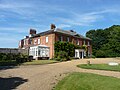 Cley Hall - geograph.org.uk - 6263100.jpg 3,264 × 2,448; 4.88 MB
-
 Cley Harbour - geograph.org.uk - 5102467.jpg 1,600 × 1,200; 694 KB
-
 Cley Marsh Nature Reserve - geograph.org.uk - 6233402.jpg 2,000 × 1,333; 1.49 MB
-
 Cley Marshes - geograph.org.uk - 3885456.jpg 640 × 430; 46 KB
-
 Cley Marshes - geograph.org.uk - 3885527.jpg 640 × 398; 47 KB
-
 Cley Marshes - geograph.org.uk - 3885532.jpg 640 × 430; 40 KB
-
 Cley Marshes - geograph.org.uk - 3885534.jpg 640 × 430; 37 KB
-
 Cley Marshes - geograph.org.uk - 3885536.jpg 640 × 430; 41 KB
-
 Cley Marshes - geograph.org.uk - 3885538.jpg 640 × 430; 44 KB
-
 Cley Marshes - geograph.org.uk - 3885540.jpg 640 × 397; 43 KB
-
 Cley Marshes - geograph.org.uk - 3893980.jpg 640 × 396; 40 KB
-
 Cley Marshes - geograph.org.uk - 4031030.jpg 640 × 430; 26 KB
-
 Cley Marshes - geograph.org.uk - 4031034.jpg 640 × 430; 30 KB
-
 Cley Marshes - geograph.org.uk - 4031039.jpg 640 × 430; 38 KB
-
 Cley Marshes - geograph.org.uk - 4031043.jpg 640 × 430; 26 KB
-
 Cley Marshes - geograph.org.uk - 4242668.jpg 640 × 480; 59 KB
-
 Cley Marshes - geograph.org.uk - 4808561.jpg 3,063 × 1,670; 1.21 MB
-
 Cley Marshes - geograph.org.uk - 4808605.jpg 1,920 × 1,154; 803 KB
-
 Cley Marshes - geograph.org.uk - 4808642.jpg 1,920 × 1,124; 690 KB
-
 Cley Marshes - geograph.org.uk - 5080800.jpg 640 × 427; 39 KB
-
 Cley Marshes by the River Glaven - geograph.org.uk - 3885460.jpg 640 × 430; 46 KB
-
 Cley Marshes looking Westward - geograph.org.uk - 5080789.jpg 640 × 427; 45 KB
-
 Cley Marshes Nature Reserve fenced off from beach - geograph.org.uk - 5941507.jpg 4,608 × 3,456; 4.79 MB
-
 Cley Marshes Visitor Centre - geograph.org.uk - 6233413.jpg 2,000 × 1,333; 1.6 MB
-
 Cley Mill - geograph.org.uk - 6277409.jpg 2,448 × 3,264; 3.83 MB
-
 Cley New Cut Outfall Sluice - geograph.org.uk - 980829.jpg 640 × 457; 91 KB
-
 Cley New Cut Outfall Sluice - sign - geograph.org.uk - 980835.jpg 640 × 480; 115 KB
-
 Cley Next the Sea - geograph.org.uk - 1516508.jpg 640 × 480; 295 KB
-
 Cley Next The Sea - geograph.org.uk - 4809601.jpg 1,920 × 1,280; 810 KB
-
 Cley next the Sea - geograph.org.uk - 5105153.jpg 1,024 × 248; 58 KB
-
 Cley next the Sea car park - geograph.org.uk - 3778639.jpg 1,600 × 1,200; 511 KB
-
 Cley Old Hall - geograph.org.uk - 6274309.jpg 3,264 × 2,448; 4.98 MB
-
 Cley Road - geograph.org.uk - 4294286.jpg 640 × 480; 113 KB
-
 Cley Road through Cley Park - geograph.org.uk - 2347515.jpg 640 × 480; 268 KB
-
 Cley Road verge - geograph.org.uk - 5917203.jpg 3,264 × 2,448; 1.74 MB
-
 Cley sea wall breached - geograph.org.uk - 3778532.jpg 4,000 × 3,000; 2.95 MB
-
 Cley seen from the Coast Path - geograph.org.uk - 2996124.jpg 640 × 480; 80 KB
-
 Cley sluice gate - geograph.org.uk - 4133071.jpg 4,320 × 3,240; 2.93 MB
-
 Cley Sluices - geograph.org.uk - 1062745.jpg 640 × 426; 75 KB
-
 Cley Spy at Cley Marshes - geograph.org.uk - 4946022.jpg 1,600 × 1,200; 544 KB
-
 Cley Tidal Flood Gate - geograph.org.uk - 3011736.jpg 640 × 480; 77 KB
-
 Cley Village Hall built 1978 - geograph.org.uk - 6138290.jpg 4,608 × 3,456; 6.17 MB
-
 Cley Windmill - geograph.org.uk - 5367903.jpg 2,000 × 1,333; 2.1 MB
-
 Cley Windmill - geograph.org.uk - 5543136.jpg 800 × 740; 142 KB
-
 Cley Windmill - geograph.org.uk - 5607314.jpg 800 × 622; 76 KB
-
 Cley windmill - geograph.org.uk - 5685140.jpg 640 × 480; 70 KB
-
 Cley Windmill at Cley next the Sea - geograph.org.uk - 5607305.jpg 800 × 556; 135 KB
-
 Cley windmill at dusk - geograph.org.uk - 5685112.jpg 640 × 480; 54 KB
-

-

-
 Cley Windmill. Cley next the Sea - geograph.org.uk - 5942514.jpg 4,608 × 3,456; 3.43 MB
-

-
 Cley, the sluice for the Glaven tidal barrier - geograph.org.uk - 1960220.jpg 1,280 × 960; 478 KB
-
 Coach on the shingle (geograph 3454460).jpg 1,600 × 1,200; 534 KB
-
 Coast Path - geograph.org.uk - 3894076.jpg 640 × 430; 44 KB
-
 Coast path by the A149 - geograph.org.uk - 3895026.jpg 640 × 430; 59 KB
-
 Coast path signpost - geograph.org.uk - 3900640.jpg 640 × 430; 55 KB
-
 Coast Road, Cley next the Sea - geograph.org.uk - 5559180.jpg 640 × 480; 69 KB
-
 Coastal defence wall and marshlands - Cley next the Sea - geograph.org.uk - 5813303.jpg 5,184 × 3,888; 4.95 MB
-
 Coastal grazing, Cley next the Sea - geograph.org.uk - 5559181.jpg 640 × 480; 73 KB
-
 Coastal path into Cley next the Sea - geograph.org.uk - 5942546.jpg 4,608 × 3,456; 3.96 MB
-
 Coastal path near Cley Eye - geograph.org.uk - 3147564.jpg 1,024 × 768; 243 KB
-
 Coastal path toward Blakeney - geograph.org.uk - 5942572.jpg 4,608 × 3,456; 3.96 MB
-
 Coastal salt marshes - geograph.org.uk - 3881630.jpg 640 × 430; 36 KB
-
 Colonising the shingle - geograph.org.uk - 981022.jpg 640 × 480; 187 KB
-

-
 Cow and calf on coastal marshes - geograph.org.uk - 3146210.jpg 1,024 × 713; 334 KB
-
 Cows grazing the coastal marshes - geograph.org.uk - 4153598.jpg 1,024 × 683; 255 KB
-
 Creek with boats near Cley windmill - geograph.org.uk - 955273.jpg 499 × 640; 109 KB
-

-
 Crockley's Plantation, Cley - geograph.org.uk - 2555931.jpg 640 × 480; 129 KB
-

-
 Daft Dog shakes after another swamping - geograph.org.uk - 5125423.jpg 1,469 × 1,102; 411 KB
-
 Daukes Hide, Cley Marshes - geograph.org.uk - 5152115.jpg 1,600 × 1,200; 850 KB
-
 Displaced seal pup - geograph.org.uk - 4057317.jpg 1,600 × 1,200; 679 KB
-
 Disused phone box, Cley-next-the-Sea - geograph.org.uk - 5687185.jpg 640 × 480; 80 KB
-
 Ditch, Cley Marshes - geograph.org.uk - 3885449.jpg 640 × 430; 66 KB


_-_geograph.org.uk_-_980626.jpg)


_-_geograph.org.uk_-_6021500.jpg)
_-_geograph.org.uk_-_6021506.jpg)


.jpg)


.jpg)


