Category:Coos County, Oregon
Sari la navigare
Sari la căutare
Counties of Oregon: Baker · Benton · Clackamas · Clatsop · Columbia · Coos · Crook · Curry · Deschutes · Douglas · Gilliam · Grant · Harney · Hood River · Jackson · Jefferson · Josephine · Klamath · Lake · Lane · Lincoln · Linn · Malheur · Marion · Morrow · Multnomah · Polk · Sherman · Tillamook · Umatilla · Union · Wallowa · Wasco · Washington · Wheeler · Yamhill
comitat din Statele Unite ale Americii   | |||||
| Încarcă multimedia | |||||
| Este un/o | |||||
|---|---|---|---|---|---|
| Numit(ă) după |
| ||||
| Locul actual | Oregon, SUA | ||||
| Capitală | |||||
| Înființare |
| ||||
| Populație |
| ||||
| Suprafață |
| ||||
| Diferit(ă) de | |||||
| site oficial | |||||
 | |||||
Subcategorii
Această categorie conține următoarele 39 de subcategorii, dintr-un total de 39.
B
- Bandon Dunes Golf Resort (23 F)
- Bastendorff Beach (12 F)
C
- Chandler Bridge (2 F)
- Coos River (1 F)
- Coquille (steamboat) (3 F)
D
- Dispatch (ship, 1903) (3 F)
E
- Eel Lake, Oregon (18 F)
- Empire Lakes (3 F)
H
L
- Lakeside, Oregon (12 F)
M
- Maps of Coos County, Oregon (13 F)
N
- New River (Oregon) (14 F)
O
P
S
- Shore Acres State Park (98 F)
- Sunset Bay State Park (108 F)
W
Fișiere media din categoria „Coos County, Oregon”
Următoarele 89 fișiere se află în această categorie, dintr-un total de 89.
-
 "OREGON'S RAIN FOREST" PARK - NARA - 545016.jpg 3.000x2.023; 708 KB
-
 Cranberry picking machine, 1946 (5857873753).jpg 3.587x2.704; 1,54 MB
-
-

-
 2013-10-23 Bankera violascens (Alb. & Schwein.) Pouzar 379678.jpg 1.024x863; 454 KB
-
 2020-05-07 — Pelagic Gooseneck Barnacle (Lepas anatifera) 1.jpg 6.000x4.000; 20,78 MB
-
 2020-05-07 — Pelagic Gooseneck Barnacle (Lepas anatifera) 2.jpg 6.000x4.000; 17,86 MB
-
 2020-05-07 — Pelagic Gooseneck Barnacle (Lepas anatifera) 3.jpg 6.000x4.000; 18,5 MB
-
 2020-05-07 — Pelagic Gooseneck Barnacle (Lepas anatifera) 3a.jpg 6.000x4.000; 17,89 MB
-

-
 Alonzo Tucker Historical Marker.jpg 3.024x4.032; 4,72 MB
-
 Bandon (5820736867).jpg 640x427; 76 KB
-
 Bandon Dune Resort Lodge - panoramio.jpg 4.000x3.000; 4,89 MB
-
 Bradley Lake (Oregon).jpg 2.100x1.500; 2,72 MB
-
 Bunker Hill Elementary.jpg 4.608x3.072; 1,51 MB
-
 Cape Blanco State Airport.jpg 4.752x3.168; 6 MB
-
 Cgas northbend insig.jpg 300x293; 24 KB
-

-
 Coos Bay Restore Salmon Habitat (8095170169).jpg 1.800x1.350; 991 KB
-
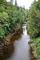
 Coquille river falls.jpg 1.182x788; 344 KB
-
 Cranberry grading table (5857872799).jpg 2.691x2.075; 537 KB
-
-
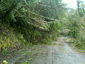
 Debris builds up under Oregon 42 (6726269227).jpg 704x480; 43 KB
-
-
-
 Drain-Coos Bay stage line ad 1890.png 548x822; 395 KB
-
 Dune Heron - panoramio.jpg 2.432x4.320; 3,39 MB
-
 Dunes on Tenmile Creek - panoramio.jpg 4.320x2.432; 4,6 MB
-
 East fork millicoma river.jpg 4.288x2.848; 10,11 MB
-
 Fallen trees (6985577043).jpg 800x600; 113 KB
-

-
 Floatin' Tenmile Creek - panoramio.jpg 4.320x2.432; 4,26 MB
-
 FOG OVER ESTUARY - NARA - 545140.jpg 3.000x2.026; 957 KB
-
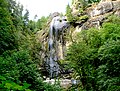 Golden and Silver Falls State Natural Area.jpg 1.800x1.369; 1,62 MB
-
 Golden Falls on the Oregon coast in Coos County (3387283247).jpg 2.187x2.843; 1,05 MB
-
 Hall Lake from Sand-board Hill - panoramio.jpg 4.320x2.432; 5,15 MB
-
 Hauser, Oregon, store.jpg 3.804x2.848; 7,74 MB
-
 History of southern Oregon, comprising Jackson, Josephine, Douglas, Curry and Coos counties (IA historyofsouthe00wall).pdf 1.154 × 1.750, 818 pagini; 75,55 MB
-
 Just past a hidden dune stream - panoramio.jpg 4.320x2.432; 4,37 MB
-
 Kayak launchsite near Twin Cedars - panoramio.jpg 4.320x2.432; 4,57 MB
-
 Light house and lifeboat station at Cape Arago, Oregon.jpg 455x344; 172 KB
-
 Map of Oregon highlighting Coos County.svg 6.451x4.810; 136 KB
-
 Millicoma river.jpg 4.288x2.848; 10,13 MB
-
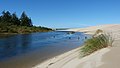
 Mouth of an unnamed dune stream - panoramio.jpg 4.320x2.432; 4,7 MB
-
 Mussel Reef, Oregon Coast (6468791217).jpg 1.538x2.000; 360 KB
-
 Near Bandon (4332557361).jpg 1.024x770; 224 KB
-
 Near the mouth of Tenmile - panoramio.jpg 4.320x2.432; 4,67 MB
-
 North Tenmile Lake in Oregon.jpg 4.288x2.848; 8,8 MB
-
 Oh Yeah, They Totally Went There.jpg 3.008x2.000; 2,69 MB
-
 Oimb campus.jpg 533x326; 72 KB
-
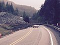
 Oregon 42 at milepost 45 (23565929999).jpg 3.264x1.836; 936 KB
-
 Pacific Ocean at Pacific Dunes (2) - panoramio.jpg 4.000x3.000; 4,73 MB
-
 Pacific Ocean at Pacific Dunes - panoramio.jpg 4.000x3.000; 4,91 MB
-
 Pacific sandfish in aquarium.jpg 720x480; 90 KB
-
-
 Plants & Fungi, Coos County, Oregon (14176411582).jpg 640x361; 70 KB
-

-
 Red Rhododendrons (5821298294).jpg 640x427; 79 KB
-
 Remote 06Sept2018 RoweSnyder.jpg 5.056x2.924; 10,41 MB
-
-
 Rock with holes (8478502154).jpg 2.642x2.013; 3,92 MB
-
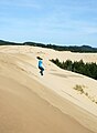 Sand Dune Jumping (8404179374).jpg 1.737x2.364; 2,07 MB
-
 Sand dune pattern (21150839826).jpg 4.633x2.768; 9,47 MB
-
 Sand patterns, Sunset Bay (8477416227).jpg 2.240x3.248; 6,16 MB
-
 Shore Acres reflection (5821288026).jpg 4.770x3.177; 12,25 MB
-
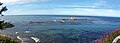 Simpson Reef Panorama.jpg 3.496x1.247; 2 MB
-
 Slide and pavement damage on Oregon 42 (23565929959).jpg 1.280x960; 451 KB
-
 South Slough NERR - Oregon.jpg 720x480; 35 KB
-
 South Slough Reserve.jpg 219x145; 19 KB
-
 South Tenmile Lake, Oregon - panoramio.jpg 4.126x2.392; 6,26 MB
-
 Spinreel kayak launch site - panoramio.jpg 4.320x2.432; 4,71 MB
-
 Steamer Dispatch on Coquille River, Oregon, circa 1910.jpg 3.181x2.011; 1,76 MB
-
 Sunset Bay - panoramio.jpg 2.314x1.543; 1,09 MB
-
 Taking a picture of someone taking pictures (8482541613).jpg 2.936x2.135; 5,09 MB
-
 Tenmile Creek in Coos County, Oregon.jpg 4.288x2.848; 9,57 MB
-
 Tenmile Lake (Oregon).jpg 2.100x1.500; 3,49 MB
-
 The fishin' hole at Spinreel - panoramio.jpg 4.320x2.432; 4,53 MB
-
 The place of persistence (21583937511).jpg 2.048x1.305; 1,57 MB
-
 The Unseen Cove - panoramio.jpg 1.000x484; 134 KB
-

-
 Top of the edge at the first bend past Spinreel - panoramio.jpg 4.320x2.432; 4,4 MB
-
-
 USA Coos, Oregon age pyramid.svg 520x600; 7 KB
-
 USFWS simpsonreef (23223728913).jpg 5.184x2.215; 2,78 MB
-
 West fork millicoma river.jpg 2.848x4.288; 9,14 MB
-
 Where Waves Become Clouds (186283845).jpeg 2.048x1.361; 453 KB
-
 Winter Lake, Peggy Nelson (5351957949).jpg 1.263x929; 716 KB
-
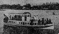 Wolverine (motor vessel).png 634x372; 252 KB
-


.jpg)
_and_Wright_(Pacific_Northwest_Forest_and_Range_Experiment_Station)._Deterioration_of_beetle-killed_Douglas-fir_analysis._Millicoma_Forest._Coos_County,_Oregon._(34853930152).jpg)
.jpg)
_Pouzar_379678.jpg)
_1.jpg)
_2.jpg)
_3.jpg)
_3a.jpg)
_to_visit_ranches,_Coos_County_(5669854645).jpg)

.jpg)

.jpg)


.jpeg)
.jpg)

.jpg)
.jpeg)
.jpg)
.jpg)


.jpg)


.jpg)


.jpg)
.jpg)


.jpg)
_-_panoramio.jpg)


.jpg)
.jpg)

.jpg)

.jpeg)
.jpg)
.jpg)
.jpg)
.jpg)
.jpg)
.jpg)


.jpg)

.jpg)

.jpg)

.jpg)


.jpg)

.jpeg)
.jpg)
.png)
.jpeg)
.jpeg)