Category:Cottingham, East Riding of Yorkshire
Zur Navigation springen
Zur Suche springen
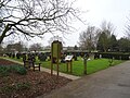
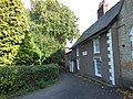
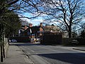
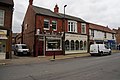
English: Cottingham is a village and civil parish in the East Riding of Yorkshire, England. It lies just to the north-west of the city of Kingston upon Hull. With a parish population of 17,263 in the 2001 UK census, Cottingham (along with other villages) claims to be the largest village in England.
Gemeinde in England  | |||||
| Medium hochladen | |||||
| Ist ein(e) | |||||
|---|---|---|---|---|---|
| Ort | East Riding of Yorkshire, Yorkshire and the Humber, England | ||||
| offizielle Website | |||||
 | |||||
Unterkategorien
Es werden 11 von insgesamt 11 Unterkategorien in dieser Kategorie angezeigt:
In Klammern die Anzahl der enthaltenen Kategorien (K), Seiten (S), Dateien (D)
C
L
M
R
S
T
Medien in der Kategorie „Cottingham, East Riding of Yorkshire“
Folgende 200 Dateien sind in dieser Kategorie, von 775 insgesamt.
(vorherige Seite) (nächste Seite)-

-
 24, 26 and 28 Beck Bank, Cottingham - geograph.org.uk - 3145071.jpg 1.024 × 768; 136 KB
-
 533261 Sergeant J. M. Ramsay, RAF - geograph.org.uk - 5191152.jpg 1.072 × 1.600; 778 KB
-
 90 Finkle Street - geograph.org.uk - 3101958.jpg 3.264 × 2.448; 2 MB
-
 A board on King Street, Cottingham - geograph.org.uk - 4397789.jpg 1.062 × 1.600; 552 KB
-
 A Green off Canada Drive, Cottingham - geograph.org.uk - 4482929.jpg 2.448 × 1.624; 1,83 MB
-
 A new house on Endyke Lane, Cottingham - geograph.org.uk - 3741434.jpg 1.024 × 681; 351 KB
-
 A path leading to Longmans Lane, Cottingham - geograph.org.uk - 3741493.jpg 1.024 × 681; 323 KB
-

-

-
 A stile on the outskirts of Cottingham (geograph 3741548).jpg 1.024 × 681; 361 KB
-
 A stone Urn, Thwaite Hall, Cottingham - geograph.org.uk - 3741559.jpg 681 × 1.024; 390 KB
-
 A tip or a pond^ - geograph.org.uk - 1981339.jpg 800 × 600; 234 KB
-
 A walk from Hessle Square ^31 - geograph.org.uk - 2006274.jpg 800 × 600; 256 KB
-
 A walk from Hessle Square ^32 - geograph.org.uk - 2006280.jpg 800 × 600; 260 KB
-
 A walk from Hessle Square ^33 - geograph.org.uk - 2006289.jpg 800 × 600; 339 KB
-
 A walk from Hessle Square ^34 - geograph.org.uk - 2006298.jpg 800 × 600; 311 KB
-
 A walk from Hessle Square ^35 - geograph.org.uk - 2006343.jpg 800 × 600; 300 KB
-
 A walk from Hessle Square ^36 - geograph.org.uk - 2006352.jpg 800 × 600; 356 KB
-
 A walk from Hessle Square ^37 - geograph.org.uk - 2006361.jpg 800 × 600; 276 KB
-
 A walk from Hessle Square ^38 - geograph.org.uk - 2006372.jpg 800 × 600; 246 KB
-
 A walk from Hessle Square ^39 - geograph.org.uk - 2006382.jpg 800 × 600; 383 KB
-
 A walk to Cottingham ^58 - geograph.org.uk - 2015280.jpg 800 × 600; 250 KB
-
 A walk to Cottingham ^59 - geograph.org.uk - 2015284.jpg 800 × 600; 305 KB
-
 A walk to Cottingham ^60 - geograph.org.uk - 2015306.jpg 800 × 600; 210 KB
-
 A walk to Cottingham ^61 - geograph.org.uk - 2015317.jpg 800 × 600; 245 KB
-
 A164 - geograph.org.uk - 5355902.jpg 640 × 426; 44 KB
-
 A164 bridge over Eppleworth Road - geograph.org.uk - 6080644.jpg 640 × 480; 58 KB
-
 A164 near Castle Hill Hospital - geograph.org.uk - 3802110.jpg 2.636 × 1.670; 2,27 MB
-
 A164 near Castle Hill Hospital - geograph.org.uk - 5924959.jpg 1.024 × 774; 124 KB
-
 A164 towards Mill Road Footbridge - geograph.org.uk - 3802113.jpg 1.600 × 1.064; 308 KB
-
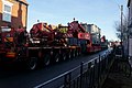
 Abnormal load heads down Park Lane - geograph.org.uk - 3763618.jpg 1.024 × 681; 290 KB
-
 Abnormal load on Harland Way, Cottingham - geograph.org.uk - 3763190.jpg 1.024 × 681; 396 KB
-
 Abnormal load on Northgate, Cottingham - geograph.org.uk - 3763192.jpg 1.024 × 681; 355 KB
-
 Abnormal load on Northgate, Cottingham - geograph.org.uk - 3763203.jpg 1.024 × 681; 346 KB
-
 Abnormal load on Northgate, Cottingham - geograph.org.uk - 3763207.jpg 1.024 × 681; 314 KB
-
 Abnormal load on Northgate, Cottingham - geograph.org.uk - 3763208.jpg 1.024 × 681; 313 KB
-
 Abnormal load on Northgate, Cottingham - geograph.org.uk - 3763211.jpg 1.024 × 681; 247 KB
-
 Abnormal load on Northgate, Cottingham - geograph.org.uk - 3763582.jpg 1.024 × 681; 259 KB
-
 Abnormal load on Northgate, Cottingham - geograph.org.uk - 3763592.jpg 1.024 × 681; 291 KB
-
 Abnormal load on Northgate, Cottingham - geograph.org.uk - 3763596.jpg 1.024 × 681; 263 KB
-
 Access to a pumping station - geograph.org.uk - 4338624.jpg 1.024 × 768; 209 KB
-
 Algae IMG 4981.jpg - panoramio.jpg 1.600 × 977; 1,28 MB
-
 Almost Autumn, Cottingham Park IMG 8214 - panoramio.jpg 1.200 × 758; 485 KB
-
 Approaching level crossing on Northgate, Cottingham - geograph.org.uk - 6077763.jpg 4.705 × 3.630; 3,42 MB
-
 Approaching the level crossing on Thwaite Street, Cottingham - geograph.org.uk - 6078591.jpg 4.233 × 2.979; 3,91 MB
-
 Arlington Avenue, Cottingham - geograph.org.uk - 4406497.jpg 1.600 × 1.062; 554 KB
-
 Arlington Avenue, Cottingham - geograph.org.uk - 4406544.jpg 1.600 × 1.062; 579 KB
-
 Autumn Colour - panoramio.jpg 1.067 × 1.600; 970 KB
-
 Autumn in the Park IMG 7744 - panoramio.jpg 1.139 × 1.600; 1.009 KB
-
 Autumn in the Park IMG 7770 - panoramio.jpg 1.600 × 998; 965 KB
-
 Autumn in the Park IMG 7776 - panoramio.jpg 1.600 × 1.067; 1,13 MB
-
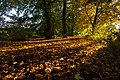
 Autumn Path - panoramio.jpg 1.067 × 1.600; 1,02 MB
-
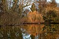 Autumn Pond - panoramio.jpg 1.600 × 1.049; 797 KB
-
 Autumn Trees - panoramio.jpg 1.067 × 1.600; 967 KB
-
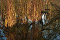 Autumn Willow - panoramio.jpg 1.600 × 1.067; 752 KB
-
 Autumn Wood - panoramio.jpg 1.600 × 965; 772 KB
-
 B1233 - geograph.org.uk - 5399397.jpg 640 × 426; 71 KB
-
 B1233, Newgate - geograph.org.uk - 5392214.jpg 640 × 426; 76 KB
-
 Badgers Wood (road) off Park Lane, Cottingham - geograph.org.uk - 4398138.jpg 1.600 × 1.062; 864 KB
-
 Badgers Wood, Cottingham - geograph.org.uk - 6078623.jpg 640 × 480; 114 KB
-
 Badgers Wood, Cottingham - panoramio.jpg 1.100 × 643; 330 KB
-
 Bargain Booze on King Street, Cottingham - geograph.org.uk - 4408001.jpg 1.600 × 1.062; 456 KB
-
 Barn on Park Lane, Cottingham - geograph.org.uk - 4398120.jpg 1.600 × 1.062; 1,05 MB
-
 Barn, Pillswood Farm - geograph.org.uk - 5399426.jpg 640 × 426; 42 KB
-
 Barnard Avenue, Cottingham - geograph.org.uk - 4406815.jpg 1.600 × 1.062; 515 KB
-
 Barnard Avenue, Cottingham - geograph.org.uk - 4406824.jpg 1.600 × 1.062; 662 KB
-
 Barrier closing on railway level crossing - geograph.org.uk - 5757117.jpg 3.068 × 2.299; 2,17 MB
-
 Baynard Avenue, Cottingham, Yorkshire - geograph.org.uk - 4503073.jpg 2.908 × 2.117; 2,42 MB
-
 Beacon Garth Lane towards South Street - geograph.org.uk - 4407798.jpg 1.600 × 1.062; 781 KB
-
 Beacon Garth Lane towards South Street - geograph.org.uk - 4407804.jpg 1.600 × 1.062; 1.004 KB
-
 Beacon Garth Lane towards South Street - geograph.org.uk - 4407810.jpg 1.600 × 1.062; 696 KB
-
 Beck Bank, Cottingham, Yorkshire - geograph.org.uk - 4514616.jpg 3.236 × 2.410; 2,68 MB
-
 Beck Bank, Cottingham, Yorkshire - geograph.org.uk - 4514619.jpg 3.210 × 2.374; 2,51 MB
-
 Beechdale off Thwaite Street, Cottingham - geograph.org.uk - 3741618.jpg 1.024 × 681; 273 KB
-
 Bell Nursery on Park Lane, Cottingham - geograph.org.uk - 4398393.jpg 1.600 × 1.062; 649 KB
-
 Beware of the train - geograph.org.uk - 1981372.jpg 800 × 600; 145 KB
-
 Bird box - geograph.org.uk - 1981557.jpg 800 × 600; 152 KB
-
 Blue plaque on house, Hallgate Cottingham - geograph.org.uk - 6077749.jpg 2.386 × 2.377; 1,07 MB
-
 Bourne's store on King Street Cottingham - geograph.org.uk - 4397839.jpg 1.600 × 1.062; 632 KB
-

-
 Bowls Walk off Bishop Alcock Road, Hull - geograph.org.uk - 3306811.jpg 800 × 600; 139 KB
-
 Bowls Walk off Bishop Alcock Road, Hull - geograph.org.uk - 3306844.jpg 800 × 600; 106 KB
-
 Bowls Walk towards Dent Road, Cottingham - geograph.org.uk - 3307596.jpg 800 × 600; 118 KB
-
 Bricknell Avenue - geograph.org.uk - 5665298.jpg 640 × 366; 51 KB
-

-
 Bricknell Avenue, Cottingham - geograph.org.uk - 3307663.jpg 800 × 600; 103 KB
-
 Bricknell Avenue, Cottingham - geograph.org.uk - 3307665.jpg 800 × 600; 96 KB
-
 Bricknell Avenue, Cottingham - geograph.org.uk - 3307715.jpg 800 × 600; 112 KB
-
 Bridleway off Dunswell Lane (geograph 6092424).jpg 1.024 × 768; 119 KB
-
 Bridlington to Hull line through Cottingham toward Hull - geograph.org.uk - 5757137.jpg 4.556 × 3.386; 4,87 MB
-
 Bronowski blue plaque, Cottingham - geograph.org.uk - 5855340.jpg 625 × 626; 418 KB
-
 Bund off North Moor Lane (geograph 4404031).jpg 1.024 × 768; 219 KB
-
 Bungalows on Canada Drive, Cottingham - geograph.org.uk - 4482934.jpg 2.448 × 1.624; 1,9 MB
-
 Bungalows on Hornbeam Drive, Cottingham - geograph.org.uk - 4405902.jpg 1.600 × 1.062; 428 KB
-
 Bungalows on King Tree Avenue, Cottingham - geograph.org.uk - 4406488.jpg 1.600 × 1.062; 807 KB
-
 Burton Road, Cottingham - geograph.org.uk - 6077960.jpg 640 × 480; 66 KB
-
 Burton Road, Cottingham - geograph.org.uk - 6077961.jpg 4.343 × 2.966; 2,56 MB
-
 Bus stop and shelter on Burton Road, Cottingham - geograph.org.uk - 6080679.jpg 5.184 × 3.888; 4,05 MB
-
 Bus stop and shelter on Endyke Lane, Cottingham - geograph.org.uk - 6084991.jpg 4.663 × 3.298; 3,65 MB
-
 Bus Stop on King Street, Cottingham - geograph.org.uk - 5200419.jpg 4.608 × 3.456; 3,77 MB
-
 Bus stop on St Margarets Avenue, Cottingham - geograph.org.uk - 6080671.jpg 4.282 × 3.151; 4,37 MB
-
 Bus stops on Hull Road, Cottingham - geograph.org.uk - 4853015.jpg 1.024 × 768; 275 KB
-
 Businesses on Hallgate, Cottingham - geograph.org.uk - 4406561.jpg 1.600 × 1.062; 538 KB
-
 Canada Drive at Quebec Drive, Cottingham - geograph.org.uk - 4482963.jpg 2.448 × 1.624; 1,13 MB
-
 Canada Drive near Montreal Crescent , Cottingham - geograph.org.uk - 4482975.jpg 2.448 × 1.624; 1,12 MB
-
 Canada Drive towards Burton Road, Cottingham - geograph.org.uk - 4483016.jpg 2.448 × 1.624; 1,01 MB
-
 Canada Drive, Cottingham - geograph.org.uk - 4482927.jpg 2.448 × 1.624; 1,96 MB
-

-
 Carisbrooke Avenue, Cottingham - geograph.org.uk - 4406380.jpg 1.600 × 1.062; 684 KB
-
 Carrington Avenue off Newgate Street, Cottingham - geograph.org.uk - 4405963.jpg 1.600 × 1.062; 545 KB
-
 Castle Road from the junction with Willerby Low Road - geograph.org.uk - 3988465.jpg 4.608 × 3.456; 3,87 MB
-
 Castle Road toward the A164 - geograph.org.uk - 3988455.jpg 4.608 × 3.456; 4,35 MB
-
 Cemetery, Cottingham - geograph.org.uk - 6080661.jpg 640 × 480; 107 KB
-
 Cheval Cafe at Willerby Hill Riding School (geograph 3685893).jpg 640 × 427; 61 KB
-
 Christchurch Community Coffee on King Street - geograph.org.uk - 4392053.jpg 1.600 × 1.062; 566 KB
-
 Christmas Light Colours on the Wet Footpath in Hallgate - geograph.org.uk - 6005621.jpg 3.955 × 3.130; 2,31 MB
-
 Christmas Lights in Cottingham - geograph.org.uk - 3253487.jpg 3.648 × 2.736; 4,63 MB
-
 Christmas Lights in Cottingham's Main Street - geograph.org.uk - 3253475.jpg 3.504 × 2.603; 1,82 MB
-
 Christmas Lights in Cottingham's Main Street - geograph.org.uk - 3253494.jpg 2.986 × 2.186; 1,59 MB
-
 Christmas Lights in King Street at night - geograph.org.uk - 6005610.jpg 4.441 × 3.281; 3,31 MB
-
-
 Church Lane, Cottingham, Yorkshire - geograph.org.uk - 4514954.jpg 3.232 × 2.404; 3,64 MB
-
 Church Walk leading to Hallgate, Cottingham - geograph.org.uk - 4406530.jpg 1.600 × 1.062; 1,01 MB
-
 Church Walk, Hallgate, Cottingham, Yorkshire - geograph.org.uk - 4766065.jpg 3.264 × 2.448; 3,27 MB
-
 Churchill Avenue off St Margaret's Avenue, Cottingham - geograph.org.uk - 5191609.jpg 1.600 × 1.065; 515 KB
-
 Cleminson Gardens off Thwaite Street, Cottingham - geograph.org.uk - 4609100.jpg 1.200 × 799; 310 KB
-
 Cleminson Hall - geograph.org.uk - 2821024.jpg 2.816 × 2.112; 771 KB
-
 Cleminson Hall - geograph.org.uk - 2836704.jpg 2.816 × 2.112; 1,04 MB
-
 Cleminson Hall - geograph.org.uk - 6089684.jpg 2.862 × 2.088; 379 KB
-
 Cleminson Hall - geograph.org.uk - 6089699.jpg 2.070 × 2.562; 286 KB
-
 Cleminson Hall - geograph.org.uk - 6089709.jpg 1.704 × 2.076; 175 KB
-

-
 Close up, Elizabeth II postbox on George Street, Cottingham - geograph.org.uk - 6077879.jpg 1.622 × 2.969; 1,06 MB
-
 Close up, Elizabeth II postbox on Park Lane, Cottingham - geograph.org.uk - 6078551.jpg 2.324 × 4.128; 2,09 MB
-
 Close up, Elizabeth II postbox on Queen's Way, Cottingham - geograph.org.uk - 6078475.jpg 2.093 × 3.751; 1,21 MB
-
 Cooplands Secret Garden Café on Hallgate - geograph.org.uk - 4406612.jpg 1.600 × 1.062; 611 KB
-

-
 Cottage on King Street, Cottingham - geograph.org.uk - 4397844.jpg 1.600 × 1.062; 980 KB
-
 Cottages on King Street, Cottingham - geograph.org.uk - 4397848.jpg 1.600 × 1.062; 658 KB
-
 Cottages on King Street, Cottingham - geograph.org.uk - 4397858.jpg 1.600 × 1.214; 731 KB
-
 Cottingham - panoramio.jpg 1.300 × 867; 610 KB
-
 Cottingham Bowling Club, Clubhouse, Cottingham - geograph.org.uk - 3741581.jpg 1.024 × 681; 303 KB
-
 Cottingham Bowling Club, Cottingham - geograph.org.uk - 3741575.jpg 1.024 × 681; 227 KB
-
 Cottingham buskers IMG 8045 - panoramio.jpg 1.066 × 1.600; 855 KB
-
 Cottingham buskers IMG 8048 - panoramio.jpg 1.600 × 1.217; 701 KB
-
 Cottingham Church - geograph.org.uk - 3253585.jpg 2.965 × 2.582; 798 KB
-
 Cottingham Church at Night - geograph.org.uk - 3253445.jpg 2.399 × 2.932; 1,49 MB
-
 Cottingham Churchyard Cross at Night - geograph.org.uk - 3253452.jpg 1.625 × 2.191; 641 KB
-
 Cottingham Cycle Centre - geograph.org.uk - 5392192.jpg 640 × 426; 62 KB
-
 Cottingham Day 2007.JPG 2.048 × 1.536; 836 KB
-
 Cottingham giraffes - geograph.org.uk - 6024577.jpg 683 × 1.024; 1,07 MB
-
 Cottingham IMG 0057 - panoramio.jpg 1.067 × 1.600; 1.005 KB
-
 Cottingham IMG 0407 - panoramio.jpg 1.400 × 1.234; 472 KB
-
 Cottingham IMG 0451 - panoramio.jpg 1.200 × 799; 331 KB
-
 Cottingham IMG 0457 - panoramio.jpg 1.400 × 894; 391 KB
-
 Cottingham IMG 0470 - panoramio.jpg 1.200 × 719; 301 KB
-
 Cottingham IMG 0620.jpg - panoramio.jpg 1.067 × 1.600; 873 KB
-
 Cottingham IMG 4894.CR2 - panoramio.jpg 1.067 × 1.600; 968 KB
-
 Cottingham IMG 4948.jpg - panoramio.jpg 1.170 × 1.600; 668 KB
-
 Cottingham IMG 4967jpg - panoramio.jpg 1.600 × 917; 740 KB
-
 Cottingham IMG 8939 - panoramio.jpg 1.600 × 1.067; 533 KB
-
 Cottingham Level Crossing (15-10-2017).jpg 4.320 × 3.240; 5,64 MB
-
 Cottingham Memorial Gardens - geograph.org.uk - 4406671.jpg 1.600 × 1.062; 835 KB
-
 Cottingham Park IMG 0826 - panoramio.jpg 1.600 × 1.067; 1,03 MB
-
 Cottingham Park IMG 6335 - panoramio.jpg 933 × 1.400; 1,46 MB
-
 Cottingham Park in the snow - panoramio.jpg 1.000 × 666; 450 KB
-
 Cottingham Park snowdrops IMG 1190 - panoramio.jpg 971 × 1.400; 465 KB
-
 Cottingham Park, Autumn 2010, IMG 3356 - panoramio.jpg 666 × 1.000; 214 KB
-
 Cottingham Park, Cottingham, East Yorkshire - panoramio.jpg 666 × 1.000; 235 KB
-
 Cottingham Police Station on Harland Way - geograph.org.uk - 3763687.jpg 1.024 × 681; 322 KB
-
 Cottingham Post Office - geograph.org.uk - 6078521.jpg 4.190 × 3.218; 2,21 MB
-
 Cottingham Post Office - geograph.org.uk - 6078525.jpg 5.184 × 3.888; 3,17 MB
-
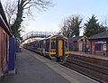 Cottingham Railway Station - geograph.org.uk - 6084979.jpg 640 × 492; 83 KB
-
 Cottingham Railway Station Approach and Car Park - geograph.org.uk - 5200401.jpg 4.608 × 3.456; 3,87 MB
-
 Cottingham Rifle ^ Pistol Club on Northgate - geograph.org.uk - 4397876.jpg 1.600 × 1.062; 1,32 MB
-
 Cottingham Rifle ^ Pistol Club on Northgate - geograph.org.uk - 4397879.jpg 1.600 × 1.062; 784 KB
-
 Cottingham Station - geograph.org.uk - 5392201.jpg 640 × 426; 64 KB
-
 Cottingham, at the Duke of Cumberland - geograph.org.uk - 6255472.jpg 1.024 × 770; 126 KB
-
 Cottingham, Castle Rd - panoramio.jpg 1.068 × 712; 246 KB
-
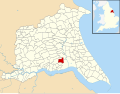 Cottingham, East Riding of Yorkshire UK parish locator map.svg 1.425 × 1.107; 1,68 MB
-
 Crescent Street, Cottingham, Yorkshire - geograph.org.uk - 5700293.jpg 2.592 × 1.944; 2,07 MB
-
 Crop field north of Eppleworth Road, Cottingham - geograph.org.uk - 6080657.jpg 5.184 × 3.888; 5,19 MB
-
 Cross Keys public house, Cottingham - geograph.org.uk - 4397861.jpg 1.600 × 1.062; 540 KB
-
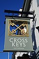 Cross Keys public house, Cottingham - geograph.org.uk - 4397864.jpg 1.062 × 1.600; 876 KB
-
 Crossing Cottage Northgate Cottingham - geograph.org.uk - 5699332.jpg 3.844 × 2.880; 3,99 MB
-
 Daffodils on Green Lane, Cottingham - panoramio.jpg 800 × 1.200; 684 KB
-
 Daisies - panoramio (1).jpg 1.940 × 2.910; 1,92 MB
-
 Dene Road from the bend in West End Road - geograph.org.uk - 5757150.jpg 3.845 × 2.880; 4,3 MB
-
 Dene Road, Cottingham - geograph.org.uk - 5660682.jpg 640 × 480; 69 KB
-
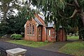 Disused Cemetery Chapel - geograph.org.uk - 5191134.jpg 1.600 × 1.065; 752 KB
-
 Dixon Court towards The Garth, Cottingham - geograph.org.uk - 4407784.jpg 1.600 × 1.062; 576 KB
-
 Dixon Court towards The Garth, Cottingham - geograph.org.uk - 4407788.jpg 1.600 × 1.062; 496 KB
-
 Don't throw stones - geograph.org.uk - 1981565.jpg 800 × 600; 117 KB
-
 Dry ditch at Mallards Reach - geograph.org.uk - 5850878.jpg 768 × 1.024; 401 KB
-
 Dunswell Road, Cottingham - geograph.org.uk - 5850874.jpg 1.024 × 768; 256 KB
-
 Earthworks near Skidby - geograph.org.uk - 6031252.jpg 1.024 × 768; 214 KB
-

-
 Elizabeth II postbox on Burton Road, Cottingham - geograph.org.uk - 6077955.jpg 2.670 × 4.738; 3,44 MB
-
 Elizabeth II postbox on George Street, Cottingham - geograph.org.uk - 6077877.jpg 5.184 × 3.888; 5,9 MB


.jpg)


_off_Park_Lane,_Cottingham_-_geograph.org.uk_-_4398138.jpg)


.jpg)


.jpg)


.jpg)


.jpg)


.jpg)


