Category:Dauntsey
Naar navigatie springen
Naar zoeken springen
plaats in Wiltshire  | |||||
| Media uploaden | |||||
| Is een | |||||
|---|---|---|---|---|---|
| Locatie | Wiltshire, Zuidwest-Engeland, Engeland | ||||
| Inwonertal |
| ||||
| officiële website | |||||
 | |||||
English: Dauntsey is a small village in the county of Wiltshire in England. It gives its name to the Dauntsey Vale in which it lies and takes its name from Saxon for Dantes- eig, or Dante's island. It is set on slightly higher ground in the flood plain of the early Bristol Avon.
Nederlands: Dauntsey is een dorp (village) en civil parish in de unitary authority Wiltshire, in het Engelse graafschap Wiltshire. De civil parish telt

Ondercategorieën
Deze categorie bevat de volgende 3 subcategorieën, van de 3 in totaal.
D
- Dauntsey Park House (2 B)
- Dauntsey railway station (2 B)
Media in categorie "Dauntsey"
Deze categorie bevat de volgende 129 bestanden, van in totaal 129.
-
 2010 , B4069 heading west at Dauntsey Lock - geograph.org.uk - 2169115.jpg 1.024 × 728; 225 kB
-
 2010 , Dauntsey Lock on the Wilts & Berks Canal - geograph.org.uk - 2162750.jpg 1.024 × 792; 257 kB
-
 2010 , The Peterborough Arms, Dauntsey Lock - geograph.org.uk - 2169081.jpg 1.600 × 1.098; 272 kB
-
 2011 , B4069 heading into Lyneham - geograph.org.uk - 2452605.jpg 2.870 × 2.439; 2,89 MB
-
 2011 , B4069 heading west toward Christian Malford - geograph.org.uk - 2447578.jpg 3.484 × 2.674; 3,53 MB
-
 2011 , North Wiltshire from a disused farm gate - geograph.org.uk - 2452592.jpg 4.675 × 2.713; 4,03 MB
-
 2011 , View over north Wiltshire - geograph.org.uk - 2452372.jpg 4.298 × 2.584; 3,82 MB
-
 Alpacas, Lane House Farm, Sodom - geograph.org.uk - 4800204.jpg 4.000 × 3.000; 6,96 MB
-
 B4069 approaching Dauntsey Lock - geograph.org.uk - 5669243.jpg 640 × 428; 106 kB
-
 B4069 crossing the railway at Dauntsey Lock - geograph.org.uk - 3209518.jpg 1.024 × 512; 440 kB
-
 Barn at Great Smithcott Farm - geograph.org.uk - 6550979.jpg 1.024 × 768; 251 kB
-
 Barn, at Glebe farm, Dauntsey. - geograph.org.uk - 379561.jpg 640 × 450; 86 kB
-
 Battery farm - geograph.org.uk - 310406.jpg 640 × 480; 66 kB
-
 Bend on B4069 - geograph.org.uk - 5669264.jpg 640 × 428; 90 kB
-

-
 Church Lane, heading east - geograph.org.uk - 6550971.jpg 1.024 × 768; 310 kB
-
 Church Lane, heading west - geograph.org.uk - 6550969.jpg 1.024 × 768; 288 kB
-
 Corner farm - geograph.org.uk - 303389.jpg 640 × 404; 52 kB
-
 Cottages at Dauntsey Lock - geograph.org.uk - 3584986.jpg 4.000 × 3.000; 2,91 MB
-
 Crew's Farm - geograph.org.uk - 4558885.jpg 4.608 × 3.456; 3,32 MB
-
 Dauntsey car boot sale - geograph.org.uk - 3584978.jpg 3.698 × 2.012; 2,99 MB
-
 Dauntsey cottage - geograph.org.uk - 310416.jpg 633 × 473; 110 kB
-
 Dauntsey Lock - geograph.org.uk - 5013119.jpg 640 × 426; 50 kB
-
 Dauntsey Lock weighbridge - geograph.org.uk - 3584981.jpg 4.000 × 3.000; 3,78 MB
-
 Dauntsey Lock. Wilts and Berks Canal. - panoramio.jpg 1.952 × 2.592; 2,66 MB
-
 Dauntsey Park House (south façade) - geograph.org.uk - 5361744.jpg 3.872 × 2.472; 4,8 MB
-
 Dauntsey primary school - geograph.org.uk - 299923.jpg 640 × 480; 71 kB
-
 Dauntsey, Wilts and Berks Canal. - panoramio.jpg 2.592 × 1.952; 2,34 MB
-
 DauntseyArms.jpg 1.144 × 1.306; 426 kB
-
 Derelict Canal - geograph.org.uk - 89425.jpg 640 × 480; 123 kB
-
 Descent from the M4 bridge to Mile Drive - geograph.org.uk - 3584992.jpg 4.000 × 3.000; 3,93 MB
-
 Earl Danby's School, Dauntsey - geograph.org.uk - 3863904.jpg 4.000 × 3.000; 2,82 MB
-
 Entering Dauntsey, please drive carefully - geograph.org.uk - 6550973.jpg 1.600 × 1.200; 719 kB
-
 Entrance to Glebe Farm - geograph.org.uk - 6550966.jpg 1.600 × 1.200; 550 kB
-
 Farm shop, Little Smithcott Farm - geograph.org.uk - 4567002.jpg 4.608 × 3.456; 3,24 MB
-
 Farmland near Dauntsey - geograph.org.uk - 5658801.jpg 1.672 × 629; 85 kB
-
 Field by Sodom Lane - geograph.org.uk - 2474803.jpg 1.500 × 948; 107 kB
-
 Field by the Wilts ^ Berks Canal - geograph.org.uk - 6036428.jpg 2.014 × 996; 238 kB
-
 Field entrance - geograph.org.uk - 6550986.jpg 1.024 × 768; 297 kB
-
 Fields near Sodom Lane - geograph.org.uk - 2474801.jpg 1.800 × 893; 112 kB
-
 Fields near Sodom Lane - geograph.org.uk - 3239249.jpg 640 × 304; 30 kB
-

-
 Footbridge, Olivemead Farm, M4 - geograph.org.uk - 3660957.jpg 640 × 386; 33 kB
-
 Good Monday's farm - geograph.org.uk - 310412.jpg 595 × 426; 99 kB
-
 Great Smithcott Farm - geograph.org.uk - 4558878.jpg 4.608 × 3.456; 3,2 MB
-
 Greenman's Lane at Sodom - geograph.org.uk - 303144.jpg 572 × 412; 88 kB
-
 GWR railway line, London to Bristol - geograph.org.uk - 4827982.jpg 640 × 480; 83 kB
-
 Houses in Dauntsey - geograph.org.uk - 6550977.jpg 1.600 × 1.200; 474 kB
-
 Houses near Great Smithcott Farm - geograph.org.uk - 6550980.jpg 1.600 × 1.200; 717 kB
-
 Idover Demesne Farm, Idover Lane, Dauntsey - geograph.org.uk - 2913361.jpg 4.000 × 3.000; 3,6 MB
-
 Idover House, Church Lane - geograph.org.uk - 5363367.jpg 3.852 × 2.792; 6,23 MB
-
 Junction of Ridgeway Lane (right) and Mile Drive (left) - geograph.org.uk - 3584999.jpg 4.000 × 3.000; 4,84 MB
-

-
 M4 Motorway - Dauntsey Bridge - geograph.org.uk - 2085475.jpg 640 × 480; 63 kB
-

-
 M4 Motorway - Olivemead Farm bridge - geograph.org.uk - 2086911.jpg 640 × 480; 61 kB
-
 M4 Motorway at Olivemead Lane - geograph.org.uk - 2086907.jpg 640 × 480; 59 kB
-
 M4 Motorway near Greenman's Lane - geograph.org.uk - 2086903.jpg 640 × 480; 56 kB
-
 M4 roadbridge - lane from Dauntseys to Swallett Gate crosses - geograph.org.uk - 2510778.jpg 3.644 × 2.670; 1,19 MB
-
 Mile Drive - geograph.org.uk - 3584988.jpg 4.000 × 3.000; 5,08 MB
-
 Mile Drive - geograph.org.uk - 5363422.jpg 3.000 × 4.000; 7,81 MB
-
 Milestone, Idover Lane, Dauntsey (geograph 7335468).jpg 769 × 1.024; 306 kB
-
 New house, Ridgeway Lane - geograph.org.uk - 5363384.jpg 4.000 × 3.000; 4,91 MB
-
 Old Dairy Farm car boot sale, Dauntsey Lock - geograph.org.uk - 3451645.jpg 4.000 × 3.000; 2,89 MB
-
 Olivemead Farm, Olivemead Lane, Dauntsey - geograph.org.uk - 1209364.jpg 640 × 480; 239 kB
-
 Olivemead Lane, Dauntsey - geograph.org.uk - 1209337.jpg 640 × 480; 138 kB
-
 On the M4 - geograph.org.uk - 4142856.jpg 4.000 × 2.664; 3,17 MB
-
 Path by Creamery Cottage - geograph.org.uk - 790905.jpg 640 × 480; 100 kB
-
 Railway bridge, Sodom Lane - geograph.org.uk - 4802006.jpg 4.000 × 3.000; 4,82 MB
-
 River Avon and Hydroelectric Power Plant - geograph.org.uk - 5630964.jpg 4.000 × 3.000; 4,4 MB
-

-
 Road junction near Brinkworth - geograph.org.uk - 6550991.jpg 1.600 × 1.200; 489 kB
-
 Shed in field near Mile Drive - geograph.org.uk - 3584991.jpg 4.000 × 3.000; 4,42 MB
-
 Sodom Hall, Sodom Lane, Dauntsey - geograph.org.uk - 1207510.jpg 640 × 480; 178 kB
-
 Sodom Lane - geograph.org.uk - 3239235.jpg 640 × 283; 31 kB
-
 Sodom Lane - geograph.org.uk - 4800188.jpg 4.000 × 3.000; 4,86 MB
-
 Sodom Lane to Dauntsey - geograph.org.uk - 2474805.jpg 1.500 × 956; 112 kB
-
 South along Olivemead Lane, Dauntsey - geograph.org.uk - 1209349.jpg 640 × 480; 203 kB
-

-

-

-

-

-

-
-
 The Peterborough Arms, Dauntsey Lock - geograph.org.uk - 2289970.jpg 640 × 480; 54 kB
-
 The road past Manor Farm, Grittenham - geograph.org.uk - 902931.jpg 640 × 480; 84 kB
-
 The road past Manor Farm, Grittenham - geograph.org.uk - 902933.jpg 640 × 480; 75 kB
-
 Track to Luker's Farm, Grittenham - geograph.org.uk - 902926.jpg 640 × 480; 79 kB
-
 Trees, Brinkworth Brook - geograph.org.uk - 5255248.jpg 640 × 351; 42 kB
-
 Turning for Brinkworth - geograph.org.uk - 1802418.jpg 640 × 480; 49 kB
-
 Turning for Brinkworth - geograph.org.uk - 1802439.jpg 640 × 480; 44 kB
-
 Union Farm, Dauntsey - geograph.org.uk - 5658798.jpg 1.493 × 556; 78 kB
-
 Union Farm, Dauntsey - geograph.org.uk - 6208180.jpg 2.612 × 1.216; 315 kB
-
 View north from the B4069 - geograph.org.uk - 4827970.jpg 640 × 471; 43 kB
-
 View southeast from Crew's House, Brinkworth Road - geograph.org.uk - 4567003.jpg 4.608 × 3.456; 3,27 MB
-
 Waite Hill Farm - geograph.org.uk - 4800180.jpg 3.944 × 2.888; 5,37 MB
-
 Waite Hill Farm from afar - geograph.org.uk - 4801987.jpg 4.000 × 3.000; 4,88 MB
-
 Wilts & Berks Canal at Dauntsey Lock - geograph.org.uk - 3584983.jpg 4.000 × 3.000; 4,25 MB
-
 Wilts & Berks Canal at Dauntsey Lock - geograph.org.uk - 4827977.jpg 640 × 480; 91 kB
-
 Wilts and Berks Canal, Dauntsey Lock. - panoramio.jpg 2.592 × 1.952; 2,74 MB
-
 Wiltshire , Calne Scenery - geograph.org.uk - 5442112.jpg 6.000 × 4.000; 6,23 MB
-
 Wiltshire , Countryside Scenery - geograph.org.uk - 5411151.jpg 6.000 × 4.000; 5,44 MB
-
 Wiltshire , Crop Field - geograph.org.uk - 5898953.jpg 6.000 × 4.000; 6,96 MB
-
 Wiltshire , Grassy Field ^ Cattle - geograph.org.uk - 5898952.jpg 6.000 × 4.000; 5,35 MB
-
 Wiltshire , M4 Motorway - geograph.org.uk - 5725337.jpg 6.000 × 4.000; 6,22 MB
-
 Wiltshire , M4 Motorway - geograph.org.uk - 5725338.jpg 6.000 × 4.000; 6,77 MB
-
 Wiltshire , M4 Motorway - geograph.org.uk - 5725339.jpg 6.000 × 4.000; 7,83 MB
-
 Wiltshire , M4 Motorway - geograph.org.uk - 5725340.jpg 6.000 × 4.000; 7,67 MB
-
 Wiltshire , M4 Motorway - geograph.org.uk - 5725341.jpg 5.864 × 3.909; 7,09 MB
-
 Wiltshire , M4 Motorway - geograph.org.uk - 5725342.jpg 6.000 × 4.000; 7,27 MB
-
 Wiltshire , M4 Motorway - geograph.org.uk - 5725343.jpg 6.000 × 4.000; 7,76 MB
-
 Brinkworth Road, Dauntsey - geograph.org.uk - 379587.jpg 640 × 426; 84 kB
-
 Copse, at Dauntsey Vale - geograph.org.uk - 379590.jpg 640 × 399; 50 kB
-
 Cottage at Dauntsey - geograph.org.uk - 313065.jpg 640 × 441; 53 kB
-
 Crew's House - geograph.org.uk - 308876.jpg 580 × 417; 100 kB
-
 Dauntsey gentlemen's cricket club - geograph.org.uk - 299919.jpg 640 × 480; 115 kB
-
 Dauntsey rectory - geograph.org.uk - 299895.jpg 603 × 418; 127 kB
-
 Dauntsey Rectory - geograph.org.uk - 379566.jpg 640 × 426; 76 kB
-
 Dauntsey Road crossing - geograph.org.uk - 379540.jpg 640 × 416; 48 kB
-
 Dauntsey vale - geograph.org.uk - 313149.jpg 615 × 420; 115 kB
-
 Development opportunity, in Dauntsey - geograph.org.uk - 379604.jpg 640 × 460; 94 kB
-
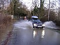 Flooding at Dauntsey - geograph.org.uk - 308936.jpg 640 × 480; 82 kB
-
 Idover house - geograph.org.uk - 299900.jpg 640 × 480; 110 kB
-
 Kennels at Crew's House - geograph.org.uk - 308872.jpg 640 × 480; 76 kB
-
 New development, at Dauntsey - geograph.org.uk - 379576.jpg 640 × 419; 67 kB
-
 Olivemead lane - geograph.org.uk - 300359.jpg 480 × 640; 108 kB
-
 The rural dream - geograph.org.uk - 379581.jpg 640 × 480; 94 kB
-
 The Whitehouse in Dauntsey - geograph.org.uk - 300356.jpg 640 × 480; 104 kB


_-_geograph.org.uk_-_5361744.jpg)


_and_Mile_Drive_(left)_-_geograph.org.uk_-_3584999.jpg)


.jpg)


_-_geograph.org.uk_-_4555596.jpg)
_-_geograph.org.uk_-_4555598.jpg)
_-_geograph.org.uk_-_4555601.jpg)
_-_geograph.org.uk_-_4555603.jpg)


