Category:Denham, Mid Suffolk
Naar navigatie springen
Naar zoeken springen
English: Denham is a village and civil parish in northern Suffolk. Located approximately 3 miles east of Eye, it is within the district of Mid Suffolk. It shares its name with Denham (St Edmundsbury), another Suffolk village.
Mid Suffolk .jpg) | |||||
| Media uploaden | |||||
| Is een | |||||
|---|---|---|---|---|---|
| Locatie | Mid Suffolk, Suffolk, East of England, Engeland | ||||
 | |||||
Ondercategorieën
Deze categorie bevat alleen de volgende subcategorie.
J
Media in categorie "Denham, Mid Suffolk"
Deze categorie bevat de volgende 200 bestanden, van in totaal 226.
(vorige pagina) (volgende pagina)-
-
-
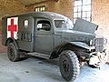
 95th Bombardment Group Hospital Museum - geograph.org.uk - 4521496.jpg 640 × 495; 368 kB
-
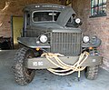
 95th Bombardment Group Hospital Museum - geograph.org.uk - 4521501.jpg 626 × 613; 429 kB
-
 95th Bombardment Group Hospital Museum - geograph.org.uk - 4521503.jpg 600 × 640; 464 kB
-
 95th Bombardment Group Hospital Museum - geograph.org.uk - 4521505.jpg 480 × 640; 255 kB
-
 95th Bombardment Group Hospital Museum - geograph.org.uk - 4521506.jpg 600 × 597; 504 kB
-
 95th Bombardment Group Hospital Museum - geograph.org.uk - 4521508.jpg 633 × 640; 127 kB
-
 95th Bombardment Group Hospital Museum - geograph.org.uk - 4521513.jpg 640 × 480; 342 kB
-
 95th Bombardment Group Hospital Museum - geograph.org.uk - 4521528.jpg 619 × 584; 430 kB
-
 95th Bombardment Group Hospital Museum - geograph.org.uk - 4521532.jpg 528 × 640; 470 kB
-
 95th Bombardment Group Hospital Museum - geograph.org.uk - 4521534.jpg 640 × 556; 530 kB
-
 95th Bombardment Group Hospital Museum - geograph.org.uk - 4521564.jpg 640 × 480; 382 kB
-
 95th Bombardment Group Hospital Museum - geograph.org.uk - 4521583.jpg 640 × 590; 580 kB
-
 95th Bombardment Group Hospital Museum - geograph.org.uk - 4521604.jpg 480 × 640; 411 kB
-
 95th Bombardment Group Hospital Museum sign - geograph.org.uk - 2705114.jpg 2.304 × 3.072; 1,4 MB
-

-
 95th Bombardment Group Museum - memorial - geograph.org.uk - 4521186.jpg 640 × 403; 355 kB
-

-

-

-
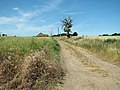
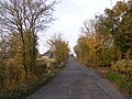
 A Long Open Road - geograph.org.uk - 3145772.jpg 1.024 × 768; 183 kB
-
 A runway control caravan - geograph.org.uk - 4521460.jpg 640 × 555; 312 kB
-
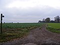
 Across A Field - geograph.org.uk - 3780054.jpg 1.024 × 771; 213 kB
-
 Air Museum entrance, Horham - geograph.org.uk - 3911148.jpg 640 × 480; 92 kB
-
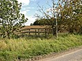
 Air raid shelter at Denham Corner - geograph.org.uk - 4521248.jpg 640 × 507; 568 kB
-
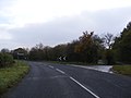 B1117 Cookley Road - geograph.org.uk - 2704368.jpg 3.072 × 2.304; 1,22 MB
-
 B1117 Cookley Road - geograph.org.uk - 2704661.jpg 3.072 × 2.304; 1,34 MB
-
 B1117 Cookley Road - geograph.org.uk - 2704664.jpg 3.072 × 2.304; 1,33 MB
-
 B1117 Cookley Road - geograph.org.uk - 2704666.jpg 3.072 × 2.304; 1,38 MB
-
 B1117 Cookley Road - geograph.org.uk - 2704867.jpg 3.072 × 2.304; 1,32 MB
-
 B1117 Cookley Road - geograph.org.uk - 2704871.jpg 3.072 × 2.304; 1,25 MB
-
 B1117 Cookley Road - geograph.org.uk - 2704891.jpg 3.072 × 2.304; 1,33 MB
-
 B1117 Cookley Road - geograph.org.uk - 2704892.jpg 3.072 × 2.304; 1,22 MB
-
 B1117 Cookley Road at Shingle Hill Corner - geograph.org.uk - 2704671.jpg 3.072 × 2.304; 1,26 MB
-
 B1117 Cookley Road at Shingle Hill Corner - geograph.org.uk - 2704857.jpg 3.072 × 2.304; 1,34 MB
-
 B1117 Denham Road, Denham - geograph.org.uk - 4442304.jpg 3.072 × 2.304; 1,83 MB
-
 B1117 road to Eye - geograph.org.uk - 3911132.jpg 640 × 480; 73 kB
-
 Barley crop field, Denham Green - geograph.org.uk - 4552291.jpg 640 × 360; 297 kB
-
 Barn - geograph.org.uk - 3147445.jpg 1.024 × 768; 273 kB
-
 Barrack hut surrounded by crop fields - geograph.org.uk - 4521155.jpg 640 × 573; 395 kB
-
 Boiler house and water tank - geograph.org.uk - 4539756.jpg 640 × 590; 571 kB
-
 Braithwaite water tank - geograph.org.uk - 4539758.jpg 640 × 496; 391 kB
-
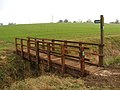
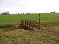
 Bridge on footpath to Denham Green - geograph.org.uk - 2612846.jpg 640 × 480; 292 kB
-
 Bridge over a slip road off the B1117 - geograph.org.uk - 3911137.jpg 640 × 480; 117 kB
-
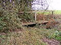
 Bucket emptying platform (remains) - geograph.org.uk - 4552140.jpg 640 × 480; 562 kB
-
 Bucket emptying platform (remains) - geograph.org.uk - 4552142.jpg 640 × 480; 548 kB
-
 Bucket emptying platform (remains) - geograph.org.uk - 4552143.jpg 640 × 480; 535 kB
-
 Church Road - geograph.org.uk - 2705153.jpg 3.072 × 2.304; 1,31 MB
-
 Church Road - geograph.org.uk - 3147444.jpg 1.024 × 768; 223 kB
-
 Church Road, Denham - geograph.org.uk - 2699248.jpg 3.072 × 2.304; 1,5 MB
-
 Church Road, Denham - geograph.org.uk - 2699249.jpg 3.072 × 2.304; 1,27 MB
-
 Church Road, Denham - geograph.org.uk - 2699266.jpg 3.072 × 2.304; 1,26 MB
-
 Church Road, Denham - geograph.org.uk - 2699278.jpg 3.072 × 2.304; 1,29 MB
-
 Church Road, Denham ^ the footpath to Denham Low Road - geograph.org.uk - 2699251.jpg 3.072 × 2.304; 1,63 MB
-

-

-
 Crop fields, Denham Green - geograph.org.uk - 4552293.jpg 640 × 360; 263 kB
-

-
 Cut Mark Denham St John The Baptist Church - geograph.org.uk - 5208440.jpg 1.920 × 1.920; 821 kB
-
 Deal Plantation, Denham - geograph.org.uk - 2612852.jpg 640 × 480; 158 kB
-
 Denham Corner Postbox - geograph.org.uk - 2698074.jpg 3.072 × 2.304; 1,63 MB
-
 Denham Corner Postbox - geograph.org.uk - 2698075.jpg 3.072 × 2.304; 1,68 MB
-
 Denham Corner Postbox - geograph.org.uk - 2698077.jpg 2.304 × 3.072; 1,53 MB
-
 Denham Corner Postbox - geograph.org.uk - 2698078.jpg 2.304 × 3.072; 1,57 MB
-
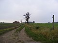
 Denham Green - geograph.org.uk - 3145795.jpg 1.024 × 768; 202 kB
-
 Denham Hall sign - geograph.org.uk - 2704363.jpg 2.304 × 3.072; 1,61 MB
-
 Denham Low Road - geograph.org.uk - 2699271.jpg 3.072 × 2.304; 1,36 MB
-
 Denham Low Road - geograph.org.uk - 2699281.jpg 2.640 × 1.980; 664 kB
-
 Denham Low Road - geograph.org.uk - 2699306.jpg 3.072 × 2.304; 1,29 MB
-
 Denham Low Road - geograph.org.uk - 2704862.jpg 2.304 × 3.072; 1,34 MB
-
 Denham Low Road - geograph.org.uk - 2705143.jpg 2.304 × 3.072; 1,38 MB
-
 Denham Low Road - geograph.org.uk - 2705146.jpg 2.304 × 3.072; 1,27 MB
-
 Denham Low Road - geograph.org.uk - 2705152.jpg 3.072 × 2.304; 1,3 MB
-
 Denham Low Road ^ the footpath to Hoxne Road, Denham Green - geograph.org.uk - 2705151.jpg 3.072 × 2.304; 1,44 MB
-
 Denham Low Road, Denham - geograph.org.uk - 2612821.jpg 640 × 480; 202 kB
-
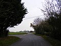
 Denham Road - geograph.org.uk - 2709712.jpg 2.640 × 1.980; 1,02 MB
-
 Denham Road, Denham - geograph.org.uk - 3911637.jpg 640 × 480; 55 kB
-
 Denham sign - geograph.org.uk - 2698586.jpg 2.304 × 3.072; 1,24 MB
-
 Denham Street - geograph.org.uk - 2704667.jpg 3.072 × 2.304; 1,65 MB
-
 Denham Street - geograph.org.uk - 4520349.jpg 640 × 480; 492 kB
-
 Denham Street sign - geograph.org.uk - 2704670.jpg 2.304 × 3.072; 1,66 MB
-
 Denham Village Hall - geograph.org.uk - 2698543.jpg 3.072 × 2.304; 1,52 MB
-
 Denham Village Hall - geograph.org.uk - 2698546.jpg 3.072 × 2.304; 1,63 MB
-
 Denham village hall - geograph.org.uk - 4521264.jpg 640 × 477; 404 kB
-
 Denham village hall - geograph.org.uk - 4521266.jpg 640 × 480; 375 kB
-
 Denham Village Sign - geograph.org.uk - 2704854.jpg 2.304 × 3.072; 1,3 MB
-
 Denham Village Sign - geograph.org.uk - 2704855.jpg 2.304 × 3.072; 1,3 MB
-
 Driveway to Park Farm - geograph.org.uk - 472421.jpg 640 × 480; 128 kB
-
 Entering Denham on Hoxne Road - geograph.org.uk - 2698582.jpg 3.072 × 2.304; 1,47 MB
-
 Entrance into an air raid shelter - geograph.org.uk - 4521253.jpg 640 × 480; 358 kB
-

-

-
 Farm bridge into fields, Denham - geograph.org.uk - 2612839.jpg 640 × 480; 185 kB
-
 Field boundary, Denham Green - geograph.org.uk - 4552285.jpg 640 × 480; 424 kB
-
 Field east of Denham Low Road, Denham - geograph.org.uk - 2612853.jpg 640 × 480; 128 kB
-
 Fields east of Denham Low Road, Denham - geograph.org.uk - 2612841.jpg 640 × 480; 153 kB
-
 Fields south of Shreeve's Farm, Denham - geograph.org.uk - 2612806.jpg 640 × 480; 201 kB
-
 Footbridge - geograph.org.uk - 3145775.jpg 768 × 1.024; 274 kB
-
 Footbridge And Path - geograph.org.uk - 3145793.jpg 1.024 × 768; 286 kB
-
 Footbridge of the footpath to Church Road - geograph.org.uk - 2699289.jpg 2.304 × 3.072; 1,28 MB
-
 Footbridge of the footpath to Church Road - geograph.org.uk - 2699291.jpg 3.072 × 2.304; 1,39 MB
-
 Footbridge of the footpath to Hoxne Road, Denham Green - geograph.org.uk - 2705134.jpg 3.072 × 2.304; 1,37 MB
-
 Footbridge of the footpath to Hoxne Road, Denham Green - geograph.org.uk - 2705139.jpg 2.304 × 3.072; 1,49 MB
-

-
 Footbridge on Watering Road at Reading Green - geograph.org.uk - 2699350.jpg 3.072 × 2.304; 1,66 MB
-
 Footbridge over drainage ditch - geograph.org.uk - 4520357.jpg 640 × 480; 368 kB
-
 Footpath - geograph.org.uk - 3145773.jpg 1.024 × 768; 186 kB
-
 Footpath across field to Denham Green - geograph.org.uk - 2612848.jpg 640 × 480; 271 kB
-
 Footpath along Low Road - geograph.org.uk - 2699398.jpg 2.304 × 3.072; 1,18 MB
-
 Footpath And RUPP Sign - geograph.org.uk - 3780060.jpg 768 × 1.024; 356 kB
-
 Footpath past Low Barn - geograph.org.uk - 4552299.jpg 640 × 480; 381 kB
-
 Footpath through oilseed rape crop field - geograph.org.uk - 4539749.jpg 640 × 360; 274 kB
-
 Footpath through oilseed rape crop field - geograph.org.uk - 4539751.jpg 640 × 360; 185 kB
-
 Footpath to Church Road - geograph.org.uk - 2699286.jpg 3.072 × 2.304; 1,32 MB
-
 Footpath to Church Road - geograph.org.uk - 2699292.jpg 3.072 × 2.304; 1,31 MB
-
 Footpath to Church Road - geograph.org.uk - 2699298.jpg 3.072 × 2.304; 1,36 MB
-
 Footpath to Cranley Farm - geograph.org.uk - 2704645.jpg 3.072 × 2.304; 1,33 MB
-
 Footpath to Denham - geograph.org.uk - 4552296.jpg 640 × 480; 406 kB
-
 Footpath to Denham church - geograph.org.uk - 349256.jpg 640 × 414; 60 kB
-
 Footpath to Denham Low Road - geograph.org.uk - 2699235.jpg 3.072 × 2.304; 1,27 MB
-
 Footpath to Denham Low Road - geograph.org.uk - 2699252.jpg 2.304 × 3.072; 1,47 MB
-
 Footpath to Horham Road, Denham Corner - geograph.org.uk - 2699407.jpg 2.304 × 3.072; 1,46 MB
-
 Footpath to Horham Road, Denham Corner - geograph.org.uk - 2699411.jpg 3.072 × 2.304; 1,32 MB
-
 Footpath to Hoxne Place ^ The Street, Horham - geograph.org.uk - 2706273.jpg 3.072 × 2.304; 1,53 MB
-
 Footpath to Hoxne Road, Denham Green - geograph.org.uk - 2705131.jpg 3.072 × 2.304; 1,48 MB
-
 Footpath to Hoxne Road, Denham Green - geograph.org.uk - 2705137.jpg 3.072 × 2.304; 1,32 MB
-
 Footpath to Low Barn, Denham - geograph.org.uk - 2612825.jpg 640 × 480; 205 kB
-
 Footpath to Red House Farm - geograph.org.uk - 2699284.jpg 3.072 × 2.304; 1,34 MB
-
 Footpath to Shingle Hill Corner - geograph.org.uk - 4552289.jpg 640 × 360; 293 kB
-
 Footpath to the B1117 - geograph.org.uk - 2698047.jpg 3.072 × 2.304; 1,67 MB
-
 Footpath to The Street, Denham Street - geograph.org.uk - 2704870.jpg 3.072 × 2.304; 1,26 MB
-

-
 Former barrack hut - geograph.org.uk - 4521122.jpg 640 × 480; 386 kB
-
 Former barrack hut - geograph.org.uk - 4521127.jpg 640 × 480; 293 kB
-
 Former barrack hut - geograph.org.uk - 4521131.jpg 640 × 480; 319 kB
-
 Former barrack hut - geograph.org.uk - 4521135.jpg 640 × 480; 497 kB
-
 Former barrack hut - geograph.org.uk - 4521138.jpg 640 × 480; 353 kB
-
 Frontage of Denham village hall - geograph.org.uk - 4521267.jpg 640 × 480; 382 kB
-
 Graffiti in the old guardroom - geograph.org.uk - 4543947.jpg 640 × 524; 451 kB
-
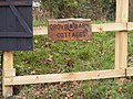 Grove ^ Barn Cottages sign - geograph.org.uk - 2704884.jpg 3.072 × 2.304; 1,53 MB
-
 Horham Road - geograph.org.uk - 2698467.jpg 3.072 × 2.304; 1,3 MB
-
 Horham Road - geograph.org.uk - 2698503.jpg 3.072 × 2.304; 1,39 MB
-
 Horham Road at Denham Corner - geograph.org.uk - 2698520.jpg 3.072 × 2.304; 1,33 MB
-
 Horham Road at Denham Corner and Denham Corner Postbox - geograph.org.uk - 2698045.jpg 3.072 × 2.304; 1,39 MB
-
 Houses at Shingle Hill Corner - geograph.org.uk - 2704866.jpg 3.072 × 2.304; 1,35 MB
-
 Hoxne Road - geograph.org.uk - 2698462.jpg 3.072 × 2.304; 1,49 MB
-
 Hoxne Road - geograph.org.uk - 2698529.jpg 3.072 × 2.304; 1,47 MB
-
 Hoxne Road at Denham Corner ^ Denham Corner Postbox - geograph.org.uk - 2698066.jpg 3.072 × 2.304; 1,54 MB
-

-
 Hoxne Road in Denham Village - geograph.org.uk - 2698606.jpg 3.072 × 2.304; 1,35 MB
-
 Hoxne Road ^ Denham Corner Postbox - geograph.org.uk - 2698452.jpg 3.072 × 2.304; 1,67 MB
-
 Hoxne Road, Denham - geograph.org.uk - 2699242.jpg 3.072 × 2.304; 1,56 MB
-
 Hoxne Road, Denham - geograph.org.uk - 2699245.jpg 3.072 × 2.304; 1,29 MB
-
 Hoxne Road, Denham Green - geograph.org.uk - 2706266.jpg 3.072 × 2.304; 1,52 MB
-

-
 Lane to Heckfield Green - geograph.org.uk - 2612812.jpg 640 × 480; 167 kB
-
 Lane to Shingle Hill Corner, Denham - geograph.org.uk - 2612815.jpg 640 × 480; 171 kB
-
 Low Barn - geograph.org.uk - 2699302.jpg 3.072 × 2.304; 1,38 MB
-

-
 Low Road - geograph.org.uk - 2704875.jpg 3.072 × 2.304; 1,32 MB
-
 Low Road ^ the footpath to The Street, Denham Street - geograph.org.uk - 2704879.jpg 3.072 × 2.304; 1,64 MB
-
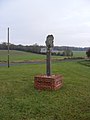
 Memorial to the men of the USAAF 95th BG (H) - geograph.org.uk - 4443961.jpg 1.024 × 758; 369 kB
-
 Memorial to the men of the USAAF 95th BG (H) - geograph.org.uk - 4443965.jpg 768 × 1.024; 367 kB
-
 MOT garage at Shingle Hill Corner - geograph.org.uk - 4520354.jpg 640 × 480; 374 kB
-
 Nearly There - geograph.org.uk - 3145787.jpg 768 × 1.024; 44 kB
-
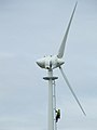
 New Turbine - geograph.org.uk - 3145781.jpg 768 × 1.024; 100 kB
-
 Old concreted road - geograph.org.uk - 4521334.jpg 640 × 480; 481 kB
-
 Old door panel - geograph.org.uk - 4521653.jpg 623 × 640; 669 kB
-
 Old guardroom - geograph.org.uk - 4521199.jpg 640 × 480; 369 kB
-

-

-
 Postbox in hedge, Denham Street - geograph.org.uk - 4520348.jpg 640 × 608; 681 kB
-
 Propeller blades - geograph.org.uk - 4521490.jpg 640 × 530; 390 kB
-
 Recovered aircraft engines - geograph.org.uk - 4521543.jpg 640 × 518; 244 kB
-
 Recovered WW2 flight jacket - geograph.org.uk - 4521549.jpg 640 × 558; 510 kB
-
 Ripening barley crop, Denham Green - geograph.org.uk - 4552295.jpg 640 × 360; 300 kB
-
 Ripening barley, Denham Green - geograph.org.uk - 4552287.jpg 640 × 360; 316 kB
-
 Road to Grove Farm, Redlingfield - geograph.org.uk - 3911141.jpg 640 × 480; 80 kB
-
 Roadsign on B1117 Cookley Road - geograph.org.uk - 2704659.jpg 2.304 × 3.072; 1,27 MB
-
 Roadsign on the B1117 - geograph.org.uk - 2699445.jpg 2.304 × 3.072; 1,53 MB
-
 Roadsign on the B1117 Cookley Road at Shingle Hill Corner - geograph.org.uk - 2704860.jpg 2.304 × 3.072; 1,35 MB
-
 Roadsign to Reading Green on Hoxne Road - geograph.org.uk - 2699238.jpg 3.072 × 2.304; 1,6 MB
-
 Roadsigns on the B1117 - geograph.org.uk - 2698507.jpg 3.072 × 2.304; 1,66 MB
-
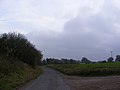
 Sharp Bend - geograph.org.uk - 3147455.jpg 1.024 × 768; 199 kB
-
 Silo at Low Barn, Denham - geograph.org.uk - 2612827.jpg 640 × 480; 167 kB
-
 Standwell Farm - geograph.org.uk - 4552294.jpg 640 × 360; 317 kB
-
 Steps to the old water tank - geograph.org.uk - 4539761.jpg 640 × 480; 524 kB
-
 Sugar beet crop, Denham - geograph.org.uk - 2612813.jpg 640 × 480; 233 kB
-
 Telephone Box ^ Post Office Postbox - geograph.org.uk - 2698612.jpg 2.304 × 3.072; 1,62 MB
-
 The B1117 and the footpath along Low Road - geograph.org.uk - 2699396.jpg 3.072 × 2.304; 1,34 MB
-
 The B1117 at the junction with Low Road - geograph.org.uk - 2699442.jpg 3.072 × 2.304; 1,32 MB
-
 The B1117 looking towards Horham - geograph.org.uk - 2698514.jpg 3.072 × 2.304; 1,31 MB
-
 The B1117 to Shingle Hill Corner ^ Hoxne - geograph.org.uk - 2698504.jpg 3.072 × 2.304; 1,41 MB
-
 The entrance to 95th Bombardment Group Hospital Museum - geograph.org.uk - 2705117.jpg 3.072 × 2.304; 1,3 MB
-

-
 The entrance to Denham Hall - geograph.org.uk - 2704359.jpg 3.072 × 2.304; 1,63 MB
-
 The entrance to Denham Hall - geograph.org.uk - 2704903.jpg 3.072 × 2.304; 1,62 MB
-
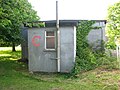
 The Red Feather Club - geograph.org.uk - 4543974.jpg 640 × 480; 379 kB
-
 The Red Feather Club - geograph.org.uk - 4543975.jpg 640 × 478; 416 kB


_-_geograph.org.uk_-_3911153.jpg)
_museum_-_geograph.org.uk_-_4443953.jpg)


_-_geograph.org.uk_-_4443961.jpg)
_-_geograph.org.uk_-_4443965.jpg)


_-_geograph.org.uk_-_4552140.jpg)
_-_geograph.org.uk_-_4552142.jpg)
_-_geograph.org.uk_-_4552143.jpg)