Category:Dorchester-on-Thames
Zur Navigation springen
Zur Suche springen
English: Dorchester-on-Thames is a village on the River Thame in Oxfordshire, England, about southeast of Oxford. Dorchester is just above the Thame's confluence with the River Thames. Historically the Thames was only so-named downstream of the village; upstream it is named the Isis, and Ordnance Survey maps continue to label the river as "River Thames or Isis" until Dorchester. Practically, however, this distinction is rarely used outside of the City of Oxford.
Français : Dorchester-on-Thames est une ville de l' Oxfordshire, en Angleterre, et elle est située à confluence de Tamise et de River Thame.
Italiano: Dorchester è un villaggio sulle rive del Tamigi nell'Oxfordshire, a circa 4,8 km a nord-ovest di Wallingford e a 13 km a sud-est di Oxford.
Nederlands: Dorchester-on-Thames is een plaats in het bestuurlijke gebied South Oxfordshire, in het Engelse graafschap Oxfordshire.
Gemeinde in der englischen Grafschaft Oxfordshire  | |||||
| Medium hochladen | |||||
| Ist ein(e) | |||||
|---|---|---|---|---|---|
| Ort | Dorchester, South Oxfordshire, Oxfordshire, Südostengland, England | ||||
| Liegt am oder im Gewässer | |||||
| Fläche |
| ||||
| offizielle Website | |||||
 | |||||
Unterkategorien
Es werden 8 von insgesamt 8 Unterkategorien in dieser Kategorie angezeigt:
In Klammern die Anzahl der enthaltenen Kategorien (K), Seiten (S), Dateien (D)
Medien in der Kategorie „Dorchester-on-Thames“
Folgende 31 Dateien sind in dieser Kategorie, von 31 insgesamt.
-

-
 Abbey Tower - geograph.org.uk - 1281262.jpg 640 × 480; 74 KB
-
 Abingdon Road, Dorchester - geograph.org.uk - 46071.jpg 640 × 481; 42 KB
-
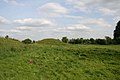 Barrow by the Dyke - geograph.org.uk - 1311205.jpg 640 × 426; 54 KB
-
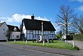
 Bridge End, Dorchester - geograph.org.uk - 1307845.jpg 640 × 410; 45 KB
-
 Bridleway, Dorchester - geograph.org.uk - 176681.jpg 640 × 480; 97 KB
-
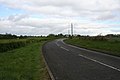 Bypassed road - geograph.org.uk - 1279330.jpg 640 × 426; 42 KB
-
 Dorchester Cross Geograph-2682969-by-Bill-Ni.jpg 426 × 640; 92 KB
-
 Dorchester Sailing Club, Oxfordshire - geograph.org.uk - 1166453.jpg 480 × 640; 61 KB
-
 Dorchester-on-Thames.jpg 8.192 × 1.856; 7,96 MB
-
 Dorchester01.JPG 1.024 × 768; 404 KB
-
 End of Bridge end - geograph.org.uk - 1310080.jpg 640 × 426; 71 KB
-
 Farmland, Dorchester - geograph.org.uk - 1589608.jpg 640 × 480; 162 KB
-
 Footbridge on the Thames Path - geograph.org.uk - 946970.jpg 640 × 480; 120 KB
-

-
 Gate on the footpath at Overy - geograph.org.uk - 1295746.jpg 640 × 427; 102 KB
-
 Looking out the box - geograph.org.uk - 1311172.jpg 640 × 426; 49 KB
-
 Overy Mill - geograph.org.uk - 1095636.jpg 640 × 480; 132 KB
-
 Sewage works at Overy - geograph.org.uk - 1295768.jpg 640 × 427; 80 KB
-
 Side chamber on the right - geograph.org.uk - 1310194.jpg 640 × 426; 58 KB
-
 Storehouse on the corner - geograph.org.uk - 1310060.jpg 400 × 600; 55 KB
-
 Thames Path heading for Shillingford - geograph.org.uk - 640156.jpg 450 × 640; 133 KB
-
 Thames River (50358351846).jpg 4.000 × 3.000; 4,85 MB
-
 The British Army in the United Kingdom 1939-45 H4689.jpg 800 × 610; 72 KB
-
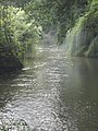
 The River Thame at Dorchester - geograph.org.uk - 1295751.jpg 640 × 427; 111 KB
-
 The River Thame by Hurst Water Meadow - geograph.org.uk - 947078.jpg 480 × 640; 108 KB
-
 The road to Overy - geograph.org.uk - 1295760.jpg 640 × 427; 100 KB
-
 The Thames near Dorchester - geograph.org.uk - 640142.jpg 480 × 640; 96 KB
-
 This way to Dorchester - geograph.org.uk - 1248212.jpg 640 × 427; 88 KB
-
 View of the front - geograph.org.uk - 1310204.jpg 640 × 426; 69 KB
-
.jpg)


.jpg)


.jpg)