Category:Dunstable Downs
Jump to navigation
Jump to search
escarpment in Bedfordshire, England, UK  | |||||
| Upload media | |||||
| Instance of | |||||
|---|---|---|---|---|---|
| Location | Central Bedfordshire, Bedfordshire, East of England, England | ||||
| Maintained by | |||||
| Elevation above sea level |
| ||||
| Parent peak |
| ||||
 | |||||
Subcategories
This category has the following 4 subcategories, out of 4 total.
Media in category "Dunstable Downs"
The following 37 files are in this category, out of 37 total.
-
 Dunstable Downs - geograph.org.uk - 1567136.jpg 640 × 480; 78 KB
-
 Dunstable Downs - geograph.org.uk - 757929.jpg 640 × 480; 81 KB
-
 Dunstable Downs 01.jpg 2,048 × 1,536; 1.16 MB
-
 Dunstable Downs 1.JPG 6,016 × 4,000; 8.78 MB
-
 Dunstable Downs 2.JPG 6,016 × 4,000; 10.23 MB
-
 Dunstable Downs 3.JPG 6,016 × 4,000; 11.22 MB
-
 Dunstable Downs 4.JPG 6,016 × 4,000; 10.92 MB
-
 Dunstable Downs 5.JPG 6,016 × 4,000; 9.02 MB
-
 Dunstable Downs, Bedfordshire - geograph.org.uk - 889334.jpg 640 × 463; 45 KB
-
 Dunstable Downs. - geograph.org.uk - 1238996.jpg 640 × 427; 57 KB
-
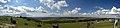 DunstableDownsPanorama.jpg 8,000 × 1,858; 8.02 MB
-
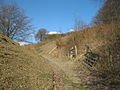
 Footpath off Buttercup Lane - geograph.org.uk - 204336.jpg 523 × 640; 163 KB
-
 GOC Dunstable Downs 001 Chilterns Gateway Centre (24629034732).jpg 4,288 × 3,216; 4.1 MB
-
 GOC Markyate 082 Dunstable Downs (9350731092).jpg 4,288 × 2,695; 3.23 MB
-
 Icknield Way - geograph.org.uk - 757925.jpg 640 × 480; 78 KB
-
 Kite flying on Dunstable Downs - geograph.org.uk - 72418.jpg 640 × 425; 76 KB
-
 Lamsey Farm - geograph.org.uk - 193359.jpg 640 × 329; 70 KB
-
 Landscape-England-IvinghoeBeacon-2006-12-20-1.jpg 2,272 × 1,704; 495 KB
-
 Landscape-England-IvinghoeBeacon-2006-12-20-2.jpg 2,272 × 1,704; 495 KB
-
 Leiodes rugosa Stephens, 1829 (3807776730).jpg 3,654 × 2,375; 898 KB
-
 Litter and rubbish bins - geograph.org.uk - 757923.jpg 640 × 480; 69 KB
-
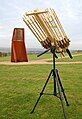 Motorised Cordless Rubberband Minigun.jpg 497 × 723; 69 KB
-

-

-
 Power lines - geograph.org.uk - 1175420.jpg 524 × 640; 182 KB
-
 Redundant Stile.jpg 640 × 480; 123 KB
-
 The Icknield Way in Spring - geograph.org.uk - 72414.jpg 640 × 425; 144 KB
-
 Thirteenth tee - geograph.org.uk - 757918.jpg 640 × 480; 69 KB
-
 Trig point, on Dunstable Downs - geograph.org.uk - 1440937.jpg 640 × 480; 98 KB
-
 Two walkers on the Icknield Way - geograph.org.uk - 757921.jpg 640 × 480; 81 KB
-
 Westerly Wind on Dunstable Downs - geograph.org.uk - 1323993.jpg 640 × 406; 143 KB
-
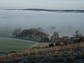
 Whipsnade sunset - geograph.org.uk - 1081306.jpg 480 × 640; 108 KB
-
 Barley Field, Wellhead Road - geograph.org.uk - 197116.jpg 640 × 480; 102 KB
-

-
 Pylons, Dunstable Downs - geograph.org.uk - 84771.jpg 480 × 640; 16 KB
-
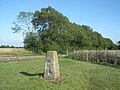
 Trig point on Dunstable Downs - geograph.org.uk - 224184.jpg 550 × 380; 25 KB
-
 Wellhead Road - geograph.org.uk - 193750.jpg 640 × 480; 75 KB


.jpg)
.jpg)


.jpg)


