Category:Duthil
Naar navigatie springen
Naar zoeken springen
nederzetting in het Verenigd Koninkrijk  | |||||
| Media uploaden | |||||
| Is een | |||||
|---|---|---|---|---|---|
| Locatie |
| ||||
 | |||||
English: Duthil is a small village, bypassed from the A938 road, in Carrbridge in the Scottish Highlands and is in the Scottish council area of Highland.
Ondercategorieën
Deze categorie bevat alleen de volgende subcategorie.
D
Media in categorie "Duthil"
Deze categorie bevat de volgende 49 bestanden, van in totaal 49.
-
 Birchwoods, Drumuillie - geograph.org.uk - 430978.jpg 640 × 480; 126 kB
-
 By Mullochard Farm - geograph.org.uk - 213367.jpg 640 × 424; 66 kB
-
 By Wester Galovie - geograph.org.uk - 213372.jpg 640 × 424; 59 kB
-
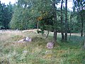
 Cairn by Clury - geograph.org.uk - 213391.jpg 640 × 425; 58 kB
-
 Creag an Fhitich - geograph.org.uk - 430986.jpg 640 × 480; 134 kB
-
 Creag an Fhitich - geograph.org.uk - 430989.jpg 480 × 640; 121 kB
-
 Deishar - geograph.org.uk - 430983.jpg 640 × 480; 137 kB
-
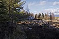
 Deishar Wood Cairn - geograph.org.uk - 897482.jpg 640 × 480; 120 kB
-
 Drynach - geograph.org.uk - 661032.jpg 640 × 412; 56 kB
-
 Duthil Burn near Duthil Old School - geograph.org.uk - 1312320.jpg 640 × 480; 109 kB
-
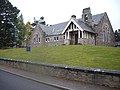 Duthil Parish Church, Carrbridge - geograph.org.uk - 1547450.jpg 640 × 480; 76 kB
-
-
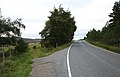
 Duthill Plantation and the B9007 - geograph.org.uk - 2825477.jpg 1.600 × 1.253; 312 kB
-
 East drive to Doune - geograph.org.uk - 369810.jpg 640 × 480; 137 kB
-

-
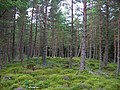
 Edge of Forest - geograph.org.uk - 235593.jpg 640 × 427; 72 kB
-
 Farm road and Mains of Tullochgribban - geograph.org.uk - 661036.jpg 640 × 425; 66 kB
-
 Farmland by the River Dulnain - geograph.org.uk - 661054.jpg 640 × 425; 68 kB
-

-
 Floods - geograph.org.uk - 311408.jpg 640 × 361; 186 kB
-
 Forest sunset - geograph.org.uk - 430993.jpg 640 × 480; 106 kB
-
 Lane to Auchtereang off the B9007. - geograph.org.uk - 242484.jpg 640 × 426; 87 kB
-
 Lyndeor, Duthil - geograph.org.uk - 721732.jpg 640 × 480; 65 kB
-
 Moorland East of Duthil Plantation - geograph.org.uk - 973579.jpg 440 × 587; 333 kB
-
 Near Auchterblair - geograph.org.uk - 213361.jpg 640 × 424; 65 kB
-
-
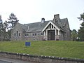
 Old School, Duthil, Carrbridge - geograph.org.uk - 1312325.jpg 640 × 480; 61 kB
-
 Old School, Duthil, Carrbridge - geograph.org.uk - 721741.jpg 640 × 480; 76 kB
-
 Shillochan - geograph.org.uk - 219878.jpg 640 × 424; 100 kB
-

-
 The descent to Carrbridge, near Ess - geograph.org.uk - 157384.jpg 640 × 480; 54 kB
-
 The isolation of Ess. - geograph.org.uk - 242485.jpg 640 × 426; 81 kB
-
 Track to Rysaurie and Lyndeor. - geograph.org.uk - 242482.jpg 640 × 410; 103 kB
-
 Track, Duthil Plantation - geograph.org.uk - 749297.jpg 480 × 640; 131 kB
-

-
 Tullochgribban Plantation - geograph.org.uk - 985145.jpg 640 × 359; 96 kB
-
 Tullochgribban Plantation - geograph.org.uk - 985179.jpg 640 × 480; 155 kB
-
 Tullochgribban Plantation - geograph.org.uk - 987408.jpg 480 × 640; 136 kB
-

-
 Wide forest ride - geograph.org.uk - 235597.jpg 640 × 427; 89 kB
-
 Woods at Drumullie - geograph.org.uk - 232072.jpg 640 × 427; 46 kB
-
 Barn, Lower Lackgie - geograph.org.uk - 228146.jpg 640 × 384; 57 kB
-
 Bog land... - geograph.org.uk - 235609.jpg 640 × 427; 118 kB
-
 Bog Myrtle, Bog and Forest - geograph.org.uk - 235601.jpg 640 × 427; 72 kB
-
 By Clury - geograph.org.uk - 213381.jpg 640 × 424; 56 kB
-
 By Shillochan - geograph.org.uk - 213365.jpg 640 × 424; 59 kB
-
 Field, Lower Lackgie - geograph.org.uk - 228144.jpg 640 × 384; 40 kB
-
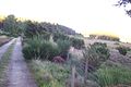
 Harebells on Old Wall, Near Lower Lackgie - geograph.org.uk - 244609.jpg 640 × 384; 115 kB
-
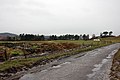
 River Spey Flood Plain - geograph.org.uk - 311369.jpg 640 × 280; 157 kB


