Category:East Walton
Jump to navigation
Jump to search
village and civil parish in Norfolk, UK   | |||||
| Upload media | |||||
| Instance of | |||||
|---|---|---|---|---|---|
| Location | King's Lynn and West Norfolk, Norfolk, East of England, England | ||||
| Population |
| ||||
| Area |
| ||||
 | |||||
Subcategories
This category has the following 3 subcategories, out of 3 total.
M
W
- Wheelwright's Oven, East Walton (12 F)
Media in category "East Walton"
The following 130 files are in this category, out of 130 total.
-
 A carpet of leaves on the track - geograph.org.uk - 3770505.jpg 4,320 × 3,240; 5.69 MB
-
 A density of trees and a ground-cover of bracken - geograph.org.uk - 6169333.jpg 3,456 × 2,592; 3.98 MB
-

-
 Approaching Bradmoor Hill, Narford - geograph.org.uk - 2576462.jpg 640 × 480; 263 KB
-
 B1153 towards Gayton - geograph.org.uk - 6635965.jpg 1,024 × 768; 81 KB
-
 Bend in the B1153, Summerend - geograph.org.uk - 6635848.jpg 1,024 × 768; 120 KB
-
 Blue bales - geograph.org.uk - 6601347.jpg 1,024 × 768; 146 KB
-
 Bradmoor Plantation, Narford - geograph.org.uk - 3555036.jpg 480 × 640; 272 KB
-
 Bridge on Narford Lane - geograph.org.uk - 5545662.jpg 4,608 × 3,072; 1.95 MB
-
 Bridge over the River Nar, Narford - geograph.org.uk - 2576467.jpg 640 × 480; 238 KB
-
 Brown and black faced lambs - geograph.org.uk - 2289852.jpg 760 × 570; 266 KB
-
 Byway to Gayton Thorpe - geograph.org.uk - 6600769.jpg 1,024 × 768; 239 KB
-
 Byway to Gayton Thorpe - geograph.org.uk - 6603710.jpg 1,024 × 768; 184 KB
-
 Byway to Gayton Thorpe - geograph.org.uk - 6603713.jpg 1,024 × 768; 227 KB
-

-
 Close-up of carriage remains (1) - geograph.org.uk - 6601999.jpg 1,024 × 768; 323 KB
-
 Close-up of carriage remains (2) - geograph.org.uk - 6602004.jpg 1,024 × 768; 351 KB
-
 Contorted tree in Pridgeon's Belt - geograph.org.uk - 3991384.jpg 4,320 × 3,240; 5.31 MB
-
 Cottage in Church Lane, East Walton - geograph.org.uk - 1744954.jpg 640 × 475; 89 KB
-
 Cottage, East Walton - geograph.org.uk - 6635956.jpg 1,024 × 731; 132 KB
-
 Direction Sign – Signpost - geograph.org.uk - 6527733.jpg 1,668 × 2,225; 1.42 MB
-

-

-

-

-
 East Walton - geograph.org.uk - 6635963.jpg 640 × 441; 76 KB
-
 East Walton bier - geograph.org.uk - 5064818.jpg 1,500 × 1,000; 564 KB
-
 East Walton common - geograph.org.uk - 150413.jpg 640 × 480; 125 KB
-
 East Walton Common, aerial 2015 - geograph.org.uk - 4485166.jpg 640 × 334; 44 KB
-
 East Walton War Memorial Plaque - geograph.org.uk - 4891493.jpg 3,456 × 2,592; 3.68 MB
-
 Electricity pylon in oilseed rape field - geograph.org.uk - 3555073.jpg 480 × 640; 113 KB
-

-
-
 Ewe and her lambs at East Walton - geograph.org.uk - 2289829.jpg 760 × 570; 277 KB
-
 Ewe with triplets at East Walton - geograph.org.uk - 2289860.jpg 760 × 570; 278 KB
-
 Ewes with newly-born lambs - geograph.org.uk - 2289833.jpg 760 × 570; 185 KB
-
 Farm track alongside Walton Common - geograph.org.uk - 6601369.jpg 1,024 × 768; 259 KB
-
 Farm track to Stowborough Heath - geograph.org.uk - 6601330.jpg 1,024 × 768; 237 KB
-
 Field east of Church Lane, East Walton - geograph.org.uk - 1744950.jpg 640 × 480; 104 KB
-
 Field entrance and headland - geograph.org.uk - 2289743.jpg 760 × 570; 179 KB
-
 Flat field towards Broom Belt - geograph.org.uk - 6635866.jpg 1,024 × 637; 119 KB
-
 Fountaine's Folly - geograph.org.uk - 6406985.jpg 4,032 × 3,024; 6.01 MB
-
 Gate on the driveway to St Mary's church - geograph.org.uk - 1745236.jpg 640 × 474; 168 KB
-
 Harvested sugar beet field near East Walton - geograph.org.uk - 3769444.jpg 4,320 × 3,240; 5.88 MB
-
 Houses on the B1153, East Walton - geograph.org.uk - 6635730.jpg 5,184 × 3,888; 6.36 MB
-
 Inquisitive horse near Gayton Thorpe - geograph.org.uk - 2889701.jpg 4,320 × 3,240; 5.83 MB
-
 Joe Crow - geograph.org.uk - 5989852.jpg 4,608 × 3,456; 6.58 MB
-
-
 Lady Plantation from the corner of Long Lady Plantation - geograph.org.uk - 6169328.jpg 3,456 × 2,592; 3.93 MB
-
 Lamb on the run, at east Walton - geograph.org.uk - 2289842.jpg 760 × 570; 279 KB
-
 Land, Summer End - geograph.org.uk - 6635850.jpg 1,024 × 768; 141 KB
-
 Lone tree by road east of East Walton - geograph.org.uk - 5981949.jpg 1,600 × 999; 578 KB
-
 Minor road towards West Acre - geograph.org.uk - 6635861.jpg 1,024 × 768; 108 KB
-
 Minor road towards West Acre - geograph.org.uk - 6635869.jpg 1,024 × 768; 99 KB
-
 Mural on a cabin at the Westacre Montessori school - geograph.org.uk - 5989855.jpg 4,608 × 3,456; 6.57 MB
-
 Narford Lane with Long Lady Plantation on the right - geograph.org.uk - 6169331.jpg 3,456 × 2,592; 3.97 MB
-
 Near Gravel Pit Plantation looking towards Gayton - geograph.org.uk - 2889745.jpg 4,320 × 3,240; 6.24 MB
-

-
 Nettles at Bradmoor Hill, Narford - geograph.org.uk - 3555026.jpg 640 × 480; 285 KB
-
 Oilseed rape crop and poppies, Narford - geograph.org.uk - 3555106.jpg 640 × 542; 272 KB
-
 Old field barn - geograph.org.uk - 754534.jpg 640 × 480; 115 KB
-

-
 Pasture near Summer End Farm - geograph.org.uk - 3991374.jpg 4,320 × 3,240; 5.52 MB
-
 Permissive path to East Walton - geograph.org.uk - 6603744.jpg 1,024 × 768; 179 KB
-
 Pig country - geograph.org.uk - 3996749.jpg 4,320 × 3,240; 5.85 MB
-
 Ploughed field - geograph.org.uk - 754556.jpg 640 × 480; 95 KB
-
 Poppies and oilseed rape, Narford - geograph.org.uk - 3555098.jpg 640 × 480; 247 KB
-
 Poppies and pylons, Narford - geograph.org.uk - 3555089.jpg 640 × 480; 224 KB
-
 Poppies beside Narford Lane - geograph.org.uk - 3555096.jpg 640 × 480; 276 KB
-

-
 Poppies in oilseed rape field, Narford - geograph.org.uk - 3555093.jpg 640 × 480; 245 KB
-
 Prepared field and Walton Field Belts - geograph.org.uk - 6601341.jpg 1,024 × 768; 176 KB
-
 Railway truck in Soigne Wood - geograph.org.uk - 3996757.jpg 4,320 × 3,240; 5.97 MB
-
 Remains of a railway carriage, Soigné Wood - geograph.org.uk - 6601997.jpg 1,024 × 768; 405 KB
-
 Restricted byway to West Acre - geograph.org.uk - 6604089.jpg 1,024 × 768; 237 KB
-

-
 Road junction - geograph.org.uk - 754567.jpg 640 × 480; 57 KB
-
 Road Sign north of Narford Hall - geograph.org.uk - 565244.jpg 640 × 426; 72 KB
-
 Shed by Abbey Farm - geograph.org.uk - 1744909.jpg 640 × 480; 82 KB
-
 Shed on Water Lane, East Walton - geograph.org.uk - 3770501.jpg 4,320 × 3,240; 5.56 MB
-
 Sprayer with wings spread wide - geograph.org.uk - 6169325.jpg 3,456 × 2,592; 3.72 MB
-
 Stowborough Heath - geograph.org.uk - 6604665.jpg 1,024 × 768; 182 KB
-
 Straw stack near Walton Common, Norfolk - geograph.org.uk - 3769378.jpg 4,320 × 3,240; 5.78 MB
-

-
 Sugar beet heap off Narford Lane, East Walton - geograph.org.uk - 3769508.jpg 4,320 × 3,240; 5.79 MB
-
 Tank traps, Narford - geograph.org.uk - 2576485.jpg 640 × 480; 319 KB
-
 Tank traps, Narford - geograph.org.uk - 2576490.jpg 640 × 480; 305 KB
-
 Tank traps, Narford - geograph.org.uk - 2576491.jpg 480 × 640; 253 KB
-
 The font at St Andrew's chapel - geograph.org.uk - 2289776.jpg 760 × 570; 353 KB
-
 The Old Rectory in East Walton - geograph.org.uk - 1744958.jpg 640 × 506; 160 KB
-
 The Old Rectory in East Walton - geograph.org.uk - 1745238.jpg 640 × 507; 118 KB
-
 The Post Office and Shop - geograph.org.uk - 58193.jpg 640 × 480; 80 KB
-
 The River Nar north of Narford Hall - geograph.org.uk - 2576471.jpg 480 × 640; 285 KB
-
 The wheelwright's oven and stone, East Walton - geograph.org.uk - 3769399.jpg 4,320 × 3,240; 5.48 MB
-
 Timber stacks - geograph.org.uk - 6601356.jpg 1,024 × 768; 157 KB
-
 Track alongside Soigne Wood near West Acre - geograph.org.uk - 3992528.jpg 4,320 × 3,240; 5.37 MB
-
 Track into Soigné Wood - geograph.org.uk - 6603752.jpg 1,024 × 768; 408 KB
-
 Track into the valley of the River Nar - geograph.org.uk - 5981951.jpg 1,600 × 801; 486 KB
-

-
 Track to Summerend Cottage - geograph.org.uk - 6635852.jpg 1,024 × 768; 120 KB
-
 Track, East Walton - geograph.org.uk - 6635857.jpg 1,024 × 610; 147 KB
-
 Trank traps, Narford - geograph.org.uk - 2576483.jpg 640 × 480; 294 KB
-

-
 Twin lambs at East Walton - geograph.org.uk - 2289837.jpg 760 × 570; 237 KB
-
 UK EastWalton.jpg 804 × 1,656; 344 KB
-
 Unclassified road in East Walton - geograph.org.uk - 5990093.jpg 3,896 × 2,922; 3.86 MB
-
-
 View along overgrown avenue - geograph.org.uk - 3555022.jpg 422 × 640; 169 KB
-
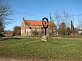
 Village sign - geograph.org.uk - 1392098.jpg 428 × 639; 79 KB
-
 Wasteland between the roads - geograph.org.uk - 6601333.jpg 1,024 × 768; 210 KB
-
 Water Lane Cottages - geograph.org.uk - 58212.jpg 640 × 480; 70 KB
-
 Water Lane, East Walton - geograph.org.uk - 2289823.jpg 760 × 570; 185 KB
-
 Westacre Montessori school - geograph.org.uk - 5989854.jpg 4,608 × 3,456; 6.19 MB
-
 Westacre Montessori school - geograph.org.uk - 5989858.jpg 4,608 × 3,456; 6.69 MB
-
 Wheelwright's Oven, East Walton - geograph.org.uk - 6635877.jpg 756 × 1,024; 236 KB
-
 Wild Flowers and Copse nr East Walton - geograph.org.uk - 566130.jpg 640 × 426; 94 KB
-
 Wilsons Drove - geograph.org.uk - 853298.jpg 640 × 480; 52 KB
-
 Woodland beside the B1153, Summerend - geograph.org.uk - 6635847.jpg 1,024 × 624; 112 KB
-
 A47(T) east of Bilney - geograph.org.uk - 564843.jpg 640 × 426; 58 KB
-
 Arable land near Magpie Farm - geograph.org.uk - 565237.jpg 640 × 426; 85 KB
-
 Bridge Abutment, east of East Winch - geograph.org.uk - 564771.jpg 640 × 426; 161 KB
-
 East Walton village sign - geograph.org.uk - 563681.jpg 640 × 480; 96 KB
-
 Field barn - geograph.org.uk - 752818.jpg 640 × 480; 81 KB
-
 Green field - geograph.org.uk - 754492.jpg 480 × 640; 92 KB
-
 Jasmine Cottage - geograph.org.uk - 58207.jpg 640 × 480; 107 KB
-
 Jubilee Belt - geograph.org.uk - 58253.jpg 640 × 480; 119 KB
-
 Large field - geograph.org.uk - 754580.jpg 640 × 480; 65 KB
-
 Queens Counsellor Shelter Belt - geograph.org.uk - 58257.jpg 640 × 480; 95 KB
-
 Sunrise over Jubilee Belt - geograph.org.uk - 58252.jpg 640 × 480; 61 KB
-
 The Village Sign, East Walton - geograph.org.uk - 57893.jpg 640 × 480; 60 KB


_-_geograph.org.uk_-_6601999.jpg)
_-_geograph.org.uk_-_6602004.jpg)


_east_of_Bilney_-_geograph.org.uk_-_564843.jpg)


