Category:East Ayrshire
Hopp til navigering
Hopp til søk
Council areas (municipalities) of Scotland: Aberdeen · Aberdeenshire · Angus · Argyll and Bute · Clackmannanshire · Dumfries and Galloway · Dundee · East Ayrshire · East Dunbartonshire · East Lothian · East Renfrewshire · Edinburgh · Falkirk · Fife · Glasgow · Highland · Inverclyde · Midlothian · Moray · North Ayrshire · North Lanarkshire · Outer Hebrides · Orkney Islands · Perth and Kinross · Renfrewshire · Scottish Borders · Shetland Islands · South Ayrshire · South Lanarkshire · Stirling · West Dunbartonshire · West Lothian
council area of Scotland   | |||||
| Last opp mediefiler | |||||
| Forekomst av | |||||
|---|---|---|---|---|---|
| Del av |
| ||||
| Plassering | Skottland | ||||
| Hovedstad | |||||
| Folketall |
| ||||
| Areal |
| ||||
| offisielt nettsted | |||||
 | |||||


Underkategorier
Denne kategorien har følgende 39 underkategorier, av totalt 39.
A
- Aerial photographs of East Ayrshire (31 filer)
B
- Barskimming Bridge House (6 filer)
- Benches in East Ayrshire (2 filer)
- Black Law Motte (7 filer)
- Bloomridge Farm (5 filer)
- Bridge House cave (5 filer)
C
D
- Dumfries House Goose House (3 filer)
- Dumfries House Woodland Garden (5 filer)
E
- Entrances in East Ayrshire (13 filer)
F
- Fardalehill Junction (4 filer)
G
H
I
M
- Maxholm (9 filer)
- Mazes in East Ayrshire (2 filer)
N
P
S
- Simon's Burn (6 filer)
- Sundials in East Ayrshire (4 filer)
T
V
Filer i kategorien «East Ayrshire»
Følgende 188 filer er i denne kategorien, av totalt 188.
-
 'The Muckle Brig' - Galston Bridge - geograph.org.uk - 6163627.jpg 4 014 × 3 000; 2,34 MB
-
 Asymmetric xylem growth in Fagus sylvatica.jpg 3 278 × 2 901; 3,64 MB
-
 Auchinleck Castle Well steps, East Ayrshire, Scotland.jpg 4 896 × 2 752; 6,73 MB
-
 Avon Water at Main Castle - geograph.org.uk - 6130257.jpg 2 309 × 1 732; 997 KB
-
 Avon Water north of Main Castle - geograph.org.uk - 6130307.jpg 5 149 × 3 678; 4,36 MB
-
 Barr Mill - Galston - geograph.org.uk - 6169622.jpg 4 118 × 3 088; 3,6 MB
-
 Boats on Loch Doon - geograph.org.uk - 5800723.jpg 2 976 × 1 984; 3,8 MB
-
 Brown’s Institute - Galston - geograph.org.uk - 6163722.jpg 4 145 × 3 109; 4,24 MB
-
 Burnanne House - Galston - geograph.org.uk - 6128214.jpg 4 010 × 3 007; 2,92 MB
-
 Cessnock Water from Shaws Bridge, Dallars, East Ayrshire. View downstream.jpg 4 896 × 2 752; 4,1 MB
-
 Changue Hill from the air - geograph.org.uk - 6063731.jpg 1 024 × 768; 328 KB
-
 Changue Hill from the air - geograph.org.uk - 6063734.jpg 1 024 × 768; 341 KB
-
 Chris Hoy Cycle Way - geograph.org.uk - 6149723.jpg 3 418 × 2 565; 1,24 MB
-
 Coat of Arms of East Ayrshire.svg 1 554 × 1 067; 780 KB
-
 Crest of the Royal Arms of Scotland.jpg 1 260 × 945; 194 KB
-
 Cumnock and Doon Valley.svg 1 023 × 1 345; 2,82 MB
-
 Cumnock town centre, Scotland.jpg 1 920 × 1 280; 1,35 MB
-
 Darvel and Strathaven Railway Line - geograph.org.uk - 6166623.jpg 3 899 × 2 923; 2,16 MB
-
 Darvel transmitter from the air - geograph.org.uk - 6063745.jpg 1 024 × 768; 402 KB
-
 Dumfries House, Marquess of Bute Memorial, 1900, East Ayrshire.jpg 4 608 × 3 456; 3,61 MB
-
 Dunaskin Church, East Ayrshire, Scotland.jpg 1 920 × 939; 695 KB
-
 Dykehead Farm - Darvel - geograph.org.uk - 6163895.jpg 4 320 × 3 240; 4,76 MB
-
 East Ayrshire Council 2017.svg 360 × 185; 2 KB
-
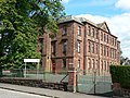
 East Ayrshire Council Headquarters, Kilmarnock.jpg 2 304 × 1 728; 1,3 MB
-
 East Burnhead Farm - geograph.org.uk - 6166637.jpg 3 892 × 2 918; 5 MB
-

-
 East Threepwood Farm Steading - geograph.org.uk - 6146515.jpg 3 718 × 2 788; 2,12 MB
-
 East Threepwood Farm Streading - geograph.org.uk - 6145081.jpg 4 320 × 3 240; 6,6 MB
-
 EastAyrshireCouncil 2017.svg 360 × 185; 2 KB
-
 Eddie Fraser, CEO East Ayrshire Council.jpg 179 × 268; 7 KB
-
 Edge of Loch Doon - geograph.org.uk - 4872416.jpg 4 896 × 3 672; 6,4 MB
-
 Enterkine House Lodge, Weston Bridge, Annbank, East Ayrshire.jpg 4 608 × 2 882; 5,33 MB
-
 Exidiopsis effusa induced 'Hair Ice or Ice Wool' on dead wood, Lainshaw, East Ayrshire.jpg 4 602 × 3 152; 3,86 MB
-
 Exidiopsis effusa induced 'Hair Ice' on dead wood, Lainshaw Woods, East Ayrshire.jpg 4 608 × 3 456; 4,14 MB
-
 Exidiopsis effusa induced 'Hair Ice' on dead wood, Lainshaw, East Ayrshire, Scotland.jpg 4 608 × 3 456; 3,61 MB
-
 Exidiopsis effusa induced 'Hair Ice' on dead wood, Lainshaw, East Ayrshire.jpg 4 608 × 3 456; 4,11 MB
-
 Farquhar Coat of arms - Gilmilnscroft House , Sorn, East Ayrshire.jpg 3 643 × 2 740; 2,43 MB
-
 Feoch Farm - Darvel - geograph.org.uk - 6146140.jpg 4 112 × 3 085; 2,54 MB
-
 Flowerbank Early Childhood Centre, Kilmarnock, Scotland.jpg 3 264 × 2 448; 1,11 MB
-
 Footbridge over the Tulloch Burn - geograph.org.uk - 6139101.jpg 2 309 × 1 732; 1,06 MB
-
 Gallow Law - Galston - geograph.org.uk - 6129989.jpg 4 320 × 3 240; 3,68 MB
-
 Gateposts and track, Burnhead - geograph.org.uk - 6130218.jpg 5 152 × 3 864; 6,13 MB
-
 Gateside Farm - Darvel - geograph.org.uk - 6143490.jpg 3 865 × 2 900; 2,04 MB
-
 Gilmilnscroft House , Sorn, East Ayrshire. Coat of arms.jpg 4 179 × 2 751; 2,67 MB
-
 Gilmilnscroft House , Sorn, East Ayrshire. Garden feature marriage stone.jpg 4 896 × 2 752; 3,3 MB
-
 Gilmilnscroft House , Sorn, East Ayrshire. Garden feature monogram stone.jpg 3 971 × 2 689; 2,81 MB
-
 Gilmilnscroft House , Sorn, East Ayrshire. Garden features.jpg 3 941 × 2 749; 3,6 MB
-
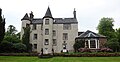 Gilmilnscroft House , Sorn, East Ayrshire.jpg 4 638 × 2 401; 1,82 MB
-
 Gilmilnscroft House gardens , Sorn, East Ayrshire.jpg 4 367 × 2 179; 2,01 MB
-
 Gilmilnscroft House, Sorn, East Ayrshire. Hare coursing carving.jpg 4 695 × 1 842; 1,8 MB
-
 Gilmilnscroft House, Sorn, East Ayrshire. North-east view.jpg 3 772 × 2 682; 1,78 MB
-
 Hair Ice induced by Exidiopsis effusa on dead wood, Lainshaw, East Ayrshire.jpg 4 409 × 3 048; 3,75 MB
-
 Hazel, Corylus avellana. Epicormic growth. River Ayr. Holehouse Holm, East Ayrshire.jpg 4 896 × 2 752; 5,85 MB
-
 Hemp Agrimony (Eupatorium cannabinum), Lainshaw Woods, East Ayrshire.jpg 3 335 × 2 752; 1,67 MB
-
 High Carlingcraig Farm - Darvel - geograph.org.uk - 6146130.jpg 3 899 × 2 924; 3,35 MB
-
 Hurlford Cross, Scotland.jpg 5 184 × 3 456; 7,29 MB
-
 Initials on mausoleum, Stewarton Churchyard, East Ayrshire, Scotland.jpg 2 759 × 1 629; 1 017 KB
-
 Island in Loch Doon - geograph.org.uk - 4075915.jpg 640 × 480; 68 KB
-
 Lady's Well, Dumfries Estate, East Ayrshire, Scotland.jpg 3 993 × 2 309; 2,55 MB
-
 Laigh Bradley Farm - Darvel - geograph.org.uk - 6143220.jpg 4 320 × 3 240; 3,39 MB
-
 Laigh Castleton Farm, Strathannick, from the Lambroughton Plantation, East Ayrshire.jpg 4 229 × 2 026; 1,11 MB
-
 Linda McAulay-Griffiths.jpg 300 × 340; 20 KB
-
 Loanfoot Farm - Darvel - geograph.org.uk - 6165243.jpg 3 854 × 2 890; 2,99 MB
-
 Loanfoot Farm - Darvel - geograph.org.uk - 6166056.jpg 4 022 × 3 017; 3,96 MB
-
 Loanfoot, near Darvel - geograph.org.uk - 6139143.jpg 5 066 × 3 205; 3,3 MB
-
 Loanhead Primary School, Kilmarnock, Scotland.jpg 2 304 × 1 728; 1,22 MB
-
 Loch Doon - geograph.org.uk - 2838151.jpg 3 872 × 2 592; 2,98 MB
-
 Loch Doon - geograph.org.uk - 2922678.jpg 3 264 × 2 448; 2,92 MB
-
 Loch Doon - geograph.org.uk - 4008242.jpg 1 920 × 1 280; 2,04 MB
-
 Loch Doon - geograph.org.uk - 4008270.jpg 1 920 × 1 280; 1,79 MB
-
 Loch Doon - geograph.org.uk - 4008276.jpg 1 920 × 1 280; 1,67 MB
-
 Loch Doon - geograph.org.uk - 4008286.jpg 1 920 × 1 280; 1,49 MB
-
 Loch Doon - geograph.org.uk - 4008291.jpg 1 920 × 1 280; 1,87 MB
-
 Loch Doon - geograph.org.uk - 4008318.jpg 1 920 × 1 280; 1,68 MB
-
 Loch Doon - geograph.org.uk - 4008329.jpg 1 920 × 1 280; 1,82 MB
-
 Loch Doon - geograph.org.uk - 4008351.jpg 1 920 × 1 280; 1,79 MB
-
 Loch Doon - geograph.org.uk - 4008357.jpg 1 920 × 1 280; 1,85 MB
-
 Loch Doon - geograph.org.uk - 4008361.jpg 1 920 × 1 280; 1,78 MB
-
 Loch Doon - geograph.org.uk - 4008373.jpg 1 920 × 1 280; 1,57 MB
-
 Loch Doon - geograph.org.uk - 4008382.jpg 1 920 × 1 280; 1,58 MB
-
 Loch Doon - geograph.org.uk - 4008396.jpg 1 920 × 1 280; 1,41 MB
-
 Loch Doon - geograph.org.uk - 4008408.jpg 1 920 × 1 280; 1,35 MB
-
 Loch Doon - geograph.org.uk - 4008451.jpg 1 920 × 1 280; 1,7 MB
-
 Loch Doon - geograph.org.uk - 4008515.jpg 1 920 × 1 280; 1,71 MB
-
 Loch Doon - geograph.org.uk - 4008541.jpg 1 920 × 1 280; 1,44 MB
-
 Loch Doon - geograph.org.uk - 4008545.jpg 1 920 × 1 280; 1,44 MB
-
 Loch Doon - geograph.org.uk - 4008547.jpg 1 920 × 1 280; 1,39 MB
-
 Loch Doon - geograph.org.uk - 4075893.jpg 640 × 480; 56 KB
-
 Loch Doon - geograph.org.uk - 5666921.jpg 4 784 × 1 710; 7,08 MB
-
 Loch Doon - geograph.org.uk - 5800685.jpg 2 976 × 1 984; 3,21 MB
-
 Loch Doon - geograph.org.uk - 5800687.jpg 2 976 × 1 984; 3,1 MB
-
 Loch Doon - geograph.org.uk - 5800689.jpg 2 976 × 1 984; 2,82 MB
-
 Loch Doon - geograph.org.uk - 5800697.jpg 2 976 × 1 984; 3,03 MB
-
 Loch Doon - geograph.org.uk - 5800707.jpg 2 976 × 1 984; 3,47 MB
-
 Loch Doon - geograph.org.uk - 5800709.jpg 2 976 × 1 984; 2,95 MB
-
 Loch Doon - geograph.org.uk - 5800713.jpg 2 976 × 1 984; 3,42 MB
-
 Loch Doon - geograph.org.uk - 5800720.jpg 2 976 × 1 984; 3,33 MB
-
 Loch Doon - geograph.org.uk - 5800725.jpg 2 976 × 1 984; 3,03 MB
-
 Loch Doon - geograph.org.uk - 5800745.jpg 2 976 × 1 984; 3,39 MB
-
 Loch Doon - geograph.org.uk - 5800746.jpg 2 976 × 1 984; 3,04 MB
-
 Loch Doon - geograph.org.uk - 5800750.jpg 2 976 × 1 984; 3,74 MB
-
 Loch Doon - geograph.org.uk - 5800751.jpg 2 976 × 1 984; 3,62 MB
-
 Loch Doon Dam - geograph.org.uk - 2838152.jpg 3 872 × 2 592; 2,42 MB
-
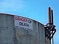 Loch Doon Dam Intakes Warning Sign - geograph.org.uk - 1939135.jpg 1 600 × 1 200; 273 KB
-
 Loch Doon View - geograph.org.uk - 3551428.jpg 640 × 480; 89 KB
-
 Loch Doon View - geograph.org.uk - 3551438.jpg 640 × 419; 79 KB
-
 Loch Doon with Boats - geograph.org.uk - 4008311.jpg 1 920 × 1 280; 1,69 MB
-
 Lochfield Farm - Birthplace of Alexander Fleming - geograph.org.uk - 6142824.jpg 4 143 × 3 107; 2,4 MB
-
 Lochfield Farm - Birthplace of Alexander Fleming - geograph.org.uk - 6145271.jpg 3 683 × 2 762; 2,59 MB
-
 Lochgoin Covenanters Museum, East Ayrshire, Scotland.jpg 1 920 × 1 080; 821 KB
-
 Lochgoin Farm and the John Howie Memorial, East Ayrshire, Scotland.jpg 1 650 × 974; 327 KB
-
 Long Cairn - geograph.org.uk - 6139128.jpg 5 152 × 3 864; 5,25 MB
-
 Looking north over the glen of Burn Anne - geograph.org.uk - 6026559.jpg 1 024 × 575; 128 KB
-
 Looking over Loch Doon from Doon Castle - panoramio.jpg 3 072 × 1 724; 4,68 MB
-
 Loudoun Hill - panoramio.jpg 1 280 × 960; 643 KB
-
 Loudoun Hill taken from the A719 a distance of 12.3 miles - panoramio.jpg 4 000 × 3 000; 6,29 MB
-
 Loudoun Hill viewed from Cairnsaigh Hill - geograph.org.uk - 6130188.jpg 5 148 × 3 677; 6,1 MB
-
 Loudoun Kirk - Galston - geograph.org.uk - 6123440.jpg 3 956 × 2 966; 3,02 MB
-
 Loudoun Kirk - Galston - geograph.org.uk - 6123467.jpg 3 023 × 4 031; 3,12 MB
-
 Loudoun Kirk - Galston - geograph.org.uk - 6123500.jpg 4 111 × 3 083; 4,71 MB
-
 Loudoun Kirk - Galston - geograph.org.uk - 6123505.jpg 2 987 × 2 240; 3,21 MB
-
 Loudoun Kirk - Galston - geograph.org.uk - 6123527.jpg 3 931 × 2 949; 2,42 MB
-
 Loudoun Kirk - Galston - geograph.org.uk - 6123556.jpg 3 037 × 4 049; 4,9 MB
-
 Loudoun Kirk - Galston - geograph.org.uk - 6123570.jpg 3 109 × 4 145; 2,77 MB
-
 Loudoun Kirk - Galston - geograph.org.uk - 6123734.jpg 3 738 × 2 803; 2,33 MB
-
 Loudoun Kirk - Galston - geograph.org.uk - 6123736.jpg 4 022 × 3 016; 5,32 MB
-
 Loudoun Kirk - Galston - geograph.org.uk - 6124185.jpg 3 523 × 2 642; 3,08 MB
-
 Loudounhill Viaduct - geograph.org.uk - 6165005.jpg 3 172 × 2 379; 1,77 MB
-
 Low Water At Loch Doon - geograph.org.uk - 1939128.jpg 1 200 × 1 600; 486 KB
-
 Mauchline in 1900. The old Loudoun town house in the distance. East Ayrshire.jpg 3 696 × 2 390; 1,82 MB
-
 Meikle Glen Farm - Darvel - geograph.org.uk - 6143153.jpg 4 223 × 3 167; 3,75 MB
-
 Merrick from Loch Doon - geograph.org.uk - 2542471.jpg 1 600 × 1 200; 241 KB
-
 Middle Third Farm - Galston - geograph.org.uk - 6128161.jpg 3 367 × 2 524; 1,48 MB
-
 Mill of Bloak. Lugton Water. Stone revetment. East Ayrshire.jpg 4 896 × 2 752; 3,74 MB
-
 Minor Road - geograph.org.uk - 6167012.jpg 3 377 × 2 534; 4,94 MB
-
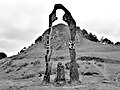
 Monument at the Martyrs Grave (geograph 3893150).jpg 640 × 480; 65 KB
-
 Mossend Farm - geograph.org.uk - 6143302.jpg 4 320 × 3 240; 3,13 MB
-
 Mossend Farm - geograph.org.uk - 6143317.jpg 4 320 × 3 240; 4,34 MB
-
 Newish tree planting on the Burn Anne path - geograph.org.uk - 6026558.jpg 1 024 × 575; 237 KB
-
 Newish tree plantings on the Burn Anne path - geograph.org.uk - 6026549.jpg 1 024 × 557; 253 KB
-
 Newish tree plantings on the Burn Anne path - geograph.org.uk - 6026554.jpg 1 024 × 541; 226 KB
-
 Newlands Farm - Darvel - geograph.org.uk - 6163851.jpg 4 320 × 3 240; 3,64 MB
-
 Old Access area for Weston Bridge Platform, Annbank, East Ayrshire.jpg 4 487 × 2 560; 4,62 MB
-
 Old Barskimming Bridge plaque, Lugar Water, Mauchline, East Ayrshire.jpg 4 896 × 2 752; 3,97 MB
-
 Old enclosure wall at Cairnsaigh - geograph.org.uk - 6130130.jpg 2 309 × 1 732; 1,3 MB
-
 Old Hone Mill - panoramio (1).jpg 1 944 × 2 592; 448 KB
-
 Old Hone Mill - panoramio.jpg 1 944 × 2 592; 1,02 MB
-
 Old Milestone by the A71, Galston - geograph.org.uk - 6048613.jpg 450 × 600; 240 KB
-
 Old Milestone by the A71, Galston parish - geograph.org.uk - 6097928.jpg 450 × 600; 326 KB
-
-
 Old Mine and quarry - panoramio (1).jpg 1 944 × 2 592; 1,81 MB
-
 Old Mine and quarry - panoramio (2).jpg 2 592 × 1 944; 1,89 MB
-
 Old Mine and quarry - panoramio.jpg 1 944 × 2 592; 2,01 MB
-
 Old railway signage, Dunaskin Heritage Centre, Doon Valley, Ayrshire.jpg 4 896 × 2 752; 2,57 MB
-
 Old Shaws Mill, Dallars, Cessnock Water, East Ayrshire.jpg 4 181 × 2 168; 2,12 MB
-
 Passford Farm - Darvel - geograph.org.uk - 6165340.jpg 4 296 × 3 222; 4,07 MB
-
 Passing Trade - panoramio.jpg 2 524 × 1 432; 2,17 MB
-
 Peden Memorial, Cumnock Old Graveyard (geograph 3705476).jpg 470 × 640; 69 KB
-
 Pogiven Bridge - geograph.org.uk - 6142783.jpg 4 320 × 3 240; 3,46 MB
-
 Rig and furrow. Old Waulkmill Farm Site. East Ayrshire.jpg 4 896 × 2 752; 3,77 MB
-
 River Irvine - Galston - geograph.org.uk - 6156444.jpg 3 842 × 2 882; 2,12 MB
-
 Robert Burns's Bath, Kingencleugh Glen, Mauchline, East Ayrshire, Scotland.jpg 4 896 × 2 752; 3,93 MB
-
 Ruined farm buildings at Cairnsaigh - geograph.org.uk - 6130112.jpg 2 309 × 1 732; 1,03 MB
-
 Ruined farmhouse at Cairnsaigh - geograph.org.uk - 6130155.jpg 5 152 × 3 864; 7,46 MB
-
 Standalane Farm, Kilmaurs, East Ayrshire. View from the west.jpg 4 624 × 2 167; 1,89 MB
-
 Symphytum tuberosum (Tuberous Comfrey) flowers, Lainshaw Woods, East Ayrshire, Scotland.jpg 3 807 × 1 985; 1,67 MB
-
 Symphytum tuberosum (Tuberous Comfrey), Lainshaw Woods, East Ayrshire, Scotland.jpg 3 020 × 2 232; 1,12 MB
-
 The Chinese Bridge, River Lugar, Dumfries House - detail.jpg 4 488 × 3 290; 7,74 MB
-
 The Chinese Bridge, River Lugar, Dumfries House.jpg 4 532 × 3 352; 6,86 MB
-
 The Gallowlaw Cairn - James Smith Memorial - geograph.org.uk - 6131120.jpg 3 133 × 4 177; 3,17 MB
-
 The Gallowlaw Cairn - James Smith Memorial - geograph.org.uk - 6131131.jpg 3 994 × 2 995; 5,14 MB
-
 The Gallowlaw Cairn - James Smith Memorial - geograph.org.uk - 6131143.jpg 4 320 × 3 240; 4,51 MB
-
 The Goose House, Dumfries House Estate, East Ayrshire.jpg 1 920 × 1 080; 1,01 MB
-
 The Jougs in Kilmaurs, East Ayrshire. 1900.jpg 3 495 × 2 531; 1,59 MB
-
 The Long Cairn - 'The Law' - geograph.org.uk - 6165187.jpg 4 223 × 3 167; 3,21 MB
-
 The old Knockshinnoch Coal Washery and train. East Ayrshire. 2002.jpg 3 812 × 2 948; 1,12 MB
-
 The old Lochgoin Covenanters Museum, East Ayrshire, Scotland.jpg 1 792 × 1 080; 838 KB
-
 The shore of the loch - geograph.org.uk - 3280071.jpg 1 600 × 1 067; 189 KB
-
 The Spirit of Scotland Monument - Loudoun Hill - geograph.org.uk - 6166525.jpg 3 655 × 2 741; 2,21 MB
-
 Track on Cairnsaigh Hill - geograph.org.uk - 6130201.jpg 5 152 × 3 864; 6,27 MB
-
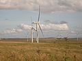 Turbines - panoramio.jpg 3 072 × 2 304; 2,74 MB
-
 View downstream, Avon Water - geograph.org.uk - 6130327.jpg 5 152 × 3 864; 6,81 MB
-
 West Ashyard Farm - geograph.org.uk - 6149747.jpg 4 014 × 3 010; 1,92 MB
-
 Weston Bridge Platform site, Annbank, East Ayrshire - view towards Trabboch.jpg 4 350 × 3 078; 8 MB
-
 Wetland from Standalane, near Brakenrig, Kilmaurs, East Ayrshire.jpg 4 896 × 2 752; 4,11 MB
-
 Whitelee Forest - geograph.org.uk - 6142769.jpg 3 805 × 2 853; 2,57 MB
-
 Whitelee Forest - geograph.org.uk - 6145682.jpg 4 251 × 3 187; 6,09 MB
-
 Wind Turbines, Greenlees - panoramio.jpg 2 304 × 3 072; 2,36 MB


,_Lainshaw_Woods,_East_Ayrshire.jpg)


.jpg)


.jpg)


.jpg)
.jpg)


.jpg)


_flowers,_Lainshaw_Woods,_East_Ayrshire,_Scotland.jpg)
,_Lainshaw_Woods,_East_Ayrshire,_Scotland.jpg)


