Category:England
Hopp til navigering
Hopp til søk
Konstituerende land i Storbritannia: England · Nord-Irland · Skottland · Wales – Kronbesittelser: Guernsey · Jersey · Man
Britiske oversjøiske territorier: Akrotiri og Dhekelia · Anguilla · Bermuda · Britisk Antarktis · De britiske Jomfruøyer · Det britiske territoriet i Indiahavet · Caymanøyene · Falklandsøyene · Gibraltar · Pitcairnøyene · Saint Helena, Ascension og Tristan da Cunha · Sør-Georgia og Sør-Sandwichøyene · Turks- og Caicosøyene
Britiske oversjøiske territorier: Akrotiri og Dhekelia · Anguilla · Bermuda · Britisk Antarktis · De britiske Jomfruøyer · Det britiske territoriet i Indiahavet · Caymanøyene · Falklandsøyene · Gibraltar · Pitcairnøyene · Saint Helena, Ascension og Tristan da Cunha · Sør-Georgia og Sør-Sandwichøyene · Turks- og Caicosøyene
del av Storbritannia  someja satełitar in avril      | |||||
| Last opp mediefiler | |||||
| Lydfil med tale | |||||
|---|---|---|---|---|---|
| Uttale (lydfil) | |||||
| Forekomst av |
| ||||
| Navn på eget morsmål |
| ||||
| Oppkalt etter | |||||
| Skytshelgen | |||||
| Plassering |
| ||||
| Hovedstad | |||||
| Styreform |
| ||||
| Offisielt språk | |||||
| Offisiell hymne |
| ||||
| Valuta | |||||
| Statsoverhode |
| ||||
| Øverste politiske forvaltningsleder |
| ||||
| Høyeste punkt | |||||
| Folketall |
| ||||
| Areal |
| ||||
| Erstatter |
| ||||
| Forskjellig fra | |||||
| offisielt nettsted | |||||
 | |||||

Underkategorier
Denne kategorien har følgende 47 underkategorier, av totalt 47.
!
*
A
C
- Coats of arms on buildings in England (3 filer)
E
F
G
H
I
L
M
N
O
P
- Pronunciation of England (13 filer)
R
S
T
U
- Users in England (4 sider)
V
W
Filer i kategorien «England»
Følgende 36 filer er i denne kategorien, av totalt 36.
-
 A few of the many turbines at the Gunfleet Sands wind farm - geograph.org.uk - 6280355.jpg 5 010 × 3 579; 5,72 MB
-
 Bar Lightship - geograph.org.uk - 6293533.jpg 502 × 393; 33 KB
-
 Beach End - geograph.org.uk - 6284152.jpg 800 × 600; 156 KB
-
 Bottlenose dolphins at St John’s Haven - geograph.org.uk - 6289430.jpg 1 024 × 697; 180 KB
-
 Brean , Steep Holm - geograph.org.uk - 6287297.jpg 6 000 × 4 000; 4,03 MB
-
 Brean , Steep Holm - geograph.org.uk - 6287352.jpg 6 000 × 4 000; 3,79 MB
-
 Chalk cliffs near Handfast Point - geograph.org.uk - 6292782.jpg 4 288 × 2 848; 2,22 MB
-
 Coast path at Muxham Point - geograph.org.uk - 6288574.jpg 4 288 × 2 848; 1,83 MB
-
 End View - geograph.org.uk - 6284178.jpg 800 × 600; 183 KB
-
 North Pinnacle - geograph.org.uk - 6292852.jpg 3 324 × 2 287; 1,08 MB
-
 Pinnacle and cliff south of Handfast Point - geograph.org.uk - 6292817.jpg 2 651 × 3 730; 1,12 MB
-
 Pinnacle by Old Nick's Ground - geograph.org.uk - 6292825.jpg 2 966 × 2 086; 833 KB
-
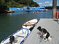 Pontoon by King Harry Ferry - geograph.org.uk - 6290418.jpg 800 × 600; 104 KB
-
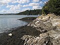 River Fal shore - geograph.org.uk - 6290395.jpg 800 × 600; 137 KB
-
 Rock climbing at Pier Quarry near Spittal - geograph.org.uk - 6281502.jpg 1 024 × 683; 586 KB
-
 Seashore at Hemsby - geograph.org.uk - 6288158.jpg 3 909 × 2 933; 2,06 MB
-

-
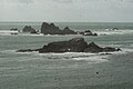 View of Shag Rock and Men Par from Lizard Point - geograph.org.uk - 6284786.jpg 3 872 × 2 592; 2,1 MB
-
 View of Shag Rock from Lizard Point - geograph.org.uk - 6284766.jpg 3 729 × 2 497; 1,06 MB
-
 View of The Brisons from Porth Nanven ^2 - geograph.org.uk - 6284334.jpg 3 872 × 2 592; 1,55 MB
-

-
 View of the sunset at Botallack - geograph.org.uk - 6285520.jpg 3 872 × 2 592; 1,39 MB
-
 View of the sunset at Botallack ^2 - geograph.org.uk - 6285523.jpg 3 872 × 2 592; 1,19 MB
-
 View of the sunset at Botallack ^3 - geograph.org.uk - 6285525.jpg 3 603 × 2 592; 1,09 MB
-
 View of waves crashing onto rocks at Botallack - geograph.org.uk - 6285499.jpg 3 872 × 2 592; 3,02 MB
-
 View of waves crashing onto the rocks at Botallack - geograph.org.uk - 6285503.jpg 3 872 × 2 592; 1,91 MB
-
 View of waves crashing onto the rocks at Lizard Point ^3 - geograph.org.uk - 6285284.jpg 3 872 × 2 592; 2,17 MB
-
 View of waves crashing onto the rocks at Lizard Point ^4 - geograph.org.uk - 6285431.jpg 3 872 × 2 592; 2,54 MB
-
 View of waves crashing onto the rocks at Lizard Point ^5 - geograph.org.uk - 6285438.jpg 3 872 × 2 592; 2,49 MB
-
 View of waves crashing onto the rocks at Lizard Point ^6 - geograph.org.uk - 6285440.jpg 3 872 × 2 592; 2,03 MB
-
 View of waves crashing onto the rocks at Lizard Point ^7 - geograph.org.uk - 6285442.jpg 3 872 × 2 592; 1,94 MB
-
 View of waves crashing onto the rocks at Lizard Point ^9 - geograph.org.uk - 6285455.jpg 3 872 × 2 592; 2,38 MB
-
 View of waves crashing up against the cliff at Botallack ^2 - geograph.org.uk - 6285498.jpg 3 872 × 2 592; 2,67 MB
-
 View of waves crashing up against the cliff at Botallack ^3 - geograph.org.uk - 6285500.jpg 3 872 × 2 592; 2,99 MB
-

-
 View of waves crashing up against the cliff at Botallack ^6 - geograph.org.uk - 6285513.jpg 3 872 × 2 592; 2,79 MB


