Category:Gemeentelijke HBS (Eindhoven)
Jump to navigation
Jump to search
| Object location | | View all coordinates using: OpenStreetMap |
|---|
 | |||||
| Upload media | |||||
| Instance of | |||||
|---|---|---|---|---|---|
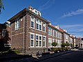
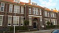
| Location | Eindhoven, North Brabant, Netherlands | ||||
| Street address |
| ||||
| Located on street |
| ||||
| Heritage designation |
| ||||
 | |||||
|
This is a category about rijksmonument number 518807
|
| Address |
|
Media in category "Gemeentelijke HBS (Eindhoven)"
The following 3 files are in this category, out of 3 total.
-
 518807 gemeentelijke HBS.jpg 4,000 × 3,011; 9.53 MB
-
 De Bergen05.jpg 876 × 720; 132 KB
-
 Rijksmonument518807.jpg 3,706 × 2,084; 2.43 MB

