Category:Geography of Greenland
Zur Navigation springen
Zur Suche springen
geography of the world's largest island  | |||||
| Medium hochladen | |||||
| Ist ein(e) |
| ||||
|---|---|---|---|---|---|
| Unterklasse von | |||||
| Aspekt von | |||||
| Ort |
| ||||
| Fläche |
| ||||
 | |||||
Unterkategorien
Es werden 15 von insgesamt 15 Unterkategorien in dieser Kategorie angezeigt:
In Klammern die Anzahl der enthaltenen Kategorien (K), Seiten (S), Dateien (D)
Seiten in der Kategorie „Geography of Greenland“
Diese Kategorie enthält nur die folgende Seite.
Medien in der Kategorie „Geography of Greenland“
Folgende 8 Dateien sind in dieser Kategorie, von 8 insgesamt.
-
 Geikie Flight Plan Map.jpg 4.280 × 3.210; 7,19 MB
-
 Geography-of-greenland.svg 300 × 500; 26 KB
-
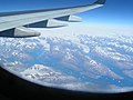
 King Frederick VI Coast 2005-08-22 01.jpg 2.048 × 1.536; 1,42 MB
-
 King Frederick VI Coast 2005-08-22 02.jpg 2.048 × 1.536; 1,24 MB
-
 King Frederick VI Coast 2005-08-22 03.jpg 2.048 × 1.536; 1,26 MB
-
 PSM V37 D325 View of upernavik.jpg 3.710 × 2.107; 2,49 MB
-
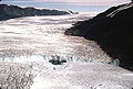 Rinksglacier.jpg 640 × 431; 156 KB
-
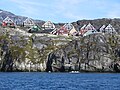 View from Nuuk Fiord.JPG 4.000 × 3.000; 3,78 MB


