Category:Geography of Ishikawa prefecture
Zur Navigation springen
Zur Suche springen

English: Geography of Ishikawa prefecture.
日本語: 石川県の地理。
Wikimedia-Kategorie | |||||
| Medium hochladen | |||||
| Ist ein(e) | |||||
|---|---|---|---|---|---|
| |||||
Unterkategorien
Es werden 14 von insgesamt 14 Unterkategorien in dieser Kategorie angezeigt:
In Klammern die Anzahl der enthaltenen Kategorien (K), Seiten (S), Dateien (D)
C
L
P
Medien in der Kategorie „Geography of Ishikawa prefecture“
Folgende 37 Dateien sind in dieser Kategorie, von 37 insgesamt.
-
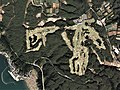
 20090913加賀三湖Tagged.jpg 1.280 × 960; 522 KB
-
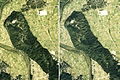
 20090913金沢平野南部Tagged.jpg 1.450 × 860; 370 KB
-
 771014 Kuwashima village and circular school building aerial.jpg 648 × 647; 539 KB
-
 991025 Mt Tomuro & quarries distribution.jpg 2.340 × 2.039; 5,38 MB
-
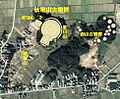 Akitsuneyama kofungun 1975.jpg 974 × 802; 779 KB
-
 Amenomiya kofungun 1975.jpg 1.928 × 2.440; 5,03 MB
-
 Golf Club Twin Fields, Komatsu Ishikawa Aerial photograph.2015.jpg 3.230 × 2.422; 2,76 MB
-
 Hakui city center area Aerial photograph.1975.jpg 4.359 × 3.396; 12,39 MB
-
 Hakusanse.jpg 200 × 269; 25 KB
-
 Kanazawa city center area Aerial photograph.1975.jpg 6.941 × 7.459; 52,43 MB
-
 Kanazawa health center stereo.jpg 1.342 × 506; 842 KB
-
 Kanazawa Racecourse Aerial photograph.1975.jpg 3.474 × 2.513; 6,32 MB
-
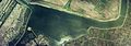
 Katano Kamoike water reservoir Aerial photograph.1975.jpg 2.146 × 1.556; 2,67 MB
-

-
 Katayamazu Golf Club Nishi Course, Kaga Ishikawa Aerial photograph.2008.jpg 4.056 × 3.042; 4,99 MB
-
 Kawada kofungun 1975.jpg 1.694 × 1.292; 2,59 MB
-
 Komatsu city center area Aerial photograph.1975.jpg 4.484 × 4.687; 13,88 MB
-
 Lake Kahoku-gata Lagoon Aerial photograph.1975.jpg 9.261 × 3.242; 19,89 MB
-
 Lake Kibagata Lagoon Aerial photograph.2015.jpg 3.170 × 2.389; 2,78 MB
-
 Lake Kitagata Lagoon Aerial photograph.2008.jpg 6.142 × 7.644; 15,92 MB
-
 Lake Ouchi-gata Lagoon Aerial photograph.1975.jpg 5.814 × 3.108; 13,73 MB
-
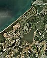
 Lake Shibayamagata Lagoon Aerial photograph.2008.jpg 4.635 × 3.476; 4,47 MB
-
 Masuhogaura Coast Shika Ishikawa Aerial photograph.2010.jpg 3.175 × 2.345; 2,23 MB
-
 Matsunejo-stereo.jpg 1.572 × 1.060; 1,5 MB
-
 Nanao city center area Aerial photograph.1975.jpg 7.213 × 3.450; 17,93 MB
-
 Notojima Golf and Country Club, Nanao Ishikawa Aerial photograph.2014.jpg 4.163 × 3.123; 4,88 MB
-
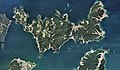 Notojima Island Aerial photograph.2014.jpg 30.250 × 17.605; 91,25 MB
-
 Port of Wajima Aerial photograph.1975.jpg 3.967 × 2.864; 10,37 MB
-
 Port of Wajima Aerial photograph.2010.jpg 3.004 × 2.003; 1,96 MB
-
 Suzu city center area Aerial photograph.1975.jpg 4.678 × 2.996; 15,03 MB
-
 Torigoejo-stereo.jpg 2.036 × 1.364; 2,23 MB
-
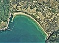
 Tsukumo Bay Noto, Ishikawa Aerial photograph.2010.jpg 2.661 × 1.995; 1,61 MB
-
 Urushizawa-no-ike water reservoir Aerial photograph.1975.jpg 1.685 × 1.220; 1,63 MB
-
 Ushinoya pass.jpg 4.055 × 2.703; 1,38 MB
-
 Wajima Banner.jpg 2.610 × 373; 735 KB
-
 Wakura Golf Club, Nanao Ishikawa Aerial photograph.2014.jpg 3.258 × 2.444; 2,63 MB
-
 夕霧峠.jpg 4.032 × 3.024; 3,97 MB


