Category:Geography of Tunisia
Zur Navigation springen
Zur Suche springen
| Medium hochladen | |||||
| Ist ein(e) |
| ||||
|---|---|---|---|---|---|
| Unterklasse von | |||||
| Aspekt von | |||||
| Ort |
| ||||
| |||||
Unterkategorien
Es werden 17 von insgesamt 17 Unterkategorien in dieser Kategorie angezeigt:
In Klammern die Anzahl der enthaltenen Kategorien (K), Seiten (S), Dateien (D)
Medien in der Kategorie „Geography of Tunisia“
Folgende 18 Dateien sind in dieser Kategorie, von 18 insgesamt.
-
 AFR V2 D128 Hamada el Kessera.jpg 1.850 × 1.292; 567 KB
-
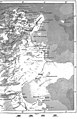
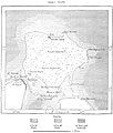
 AFR V2 D130 Tunis map left half.jpg 2.313 × 3.471; 1,31 MB
-
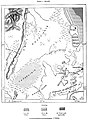
 AFR V2 D131 Constantine right half of map.jpg 2.275 × 3.527; 958 KB
-
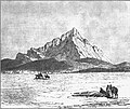 AFR V2 D133 The Jebel Zaghwan.jpg 1.909 × 1.600; 406 KB
-
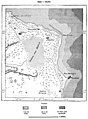
 AFR V2 D135 Lakes of Eskel and Bizerta.jpg 1.776 × 2.370; 722 KB
-
 AFR V2 D136 Gorges of the middle Mejerda.jpg 1.721 × 1.620; 662 KB
-
 AFR V2 D137 Old beds of the lower Mejerda.jpg 1.726 × 2.481; 751 KB
-
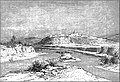 AFR V2 D139 The Mejerda at Slugia, above Mejez-El-Bab.jpg 3.027 × 2.078; 1,31 MB
-
 AFR V2 D142 Sill of Cabes.jpg 1.761 × 1.819; 354 KB
-
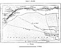
 AFR V2 D143 Zone of the Shotts, South of East Algeria and Tunis.jpg 1.730 × 1.092; 180 KB
-
 AFR V2 D144 Tracks of travelers in the Shott-El-Jerid.jpg 1.731 × 1.370; 376 KB
-
 AFR V2 D148 Island of Jerba.jpg 1.760 × 2.076; 482 KB
-
 AFR V2 D152 Cape Bon and Zembra Island.jpg 1.750 × 2.493; 790 KB
-
 AFR V2 D191 Mahdiya.jpg 1.839 × 2.493; 635 KB
-
 AFR V2 D192 Monastir and Susa.jpg 1.814 × 1.744; 359 KB
-
 AFR V2 D193 Kairwan.jpg 1.827 × 1.754; 297 KB
-
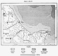
 AFR V2 D202 Susa and Enfida.jpg 1.794 × 2.449; 483 KB
-
 AFR V2 D205 Aqueducts of Carthage.jpg 1.249 × 2.565; 571 KB


