Category:Grüsch
Jump to navigation
Jump to search
municipality in Switzerland    | |||||
| Upload media | |||||
| Pronunciation audio | |||||
|---|---|---|---|---|---|
| Instance of | |||||
| Location |
| ||||
| Located in or next to body of water | |||||
| Heritage designation | |||||
| Population |
| ||||
| Area |
| ||||
| Elevation above sea level |
| ||||
| Replaces |
| ||||
| official website | |||||
 | |||||
Mga ubos-nga-kaarangay
Ini nga kaarangay mayda han mga nasunod nga 9 nga mga ubos-nga-kaarangay, tikang hin 9 nga kabug-osan.
C
F
G
- Girenspitz (Schuders) (10 F)
- Grüsch railway station (16 F)
R
- Reformierte Kirche Grüsch (14 F)
S
- Sassauna (5 F)
V
- Valzeina (9 F)
Media ha kaarangay nga "Grüsch"
An mga nasunod nga 40 ka mga fayl aada han hini nga kaarangay, tikang hin 40 nga kabug-osan.
-
 Brand (Sigg, Valzeina oostzijde).jpg 3,872 × 2,592; 2.27 nga MB
-
 CH-NB-200 Schweizer Bilder-nbdig-18634-page255.tif 1,204 × 1,665; 4.7 nga MB
-
 CHE Grüsch Flag.svg 512 × 514; 643 nga KB
-
 Drusenfluh Süden Grüscher Älpli.jpg 4,032 × 3,024; 3.22 nga MB
-
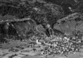 ETH-BIB-Grüsch Prättigau-LBS H1-018261.tif 6,725 × 4,725; 91.09 nga MB
-
 ETH-BIB-Grüsch, Prättigau-LBS H1-018262.tif 6,781 × 4,707; 91.46 nga MB
-
 ETH-BIB-Landquart, Malans, Igis, Zizers, Grüsch, Prättigau-Inlandflüge-LBS MH01-003010.tif 6,196 × 4,467; 79.32 nga MB
-
 Field seen from train in Grüsch 2022-09-25 01.jpg 8,368 × 5,584; 38.18 nga MB
-
 Field seen from train in Grüsch 2022-09-25 02.jpg 8,368 × 5,584; 38.18 nga MB
-
 Flag of Grüsch.gif 216 × 216; 2 nga KB
-
 CHE Grüsch COA.svg 227 × 265; 2 nga KB
-
 Grüsch wappen.svg 209 × 245; 3 nga KB
-
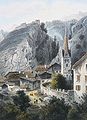 Grüsch 1860.jpg 1,768 × 2,445; 1.09 nga MB
-
 Grüsch seen from trail Grüsch-Fanas 2022-09-25 01.jpg 8,368 × 5,584; 40.36 nga MB
-
 Grüsch seen from trail Grüsch-Fanas 2022-09-25 02.jpg 8,368 × 5,584; 43.9 nga MB
-
 Grüsch seen from trail Grüsch-Fanas 2022-09-25 03.jpg 8,368 × 5,584; 42.71 nga MB
-
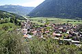 Grüsch.jpg 2,039 × 1,359; 529 nga KB
-
 Gätziloch Brücke über die Landquart, Seewis im Prättigau GR - Grüsch GR 20190830-jag9889.jpg 4,608 × 3,456; 11.93 nga MB
-
 Karte Gemeinde Grüsch 2007.png 1,181 × 1,135; 313 nga KB
-
 Karte Gemeinde Grüsch 2009.png 1,476 × 1,419; 552 nga KB
-
 Karte Gemeinde Grüsch 2011.png 1,476 × 1,419; 549 nga KB
-
 Karte Gemeinde Grüsch 2016.png 1,476 × 1,419; 526 nga KB
-
 Karte Gemeinde Grüsch 2021.png 1,476 × 1,419; 395 nga KB
-
 Karte Gemeinde Grüsch.png 944 × 1,000; 222 nga KB
-
 Klus Brücke über die Landquart, Seewis im Prättigau GR - Grüsch GR 20190830-jag9889.jpg 4,608 × 3,456; 12.54 nga MB
-
 Kommandofahrzeug KDO1.jpg 800 × 533; 232 nga KB
-
Roh-Crusch.ogg 1.4 s; 28 nga KB
-
 Sagagätterli Brücke über die Landquart, Grüsch GR 20190830-jag9889.jpg 4,608 × 3,456; 10.45 nga MB
-
 Trail Grüsch-Fanas 2022-09-25 01.jpg 8,368 × 5,584; 46.58 nga MB
-
 Trail Grüsch-Fanas 2022-09-25 02.jpg 8,368 × 5,584; 47.22 nga MB
-
 Trumpf Schweiz in Grüsch im Prättigau.jpg 4,000 × 2,500; 6.77 nga MB
-
 View from Bättlergadaweg Grüsch 2022-09-25 01.jpg 8,368 × 5,584; 45.28 nga MB
-
 View from Bättlergadaweg Grüsch 2022-09-25 02.jpg 8,368 × 5,584; 51.23 nga MB
-
 View from Bättlergadaweg Grüsch 2022-09-25 03.jpg 8,368 × 5,584; 44.21 nga MB
-
 View from Bättlergadaweg Grüsch 2022-09-25 04.jpg 8,368 × 5,584; 46.98 nga MB
-
 View from trail Grüsch-Fanas 2022-09-25 01.jpg 8,368 × 5,584; 45.27 nga MB
-
 View from trail Grüsch-Fanas 2022-09-25 02.jpg 8,368 × 5,584; 42.14 nga MB
-
 View from trail Grüsch-Fanas 2022-09-25 03.jpg 8,368 × 5,584; 51.06 nga MB
-
 View from trail Grüsch-Fanas 2022-09-25 04.jpg 8,368 × 5,584; 49.96 nga MB
-
 Überlandquartstrasse Brücke über die Landquart, Grüsch GR 20190830-jag9889.jpg 4,608 × 3,456; 11.16 nga MB
.jpg)


