Category:Great Barford
Zur Navigation springen
Zur Suche springen
Ortschaft und Gemeinde in England  | |||||
| Medium hochladen | |||||
| Ist ein(e) | |||||
|---|---|---|---|---|---|
| Ort | Borough of Bedford, Bedfordshire, East of England, England | ||||
| Liegt am oder im Gewässer | |||||
| Einwohnerzahl |
| ||||
| offizielle Website | |||||
 | |||||
English: Great Barford is a village and civil parish on the River Great Ouse in Bedfordshire, England, a few miles northeast of Bedford.
Unterkategorien
Es werden 3 von insgesamt 3 Unterkategorien in dieser Kategorie angezeigt:
In Klammern die Anzahl der enthaltenen Kategorien (K), Seiten (S), Dateien (D)
A
B
- Great Barford Bridge (7 D)
Medien in der Kategorie „Great Barford“
Folgende 112 Dateien sind in dieser Kategorie, von 112 insgesamt.
-
 'Touch Wood' - geograph.org.uk - 4543263.jpg 3.255 × 2.203; 2,62 MB
-

-
 A421 - geograph.org.uk - 5448683.jpg 640 × 426; 34 KB
-
 A421 - passing a layby - geograph.org.uk - 2673329.jpg 640 × 406; 33 KB
-
 A421 Bedford Southern Bypass at the Meadow Lane Bridge - geograph.org.uk - 3665977.jpg 2.442 × 2.149; 1,21 MB
-
 A421 lay-by - geograph.org.uk - 5786015.jpg 640 × 480; 56 KB
-
 A421 northbound - geograph.org.uk - 4431404.jpg 640 × 458; 49 KB
-
 A421 northbound - geograph.org.uk - 4431416.jpg 640 × 455; 47 KB
-

-
 A421, northbound - geograph.org.uk - 5005204.jpg 640 × 426; 44 KB
-
 A421, southbound - geograph.org.uk - 5448684.jpg 640 × 425; 38 KB
-
 A421, westbound - geograph.org.uk - 5442595.jpg 640 × 382; 39 KB
-
 Alban Middle School - geograph.org.uk - 1154981.jpg 640 × 480; 111 KB
-
 All Saints Church, Great Barford - geograph.org.uk - 5563749.jpg 1.600 × 1.065; 719 KB
-
 All Saints Church, Great Barford - geograph.org.uk - 5569038.jpg 1.600 × 1.065; 673 KB
-
 All Saints Church, Great Barford - geograph.org.uk - 5569049.jpg 1.065 × 1.600; 416 KB
-
 Barford Bridge, Barford - geograph.org.uk - 5569064.jpg 1.600 × 1.065; 587 KB
-
 Barford Road - geograph.org.uk - 5599119.jpg 640 × 480; 133 KB
-
 Barford Road - geograph.org.uk - 5839334.jpg 640 × 480; 55 KB
-
 Barford Road - geograph.org.uk - 5839339.jpg 640 × 480; 48 KB
-
 Barford Road - geograph.org.uk - 5839343.jpg 640 × 480; 83 KB
-
 Barford Road Bridge, A421 - geograph.org.uk - 5005208.jpg 640 × 426; 49 KB
-
 Barford Road crosses the A421 - geograph.org.uk - 5599110.jpg 640 × 480; 99 KB
-
 Barford-by the river - geograph.org.uk - 4510740.jpg 4.320 × 3.240; 4,65 MB
-
 Bedford Rd - geograph.org.uk - 4988094.jpg 640 × 385; 60 KB
-
 Bedford road heading towards Great Barford - geograph.org.uk - 4518947.jpg 1.600 × 1.066; 502 KB
-
 Bedfordshire Walking Festival - geograph.org.uk - 1490578.jpg 640 × 462; 134 KB
-
 Birchfield Road Bridge, A421 - geograph.org.uk - 5005210.jpg 640 × 426; 50 KB
-
 Birchfield Road Bridge, A421 - geograph.org.uk - 5442596.jpg 640 × 426; 38 KB
-
 Birchfield Road going over the A421 - geograph.org.uk - 4497818.jpg 1.600 × 1.066; 484 KB
-
 Bridge and Weir - geograph.org.uk - 2271243.jpg 897 × 1.024; 349 KB
-
 Bridge Farm, Great Barford - geograph.org.uk - 5569046.jpg 1.600 × 1.065; 804 KB
-
 Bridleway to Great Barford church - geograph.org.uk - 493127.jpg 640 × 425; 120 KB
-
 BronzeSteelyardWeights.JPG 1.504 × 2.400; 984 KB
-
 By the River - geograph.org.uk - 2583868.jpg 768 × 1.024; 181 KB
-
 Canal boats moored by Barford Bridge - geograph.org.uk - 4543405.jpg 3.264 × 2.448; 3,93 MB
-
 Chapel, Bedford Road - geograph.org.uk - 3561538.jpg 3.264 × 2.448; 3,35 MB
-

-
 Farm track and bridleway across A421 near Roxton - geograph.org.uk - 5895664.jpg 1.024 × 647; 146 KB
-
 Farm Track towards the Ouse Valley Way - geograph.org.uk - 4518945.jpg 1.600 × 1.066; 728 KB
-
 Field by Roxton Road - geograph.org.uk - 3821455.jpg 1.600 × 1.068; 517 KB
-
 Flood arch, Great Barford bridge - geograph.org.uk - 4809822.jpg 3.091 × 2.048; 2,89 MB
-
 Football pitch - geograph.org.uk - 162475.jpg 640 × 332; 52 KB
-
 Footbridge, A421 - geograph.org.uk - 5442589.jpg 640 × 426; 36 KB
-
 Footpath to Birchfield Farm - geograph.org.uk - 4497816.jpg 1.066 × 1.600; 362 KB
-
 Footpath towards Wilden - geograph.org.uk - 4497827.jpg 1.600 × 1.066; 624 KB
-
 From the bridge at Great Barford - geograph.org.uk - 410736.jpg 640 × 480; 52 KB
-
 Great Barford bridge - geograph.org.uk - 4809821.jpg 3.091 × 2.048; 2,1 MB
-
 Great Barford bridge again - geograph.org.uk - 4809825.jpg 3.091 × 2.048; 1,94 MB
-
 Great Barford bypass eastbound - geograph.org.uk - 406791.jpg 640 × 480; 70 KB
-
 Great Barford lock - geograph.org.uk - 4810214.jpg 3.091 × 2.048; 2,2 MB
-
 Great Barford Old School - geograph.org.uk - 4543442.jpg 3.264 × 2.448; 3,63 MB
-
 Great Barford Village Hall - geograph.org.uk - 4497822.jpg 1.600 × 1.066; 459 KB
-
 Great Barford Village Hall - geograph.org.uk - 4543256.jpg 3.264 × 2.448; 3,99 MB
-
 Great Barford village sign - geograph.org.uk - 4510752.jpg 4.320 × 3.240; 5,25 MB
-
 Great Barford Village Sign - geograph.org.uk - 5569066.jpg 1.065 × 1.600; 778 KB
-
 Great Barford Village sign and Jubilee tree - geograph.org.uk - 4543428.jpg 3.264 × 2.448; 4,78 MB
-
 Great Ouse near Willington - geograph.org.uk - 3623719.jpg 640 × 480; 119 KB
-
 Great Ouse near Willington - geograph.org.uk - 3639909.jpg 640 × 328; 43 KB
-
 Green End Road, Great Barford - geograph.org.uk - 4543250.jpg 3.264 × 2.448; 4,43 MB
-
 House at Great Barford - geograph.org.uk - 5569069.jpg 1.600 × 1.065; 530 KB
-
 House on High Street, Great Barford - geograph.org.uk - 4543356.jpg 3.264 × 2.448; 3,85 MB
-
 Houses at Great Barford - geograph.org.uk - 3561542.jpg 3.264 × 2.448; 3,76 MB
-
 Houses on New Road, Great Barford - geograph.org.uk - 5569035.jpg 1.600 × 1.065; 739 KB
-
 Lay-by A421 - geograph.org.uk - 4873736.jpg 640 × 480; 38 KB
-
 Lay-by on the A421 - geograph.org.uk - 4567613.jpg 2.000 × 1.333; 1,33 MB
-
 Lay-by on the A421 - geograph.org.uk - 5853739.jpg 1.024 × 683; 208 KB
-
 Lay-By on the A421 to Bedford - geograph.org.uk - 5479126.jpg 1.024 × 683; 237 KB
-
 Long view of the A421 - geograph.org.uk - 2673325.jpg 640 × 400; 29 KB
-
 Looking towards Bridge Farm, Great Barford - geograph.org.uk - 5569042.jpg 1.600 × 1.065; 627 KB
-
 Lowlands, Great Barford - geograph.org.uk - 449725.jpg 640 × 480; 135 KB
-
 Mega pooh, Great Barford - geograph.org.uk - 1285402.jpg 640 × 480; 87 KB
-
 Men at Work - geograph.org.uk - 2587018.jpg 768 × 1.024; 177 KB
-
 Minor road from Great Barford - geograph.org.uk - 493134.jpg 640 × 425; 82 KB
-
 Moorings at Great Barford - geograph.org.uk - 4543397.jpg 3.264 × 2.448; 4,11 MB
-
 New Road towards Great Barford - geograph.org.uk - 5563739.jpg 1.600 × 1.158; 621 KB
-
 Old Lock Great Barford - geograph.org.uk - 2059608.jpg 640 × 454; 106 KB
-
 Pavement up, Great Barford - geograph.org.uk - 5599108.jpg 640 × 428; 128 KB
-
 Playing field by Green End Road - geograph.org.uk - 4497825.jpg 1.600 × 1.066; 512 KB
-

-
 Riverbank - geograph.org.uk - 191390.jpg 640 × 480; 130 KB
-
 Roadsign on the A421 Great Barford Bypass - geograph.org.uk - 4608718.jpg 1.369 × 1.605; 836 KB
-

-
 Rural traffic, Barford Bridge - geograph.org.uk - 1285388.jpg 640 × 480; 105 KB
-
 Seventeenth century farmhouse, Green End, Great Barford - geograph.org.uk - 4510858.jpg 4.320 × 3.240; 3,76 MB
-
 South Brook - geograph.org.uk - 583661.jpg 480 × 640; 128 KB
-
 The A421 from Birchfield Road bridge - geograph.org.uk - 4497821.jpg 1.600 × 1.066; 404 KB
-
 The Anchor, Great Barford - geograph.org.uk - 4988090.jpg 640 × 369; 47 KB
-
 The Anchor, Great Barford - geograph.org.uk - 5569052.jpg 1.600 × 1.065; 410 KB
-
 The Anchor, Great Barford - geograph.org.uk - 5569058.jpg 1.069 × 1.600; 465 KB
-
 The back of "Lowlands" on the Bedford Road - geograph.org.uk - 4518946.jpg 1.600 × 1.068; 513 KB
-
 The Brambles - geograph.org.uk - 5839345.jpg 640 × 480; 59 KB
-

-
 The Great Ouse at Great Barford - geograph.org.uk - 4497807.jpg 1.600 × 1.066; 426 KB
-
 The old cottage - geograph.org.uk - 410747.jpg 640 × 480; 98 KB
-
 The Old Cottage, Great Barford, Bedfordshire - geograph.org.uk - 1478679.jpg 1.600 × 1.091; 777 KB
-
 The road to Hill Farm - geograph.org.uk - 4518944.jpg 1.600 × 1.066; 642 KB
-
 Track down towards the Ouse - geograph.org.uk - 3589525.jpg 1.600 × 1.068; 527 KB
-
 Track to Brewer's Hall Farm - geograph.org.uk - 3589522.jpg 1.063 × 1.600; 406 KB
-
 Wind turbine by Green End Farm - geograph.org.uk - 4497831.jpg 1.600 × 1.066; 290 KB
-
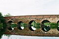
 Barford Bridge over the Great Ouse - geograph.org.uk - 390756.jpg 640 × 480; 94 KB
-
 Birchfield Farm, Great Barford - geograph.org.uk - 449741.jpg 640 × 480; 72 KB
-

-

-
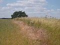
 Field margin - geograph.org.uk - 583665.jpg 640 × 480; 130 KB
-
 Fields - geograph.org.uk - 191392.jpg 640 × 480; 101 KB
-
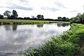
 Fields by the river - geograph.org.uk - 191389.jpg 480 × 640; 103 KB
-

-
 High Barns Farm - geograph.org.uk - 162474.jpg 640 × 404; 72 KB
-

-
 Ouse Bank Farm, Great Barford - geograph.org.uk - 449721.jpg 640 × 480; 73 KB
-
 Sunset over High Barns Farm - geograph.org.uk - 162473.jpg 640 × 477; 42 KB


.jpg)


