Category:Great Lakes
Pereiti į navigaciją
Jump to search
group of lakes in North America _Brighter.jpg) The Great Lakes taken by the MODIS instrument onboard the Aqua satellite in August 2010  | |||||
| Įkelti mediją | |||||
| Tai yra |
| ||||
|---|---|---|---|---|---|
| Vieta | Šiaurės Amerika, Šiaurės pusrutulis | ||||
| Susideda iš | |||||
| Plotas |
| ||||
| Išteka | |||||
| Skiriasi nuo | |||||
 | |||||
Subkategorijos
Rodoma 30 subkategorijų (iš viso yra 30 subkategorijų).
A
B
C
- Canada's Cup (3 F)
D
G
- Great Lakes Towing (1 F)
H
L
M
N
P
S
T
V
- Vertical column headers Great Lakes (empty)
Puslapiai kategorijoje „Great Lakes“
Rodomi 2 šios kategorijos puslapiai (iš viso kategorijoje yra 2 puslapiai).
Daugialypės terpės rinkmenos kategorijoje „Great Lakes“
Rodoma 115 šios kategorijos rinkmenų (iš viso kategorijoje yra 115 rinkmenų).
-
 2004 MI Proof.png 922 × 925; 614 KiB
-
 2007 Michigan Mackinac Island 01.jpg 2 112 × 2 816; 2,07 MiB
-
 2007 Michigan Mackinac Island 02.jpg 2 795 × 2 096; 1,67 MiB
-
 Advanced Geography (1899) (14595253298).jpg 2 840 × 1 864; 2,2 MiB
-
 Amelanchier sp Carleton2 RT.jpg 2 612 × 1 959; 1,45 MiB
-
 Birds eye view of Great Lakes Naval Training Station LCCN2007664114.tif 5 781 × 714; 11,82 MiB
-
 Buckingham Al Bundy fountain Chicago (22038246929).jpg 2 448 × 3 264; 1,5 MiB
-
 Buckingham Al Bundy fountain Chicago (22199055196).jpg 3 264 × 2 448; 2,17 MiB
-
 CaptainRobertWilson.jpg 1 064 × 1 600; 176 KiB
-
 Climate March 1168 (34327144266).jpg 2 615 × 2 320; 722 KiB
-
 Cloudy Chicago.JPG 4 032 × 3 024; 5,28 MiB
-
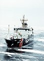 Coast Guard cutter Juniper (1071167).jpg 1 313 × 1 800; 333 KiB
-
 David M. Roderick Wildlife Reserve (Revisited) (1) (9062419107).jpg 5 184 × 2 950; 8,38 MiB
-
 David M. Roderick Wildlife Reserve (Revisited) (2) (9062428931).jpg 5 184 × 3 247; 10,55 MiB
-
 David M. Roderick Wildlife Reserve (Revisited) (3) (9064675480).jpg 5 184 × 3 456; 18,15 MiB
-
 David M. Roderick Wildlife Reserve (Revisited) (5) (9064632046).jpg 5 184 × 3 456; 13,94 MiB
-
 Dune Overlook in the Sleeping Bear Dunes National Lakeshore.jpg 4 272 × 2 848; 3,94 MiB
-
 EPA Federal Partner Holding a Lake Sturgeon.jpg 3 821 × 2 547; 1,03 MiB
-
 Fig 5 Map of drifts in the northern United States.jpg 1 024 × 1 135; 371 KiB
-
 Flotte Engloisses, Lac Ontario, 1757.jpg 1 920 × 961; 283 KiB
-
 FMIB 42892 Bloater of Lake Michigan - Leucichthys johannae (Wagner).jpeg 1 913 × 1 068; 284 KiB
-
 GLDDLOGO.jpg 301 × 300; 36 KiB
-
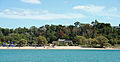 GoderichBeachView.jpg 3 456 × 1 797; 1,59 MiB
-
 Great Lakes (metric DE).svg 1 201 × 480; 25 KiB
-
 Great Lakes Algonquian Syllabary, Third Style.png 1 467 × 1 054; 70 KiB
-
 Great Lakes Algonquian Syllabics, First Style.png 1 467 × 1 054; 101 KiB
-
 Great Lakes Algonquian Syllabics, Second Style.png 1 467 × 1 054; 53 KiB
-
 Great Lakes and St Lawrence River.jpg 2 990 × 1 263; 2,49 MiB
-
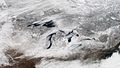 Great Lakes in January (15660338863).jpg 2 048 × 1 152; 588 KiB
-
 Great Lakes kayaking (8740756579).jpg 2 048 × 1 536; 1,02 MiB
-
 Great Lakes Steelhead on a Fly Rod.jpg 2 304 × 2 304; 2,6 MiB
-
 Great Lakes surface weather analysis at 00 UTC on 12 April 1965.png 694 × 482; 224 KiB
-
 Great Lakes unlabeled.svg 1 000 × 399; 10 KiB
-
 Great Lakes Waterspouts.jpg 600 × 372; 14 KiB
-
 Green Mill Chicago (22224946305).jpg 3 264 × 2 448; 2,12 MiB
-
 Hanging Around (16667486560).jpg 1 848 × 2 784; 1,75 MiB
-
 Harbour, Sault St. Marie, ON, 1884 (2918688901).jpg 768 × 628; 253 KiB
-
 Herring Creek Floating Dock.jpg 3 840 × 1 920; 2,33 MiB
-
 Huron(1).jpg 2 641 × 2 498; 2,15 MiB
-
 Ilex mucronata Harc.jpg 1 869 × 1 353; 547 KiB
-

-

-

-

-
-
 Index of Lake Charts - NARA - 100306336.jpg 11 882 × 7 838; 8,83 MiB
-
ISS pass over Southern California to Hudson Bay.ogv 21 s, 640 × 425; 2,87 MiB
-
 Journal of applied microscopy and laboratory methods (1901) (14597532367).jpg 2 182 × 2 426; 769 KiB
-
 Journal of applied microscopy and laboratory methods (1901) (14780897661).jpg 2 350 × 3 613; 952 KiB
-
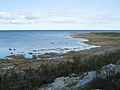
 Lake Ontario Shoreline.jpg 5 804 × 3 869; 9,06 MiB
-
 Lake Superior and Northern Michigan, thumbnail.jpg 760 × 547; 162 KiB
-
 Logo for Copi the new name for Asian carp.svg 512 × 320; 1 KiB
-
 Lower Herring Lake Public Access flood.jpg 3 840 × 1 920; 1,57 MiB
-
 Mackinacsugarloaf.jpg 1 000 × 750; 283 KiB
-
 Marina Fest.jpg 4 000 × 3 000; 4,23 MiB
-
 Maury Geography 064C grain elevator.jpg 1 020 × 740; 107 KiB
-
 Meijer Gardens October 2014 06 (Children's Garden).jpg 3 072 × 2 304; 1,09 MiB
-
 Meijer Gardens October 2014 07 (Children's Garden).jpg 3 072 × 2 304; 1,21 MiB
-
 Meijer Gardens October 2014 08 (Children's Garden).jpg 3 072 × 2 304; 1,2 MiB
-
 MenomineeMichiganGreatLakesMarinaPark.jpg 2 304 × 1 728; 806 KiB
-
 MH-65C Dolphin on Lake St. Clair (8455413915).jpg 1 182 × 1 641; 1,2 MiB
-
 Morro Bay rescues snowmobiler (5547936966).jpg 1 024 × 731; 442 KiB
-
 Motorboat Betty M. II.jpg 800 × 497; 145 KiB
-
 Motorboat Dicky.jpg 740 × 435; 49 KiB
-
 Motorboat Doloma.jpg 740 × 535; 54 KiB
-
 Motorboat Hyac.jpg 900 × 529; 71 KiB
-
 Motorboat Jaydee III.jpg 740 × 445; 58 KiB
-
 Motorboat Marjorie M. off cabin.jpg 740 × 500; 70 KiB
-
 Motorboat Minnemac II pierside.jpg 575 × 675; 93 KiB
-
 Motorboat Minnemac II.jpg 740 × 445; 63 KiB
-
 Motorboat Miss Toledo.jpg 740 × 335; 63 KiB
-
 Motorboat Seatag.jpg 740 × 535; 93 KiB
-
 Motorboat Welcome in port.jpg 740 × 530; 94 KiB
-
 Motorboat Welcome underway.jpg 740 × 490; 92 KiB
-
 Motorboat Yarrow.jpg 740 × 440; 67 KiB
-
 NASA photo Great Lakes on 2 15 2015.jpg 760 × 409; 90 KiB
-
 Northern Great Lakes Visitor Center Ashland Wisconsin.jpg 3 888 × 2 592; 3,9 MiB
-
 Oliver H Smith Fish Tug Outside Of Bailey's Harbor, Wi.jpg 1 073 × 563; 92 KiB
-
 OwenSoundHarbour.JPG 1 280 × 960; 598 KiB
-
 Partial autocorrelation function.png 480 × 480; 4 KiB
-
 Phragmites australis - NASA Tracks an Environmental Invader (48049936657).jpg 1 200 × 1 130; 517 KiB
-

-

-
 PSM V49 D174 River and lake formation around lake ontario.jpg 1 062 × 771; 163 KiB
-
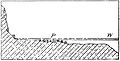
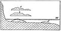 PSM V49 D178 Cut terrace and beach section.jpg 868 × 445; 41 KiB
-
 PSM V49 D178 Cut terrace section without beach.jpg 857 × 435; 38 KiB
-
 PSM V49 D180 Ancient bowlder pavement of algonquin beach.jpg 1 483 × 1 154; 383 KiB
-
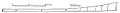
 PSM V49 D180 Section of lake district from ny state to north of lake huron.jpg 1 657 × 307; 60 KiB
-
 PSM V49 D181 Section of michigan highlands to lake nipissing.jpg 1 442 × 300; 54 KiB
-
-
 PSM V56 D0082 Glacial map of the great lakes region.png 1 744 × 2 551; 1,37 MiB
-
 PSM V60 D202 Buildings of minnesota seaside station.png 1 564 × 1 220; 244 KiB
-
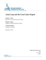 R41082 Asian Carp and the Great Lakes Region (IA R41082AsianCarpandtheGreatLakesRegion-crs).pdf 1 275 × 1 650, 28 puslapiai; 572 KiB
-
 Retired lake freighter valley camp.jpg 5 370 × 3 582; 15,47 MiB
-
 River Sondu-Miriu.jpg 2 160 × 2 160; 1,68 MiB
-
 Satellite image of The Great Lakes Region 2021.jpg 1 818 × 1 167; 354 KiB
-
-
 St Marys River winter.jpg 1 024 × 768; 172 KiB
-
 St. Marys River blockade (1).jpg 1 732 × 709; 329 KiB
-
 St. Marys River blockade (2).jpg 1 999 × 744; 323 KiB
-
 St. Marys River blockade (3).jpg 1 999 × 729; 312 KiB
-
 Strand in Chicago, Uptown (21574953284).jpg 3 022 × 2 267; 1,71 MiB
-
 Straße in Chicago (22199062056).jpg 2 448 × 3 264; 2,45 MiB
-
 The Sorlandet (9369635109).jpg 4 288 × 2 848; 4,35 MiB
-
 Tugboat-ship-Duluth-20060528.jpg 1 280 × 929; 147 KiB
-

-
 USEPA GL collection 136 LakerAtDuluthOreDock.jpg 2 976 × 1 948; 893 KiB
-
 USEPA GL collection 151 DuluthHalletDockSelfunloader.jpg 2 976 × 1 948; 1,07 MiB
-
 USGS image cropped.jpg 1 073 × 759; 196 KiB
-
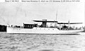
 USS Arroyo (SP-197).jpg 740 × 275; 60 KiB
-
 USS Hyac (SP-216).jpg 740 × 425; 68 KiB
-
 USS Welcome (SP-1175).jpg 740 × 530; 67 KiB
-
 Vanburen state park MI.jpg 2 632 × 1 974; 781 KiB
-
 Yacht Whirlwind out of water.jpg 740 × 325; 53 KiB
-
 Yacht Whirlwind.jpg 740 × 495; 55 KiB


_(14595253298).jpg)

.jpg)
.jpg)

.jpg)

.jpg)
_(1)_(9062419107).jpg)
_(2)_(9062428931).jpg)
_(3)_(9064675480).jpg)
_(5)_(9064632046).jpg)


.jpeg)


.jpg)
.jpg)


.jpg)
.jpg)
.jpg)

.jpg)


_(14597532367).jpg)
_(14780897661).jpg)


.jpg)
.jpg)
.jpg)

.jpg)
.jpg)


.jpg)
.jpg)


.jpg)
.jpg)
.jpg)


.jpg)
.jpg)


.svg)
.jpg)
.jpg)
.jpg)
.jpg)