Category:Halesworth
Naar navigatie springen
Naar zoeken springen
plaats in Suffolk  | |||||
| Media uploaden | |||||
| Is een | |||||
|---|---|---|---|---|---|
| Locatie | East Suffolk, Suffolk, East of England, Engeland | ||||
| Inwonertal |
| ||||
| Naar verluidt hetzelfde als | Halesworth (Wikimedia-doublure, civil parish) | ||||
 | |||||
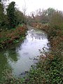
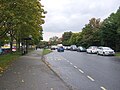
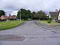
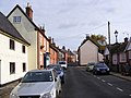
English: Halesworth is a small market town (population of around 6000) in the north east corner of Suffolk, England. It is located south west of Lowestoft, and straddles the River Blyth, nine miles (14 km) upstream from Southwold. The town is served by Halesworth railway station on the Ipswich-Lowestoft East Suffolk Line. Halesworth is twinned with both Bouchain in France and Eitorf in Germany.
Polski: Halesworth - miasto w Wielkiej Brytanii. w Anglii w hrabstwie Suffolk połozone w północno-wschodnim rogu hrabstwa nad rzeką Blyth, trzy mile na zachód od Morza Północnego. Miasto zamieszkuje ok. 6 000 mieszkańców.
Ondercategorieën
Deze categorie bevat de volgende 12 subcategorieën, van de 12 in totaal.
Media in categorie "Halesworth"
Deze categorie bevat de volgende 200 bestanden, van in totaal 1.025.
(vorige pagina) (volgende pagina)-
 About Halesworth sign - geograph.org.uk - 5872506.jpg 4.608 × 3.456; 4,2 MB
-
 About Halesworth sign - geograph.org.uk - 5872528.jpg 3.021 × 2.409; 2,02 MB
-
 Anglia in Bloom Information sign - geograph.org.uk - 5872491.jpg 2.986 × 3.981; 3,77 MB
-
 Anglia in Bloom Information sign - geograph.org.uk - 5872519.jpg 1.857 × 2.371; 1,73 MB
-
 Back Garden at Highfield Residential Home - geograph.org.uk - 3069479.jpg 1.536 × 2.048; 733 kB
-
 Barclays Bank Plc car park - geograph.org.uk - 4786239.jpg 2.304 × 3.072; 3,32 MB
-
 Barley Crop off the B1117 Walpole Road - geograph.org.uk - 5016836.jpg 3.072 × 2.304; 1,89 MB
-
 Barley Crop off the B1117 Walpole Road - geograph.org.uk - 5016838.jpg 2.304 × 3.072; 1,84 MB
-
 Barley Crop off the B1117 Walpole Road - geograph.org.uk - 5016839.jpg 2.304 × 3.072; 1,9 MB
-
 Barley Meadow sign - geograph.org.uk - 3077754.jpg 3.072 × 2.304; 1,62 MB
-
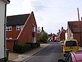
 Barley Meadow, Halesworth - geograph.org.uk - 3077846.jpg 3.072 × 2.304; 1,28 MB
-
 Barons Close sign - geograph.org.uk - 3083083.jpg 3.072 × 2.304; 1,54 MB
-
 Barons Close, Halesworth - geograph.org.uk - 3083112.jpg 3.072 × 2.304; 1,25 MB
-
 Baseball Court and path in Town Park - geograph.org.uk - 3770224.jpg 3.072 × 2.304; 1,82 MB
-
 Basketball Court in Town Park - geograph.org.uk - 3770025.jpg 3.072 × 2.304; 1,79 MB
-
 Basley Park sign - geograph.org.uk - 3441371.jpg 2.223 × 2.967; 1,97 MB
-
 Basley Park sign - geograph.org.uk - 3441375.jpg 2.304 × 3.072; 1,62 MB
-
 Basley Park sign - geograph.org.uk - 3441378.jpg 3.072 × 2.304; 1,54 MB
-
 Basley Park, Halesworth - geograph.org.uk - 3441385.jpg 3.072 × 2.304; 1,38 MB
-
 Basley Park, Halesworth - geograph.org.uk - 3441421.jpg 3.072 × 2.304; 1,43 MB
-
 Baytree Bistro, The Thoroughfare, Halesworth - geograph.org.uk - 2131336.jpg 2.304 × 3.072; 1,3 MB
-
 Bedingfield Crescent sign - geograph.org.uk - 3077880.jpg 3.072 × 2.304; 1,45 MB
-
 Bedingfield Crescent sign - geograph.org.uk - 3077890.jpg 2.572 × 2.163; 1,07 MB
-
 Bedingfield Crescent, Halesworth - geograph.org.uk - 2165779.jpg 3.072 × 2.304; 1,38 MB
-
 Bedingfield Crescent, Halesworth - geograph.org.uk - 2179080.jpg 580 × 435; 106 kB
-
 Bedingfield Crescent, Halesworth - geograph.org.uk - 3077884.jpg 3.072 × 2.304; 1,38 MB
-
 Bedingfield Crescent, Halesworth - geograph.org.uk - 3096360.jpg 3.072 × 2.304; 1,2 MB
-
 Bedingfield Crescent, Halesworth - geograph.org.uk - 3096377.jpg 3.049 × 2.149; 1,48 MB
-
 Bedingfield Crescent, Halesworth - geograph.org.uk - 3096386.jpg 3.072 × 2.304; 1,24 MB
-
 Bedingfield Crescent, Halesworth - geograph.org.uk - 3098054.jpg 3.072 × 2.304; 1,25 MB
-
 Beech Close, Halesworth - geograph.org.uk - 2146141.jpg 3.072 × 2.304; 1,4 MB
-
 Beech Close, Halesworth - geograph.org.uk - 3091906.jpg 3.072 × 2.304; 1,4 MB
-
 Bend on the A144 - geograph.org.uk - 2183502.jpg 640 × 480; 82 kB
-
 Bend on the A144 at Halesworth - geograph.org.uk - 2055642.jpg 640 × 480; 64 kB
-
 Black Eagle Court, Chediston Street - geograph.org.uk - 2200161.jpg 480 × 640; 56 kB
-
 Blyth Meadow - geograph.org.uk - 1779303.jpg 3.072 × 2.304; 1,34 MB
-
 Blyth Mews sign - geograph.org.uk - 3772528.jpg 3.072 × 2.304; 1,71 MB
-
 Blyth Mews, Halesworth - geograph.org.uk - 3107831.jpg 3.072 × 2.304; 1,35 MB
-
 Blyth Mews, Halesworth - geograph.org.uk - 3772534.jpg 3.072 × 2.304; 1,49 MB
-
 Blyth River at Halesworth - geograph.org.uk - 614546.jpg 480 × 640; 111 kB
-
 Blyth Road sign - geograph.org.uk - 5794172.jpg 3.857 × 2.569; 6,69 MB
-
 Blyth Road ^ footpath - geograph.org.uk - 5794111.jpg 4.608 × 3.072; 1,83 MB
-
 Blyth Road ^ the footpath to the A144 Bramfield Road - geograph.org.uk - 2574524.jpg 3.072 × 2.304; 1,29 MB
-
 Blyth Road, Halesworth - geograph.org.uk - 5794130.jpg 4.608 × 3.072; 2,1 MB
-
 Blyth Road, Halesworth - geograph.org.uk - 5795298.jpg 4.608 × 3.072; 1,92 MB
-
 Boarding Steps to New Reach, Halesworth - geograph.org.uk - 1778261.jpg 3.072 × 2.304; 1,64 MB
-
 Bollards in Bridge Street - geograph.org.uk - 2064738.jpg 360 × 640; 72 kB
-
 Bouchain Court, Chediston Street - geograph.org.uk - 2200162.jpg 640 × 480; 67 kB
-
 Bramblewood Way sign - geograph.org.uk - 5846241.jpg 4.608 × 3.072; 1,81 MB
-
 Bramblewood Way, Halesworth - geograph.org.uk - 4019660.jpg 3.049 × 2.290; 883 kB
-
 Bramblewood Way, Halesworth - geograph.org.uk - 5846245.jpg 4.608 × 3.072; 2,04 MB
-
 Bramblewood Way, Halesworth - geograph.org.uk - 5846816.jpg 4.608 × 3.072; 1,82 MB
-
 Bramfield Road Postbox - geograph.org.uk - 2131307.jpg 2.304 × 3.072; 1,41 MB
-
 Bramfield Road Postbox - geograph.org.uk - 2131316.jpg 2.304 × 3.072; 1,52 MB
-
 Bramfield Road sign - geograph.org.uk - 3096423.jpg 3.072 × 2.304; 1,62 MB
-
 Briar Close sign - geograph.org.uk - 4016030.jpg 3.030 × 2.276; 1,46 MB
-
 Briar Close sign - geograph.org.uk - 4019673.jpg 3.049 × 2.290; 1,53 MB
-
 Briar Close, Halesworth - geograph.org.uk - 2055609.jpg 3.072 × 2.304; 1,63 MB
-
 Briar Close, Halesworth - geograph.org.uk - 4016036.jpg 3.072 × 2.304; 1,18 MB
-
 Briar Close, Halesworth - geograph.org.uk - 5846380.jpg 4.608 × 3.072; 1,76 MB
-
 Bridge - geograph.org.uk - 230644.jpg 1.600 × 1.200; 381 kB
-
 Bridge house - geograph.org.uk - 772974.jpg 480 × 640; 80 kB
-
 Bridge Identification sign - geograph.org.uk - 2131280.jpg 2.304 × 3.072; 1,42 MB
-
 Bridge in River Lane - geograph.org.uk - 1779275.jpg 3.072 × 2.304; 1,67 MB
-

-
 Bridge over New Reach in Town Park - geograph.org.uk - 3769864.jpg 2.304 × 3.072; 1,95 MB
-
 Bridge over New Reach in Town Park - geograph.org.uk - 3769865.jpg 3.072 × 2.304; 1,89 MB
-
 Bridge remains of dismantled railway - geograph.org.uk - 2055597.jpg 2.304 × 3.072; 1,45 MB
-
 Bridge remains of dismantled railway - geograph.org.uk - 2055607.jpg 2.304 × 3.072; 1,44 MB
-
 Bridge Street, Halesworth - geograph.org.uk - 3769583.jpg 3.072 × 2.304; 1,83 MB
-
 Bridge Street, Halesworth - geograph.org.uk - 4535829.jpg 3.072 × 2.304; 1,82 MB
-
 Bridge Street, Halesworth - geograph.org.uk - 5715455.jpg 1.600 × 1.064; 287 kB
-
 British Legion Club, Bridge Street - geograph.org.uk - 2064734.jpg 360 × 640; 50 kB
-
 Broadway Drive sign - geograph.org.uk - 4618405.jpg 3.072 × 2.304; 1,94 MB
-
 Broadway Drive, Broadway, Halesworth - geograph.org.uk - 4618404.jpg 3.072 × 2.304; 1,8 MB
-
 Broadway Postbox - geograph.org.uk - 2142883.jpg 2.304 × 3.072; 1,49 MB
-
 Broadway Postbox - geograph.org.uk - 2142886.jpg 3.072 × 2.304; 1,43 MB
-
 Brodie-Murphy in Chediston Street - geograph.org.uk - 2200145.jpg 480 × 640; 55 kB
-

-
 Building Site off Wissett Road - geograph.org.uk - 3159696.jpg 3.072 × 2.304; 1,41 MB
-
 Building Site ^ Wissett Road - geograph.org.uk - 3159709.jpg 2.011 × 2.184; 844 kB
-

-
 Bungalow as seen from the A144 - geograph.org.uk - 2183633.jpg 640 × 480; 82 kB
-
 Bungalow in Norwich Road - geograph.org.uk - 2181090.jpg 640 × 360; 90 kB
-
 Bungalows in Chediston Street - geograph.org.uk - 2200152.jpg 640 × 480; 85 kB
-
 Bungalows in Norwich Road - geograph.org.uk - 2181103.jpg 640 × 360; 65 kB
-
 Bungalows in Roman Way - geograph.org.uk - 2184079.jpg 640 × 480; 69 kB
-
 Bungalows in School Lane - geograph.org.uk - 2211006.jpg 640 × 360; 64 kB
-
 Bungalows in Wissett Road - geograph.org.uk - 2204493.jpg 640 × 360; 81 kB
-
 Bungay Road - geograph.org.uk - 1023660.jpg 3.072 × 2.304; 1,25 MB
-
 Bungay Road junction with Norwich Road - geograph.org.uk - 1023664.jpg 3.072 × 2.304; 1,32 MB
-
 Bungay Road sign - geograph.org.uk - 5846872.jpg 4.608 × 3.072; 1,84 MB
-
 Bungay Road, Halelesworth - geograph.org.uk - 1834529.jpg 3.072 × 2.304; 1,38 MB
-
 Bungay Road, Halesworth - geograph.org.uk - 1993770.jpg 3.072 × 2.304; 1,35 MB
-
 Bungay Road, Halesworth - geograph.org.uk - 4361513.jpg 2.304 × 3.072; 2,18 MB
-
 Bungay Road, Halesworth - geograph.org.uk - 5833020.jpg 4.416 × 3.312; 1,27 MB
-
 Bungay Road, Halesworth - geograph.org.uk - 5844780.jpg 4.000 × 2.667; 2,57 MB
-
 Bungay Road, Halesworth - geograph.org.uk - 5846239.jpg 3.663 × 2.439; 3,58 MB
-
 Bungay Road, Halesworth - geograph.org.uk - 5846823.jpg 4.608 × 3.072; 1,79 MB
-
 Bungay Road, Halesworth - geograph.org.uk - 5846970.jpg 2.510 × 3.318; 3,13 MB
-
 Bus shelter in Norwich Road - geograph.org.uk - 2181097.jpg 640 × 360; 76 kB
-
 Bus Shelter on Durban Close - geograph.org.uk - 3096397.jpg 2.304 × 3.072; 1,31 MB
-
 Bus Shelter on Durban Close - geograph.org.uk - 3096399.jpg 2.304 × 3.072; 1,27 MB
-
 Bus shelter on the A144 - geograph.org.uk - 2183638.jpg 640 × 480; 80 kB
-
 Bus Shelter on the A144 Norwich Road, Halesworth - geograph.org.uk - 1993748.jpg 3.072 × 2.304; 1,5 MB
-
-

-
 Bus stop in Bramblewood Way - geograph.org.uk - 2048072.jpg 360 × 640; 40 kB
-
 Bus stop in Quay Street - geograph.org.uk - 2181038.jpg 640 × 360; 78 kB
-
 Bus turning road, Halesworth - geograph.org.uk - 5846247.jpg 4.608 × 3.072; 1,95 MB
-
 Canalside Bench - geograph.org.uk - 1778178.jpg 3.072 × 2.304; 1,65 MB
-
 Cars in Quay Street - geograph.org.uk - 2180134.jpg 640 × 360; 60 kB
-
 Carved beam - geograph.org.uk - 772761.jpg 640 × 480; 82 kB
-
 Castle Hill sign - geograph.org.uk - 3107757.jpg 3.072 × 2.304; 1,5 MB
-
 Castle Hill, Halesworth - geograph.org.uk - 3107753.jpg 3.072 × 2.304; 1,36 MB
-
 Chediston Street - geograph.org.uk - 243226.jpg 1.600 × 1.200; 389 kB
-
 Chediston Street Postbox - geograph.org.uk - 2142923.jpg 2.304 × 3.072; 1,47 MB
-

-
 Chediston Street sign - geograph.org.uk - 3083279.jpg 3.072 × 2.304; 1,52 MB
-
 Chediston Street ^ Chediston Street Postbox - geograph.org.uk - 2142922.jpg 3.072 × 2.304; 1,33 MB
-
 Chediston Street, Halesworth - geograph.org.uk - 2142926.jpg 3.072 × 2.304; 1,31 MB
-
 Chediston Street, Halesworth - geograph.org.uk - 2142929.jpg 3.072 × 2.304; 1,24 MB
-
 Chediston Street, Halesworth - geograph.org.uk - 3083287.jpg 3.072 × 2.304; 1,25 MB
-
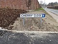 Cherry Close sign - geograph.org.uk - 4399834.jpg 3.072 × 2.304; 1,93 MB
-
 Cherry Close, Halesworth - geograph.org.uk - 4399835.jpg 3.072 × 2.304; 1,7 MB
-
 Cherry Close, Halesworth - geograph.org.uk - 4399837.jpg 3.072 × 2.304; 1,67 MB
-
 Cherry Close, Halesworth - geograph.org.uk - 4399838.jpg 3.072 × 2.304; 1,6 MB
-
 Cherry Close, Halesworth - geograph.org.uk - 4399841.jpg 3.072 × 2.304; 1,68 MB
-
 Chichester Road Postbox - geograph.org.uk - 2205186.jpg 2.304 × 3.072; 1,51 MB
-
 Chichester Road Postbox - geograph.org.uk - 2205189.jpg 3.072 × 2.304; 1,41 MB
-
 Chichester Road Postbox - geograph.org.uk - 2205192.jpg 3.072 × 2.304; 1,5 MB
-
 Chichester Road sign - geograph.org.uk - 3159928.jpg 3.072 × 2.304; 1,67 MB
-
 Chichester Road ^ Chichester Road Postbox - geograph.org.uk - 2205184.jpg 3.072 × 2.304; 1,47 MB
-
 Chichester Road, Halesworth - geograph.org.uk - 3159919.jpg 3.072 × 2.304; 1,43 MB
-
 Children's Play Area - geograph.org.uk - 2036438.jpg 3.072 × 2.304; 1,36 MB
-
 Children's Play Area in Town Park - geograph.org.uk - 3769860.jpg 3.072 × 2.304; 1,92 MB
-
 Children's Play Area ^ new housing development - geograph.org.uk - 3769961.jpg 3.072 × 2.304; 2,01 MB
-
 Children's Play Equipment at Basley Park - geograph.org.uk - 3441381.jpg 3.072 × 2.304; 1,49 MB
-
 Children's Play Equipment at Basley Park - geograph.org.uk - 3441417.jpg 3.072 × 2.304; 1,49 MB
-
 Children's Society shop, Bridge Street, Halesworth - geograph.org.uk - 5715331.jpg 1.064 × 1.600; 261 kB
-
 Chinny's Cue Club, Bar ^ Diner - geograph.org.uk - 3529347.jpg 2.930 × 2.201; 789 kB
-
 Chippy in Bridge Street - geograph.org.uk - 2222022.jpg 360 × 640; 43 kB
-
 Church Farm Lane - geograph.org.uk - 1024626.jpg 2.800 × 2.100; 938 kB
-
 Church Farm Lane, Halesworth - geograph.org.uk - 2816828.jpg 3.072 × 2.304; 1,49 MB
-
 Church Farm Lane, Halesworth - geograph.org.uk - 3091894.jpg 2.304 × 3.072; 1,63 MB
-
 Clay Hills sign - geograph.org.uk - 3077864.jpg 3.072 × 2.304; 1,47 MB
-
 Clay Hills, Halesworth - geograph.org.uk - 3077862.jpg 3.072 × 2.304; 1,34 MB
-

-

-
 Club for sale in Station Approach - geograph.org.uk - 2156920.jpg 640 × 360; 49 kB
-
 Co Op Postbox - geograph.org.uk - 3774712.jpg 1.536 × 2.048; 572 kB
-
 Co Op Roundabout - geograph.org.uk - 1024649.jpg 3.072 × 2.304; 1,35 MB
-
 Co-Operative Fuel Filling Station at night - geograph.org.uk - 4229093.jpg 3.072 × 2.304; 2,41 MB
-
 Co-Operative Fuel Filling Station sign - geograph.org.uk - 4319800.jpg 2.304 × 3.072; 1,98 MB
-
 Combining off the B1117 Walpole Road - geograph.org.uk - 3076714.jpg 2.304 × 3.072; 1,36 MB
-

-

-
 Constable Close sign - geograph.org.uk - 3106024.jpg 3.072 × 2.304; 1,59 MB
-
 Constable Close, Halesworth - geograph.org.uk - 3106020.jpg 3.072 × 2.304; 1,4 MB
-
 Cottages by St Mary's church, Halesworth - geograph.org.uk - 2498518.jpg 640 × 480; 158 kB
-
 Cottages by St Mary's church, Halesworth - geograph.org.uk - 2498520.jpg 640 × 480; 173 kB
-
 Cottages in Chediston Street - geograph.org.uk - 2200142.jpg 640 × 480; 101 kB
-
 Cottages in Wissett Road - geograph.org.uk - 2204446.jpg 640 × 360; 105 kB
-
 Country Kitchen in Thoroughfare - geograph.org.uk - 2078138.jpg 360 × 640; 53 kB
-
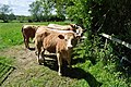 Cow Moos - geograph.org.uk - 1885583.jpg 800 × 531; 196 kB
-
 Cultivating off the B1117 Walpole Road - geograph.org.uk - 3091918.jpg 3.072 × 2.304; 1,25 MB
-
 Cultivating off the B1117 Walpole Road - geograph.org.uk - 3091925.jpg 3.072 × 2.304; 1,27 MB
-

-
 Cut Mark Halesworth No 86 Chediston - geograph.org.uk - 5072011.jpg 2.231 × 2.231; 3,77 MB
-
 Cut Mark Halesworth Patrick Stead Hospital - geograph.org.uk - 5398555.jpg 2.410 × 2.410; 5,22 MB
-
 Cut Mark Halesworth Quay Street - geograph.org.uk - 5671813.jpg 1.393 × 1.598; 1,36 MB
-
 Cut Mark Halesworth St Mary's Church - geograph.org.uk - 5049885.jpg 2.231 × 2.231; 3,69 MB
-
 Cut Mark Halesworth White Hart Public House - geograph.org.uk - 5062357.jpg 1.600 × 1.476; 670 kB
-
 Cut through within Holmere Drive - geograph.org.uk - 2197151.jpg 480 × 640; 123 kB
-
 Cutlers Hill Surgery, Halesworth - geograph.org.uk - 5832974.jpg 4.416 × 3.312; 1,1 MB
-
-

-

-
 Dairy Hill sign - geograph.org.uk - 5845077.jpg 4.000 × 2.667; 4,7 MB
-
 Dairy Hill, Halesworth - geograph.org.uk - 1993778.jpg 2.304 × 3.072; 1,31 MB
-
 Dairy Hill, Halesworth - geograph.org.uk - 5833923.jpg 3.975 × 2.896; 3 MB
-
 Dairy Hill, Halesworth - geograph.org.uk - 5845131.jpg 3.837 × 2.668; 3,99 MB
-
 Dairy Hill, Halesworth - geograph.org.uk - 5846234.jpg 4.608 × 3.072; 1,8 MB
-
 Dairy Hill, Halesworth - geograph.org.uk - 5846839.jpg 4.608 × 3.072; 1,98 MB
-
 Dairy Hill, Halesworth - geograph.org.uk - 5852869.jpg 4.000 × 2.667; 4,71 MB
-
 Daking's Drift sign - geograph.org.uk - 3077824.jpg 3.072 × 2.304; 1,44 MB
-
 Damson Tree at Highfield - geograph.org.uk - 3717711.jpg 2.304 × 3.072; 2,27 MB
-
 Detail of the Font cover War Memorial at Halesworth - geograph.org.uk - 6213329.jpg 2.847 × 2.352; 1,46 MB
-
 Disabled Toilets in Halesworth Car Park - geograph.org.uk - 2142974.jpg 2.304 × 3.072; 1,48 MB
-
 Discreet entrance in Thoroughfare - geograph.org.uk - 2123189.jpg 360 × 640; 55 kB
-

-
 Dog in Bramblewood Way - geograph.org.uk - 2048025.jpg 640 × 360; 75 kB
-

-
 Dried up section of New Reach - geograph.org.uk - 3770265.jpg 2.304 × 3.072; 1,9 MB
-
 Dukes Drive Postbox - geograph.org.uk - 1490246.jpg 3.072 × 2.304; 1,5 MB
-
 Dukes Drive Postbox - geograph.org.uk - 1490259.jpg 2.304 × 3.072; 2,31 MB
-
 Dukes Drive Postbox - geograph.org.uk - 2142942.jpg 2.304 × 3.072; 1,59 MB
-
 Dukes Drive sign - geograph.org.uk - 3077873.jpg 3.072 × 2.304; 1,48 MB
-
 Dukes Drive ^ Dukes Drive Postbox - geograph.org.uk - 2142940.jpg 3.072 × 2.304; 1,45 MB
-
 Dukes Drive, Halesworth - geograph.org.uk - 1472584.jpg 3.072 × 2.304; 1,41 MB


_-_geograph.org.uk_-_5161745.jpg)
_-_geograph.org.uk_-_5161751.jpg)


