Category:Hanley, Staffordshire
Zur Navigation springen
Zur Suche springen
Kleinstadt im Vereinigten Königreich  | |||||
| Medium hochladen | |||||
| Ist ein(e) | |||||
|---|---|---|---|---|---|
| Ort | City of Stoke-on-Trent, Staffordshire, West Midlands, England | ||||
 | |||||
Deutsch: Hanley ist die bevölkerungsreichste der sechs Städte, aus denen die englische Stadt Stoke-on-Trent besteht. Sie ist das Herz von Stoke-on-Trent, in dem sich viele Pubs, Cafés, Clubs, Museen, Theater und auch Geschäfte (insbesondere das größte Shoppingcenter in Stoke, das sogenannte „Potteries Shopping Centre“) befinden. „Going up Hanley“ bedeutet deshalb so viel wie „ausgehen“.
English: Hanley, Staffordshire, England, is one of the six major towns that joined together to form Stoke-on-Trent in 1910. Hanley was the only one of the six towns to be a county borough before the merger; its status was transferred to the enlarged borough. Hanley was incorporated as a municipal borough in 1857 and became a county borough with the passage of the Local Government Act 1888.
Italiano: Hanley è una delle sei comunità che, aggregate, formano la città di Stoke-on-Trent, nella contea dello Staffordshire, in Inghilterra.
Nederlands: Hanley is een plaats in het bestuurlijke gebied Stoke-on-Trent, in het Engelse graafschap Staffordshire.
Svenska: Hanley, Staffordshire, England, är ett av de sex stadsområden som år 1925 förenades för att forma staden Stoke-on-Trent. Hanley fungerar idag som stadens city-centrum och köpcentrum, och erbjuder stora kulturella evenemang och olika kulturella kvartersbyggnader och kaféer. I Hanley finns bland annat en stor romersk-katolsk kyrka och en ortodox synagoga. Staden ligger 6 kilometer från Newcastle-under-Lyme. I utkanten av Hanley ligger området Birches Head.
Unterkategorien
Es werden 14 von insgesamt 14 Unterkategorien in dieser Kategorie angezeigt:
In Klammern die Anzahl der enthaltenen Kategorien (K), Seiten (S), Dateien (D)
D
- Dudson Pottery, Hanley (2 D)
H
- Hanley railway station (3 D)
- Hanley Town Hall (1 D)
- Hanley War Memorial (1 D)
- St Luke's Church, Hanley (3 D)
P
- Pubs in Hanley (11 D)
Medien in der Kategorie „Hanley, Staffordshire“
Folgende 200 Dateien sind in dieser Kategorie, von 406 insgesamt.
(vorherige Seite) (nächste Seite)-

-

-
 'Source of Light' - geograph.org.uk - 5612699.jpg 1.225 × 919; 379 KB
-
 2015 Tour of Britain - 011 Mark Cavendish.JPG 1.024 × 1.366; 370 KB
-
 2015 Tour of Britain - 015 Matteo Trentin.JPG 1.366 × 1.024; 366 KB
-
 2015 Tour of Britain - 191 Sir Bradley Wiggins.JPG 1.024 × 1.366; 427 KB
-
 2015 Tour of Britain stage 6 - 194 Owain Doull signing in.JPG 1.024 × 768; 343 KB
-
 2015 Tour of Britain stage 6 - a roll out (1).JPG 1.366 × 910; 808 KB
-
 2015 Tour of Britain stage 6 - a roll out (2).JPG 1.366 × 910; 634 KB
-
 2015 Tour of Britain stage 6 - Team Tinkoff Saxo sign in.JPG 1.366 × 910; 590 KB
-
 A Spiritual Awakening^ - geograph.org.uk - 4633759.jpg 640 × 428; 92 KB
-
 A street in Hanley - geograph.org.uk - 6137057.jpg 2.000 × 1.333; 2,53 MB
-
 Advertising rotunda in Market Square - geograph.org.uk - 4941368.jpg 640 × 480; 73 KB
-

-

-
 Airspace (derelict building in Hanley) - geograph.org.uk - 4337952.jpg 640 × 428; 112 KB
-
 Airspace (looking NE) - geograph.org.uk - 4337960.jpg 640 × 428; 112 KB
-
 Albion Street, Hanley - geograph.org.uk - 1572564.jpg 640 × 426; 51 KB
-
 Another full carpark - geograph.org.uk - 6137034.jpg 2.000 × 1.333; 2,02 MB
-

-

-
 Arnold Bennett Statue - geograph.org.uk - 5862336.jpg 768 × 1.024; 298 KB
-
 Arnold Bennett Statue, Potteries Museum, Hanley - geograph.org.uk - 6264139.jpg 2.000 × 1.500; 2,8 MB
-
 Art Deco Architecture Hanley Stoke-on-Trent.jpg 2.634 × 3.256; 1,38 MB
-
 Art Deco parade of shops Hanley Stoke-on-Trent.jpg 3.501 × 1.958; 1,06 MB
-
 Art Deco shop Hanley Stoke-on-Trent.jpg 3.648 × 2.736; 3,61 MB
-
 Bagnall Street, Hanley - geograph.org.uk - 3670636.jpg 1.024 × 768; 128 KB
-

-
 BBC Radio Stoke, Hanley - geograph.org.uk - 3157594.jpg 640 × 480; 74 KB
-
 Berryhill - geograph.org.uk - 3236163.jpg 800 × 450; 97 KB
-
 Bethesda Chapel - Albion Street - geograph.org.uk - 5614250.jpg 1.200 × 1.600; 436 KB
-
 Bethesda Street. - geograph.org.uk - 824119.jpg 640 × 480; 77 KB
-
 Botteslow Road Bridge near Hanley, Stoke-on-Trent - geograph.org.uk - 6108898.jpg 1.280 × 1.280; 1,93 MB
-

-
 Bottle kiln at Dudson Pottery - geograph.org.uk - 5868467.jpg 768 × 1.024; 239 KB
-
-
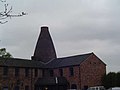
 Bottle Kilns at Wedgwood's Bullers Works, Hanley - geograph.org.uk - 5110790.jpg 1.500 × 1.003; 1,09 MB
-

-
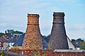
 Bottle Kilns, Hanley - geograph.org.uk - 5564149.jpg 1.200 × 1.600; 335 KB
-
 Bottle ovens (kilns), Hanley - geograph.org.uk - 4435771.jpg 640 × 427; 59 KB
-
 Bottom end of Piccadilly - geograph.org.uk - 4941319.jpg 640 × 480; 58 KB
-
 Bridge 14A, Caldon Canal - geograph.org.uk - 3022052.jpg 1.280 × 856; 331 KB
-

-
 Britannic Pottery, Hanley - geograph.org.uk - 4435730.jpg 640 × 427; 60 KB
-
 Broad Street (A5006) - geograph.org.uk - 4578273.jpg 640 × 480; 53 KB
-
 Broad Street (A5006) - geograph.org.uk - 4578275.jpg 640 × 413; 43 KB
-
 Broad Street Hanley - geograph.org.uk - 6137024.jpg 2.000 × 1.333; 1,76 MB
-
 Broken Window (Airspace building) - geograph.org.uk - 4339707.jpg 428 × 640; 109 KB
-
 Bucknall Old Road, Hanley - geograph.org.uk - 5404973.jpg 1.600 × 1.200; 613 KB
-
 Bus in Boothroyd Street - geograph.org.uk - 4941156.jpg 640 × 480; 66 KB
-
 But for how much longer - geograph.org.uk - 4941370.jpg 640 × 480; 74 KB
-
 Caldon Canal east of Hanley in Stoke-on-Trent - geograph.org.uk - 6108666.jpg 1.600 × 900; 1,59 MB
-
 Caldon Canal east of Hanley in Stoke-on-Trent - geograph.org.uk - 6108695.jpg 1.440 × 960; 1,71 MB
-
 Caldon Canal east of Hanley in Stoke-on-Trent - geograph.org.uk - 6108699.jpg 1.440 × 960; 1,45 MB
-
 Caldon Canal east of Hanley, Stoke-on-Trent - geograph.org.uk - 2482215.jpg 1.024 × 791; 444 KB
-
 Caldon Canal east of Hanley, Stoke-on-Trent - geograph.org.uk - 5578780.jpg 1.600 × 1.200; 1,29 MB
-
 Caldon Canal near Joiner's Square in Stoke-on-Trent - geograph.org.uk - 6110367.jpg 1.280 × 960; 1,37 MB
-
 Caldon Canal near Joiner's Square in Stoke-on-Trent - geograph.org.uk - 6110370.jpg 1.440 × 960; 1,48 MB
-

-
 Caldon Canal near Joiner's Square, Stoke-on-Trent - geograph.org.uk - 6368024.jpg 1.600 × 900; 1,34 MB
-
 Caldon Canal near Joiner's Square, Stoke-on-Trent - geograph.org.uk - 6368025.jpg 1.440 × 1.080; 1,29 MB
-
 Caldon Canal near Joiner's Square, Stoke-on-Trent - geograph.org.uk - 6368028.jpg 1.440 × 960; 1,28 MB
-
 Caldon Canal near Joiner's Square, Stoke-on-Trent - geograph.org.uk - 6368029.jpg 1.440 × 960; 1,25 MB
-
 Caldon Canal near Joiners Square, Stoke-on-Trent - geograph.org.uk - 5576725.jpg 1.280 × 913; 883 KB
-

-

-
 Caldon Canal north of Joiners Square, Stoke-on-Trent - geograph.org.uk - 5577848.jpg 1.280 × 863; 1.011 KB
-
 Caldon Canal south-east of Hanley in Stoke-on-Trent - geograph.org.uk - 6108710.jpg 1.440 × 960; 1,63 MB
-
 Caldon Canal south-east of Hanley in Stoke-on-Trent - geograph.org.uk - 6108717.jpg 1.440 × 960; 1,68 MB
-
 Caldon Canal south-east of Hanley in Stoke-on-Trent - geograph.org.uk - 6108721.jpg 1.440 × 960; 1,59 MB
-
 Caldon Canal south-east of Hanley in Stoke-on-Trent - geograph.org.uk - 6368712.jpg 1.440 × 960; 1,13 MB
-
 Caldon Canal south-east of Hanley in Stoke-on-Trent - geograph.org.uk - 6370224.jpg 1.440 × 960; 1,39 MB
-

-
 Caldon Canal south-east of Hanley, Stoke-on-Trent - geograph.org.uk - 5577906.jpg 1.280 × 924; 1,15 MB
-

-
 Caldon Canal south-east of Hanley, Stoke-on-Trent - geograph.org.uk - 5578065.jpg 1.600 × 1.200; 1,21 MB
-
 Caldon Canal south-east of Hanley, Stoke-on-Trent - geograph.org.uk - 6369595.jpg 1.440 × 960; 1,06 MB
-
 Caldon Canal south-east of Hanley, Stoke-on-Trent - geograph.org.uk - 6369600.jpg 1.440 × 1.080; 1,4 MB
-
 Canal and new housing, Hanley, Stoke-on-Trent - geograph.org.uk - 5578055.jpg 1.600 × 1.200; 1,27 MB
-

-

-
 Canal south-east of Hanley in Stoke-on-Trent - geograph.org.uk - 6368034.jpg 1.440 × 960; 1,41 MB
-

-
 Canalside housing and bottle kilns, Stoke-on-Trent - geograph.org.uk - 6368800.jpg 1.440 × 1.080; 1,25 MB
-

-
 Car sales on Leek Road - geograph.org.uk - 4068566.jpg 640 × 428; 49 KB
-
 Clock in Hanley town centre - geograph.org.uk - 4941358.jpg 640 × 480; 69 KB
-

-
 Commercial Road, Hanley - geograph.org.uk - 1866915.jpg 640 × 480; 53 KB
-

-
 Cricket Club bowling green - geograph.org.uk - 209857.jpg 640 × 480; 25 KB
-
 Demolition of Unity House, Hanley - geograph.org.uk - 343830.jpg 640 × 484; 72 KB
-
 Demolition on Balfour Street - geograph.org.uk - 2858746.jpg 640 × 427; 75 KB
-
 Derelict canalside factory near Hanley, Stoke-on-Trent - geograph.org.uk - 6369622.jpg 2.581 × 3.441; 7,49 MB
-

-
 Derelict factory buildings by the Caldon Canal near Hanley - geograph.org.uk - 6369634.jpg 1.440 × 1.080; 1,45 MB
-

-

-
 Derelict industrial buildings on the Caldon Canal, Hanley - geograph.org.uk - 5748184.jpg 3.776 × 2.520; 2,82 MB
-

-
 Detail of Stoke on Trent Council House - geograph.org.uk - 6080287.jpg 683 × 1.024; 140 KB
-

-

-

-

-
 Dresden Street, Hanley - geograph.org.uk - 1866893.jpg 640 × 480; 67 KB
-
 Dudson Pottery - geograph.org.uk - 5867576.jpg 1.024 × 768; 217 KB
-
 Dyke Street, Hanley - geograph.org.uk - 5405134.jpg 1.600 × 1.200; 521 KB
-

-

-
 Eastwood Road Bridge south-east of Hanley, Stoke-on-Trent - geograph.org.uk - 6368686.jpg 1.440 × 1.080; 1,37 MB
-
 Eastwood school - geograph.org.uk - 3236232.jpg 960 × 540; 66 KB
-
 Eco-friendly Commuter - geograph.org.uk - 4633429.jpg 640 × 437; 72 KB
-
 Emma Bridgewater factory - geograph.org.uk - 5706495.jpg 465 × 640; 71 KB
-
 Emma Bridgewater factory - geograph.org.uk - 5932583.jpg 1.024 × 768; 250 KB
-
 Emma Bridgewater factory - geograph.org.uk - 5932620.jpg 1.024 × 768; 178 KB
-
 Emma Bridgewater factory - geograph.org.uk - 5932624.jpg 1.024 × 768; 211 KB
-
 Emma Bridgewater Factory Shop - geograph.org.uk - 5706493.jpg 640 × 480; 83 KB
-
 Enclosed Bottle Kiln (Smithfield Pottery), Hanley - geograph.org.uk - 5108469.jpg 1.500 × 1.125; 1,21 MB
-
 End of roadworks on the A5008 - geograph.org.uk - 4578278.jpg 640 × 480; 70 KB
-

-
 Etruria, A^D Gates - geograph.org.uk - 5143861.jpg 4.531 × 3.207; 3,07 MB
-
 Etruria, Cobridge Road (A53) - geograph.org.uk - 5143878.jpg 4.896 × 3.672; 4,15 MB
-
 Etruria, Shell filling station on Cobridge Road - geograph.org.uk - 5143907.jpg 4.858 × 3.089; 3,12 MB
-
 Etruria, Suzuki dealership - geograph.org.uk - 5143816.jpg 4.896 × 3.095; 2,96 MB
-
 Evening sun across Hanley in Stoke-on-Trent - geograph.org.uk - 6364173.jpg 1.440 × 960; 1,43 MB
-
 Factory rooftop and apartments, Stoke-on-Trent - geograph.org.uk - 6364790.jpg 1.440 × 1.080; 1,63 MB
-
 Falcon Works, Hanley - geograph.org.uk - 1992576.jpg 640 × 427; 69 KB
-
 Falcon Works, Hanley - geograph.org.uk - 1992584.jpg 640 × 427; 64 KB
-
 Festival Park - geograph.org.uk - 1817653.jpg 1.500 × 989; 160 KB
-
 Festival Park, car park - geograph.org.uk - 5146468.jpg 3.264 × 2.448; 1,77 MB
-
 Festival Park, Currys PC World - geograph.org.uk - 5132781.jpg 4.563 × 2.731; 2,47 MB
-
 Festival Park, Frankie ^ Benny's - geograph.org.uk - 5135074.jpg 3.264 × 2.448; 1,46 MB
-
 Festival Park, McDonald's - geograph.org.uk - 5146465.jpg 3.264 × 2.448; 1,74 MB
-
 Festival Park, Pizza Hut - geograph.org.uk - 5139855.jpg 2.709 × 1.828; 1,17 MB
-
 Festival Park, Pizza Hut - geograph.org.uk - 5146456.jpg 2.720 × 2.069; 1,36 MB
-
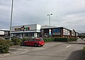 Festival Park, Toys R Us - geograph.org.uk - 5139768.jpg 3.169 × 2.249; 1,5 MB
-
 Former Buller's Works, Hanley - geograph.org.uk - 4435765.jpg 640 × 427; 94 KB
-

-
 Former Burtons store Hanley Stoke-on-Trent.jpg 2.663 × 2.720; 1,11 MB
-
 Former Hanley Shopping Centre - geograph.org.uk - 2252745.jpg 1.983 × 1.486; 389 KB
-
 Former Meat Market - geograph.org.uk - 5614162.jpg 1.600 × 1.200; 367 KB
-
 Former Odeon Cinema Hanley Stoke-on-Trent.jpg 3.146 × 2.614; 1,5 MB
-
 Former shopping centre - geograph.org.uk - 2252733.jpg 2.012 × 1.509; 475 KB
-
-
 Former Smithfield pottery, Hanley - geograph.org.uk - 1992617.jpg 640 × 427; 55 KB
-
 Fountain Square - geograph.org.uk - 4941357.jpg 640 × 480; 55 KB
-
 Garage on Leek Road - geograph.org.uk - 4068583.jpg 640 × 480; 51 KB
-
 George and Dragon near Joiner's Square, Stoke-on-Trent - geograph.org.uk - 6110333.jpg 1.024 × 1.024; 1,12 MB
-
 H S B C Bank, Hanley, Stoke-on-Trent - geograph.org.uk - 3157591.jpg 640 × 480; 82 KB
-
 Hanley - building dated 1901 on Foundry Street - geograph.org.uk - 3006947.jpg 1.600 × 1.200; 611 KB
-
 Hanley - Church of Sacred Heart - geograph.org.uk - 3006990.jpg 1.600 × 1.200; 627 KB
-
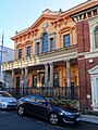
 Hanley - Coles House - geograph.org.uk - 3006982.jpg 1.200 × 1.600; 647 KB
-
 Hanley - former Bethesda School - geograph.org.uk - 3006963.jpg 1.600 × 1.194; 599 KB
-
 Hanley - former Mineworkers Union offices - geograph.org.uk - 3006979.jpg 1.600 × 1.200; 562 KB
-
 Hanley - former water board offices - geograph.org.uk - 3006969.jpg 640 × 492; 110 KB
-
 Hanley - Head Post Office - geograph.org.uk - 2514232.jpg 1.600 × 1.216; 503 KB
-
 Hanley - houses on Regent Road - geograph.org.uk - 3006996.jpg 1.600 × 1.223; 651 KB
-
 Hanley - No 1 Bethesda Street - geograph.org.uk - 3006971.jpg 1.600 × 1.219; 605 KB
-
 Hanley - service road off Jasper Street - geograph.org.uk - 3006993.jpg 1.600 × 1.179; 632 KB
-
 Hanley - shops on Piccadilly - geograph.org.uk - 3006954.jpg 1.600 × 1.200; 685 KB
-
 Hanley - signmakers on Jasper Street - geograph.org.uk - 3006986.jpg 1.600 × 1.185; 718 KB
-
 Hanley - Telephone Building - geograph.org.uk - 3000981.jpg 1.293 × 1.600; 660 KB
-
 Hanley - Victoria Hall - geograph.org.uk - 3000986.jpg 1.154 × 1.600; 583 KB
-
 Hanley - Webberleys Bookshop - geograph.org.uk - 2514228.jpg 1.154 × 1.600; 565 KB
-
 Hanley Bus Station - geograph.org.uk - 5706483.jpg 640 × 480; 62 KB
-
 Hanley Bus Station, Victoria Roundabout, Stoke-on-Trent - geograph.org.uk - 5588415.jpg 3.776 × 2.520; 3,68 MB
-
 Hanley fire station - geograph.org.uk - 266823.jpg 640 × 427; 172 KB
-
 Hanley Flats, Stoke-on-Trent - geograph.org.uk - 4615545.jpg 640 × 428; 71 KB
-
 Hanley High School.jpg 552 × 420; 112 KB
-
 Hanley skyline in Stoke-on-Trent - geograph.org.uk - 6364167.jpg 1.600 × 900; 1,23 MB
-
 Hanley skyline in Stoke-on-Trent - geograph.org.uk - 6364190.jpg 1.440 × 960; 1,24 MB
-
 Hanley, car park off Marsh Street North - geograph.org.uk - 4444580.jpg 3.008 × 2.000; 1,88 MB
-
 Hanley, Century Street - geograph.org.uk - 5142760.jpg 3.264 × 2.448; 2,11 MB
-
 Hanley, Cooper Street - geograph.org.uk - 5183715.jpg 4.896 × 3.672; 6,76 MB
-
 Hanley, Cooper Street - geograph.org.uk - 5183878.jpg 4.896 × 3.672; 6,79 MB
-
 Hanley, Faithways Chapel, Lower Foundry Street - geograph.org.uk - 4444799.jpg 3.008 × 2.000; 1,93 MB
-
 Hanley, former car dealership - geograph.org.uk - 5143780.jpg 4.681 × 2.892; 2,78 MB
-
 Hanley, former telephone exchange - geograph.org.uk - 4440431.jpg 2.862 × 2.407; 1,47 MB
-
 Hanley, furniture store on Clough Street - geograph.org.uk - 4440466.jpg 3.264 × 2.448; 1,71 MB
-
 Hanley, Genting Club - geograph.org.uk - 4444538.jpg 2.769 × 1.700; 822 KB
-
 Hanley, GO Outdoors - geograph.org.uk - 4444787.jpg 3.008 × 2.000; 2,06 MB
-
 Hanley, Horton's Stores on the corner of Denbigh Street - geograph.org.uk - 5143773.jpg 3.264 × 2.301; 2,21 MB
-
 Hanley, One Smithfield offices - geograph.org.uk - 5219692.jpg 5.184 × 2.920; 5,65 MB
-
 Hanley, Premier Inn on A5008 - geograph.org.uk - 4441864.jpg 3.008 × 2.000; 1,94 MB
-
 Hanley, Quality Hotel - geograph.org.uk - 4441475.jpg 3.147 × 2.360; 1,86 MB
-

-
 Hanley, roadworks at foot of Clough Street - geograph.org.uk - 4440475.jpg 3.264 × 2.448; 2,51 MB
-
 Hanley, Smithfield development - geograph.org.uk - 4441510.jpg 3.264 × 2.448; 2,33 MB
-
 Hanley, Smithfield development - geograph.org.uk - 4441541.jpg 3.264 × 2.448; 2,28 MB
-
 Hanley, Star Hotel - geograph.org.uk - 4444592.jpg 3.008 × 2.000; 1,92 MB
-
 Hanley, statue on Bethesda Street - geograph.org.uk - 3179384.jpg 3.648 × 2.736; 4,58 MB
-
 Hanley, store on corner of Century Street and A53 - geograph.org.uk - 5143829.jpg 4.896 × 3.672; 3,29 MB
-
 Hanley, Storey Carpets - geograph.org.uk - 4444524.jpg 2.911 × 1.560; 1,15 MB
-
 Hanley, Stratstone - geograph.org.uk - 5183847.jpg 4.896 × 3.672; 6,16 MB
-
 Hanley, Telecom House - geograph.org.uk - 4441487.jpg 2.800 × 2.112; 1,78 MB
-
 Hanley, Tesco Extra - geograph.org.uk - 4441494.jpg 3.264 × 1.810; 1,41 MB
-
 Hanley, Trinity Street - geograph.org.uk - 4444557.jpg 2.734 × 1.893; 1,75 MB
-
 Hanley, waste ground off Clough Street - geograph.org.uk - 4441577.jpg 3.264 × 2.448; 2,35 MB
-
 Hanley, Weaver Street - geograph.org.uk - 4444793.jpg 3.008 × 2.000; 1,93 MB


.JPG)
.JPG)


_-_geograph.org.uk_-_4337952.jpg)
_-_geograph.org.uk_-_4337960.jpg)


_-_geograph.org.uk_-_4695324.jpg)


,_Hanley_-_geograph.org.uk_-_4435771.jpg)


_-_geograph.org.uk_-_4578273.jpg)
_-_geograph.org.uk_-_4578275.jpg)

_-_geograph.org.uk_-_4339707.jpg)


,_Hanley_-_geograph.org.uk_-_5108469.jpg)


_-_geograph.org.uk_-_5143878.jpg)


