Category:Hawke's Bay Region
Hopp til navigering
Hopp til søk
Regions of New Zealand: Auckland · Bay of Plenty · Canterbury · Gisborne · Hawke's Bay · Manawatu-Whanganui · Marlborough · Nelson · Otago · Northland · Southland · Taranaki · Tasman · Waikato · Wellington · West Coast
Outlying islands, territories and dependencies: Antipodes Islands · Auckland Islands · Bounty Islands · Chatham Islands · Kermadec Islands · Snares Islands · Three Kings Islands · Tokelau – Territory with specific status: Ross Dependency
Associated countries: Cook Islands · Niue
Outlying islands, territories and dependencies: Antipodes Islands · Auckland Islands · Bounty Islands · Chatham Islands · Kermadec Islands · Snares Islands · Three Kings Islands · Tokelau – Territory with specific status: Ross Dependency
Associated countries: Cook Islands · Niue
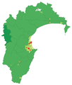
region on the east coast of New Zealand's North Island   | |||||
| Last opp mediefiler | |||||
| Forekomst av | |||||
|---|---|---|---|---|---|
| Oppkalt etter | |||||
| Plassering | New Zealand | ||||
| Hovedstad | |||||
| Betydningsfull hendelse |
| ||||
| Folketall |
| ||||
| Areal |
| ||||
 | |||||
Underkategorier
Denne kategorien har følgende 28 underkategorier, av totalt 28.
- Satellite pictures of the Hawke's Bay Region (47 filer)
*
1
B
C
D
F
- Flora of Hawke's Bay Region (8 filer)
G
H
- Hawke's Bay Airport (6 filer)
M
- Mohaka Viaduct (11 filer)
N
P
S
- State Highway 52 (New Zealand) (5 filer)
T
- Tangoio (11 filer)
W
Filer i kategorien «Hawke's Bay Region»
Følgende 61 filer er i denne kategorien, av totalt 61.
-
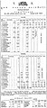 1887 timetable.jpg 700 × 1 609; 386 KB
-
 22 March 1887 Napier Section timetable.jpg 700 × 1 662; 387 KB
-
 500px photo (26768337).jpeg 1 306 × 979; 184 KB
-

-
 Bare Island1 800x600.jpg 800 × 600; 121 KB
-
 Bridge at Esk Valley Napier 2023.jpg 5 568 × 3 712; 15,62 MB
-
 Equalized Hawkes Bay NZ.jpg 1 024 × 683; 299 KB
-
 Flat Rock Beach, New Zealand 05.JPG 5 184 × 3 097; 5,97 MB
-
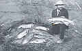 FMIB 34978 Catch of Trout, Hawke's Bay District.jpeg 848 × 532; 98 KB
-
 FMIB 34981 Catch of Trout, Hawke's Bay District.jpeg 905 × 673; 181 KB
-
 Hawke's Bay Crown Lands Sale Act 1870.pdf 1 150×1 889, 2 sider; 97 KB
-
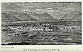
 Hawke's Bay region view.jpg 720 × 540; 73 KB
-
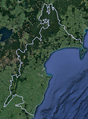
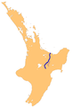
 Hawke's Bay within North Island 2023.png 784 × 918; 101 KB
-
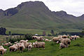
 Hawke's Bay, Sheep Station.jpg 900 × 688; 243 KB
-
 Hawkes bay cropped.png 771 × 1 044; 1,21 MB
-
 HawkesBay02LB.jpg 1 600 × 1 200; 410 KB
-
 HawkesBay03LB.jpg 1 280 × 960; 488 KB
-
 HawkesBaymap00001.JPG 1 600 × 1 280; 563 KB
-
 HawkesBayRegionPopulationDensity.png 1 061 × 1 250; 113 KB
-
 HB Vineyard autumn.JPG 2 816 × 1 880; 2,08 MB
-
 HNHS-Logo@2x-e1441425088722.png 208 × 191; 15 KB
-
 Limestone bluffs in Boundary Stream Scenic Reserve.jpg 1 024 × 768; 312 KB
-
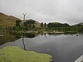
 Lower pond in Trellinoe Gardens.jpg 1 024 × 768; 352 KB
-
 Matahorua Viaduct.jpg 1 840 × 1 312; 960 KB
-
 Maungaturanga Viaduct.jpg 1 815 × 2 775; 2,77 MB
-
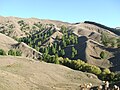
 More of a do-a-up-a - panoramio.jpg 2 816 × 1 880; 2,12 MB
-
 Māhia Peninsula Panorama.jpg 5 000 × 768; 1,24 MB
-
 NH90 flying over Aropaoanui 2023.jpg 5 568 × 3 712; 545 KB
-
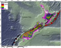 NZ faults Napier Fault.png 760 × 600; 703 KB
-
 NZ-Māhia P.png 405 × 590; 114 KB
-
 NZ-Rangitaiki R.png 1 003 × 1 457; 228 KB
-
 Omaruhakeke pa, upper wairoa.jpg 1 260 × 831; 342 KB
-
 Omarunui hawkes bay.jpg 1 875 × 1 183; 658 KB
-
 Pekapeka Swamp 12.JPG 3 968 × 2 976; 2,8 MB
-
 Pekapeka Swamp 13.JPG 3 968 × 2 976; 3,14 MB
-
 Pekapeka Swamp 14.JPG 3 968 × 2 976; 2,53 MB
-
 Position of Hawkes Bay.png 405 × 590; 7 KB
-
 Pourerere (57247730).jpeg 2 048 × 1 365; 270 KB
-
 Pukeora1.JPG 814 × 545; 82 KB
-
 Pukeora4.JPG 717 × 480; 81 KB
-
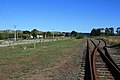 Raupunga crossing loop and old water tower - panoramio.jpg 3 888 × 2 592; 4,43 MB
-
 St Francis, Te Awanga.JPG 4 203 × 2 804; 8,63 MB
-
 Steel Reinforced Skylike (142161059).jpeg 1 936 × 1 936; 933 KB
-
 Summer in Hawkes Bay1.jpg 2 848 × 2 136; 2,87 MB
-
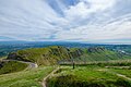 Te Mata Peak (204548379).jpeg 2 048 × 1 365; 879 KB
-
 Te Mata Peak from Tuki Tuki Road, Hawkes Bay, New Zealand, 22 November 2005 (65884464).jpg 3 264 × 2 176; 3,95 MB
-
 Transporting harvested Kiwifruits at Hawke's Bay 2008-03-15.jpg 2 592 × 1 944; 863 KB
-
 Trellinoe Gardens.jpg 1 024 × 768; 317 KB
-
 Tunnel 5.jpg 1 379 × 744; 200 KB
-
 Unequalized Hawkes Bay NZ.jpg 1 024 × 683; 108 KB
-
 View from Bridge of Reflection in Trellinoe Gardens.jpg 1 024 × 768; 321 KB
-
 View from route to the Mangaone caves.jpg 1 024 × 768; 326 KB
-
 View northwest from Te Mata Peak.jpg 1 024 × 768; 290 KB
-
 Vineyard Outside Te Awanga.jpg 2 048 × 1 536; 817 KB
-
 Waikari Viaduct construction.jpg 817 × 592; 213 KB
-
 Waikari Viaduct.jpg 2 281 × 1 473; 1,76 MB
-
 Waikoau Viaduct.jpg 1 181 × 998; 571 KB
-
 Waimarama.jpg 3 072 × 2 304; 1,38 MB
-
 Waipatiki Reserve 01.jpg 2 048 × 1 536; 399 KB
-
 WaitahoraWindFarm.jpg 1 600 × 780; 112 KB
-
 White House Te Mata.jpg 500 × 333; 183 KB


.jpeg)


.jpeg)


.jpeg)

.jpeg)
.jpg)


