Category:Hoensbroek
Aller à la navigation
Aller à la recherche
localité des Pays-Bas    | |||||
| Téléverser des médias | |||||
| Nature de l’élément | |||||
|---|---|---|---|---|---|
| Lieu | |||||
| Population |
| ||||
 | |||||
Sous-catégories
Cette catégorie comprend 20 sous-catégories, dont les 20 ci-dessous.
B
- BC Victoria (5 F)
- Broekmolen (Heerlen) (5 F)
C
E
F
- FC Hoensbroek (1 F)
J
K
- Kathagermolen (7 F)
- Kouvenderstraat (Heerlen) (3 F)
L
- LOMA-huis, Hoensbroek (2 F)
N
- Nieuwenhofstraat (Heerlen) (5 F)
S
- Sint-Janskerk (Hoensbroek) (151 F)
- Staatsmijn Emma (63 F)
- Station Hoensbroek (5 F)
T
- Terschuren (Hoensbroek) (12 F)
W
- Wijngaardsweg 121, Hoensbroek (46 F)
Média dans la catégorie « Hoensbroek »
Cette catégorie comprend 34 fichiers, dont les 34 ci-dessous.
-
 2016 Hoensbroek, Maria Gewanden, vm kerk Zandbergsweg 01.jpg 2 500 × 1 581 ; 2,13 Mio
-
 2016 Hoensbroek, Maria Gewanden, vm kerk Zandbergsweg 02.jpg 2 500 × 1 684 ; 1,96 Mio
-
 2016 Hoensbroek, Wingerdweg volkstuinen.jpg 2 500 × 1 797 ; 2,41 Mio
-
 2016 Hoensbroek, Wingerdweg-Damiaanstraat.jpg 2 500 × 1 694 ; 2,13 Mio
-
 2016 Hoensbroek, Wingerdweg.jpg 2 500 × 1 660 ; 1,84 Mio
-
 209 - Schinnen - levels.jpg 21 577 × 13 563 ; 54,34 Mio
-
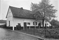
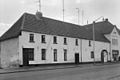
 Achtergevel - Hoensbroek - 20404149 - RCE.jpg 1 200 × 955 ; 310 kio
-
 Achterzijde - Hoensbroek - 20404144 - RCE.jpg 1 200 × 950 ; 311 kio
-
 Alburnus alburnus cropped.jpg 1 875 × 787 ; 511 kio
-
 Flag of Hoensbroek.svg 450 × 300 ; 709 octet
-
 Het huis van de roofmoord in Hoensbroek, SFA022818802.jpg 3 542 × 2 492 ; 1,24 Mio
-
 Hoensbroek (Nederland) Staking in het mijngebied, SFA006011665.jpg 2 844 × 1 862 ; 1,76 Mio
-
 Hoensbroek - voormalig gemeentehuis.jpg 5 152 × 3 864 ; 4,57 Mio
-
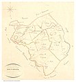 Hoensbroek1823.jpg 5 912 × 6 400 ; 5,96 Mio
-
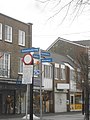 Hoofdstraat Hoensbroek - panoramio.jpg 3 000 × 4 000 ; 4,16 Mio
-
 IJs op de vijver Hoensbroek winter 2010 - panoramio.jpg 3 072 × 2 048 ; 2,72 Mio
-
 Locomotief bij Staatsmijn Emma 1955.jpg 4 654 × 3 520 ; 7,66 Mio
-
 Miskelk - Hoensbroek - 20404289 - RCE.jpg 957 × 1 200 ; 184 kio
-
 Overzicht - Hoensbroek - 20403045 - RCE.jpg 805 × 1 200 ; 212 kio
-
 Overzicht - Hoensbroek - 20403046 - RCE.jpg 1 200 × 809 ; 231 kio
-
 Overzicht - Hoensbroek - 20403047 - RCE.jpg 1 200 × 799 ; 175 kio
-
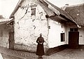
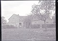 Overzicht van de voorgevel met bewoners in de deuropening - Koumen - 20450534 - RCE.jpg 1 200 × 844 ; 260 kio
-
 Rieksweeg76.jpg 2 048 × 1 536 ; 1,42 Mio
-
 Schacht3 emma emmastaete.jpg 584 × 438 ; 67 kio
-
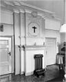
 Schouw in achterkamer - Hoensbroek - 20404147 - RCE.jpg 943 × 1 200 ; 172 kio
-
 Schouw in voorkamer - Hoensbroek - 20404148 - RCE.jpg 957 × 1 200 ; 196 kio
-
 SjtatieGebrook.jpg 2 048 × 1 536 ; 933 kio
-
 Sportcomplex In de Biessen Hoensbroek.jpg 5 345 × 3 563 ; 5,67 Mio
-
 Staatsmijnemma.jpg 1 600 × 1 200 ; 272 kio
-
 Vijver Hoensbroek winter 2010 - panoramio (1).jpg 3 072 × 2 048 ; 2,53 Mio
-
 Vijver Hoensbroek winter 2010 - panoramio (2).jpg 3 072 × 2 048 ; 2,51 Mio
-
 Vijver Hoensbroek winter 2010 - panoramio.jpg 3 072 × 2 048 ; 2,67 Mio
-
 Voorzijde (noordgevel) - Hoensbroek - 20404145 - RCE.jpg 1 200 × 951 ; 247 kio
-
 Winter 2009 - panoramio (15).jpg 2 048 × 1 536 ; 755 kio


_Staking_in_het_mijngebied,_SFA006011665.jpg)


.jpg)
.jpg)

_-_Hoensbroek_-_20404145_-_RCE.jpg)
.jpg)