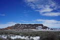
Category:Hopi Buttes volcanic field
Jump to navigation
Jump to search
- Hopi Buttes volcanic field — in Navajo County, northeastern Arizona.
Monogenetic volcanic field in Arizona | |||||
| Upload media | |||||
| Instance of | |||||
|---|---|---|---|---|---|
| Location | Arizona | ||||
 | |||||
Subcategories
This category has the following 5 subcategories, out of 5 total.
M
T
Media in category "Hopi Buttes volcanic field"
The following 11 files are in this category, out of 11 total.
-
 Bidahochi Butte, February 2019.jpg 6,000 × 4,000; 15.25 MB
-
 Flying Butte Hopi Buttes AZ.jpg 910 × 624; 99 KB
-
 Geologic map of Sanders quadrangle northern Arizona.jpg 6,042 × 11,567; 6.35 MB
-
 Gorilla Butte, February 2019.jpg 6,000 × 4,000; 13.69 MB
-
 Hopi Buttes eastern Arizona Topo Rainbow Zebra 1326.png 2,473 × 2,028; 4.17 MB
-
 Hopi Buttes from Homolovi II (3296676922).jpg 1,600 × 1,200; 927 KB
-
 Hopi Buttes from Homolovi Visitor Center (3296652600).jpg 1,600 × 1,200; 603 KB
-
 Nipple Butte, February 2019.jpg 6,000 × 4,000; 11.38 MB
-
 Pyramid Butte, February 2019.jpg 6,000 × 4,000; 16.09 MB
-
 Saddle Butte, February 2019.jpg 6,000 × 4,000; 16.75 MB
-
 Smith Butte Hopi Buttes AZ.jpg 693 × 367; 62 KB


.jpg)
.jpg)


