Category:Ice ages
Zur Navigation springen
Zur Suche springen
Deutsch: Eiszeit, Eiszeiten, Eiszeitalter
日本語: 氷河時代
Türkçe: Buz Devri
Zeitalter ausgedehnter Vergletscherungen  | |||||
| Medium hochladen | |||||
| Unterklasse von |
| ||||
|---|---|---|---|---|---|
| Aspekt von | |||||
| Besteht aus | |||||
| Verschieden von | |||||
| |||||
Unterkategorien
Es werden 25 von insgesamt 25 Unterkategorien in dieser Kategorie angezeigt:
In Klammern die Anzahl der enthaltenen Kategorien (K), Seiten (S), Dateien (D)
+
A
E
- Eiszeitstein Jena-Lobeda (1 D)
F
G
H
I
- Ice age pollen diagrams (73 D)
L
- Lake Duluth (7 D)
M
- Milankovitch cycles (1 S, 44 D)
N
P
Q
- Quaternary Ice Ages (4 D)
S
Medien in der Kategorie „Ice ages“
Folgende 127 Dateien sind in dieser Kategorie, von 127 insgesamt.
-
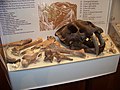
 Age of the mastodon - side looking at cases - 27 FEB 0222 copy.jpg 4.955 × 3.490; 13,02 MB
-
 Blue glacial clay IMG 5670 ersvika.JPG 2.592 × 3.888; 5,38 MB
-
 Blue glacial clay IMG 5671 ersvika.JPG 2.592 × 3.888; 5,5 MB
-
 Carbon 13 and time scale during the Ordovician.png 881 × 1.045; 244 KB
-
 Chronologie Würm fr.svg 3.000 × 700; 41 KB
-
 Climate.Indicators.0.5.MYr-1-ru.svg 733 × 648; 11 KB
-
 Climate.Indicators.0.5.MYr-1.jpg 952 × 839; 93 KB
-
 Cluster-of-erratics-on-Red-Mountain.JPG 923 × 1.155; 448 KB
-
 Col des Garcinets W.jpg 2.560 × 1.920; 981 KB
-
 Contmargin-interglacial hg.png 1.673 × 1.081; 842 KB
-
 Dalinghausen Endmoräne.jpg 1.536 × 1.024; 749 KB
-
 Diluvial bars in Central Altay Mountains July 2011 by Alexei Rudoy.jpg 2.778 × 2.086; 1,96 MB
-
 Display 2.jpg 1.944 × 2.592; 887 KB
-
 DO-heinrich.png 869 × 469; 12 KB
-
 Eaax4184.full.pdf 1.237 × 1.575, 11 Seiten; 736 KB
-
 Eiskratzer hg.jpg 4.032 × 3.024; 5,29 MB
-
 EiszeitSteinzeit1.png 1.264 × 2.056; 543 KB
-
 El Aculadero-(Puerto de Santa María-Cádiz).jpg 640 × 1.006; 135 KB
-
 Erratic greenland hg.jpg 2.560 × 1.920; 3,47 MB
-
 ETH-BIB-Eiszeit-Landdschaft-Dia 247-03306.tif 3.644 × 2.758; 28,85 MB
-
 ETH-BIB-Luzern zur Eiszeit, Gemälde von Hodel-Dia 247-12410.tif 3.656 × 2.468; 8,69 MB
-
 ETH-BIB-Mamut-Herde der Eiszeit-Dia 247-03313.tif 3.724 × 2.663; 28,46 MB
-
 Fjord bildning.png 1.000 × 540; 7 KB
-
 Fjord Entstehung.png 1.000 × 540; 8 KB
-
 Fjord genesis 0text.png 1.000 × 540; 4 KB
-
 Fjord genesis zh.png 1.000 × 540; 19 KB
-
 Fjord genesis.png 1.000 × 540; 7 KB
-
 Fjord no text.jpg 1.274 × 684; 414 KB
-
 Fjord some eng text.jpg 1.274 × 684; 427 KB
-
 Fjord sve text.jpg 1.274 × 684; 454 KB
-
 Geschiebe-heide hg.jpg 3.064 × 2.923; 1,07 MB
-
 Geschiebelehm hg.jpg 4.928 × 3.280; 2,99 MB
-
 GISP2D1837 crop portion.jpg 2.400 × 1.805; 2,69 MB
-
 Glacial effect hg.png 2.000 × 1.373; 1,64 MB
-
 Glacial-abrasion-ss-2006.jpg 800 × 600; 276 KB
-
 Greenland stadial 2.jpg 792 × 572; 152 KB
-
 Grip-ngrip-closeup.png 769 × 467; 10 KB
-
 Holm, Terminologie Eiszeit zweistufig.png 1.156 × 683; 188 KB
-
 Hornchurch Cutting SSSI.JPG 4.608 × 2.592; 4,96 MB
-
 Huneborg.PNG 520 × 746; 27 KB
-
 Ice Age Mammals display at the Burke Museum.jpg 4.608 × 3.072; 2,52 MB
-
 Ice Age Temperature de.png 564 × 377; 38 KB
-
 Ice Age Temperature-fi.png 582 × 389; 28 KB
-
 Ice Age Temperature.png 564 × 377; 44 KB
-
 Ice age water cycle.jpg 823 × 461; 41 KB
-
 Ice aged clay.jpg 2.560 × 1.920; 886 KB
-
 Iceage time 18kyr and 120yr.png 1.282 × 1.334; 52 KB
-
 Iceage time 18kyr.png 1.026 × 632; 27 KB
-
 Iceage time-slice hg.png 3.208 × 2.074; 150 KB
-
 IJstijden-nl.svg 829 × 75; 10 KB
-
 Inngang Helvete i Østerdalen.jpg 850 × 432; 65 KB
-
 Insolation at 65N late glacial holocene 1.svg 1.065 × 532; 46 KB
-
 Isostasy.jpg 501 × 753; 84 KB
-
 Isotopic stages hg.png 1.149 × 799; 109 KB
-
 Istider gjennom jordhistorien.jpg 543 × 470; 98 KB
-
 Klovsteinen.jpg 2.496 × 1.664; 1,14 MB
-
 Knutmannsteinen.jpg 2.496 × 1.664; 1,47 MB
-
 La Roche-Cotard Aurochs in Snow.jpg 1.280 × 720; 113 KB
-
 La Roche-Cotard Bear and Fox.jpg 1.280 × 720; 117 KB
-
 Lackprofil Elsbachtal GD.jpg 1.417 × 944; 911 KB
-
 Late glacial temperature curve bolling2.png 1.600 × 766; 329 KB
-
 Late glacial temperature curve1.jpg 1.600 × 766; 344 KB
-
 Lgm ngrip o18 1.jpg 2.200 × 1.062; 598 KB
-
 Maisières.png 522 × 780; 23 KB
-
 Mastodon-nd-heritage-center.jpg 870 × 1.044; 223 KB
-
 Mauna Kea glaciation.jpg 450 × 267; 34 KB
-
 Maunder Minimum and Little Ice Age.tif 690 × 780; 329 KB
-
 Middle weichselian oxygen isotope curve 1.gif 1.600 × 766; 196 KB
-
 MoraenenSchlossZeil2a.jpg 4.000 × 2.250; 2,67 MB
-
 Ngrip bolling allerod do18 1.png 1.275 × 944; 240 KB
-
 Ngrip lateglacial do18 1.png 640 × 480; 10 KB
-
 Ngrip20 yd pb 2.png 1.600 × 766; 207 KB
-
 Oesoedd yr Ia SVG.svg 848 × 189; 11 KB
-
 Osterseen and Isar-Vorlandgletscher Map.jpg 6.491 × 5.355; 24,95 MB
-
 Our ice age re-entry is assured during the 21st-century.jpg 960 × 522; 186 KB
-
 Pleisztocén hőmérsékletváltozások.PNG 564 × 377; 24 KB
-
 Porkkalanniemen silokallio 01.jpg 3.240 × 2.160; 7,79 MB
-
 Porkkalanniemen silokallio 02.jpg 3.240 × 2.160; 7,6 MB
-
 Porkkalanniemen silokallio 03.jpg 3.240 × 2.160; 7,13 MB
-
 Porkkalanniemen silokallio 04.jpg 3.240 × 2.160; 5,89 MB
-
 Porkkalanniemi rocks 03.jpg 3.264 × 2.448; 4,83 MB
-
 Preservated soil profile from Elsbachtal near Garzweiler.jpg 14.173 × 9.439; 40,1 MB
-
 Proxy-based temperature reconstruction(500AD~2000AD).png 720 × 237; 19 KB
-
 PSM V45 D203 Split rock near mouth of woolperts creek ky.jpg 1.484 × 1.126; 546 KB
-
 PSM V48 D170 Original condition of the pit.jpg 1.663 × 1.491; 496 KB
-
 PSM V48 D171 General view of the abandoned gravel pit.jpg 1.673 × 1.362; 496 KB
-
 PSM V48 D176 Views of sharpened stone implement.jpg 1.457 × 693; 125 KB
-
 PSM V56 D0082 Glacial map of the great lakes region caption.png 1.539 × 414; 54 KB
-
 Regions Bank Nashville Display.jpg 2.592 × 1.944; 841 KB
-
 Roihuvuoren-kallio1.JPG 800 × 600; 155 KB
-
 Roihuvuoren-kallio10.JPG 800 × 600; 168 KB
-
 Roihuvuoren-kallio11.JPG 800 × 600; 157 KB
-
 Roihuvuoren-kallio13.JPG 800 × 600; 165 KB
-
 Roihuvuoren-kallio3.JPG 800 × 600; 163 KB
-
 Roihuvuoren-kallio4.JPG 800 × 600; 166 KB
-
 Roihuvuoren-kallio5.JPG 600 × 800; 127 KB
-
 Roihuvuoren-kallio6.JPG 800 × 600; 181 KB
-
 Roihuvuoren-kallio7.JPG 800 × 600; 153 KB
-
 Scandinavia glacial hg.jpg 2.538 × 1.862; 937 KB
-
 SchnittUTal.jpg 800 × 600; 53 KB
-
 Silokallio Pappilanniemi Lappeenranta.jpg 3.519 × 1.897; 2,92 MB
-
 Skull of Cave Bear, Pestera Rece.jpg 394 × 275; 150 KB
-
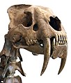 Smilodon head.jpg 960 × 1.126; 567 KB
-
 Spuren der letzten Eiszeit.jpg 1.500 × 1.000; 1,3 MB
-
 St Andrew's Church Hornchurch.JPG 4.608 × 2.592; 3,22 MB
-
 Temperature difference 400kyr.png 1.301 × 285; 29 KB
-
 Temperature variation 800kyr.png 676 × 252; 33 KB
-
 Temperatures âge glaciaire.png 564 × 377; 44 KB
-
 Terra-Amata-Hut.gif 1.125 × 804; 40 KB
-
 The ice age started millennia ago.jpg 986 × 534; 193 KB
-
 The Lower Huronian Ice Age.pdf 975 × 1.404, 10 Seiten; 1,43 MB
-
 The slowest start to an ice age in 2 million years.jpg 967 × 526; 161 KB
-
 Timeframes of Different Volcanic Cooling Mechanisms.png 1.500 × 450; 40 KB
-
 Tutaj paleotempoj.png 1.754 × 566; 116 KB
-
 U-shaped valley eng text.jpg 1.088 × 684; 275 KB
-
 U-shaped valley no text.jpg 1.088 × 684; 269 KB
-
 U-shaped valley sve text.jpg 1.088 × 684; 273 KB
-
-
-
 Vashon Glaciation Mockup 2016-06-26.png 6.346 × 4.977; 40,58 MB
-
 Volcanic winter of 536, 1258, 1453, 1816.png 3.600 × 2.400; 302 KB
-
 Wallula-Gap-the-sisters.JPG 1.339 × 1.786; 716 KB
-
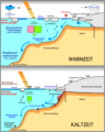 Warm-kaltzeit hg.png 786 × 979; 173 KB
-
Wie das letzte Eiszeitalter begann CC BY 4.0 Terra X plus.webm 2 min 34 s, 1.920 × 1.080; 63,28 MB
-
 Wurzacher-Ried Riss-Wuerm-Glaziale.jpg 1.200 × 800; 231 KB
-
 Younger Dryas temperature variation.png 1.026 × 632; 27 KB
-
 Younger Dryas-Preboreal boundary on Ngrip 50 dataset.png 1.527 × 797; 310 KB


.jpg)


.png)