Category:Interstate 40 in Texas
Jump to navigation
Jump to search
section of Interstate Highway in Texas, United States  .svg) .png) | |||||
| Upload media | |||||
| Instance of | |||||
|---|---|---|---|---|---|
| Location |
| ||||
| Transport network | |||||
| Owned by |
| ||||
| Maintained by |
| ||||
| Inception |
| ||||
| Length |
| ||||
| Terminus | |||||
| Partially coincident with |
| ||||
 | |||||
English: Media related to Interstate 40 in Texas (I-40), a 177.139-mile (285.078 km) section of Interstate Highway in Texas, United States, that connects I-40 in New Mexico with I-40 in Oklahoma
Subcategories
This category has the following 4 subcategories, out of 4 total.
B
Media in category "Interstate 40 in Texas"
The following 10 files are in this category, out of 10 total.
-
 I-40 (TX).svg 601 × 601; 16 KB
-

-

-
 At Grade Intersection on I-40 in Texas.jpg 3,264 × 2,448; 2.92 MB
-
 DOW im Heckfenster, Texas Panhandle II.jpg 3,888 × 2,592; 1.88 MB
-
 Glenrio-topographic-map.png 1,013 × 805; 732 KB
-
 I-40 (TX) Metric.svg 601 × 601; 16 KB
-
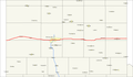 Interstate 40 map (Texas).png 1,688 × 984; 26 KB
-
 Land of Enchantment, NM, USA (50139336238).jpg 2,542 × 2,542; 4.88 MB
-
 Leaning Tower of Britten seen from Interstate 40.jpg 1,212 × 1,635; 258 KB


_Metric.svg)
.jpg)
