Category:Interstate 91 in Massachusetts
Jump to navigation
Jump to search
section of Interstate Highway Hampden, Hampshire, and Franklin counties in Massachusetts, United State .jpg)  | |||||
| Upload media | |||||
| Instance of | |||||
|---|---|---|---|---|---|
| Part of | |||||
| Location |
| ||||
| Transport network | |||||
| Owned by | |||||
| Maintained by | |||||
| Length |
| ||||
| |||||
English: Media related to Interstate 91 in Massachusetts, a 54.90-mile (88.35 km) section of Interstate Highway in Hampden, Hampshire, and Franklin counties in Massachusetts, United States.
Subcategories
This category has the following 2 subcategories, out of 2 total.
2
3
Media in category "Interstate 91 in Massachusetts"
The following 36 files are in this category, out of 36 total.
-
 AT^T Cell Tower - panoramio.jpg 1,920 × 2,560; 1.55 MB
-
 ChicopeeMA I91 CTRiverBridge.jpg 1,024 × 680; 346 KB
-
 I-91 North - Entering Massachusetts Sign (30174112418).jpg 2,400 × 1,600; 1.96 MB
-
 I-91 North - Exit 110 - MA116 (30174141008).jpg 2,400 × 1,600; 1.82 MB
-
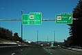
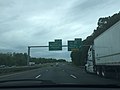
 I-91 North - Exit 12 - Interstate 391 North (30174146088).jpg 2,400 × 1,600; 1.75 MB
-
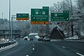
 I-91 North - Exit 14 - I-90 One Mile (44042033971).jpg 2,400 × 1,600; 1.64 MB
-
 I-91 North - Exit 16 - US202 (29105112897).jpg 2,400 × 1,600; 1.55 MB
-
 I-91 North - Exit 17AB - MA141 (44042034621).jpg 2,400 × 1,600; 1.42 MB
-
 I-91 North - Exit 18 - US5 Northampton (44042040691).jpg 2,400 × 1,600; 1.52 MB
-
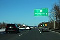
 I-91 North - Exit 19 - MA9 (42233040720).jpg 2,400 × 1,600; 2 MB
-
 I-91 North - Exit 2 - MA83 South (30174114748).jpg 2,400 × 1,600; 2.17 MB
-
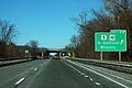 I-91 North - Exit 22 - US5 MA10 (44042043801).jpg 2,400 × 1,600; 2.16 MB
-
 I-91 North - Exit 24 - US5 MA10 Deerfield (42233042500).jpg 2,400 × 1,600; 1.79 MB
-
 I-91 North - Exit 26 - MA2 MA2A (42233045920).jpg 2,400 × 1,600; 1.73 MB
-
 I-91 North - Exit 27 - MA2 (42233047890).jpg 2,400 × 1,600; 2.29 MB
-
 I-91 North - Exit 28AB - MA10 (42233048570).jpg 2,400 × 1,600; 1.92 MB
-
 I-91 North - Exit 5 - Broad Main Street - Half Mile (43323381464).jpg 2,400 × 1,600; 1.75 MB
-
 I-91 North - Exit 8 Ramp - US20 (30174139828).jpg 2,400 × 1,600; 1.61 MB
-
 I-91 North - Exit12 - Interstate 391 North Lanes (44042033141).jpg 2,400 × 1,600; 1.77 MB
-
 I-91 North - Massachusetts Welcomes You Sign (30174113078).jpg 2,400 × 1,600; 1.78 MB
-
 I-91 North - MM13 - Blizzard Expected VMS (43993605792).jpg 2,400 × 1,600; 1.81 MB
-
 I-91 North - MM2 - Entering Springfield (30174113838).jpg 2,400 × 1,600; 1.95 MB
-
 I-91 North - Northampton Exits - US5 MA9 MA10 (42233037750).jpg 2,400 × 1,600; 2.3 MB
-
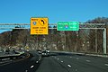 I-91 North - Sharp Left Curve - Use Holyoke I-391 Day (30174141858).jpg 2,400 × 1,600; 2.07 MB
-
 I-91 North Exit - Springfield (30174122028).jpg 2,400 × 1,600; 1.72 MB
-
 I-91 North Exit9 - US 20 + MA 20A (36312796504).jpg 2,400 × 1,600; 1.48 MB
-
 I-91 North MA2 East Signs (42233046920).jpg 2,400 × 1,600; 2.07 MB
-
 I-91 North Sign - Near Exit 22 (42233043570).jpg 2,400 × 1,600; 1.95 MB
-
 I-91 North Springfield - South Bear Left - Paddle Signs (43323387064).jpg 1,600 × 2,400; 1.6 MB
-

-
 I-91 underpass, Manhan Rail Trail, Mount Tom MA.jpg 4,032 × 3,024; 4.53 MB
-
 I-91 US5 North Signs - MM2 (30174118908).jpg 2,400 × 1,600; 2.25 MB
-
 I91N MA 14.jpg 3,264 × 2,448; 1.52 MB
-
 Keep Mass Clean on I-91 Rest Stop (44042039221).jpg 1,600 × 2,400; 1.6 MB
-
 Mount Tom Ski Area, USGS Aerial Frame, April 27, 2002.jpg 4,111 × 4,672; 9.03 MB
-
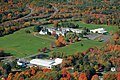 Stoneleigh-Burnham School campus aerial.jpg 500 × 335; 120 KB


.jpg)
.jpg)
.jpg)
.jpg)
.jpg)
.jpg)
.jpg)
.jpg)
.jpg)
.jpg)
.jpg)
.jpg)
.jpg)
.jpg)
.jpg)
.jpg)
.jpg)
.jpg)
.jpg)
.jpg)
.jpg)
.jpg)
.jpg)
.jpg)
.jpg)
.jpg)


.jpg)

.jpg)

