Category:Interstate 91 in Vermont
Jump to navigation
Jump to search
section of Interstate Highway in Vermont, United States .jpg)  | |||||
| Upload media | |||||
| Instance of | |||||
|---|---|---|---|---|---|
| Location | Vermont | ||||
| Transport network |
| ||||
| Owned by | |||||
| Maintained by | |||||
| Length |
| ||||
| |||||
English: Media related to Interstate 91 in Vermont, a 177.43-mile (285.55 km) section of Interstate Highway in Vermont, United States.
Subcategories
This category has only the following subcategory.
Media in category "Interstate 91 in Vermont"
The following 20 files are in this category, out of 20 total.
-
 America's Highways 1776–1976 - page 471.jpg 1,171 × 2,984; 2.65 MB
-
 Flughöhe, ~11800 mNN - panoramio - Johannes Geiger.jpg 1,200 × 1,600; 178 KB
-
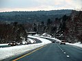
 Highway View, Barnet, VT - panoramio.jpg 4,288 × 2,848; 7.21 MB
-
 I-91 (VT 1957).svg 600 × 600; 16 KB
-
 I-91 in Westminster, VT at sunset.JPG 4,320 × 3,240; 3.33 MB
-
 I-91 in Wheelock VT.jpg 2,622 × 1,749; 1.74 MB
-
 I-91 North - Vermont State Line (42233049360).jpg 2,400 × 1,600; 2.01 MB
-
 I-91 North VT - Construction Two Lane Section (42233053690).jpg 2,400 × 1,600; 1.63 MB
-
 I-91 North VT - Exit 1 - US5 Brattleboro (42233051430).jpg 2,400 × 1,600; 1.67 MB
-
 I-91 North VT - Exit 2 - VT9 West (42233052640).jpg 2,400 × 1,600; 1.8 MB
-
 I-91 North VT - Exit 3 - US5 VT9 East (29105129377).jpg 2,400 × 1,600; 1.97 MB
-
 I-91 North VT - Moose Crossing Sign (42233050540).jpg 2,400 × 1,600; 2.13 MB
-
 I-91 Vermont.svg 601 × 601; 18 KB
-
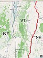 I-91 VT map.jpg 768 × 1,024; 184 KB
-
 I-91-Vermont.JPG 1,536 × 1,024; 325 KB
-
 I91 rockingham vt 20081220.jpg 640 × 480; 46 KB
-
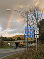 Rainbow Vermont Route 5 Lyndonville VT September 2021.jpg 642 × 856; 180 KB
-
 Toonerville Rail Trail, I-91 underpass, Springfield VT.jpg 4,032 × 3,024; 5.74 MB
-
 Vail Drive Lyndonville VT April 2019.jpg 1,152 × 864; 150 KB
-
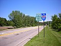 VT 191 southbound towards I-91.jpg 1,024 × 768; 181 KB


.svg)


.jpg)
.jpg)
.jpg)
.jpg)
.jpg)


