Category:Islands of California
Jump to navigation
Jump to search
States of the United States: Alabama · Alaska · Arizona · Arkansas · California · Colorado · Connecticut · Florida · Georgia · Hawaii · Idaho · Illinois · Indiana · Louisiana · Maine · Maryland · Massachusetts · Michigan · Minnesota · Mississippi · Missouri · Montana · Nebraska · Nevada · New Hampshire · New Jersey · New York · North Carolina · Ohio · Oregon · Pennsylvania · Rhode Island · South Carolina · South Dakota · Tennessee · Texas · Utah · Vermont · Virginia · Washington · West Virginia · Wisconsin · Wyoming – District of Columbia: Washington, D.C.
American Samoa · Northern Mariana Islands · Puerto Rico · United States Virgin Islands – United States Minor Outlying Islands
American Samoa · Northern Mariana Islands · Puerto Rico · United States Virgin Islands – United States Minor Outlying Islands
Wikimedia category | |||||
| Upload media | |||||
| Instance of | |||||
|---|---|---|---|---|---|
| Category combines topics | |||||
| California | |||||
state of the United States of America | |||||
| Pronunciation audio | |||||
| Instance of |
| ||||
| Part of | |||||
| Named after |
| ||||
| Location | Pacific States Region | ||||
| Located in or next to body of water | |||||
| Capital |
| ||||
| Legislative body | |||||
| Executive body | |||||
| Highest judicial authority | |||||
| Official language | |||||
| Anthem | |||||
| Head of government |
| ||||
| Inception |
| ||||
| Highest point | |||||
| Population |
| ||||
| Area |
| ||||
| Elevation above sea level |
| ||||
| Replaces |
| ||||
| Different from | |||||
| Said to be the same as | Golden State | ||||
| Maximum temperature record |
| ||||
| Minimum temperature record |
| ||||
| official website | |||||
 | |||||
Subcategories
This category has the following 36 subcategories, out of 36 total.
*
A
- Ano Nuevo light station (7 F)
- Arched Rock (5 F)
B
- Bethel Island (7 F)
- Bouldin Island (3 F)
- Bradford Island (11 F)
- Brewer Island (8 F)
- Brooks Island (34 F)
C
F
- Forbes Island (10 F)
G
- Grizzly Island (6 F)
H
I
J
- Joice Island (3 F)
M
- Marin Islands (2 F)
N
- Negit Island (1 P, 28 F)
P
- Paoha Island (24 F)
R
- Red Rock Island (4 F)
- Rincon Island, California (16 F)
S
- San Pedro Rock (7 F)
- Sherman Island (California) (15 F)
T
Media in category "Islands of California"
The following 180 files are in this category, out of 180 total.
-
2023 Family Category Entry 15- The Island (5faf3a76-3ccc-44cc-a262-cee5476d0919).jpg 5,184 × 3,888; 6.94 MB
-
A flock of sheeps roam at Holland Tract, California.JPG 3,456 × 2,304; 1.69 MB
-
Aerial view of Joice Island in California 1 cropped.jpg 2,100 × 1,400; 1.07 MB
-
Aerial view of Quimby Island, October 2020.JPG 5,184 × 3,888; 5.27 MB
-
Anchorage area.jpeg 700 × 480; 82 KB
-
Andrus Island (California) Highlighted.png 817 × 818; 1.06 MB
-
Andrus Island (California).png 817 × 818; 1.18 MB
-
Ano Nuevo Island.jpg 1,291 × 968; 321 KB
-
Antioch aerial view, August 2018 (cropped).JPG 4,993 × 2,873; 4.19 MB
-
Antioch aerial view, August 2018 cropped.jpg 1,456 × 968; 321 KB
-
Antioch aerial view, August 2018.JPG 5,184 × 3,888; 5.06 MB
-
Aramburu Island 2023-03-07.jpg 4,080 × 3,072; 2.92 MB
-
Aramburu Island, USGS, 1955.png 582 × 582; 550 KB
-
Aramburu Island, USGS, 1980.png 582 × 582; 710 KB
-
Aramburu Island, USGS, 1999.png 582 × 582; 642 KB
-
Bacon Island (California).png 606 × 813; 805 KB
-
Little Balboa Island Photo D Ramey Logan.jpg 4,288 × 2,848; 5.07 MB
-
Birdisland.jpg 800 × 595; 589 KB
-
BirdRock3339.jpg 1,849 × 807; 1.19 MB
-
Bouldin Island (California).png 1,046 × 786; 1.26 MB
-
Bull Island, USGS map CA Cuttings Wharf 289711 1949 24000.png 500 × 500; 432 KB
-
Burdell Island, USGS map CA Petaluma Creek 294065 1954 24000.png 200 × 200; 87 KB
-
CA topo san quentin quadrangle.jpg 3,300 × 4,263; 7.11 MB
-
California coastal nm.jpg 822 × 481; 73 KB
-
Coon Island, USGS map CA Cuttings Wharf 289711 1949 24000.png 900 × 900; 1.29 MB
-
Day Island, California, 2023-03-07.jpg 4,080 × 3,072; 3.29 MB
-
Day Island, USGS map CA Petaluma Point 294067 1951 24000.png 250 × 250; 191 KB
-
Dead Horse Island, California.png 688 × 520; 503 KB
-
DeadmansIsland-SanPedro-1873.jpg 800 × 782; 149 KB
-
Deer Island, California, 2023-03-07.jpg 4,000 × 2,000; 2.14 MB
-
Deer Island, USGS map CA Novato 293602 1954 24000.png 500 × 500; 442 KB
-
Edgerly Island, USGS map CA Cuttings Wharf 289711 1949 24000.png 600 × 600; 659 KB
-
Forbes Island, California, February 2021.jpg 3,456 × 2,304; 1.26 MB
-
Grand Island (California).png 683 × 760; 928 KB
-
Green Island, USGS map CA Cuttings Wharf 289711 1949 24000.png 300 × 300; 151 KB
-
Guanorots.jpg 400 × 533; 67 KB
-
Hog Island, Tomales Bay, Marin County, California.jpg 815 × 268; 263 KB
-
Hooks Island, California, USGS survey map 1899 (1899 edition).png 700 × 700; 645 KB
-
Hooks Island, California, USGS survey map 1953 (1955 edition).png 700 × 700; 1.06 MB
-
Hooks Island, California, USGS survey map 2018 (2018 edition).png 700 × 700; 896 KB
-
Indian Island Tolowot California.jpg 1,024 × 1,041; 954 KB
-
Island No 1, USGS map CA Cuttings Wharf 289711 1949 24000.png 3,000 × 3,000; 14.39 MB
-
Island No 2, USGS map 1902.png 180 × 179; 127 KB
-
Island No 2, USGS map CA Cuttings Wharf 289711 1949 24000.png 900 × 900; 1.48 MB
-
Island No. 1, California, 2023-03-07.jpg 4,000 × 3,000; 3.09 MB
-
Island No. 2, California, 2023-03-07, panorama.jpg 4,200 × 1,600; 1.71 MB
-
Island offshore of Elk, California.jpeg 3,469 × 1,854; 1.48 MB
-
Islands off mendocino.jpg 1,600 × 1,200; 1,005 KB
-
Islands, Sacramento River Delta, California.jpg 1,600 × 1,200; 348 KB
-
JerseyIsland-1.jpg 2,624 × 1,312; 1.08 MB
-
Jones-tract.png 382 × 382; 216 KB
-
Kent Island 3420.jpg 1,909 × 1,098; 1.38 MB
-
King Island (California).png 624 × 624; 521 KB
-
Kings Island and others (California).png 1,092 × 806; 1.21 MB
-
Knight Island, USGS map CA Cuttings Wharf 289711 1949 24000.png 1,200 × 1,200; 2.69 MB
-
Little Island, USGS map CA Cuttings Wharf 289711 1949 24000.jpg 1,700 × 1,700; 1.27 MB
-
Little Mandeville Island (California).png 998 × 748; 1.24 MB
-
Mandeville Island (California).png 606 × 813; 921 KB
-
McDonald Island (California).png 856 × 854; 1.1 MB
-
Medford Island, California.png 479 × 524; 355 KB
-
Mescalitan.JPG 428 × 303; 27 KB
-
Mildred-island-lol-its-like-completely-gone.png 397 × 499; 202 KB
-
Morro Bay Islands from shore.jpg 6,000 × 4,000; 5 MB
-
Morrow Island (California).png 571 × 861; 860 KB
-
NASA Worldwind, USGS imagery map, Acker Island, California.png 899 × 901; 756 KB
-
NASA Worldwind, USGS imagery map, Atherton Island, California.png 500 × 200; 146 KB
-
NASA Worldwind, USGS imagery map, Atlas Tract, California.png 1,600 × 1,600; 2.04 MB
-
NASA Worldwind, USGS imagery map, Bird Island, California.png 1,200 × 1,200; 1.39 MB
-
NASA Worldwind, USGS imagery map, Bradmoor Island, California.png 1,500 × 1,500; 3.21 MB
-
NASA Worldwind, USGS imagery map, Brannan Island, California.png 1,300 × 1,300; 2.2 MB
-
NASA Worldwind, USGS imagery map, Bull Island, California.png 700 × 700; 655 KB
-
NASA Worldwind, USGS imagery map, Burdell Island, California.png 410 × 410; 172 KB
-
NASA Worldwind, USGS imagery map, Chain Island, California.png 600 × 600; 420 KB
-
NASA Worldwind, USGS imagery map, Coney Island, California.png 300 × 450; 188 KB
-
NASA Worldwind, USGS imagery map, Coon Island, California.png 1,800 × 1,800; 3.5 MB
-
NASA Worldwind, USGS imagery map, Day Island, California.png 500 × 500; 346 KB
-
NASA Worldwind, USGS imagery map, Deadman Island, California.png 300 × 300; 112 KB
-
NASA Worldwind, USGS imagery map, Deer Island, California.png 1,000 × 1,000; 1.34 MB
-
NASA Worldwind, USGS imagery map, Dutton Island, California.png 900 × 900; 1.14 MB
-
NASA Worldwind, USGS imagery map, Edgerly Island, California.png 1,800 × 1,800; 3.28 MB
-
NASA Worldwind, USGS imagery map, Empire Tract, California.png 1,213 × 1,923; 2.88 MB
-
NASA Worldwind, USGS imagery map, Eucalyptus Island, California.png 475 × 300; 170 KB
-
NASA Worldwind, USGS imagery map, Fay Island, California.png 479 × 501; 313 KB
-
NASA Worldwind, USGS imagery map, French Island, California.png 600 × 600; 356 KB
-
NASA Worldwind, USGS imagery map, Goat Island, California.png 200 × 200; 60 KB
-
NASA Worldwind, USGS imagery map, Green Island, California.png 700 × 700; 410 KB
-
NASA Worldwind, USGS imagery map, Hammer Island, California.png 450 × 300; 153 KB
-
NASA Worldwind, USGS imagery map, Hammond Island, California.png 3,400 × 1,700; 7.53 MB
-
NASA Worldwind, USGS imagery map, Hastings Tract, California.png 2,672 × 1,668; 5.37 MB
-
NASA Worldwind, USGS imagery map, Headreach Island, California.png 500 × 400; 239 KB
-
NASA Worldwind, USGS imagery map, Hog Island (San Joaquin County), California.png 1,375 × 1,375; 1.69 MB
-
NASA Worldwind, USGS imagery map, Holland Tract, California.png 1,673 × 1,907; 4.31 MB
-
NASA Worldwind, USGS imagery map, Ida Island, California.png 900 × 500; 619 KB
-
NASA Worldwind, USGS imagery map, Island No. 1, California.png 3,000 × 1,500; 3.71 MB
-
NASA Worldwind, USGS imagery map, Island No. 2, California.png 1,990 × 1,900; 4.22 MB
-
NASA Worldwind, USGS imagery map, Jakes Island, California.png 500 × 500; 219 KB
-
NASA Worldwind, USGS imagery map, Joice Island, California.png 1,500 × 1,500; 2.51 MB
-
NASA Worldwind, USGS imagery map, Kimball Island, California.png 1,600 × 1,200; 1.86 MB
-
NASA Worldwind, USGS imagery map, Kings Island, California.png 225 × 225; 93 KB
-
NASA Worldwind, USGS imagery map, Knight Island, California.png 1,900 × 1,900; 3.57 MB
-
NASA Worldwind, USGS imagery map, Liberty Island, California.png 550 × 1,800; 1.25 MB
-
NASA Worldwind, USGS imagery map, Little Hastings Tract, California.png 1,000 × 1,000; 1.24 MB
-
NASA Worldwind, USGS imagery map, Little Holland Tract, California.png 2,001 × 2,000; 3.82 MB
-
NASA Worldwind, USGS imagery map, Little Island, California.png 1,700 × 1,700; 3.06 MB
-
NASA Worldwind, USGS imagery map, Little Venice Island, California.png 1,000 × 1,000; 916 KB
-
NASA Worldwind, USGS imagery map, Long Island, California.png 650 × 350; 310 KB
-
NASA Worldwind, USGS imagery map, Mallard Island, California.png 300 × 150; 71 KB
-
NASA Worldwind, USGS imagery map, Montezuma Island, California.png 600 × 600; 428 KB
-
NASA Worldwind, USGS imagery map, Moore Tract, California.png 2,090 × 2,090; 4.93 MB
-
NASA Worldwind, USGS imagery map, Neils Island, California.png 900 × 900; 1,021 KB
-
NASA Worldwind, USGS imagery map, Ogilvie Island, California.png 1,900 × 1,900; 2.48 MB
-
NASA Worldwind, USGS imagery map, Orwood Tract, California.png 1,729 × 1,729; 3.34 MB
-
NASA Worldwind, USGS imagery map, Palm Tract, California.png 1,729 × 1,729; 3.38 MB
-
NASA Worldwind, USGS imagery map, Randall Island, California.png 1,800 × 1,800; 4.36 MB
-
NASA Worldwind, USGS imagery map, Rhode Island, California.png 550 × 550; 342 KB
-
NASA Worldwind, USGS imagery map, Richardson Island, California.png 602 × 601; 588 KB
-
NASA Worldwind, USGS imagery map, Rindge Tract, California.png 2,359 × 1,778; 5.09 MB
-
NASA Worldwind, USGS imagery map, Rio Blanco Tract, California.png 2,507 × 1,787; 4.43 MB
-
NASA Worldwind, USGS imagery map, Rough and Ready Island, California.png 2,262 × 1,748; 5.51 MB
-
NASA Worldwind, USGS imagery map, Russ Island, California.png 1,887 × 1,887; 3.45 MB
-
NASA Worldwind, USGS imagery map, Shenkel Island, California.png 250 × 200; 96 KB
-
NASA Worldwind, USGS imagery map, Shima Tract, California.png 1,759 × 1,758; 3.2 MB
-
NASA Worldwind, USGS imagery map, Shin Kee Tract, California.png 1,991 × 1,630; 3.78 MB
-
NASA Worldwind, USGS imagery map, Simmons Island, California.png 688 × 490; 522 KB
-
NASA Worldwind, USGS imagery map, Spinner Island, California.png 800 × 800; 816 KB
-
NASA Worldwind, USGS imagery map, Spud Island, California.png 1,180 × 1,179; 1.19 MB
-
NASA Worldwind, USGS imagery map, Stewart Tract, California.png 2,000 × 1,222; 2.66 MB
-
NASA Worldwind, USGS imagery map, Sutter Island, California.png 200 × 500; 157 KB
-
NASA Worldwind, USGS imagery map, Terminous Tract, California.png 1,800 × 1,800; 3.18 MB
-
NASA Worldwind, USGS imagery map, Terminous, California.png 1,800 × 1,800; 3.19 MB
-
NASA Worldwind, USGS imagery map, Tubbs Island, California.png 1,870 × 1,870; 3.83 MB
-
NASA Worldwind, USGS imagery map, Tule Island, California.png 611 × 611; 447 KB
-
NASA Worldwind, USGS imagery map, Vulcan Island, California.png 600 × 300; 267 KB
-
NASA Worldwind, USGS imagery map, Ward Island, California.png 647 × 645; 431 KB
-
NASA Worldwind, USGS imagery map, Webb Tract, California.png 1,956 × 1,671; 4.07 MB
-
NASA Worldwind, USGS imagery map, Wheeler Island, California.png 3,000 × 1,500; 5.67 MB
-
NASA Worldwind, USGS imagery map, Widdows Island, California.png 542 × 542; 292 KB
-
NASA Worldwind, USGS imagery map, Wood Island, California.png 400 × 400; 247 KB
-
NASA Worldwind, USGS imagery map, Wright-Elmwood Tract, California.png 1,790 × 1,936; 3.55 MB
-
Negit Island from west (2013).JPG 4,428 × 2,734; 5.15 MB
-
Neils Island, USGS map CA Petaluma Creek 294065 1954 24000.png 450 × 450; 531 KB
-
Pittsburg CA aerial view, August 2018.JPG 5,184 × 3,888; 4.38 MB
-
Prospect Island (California).png 430 × 853; 574 KB
-
Quimby Island, California.png 452 × 713; 562 KB
-
Rat Rock 3655.jpg 889 × 260; 174 KB
-
Remains of Benicia Point railroad pier, May 2019.JPG 4,857 × 3,470; 3.1 MB
-
Richardson Island, 2023-03-07.jpg 4,080 × 3,072; 4.66 MB
-
Rindge Tract (California).png 1,109 × 837; 1.38 MB
-
Roberts Island (California).png 657 × 826; 827 KB
-
Russ Island, USGS map CA Cuttings Wharf 289711 1949 24000.png 1,500 × 1,500; 3.74 MB
-
Ryer Island (California).png 445 × 890; 603 KB
-
Sacramento Delta at flood stage, 2009.jpg 3,504 × 2,336; 5.95 MB
-
San Francisco Bay, California 13.JPG 5,849 × 3,888; 2.81 MB
-
San Pablo Bay and Napa Delta, USGS map CA Mare Island 298113 1916 62500.jpg 2,491 × 2,966; 1.78 MB
-
Silva Island 2023-03-07.jpg 2,900 × 1,450; 940 KB
-
Silva Island, USGS, 1897.png 400 × 400; 319 KB
-
Silva Island, USGS, 1954.png 400 × 400; 397 KB
-
Smith Island.jpg 4,896 × 3,672; 549 KB
-
Staten Island (California).png 594 × 864; 763 KB
-
The Sisters 3647.jpg 247 × 168; 44 KB
-
Tubbs Island, California, 2023-03-07.jpg 4,080 × 3,072; 3.41 MB
-
Tubbs Island, USGS map CA Cuttings Wharf 289711 1949 24000-2.png 1,700 × 1,700; 4.86 MB
-
Tyler Island (California).png 515 × 649; 527 KB
-
Union Island (California).png 806 × 517; 540 KB
-
Unit Island, Morro Bay, CA.jpg 982 × 585; 99 KB
-
USGS Aerial imagery of Van Sickle Island, California.png 1,850 × 1,850; 4.26 MB
-
USGS survey map, Orwood and Palm Tracts, 1913.png 1,800 × 1,800; 4.35 MB
-
USGS survey map, Van Sickle Island, 1918.png 1,000 × 1,000; 2.15 MB
-
Van Norden Lake in California.webm 2 min 48 s, 1,280 × 720; 108.87 MB
-
Venice Island, California.png 972 × 680; 998 KB
-
Victoria Island (California).png 858 × 638; 727 KB
-
Wednesday Island, Morro Bay, California.jpg 3,968 × 2,976; 5 MB
-
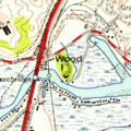
Wood Island, USGS map CA San Rafael 300201 1954 24000.png 250 × 250; 199 KB
-
Woodward Island (California).png 1,102 × 827; 1.31 MB


