Category:Josephine County, Oregon
Bước tới điều hướng
Bước tới tìm kiếm
Counties of Oregon: Baker · Benton · Clackamas · Clatsop · Columbia · Coos · Crook · Curry · Deschutes · Douglas · Gilliam · Grant · Harney · Hood River · Jackson · Jefferson · Josephine · Klamath · Lake · Lane · Lincoln · Linn · Malheur · Marion · Morrow · Multnomah · Polk · Sherman · Tillamook · Umatilla · Union · Wallowa · Wasco · Washington · Wheeler · Yamhill
county in Oregon, United States   | |||||
| Tải lên phương tiện | |||||
| Là một | |||||
|---|---|---|---|---|---|
| Vị trí | Oregon, Hoa Kỳ | ||||
| Trung tâm hành chính | |||||
| Ngày thành lập hoặc tạo ra |
| ||||
| Dân số |
| ||||
| Diện tích |
| ||||
| trang chủ chính thức | |||||
 | |||||
Thể loại con
Thể loại này có 32 thể loại con sau, trên tổng số 32 thể loại con.
B
C
G
- Grayback Mountain Trail (5 F)
I
- Illinois River (Oregon) (1 P, 48 F)
- Illinois River Road (Oregon) (28 F)
K
L
M
- Maps of Josephine County, Oregon (12 F)
- Minerals of Josephine Creek (2 F)
N
O
- O'Brien, Oregon (4 F)
R
- Red Buttes Wilderness (2 F)
- Rough and Ready Flat Botanical Area (1 P, 24 F)
S
- Savage Rapids Dam (3 F)
T
- T. J. Howell Botanical Drive (1 P, 97 F)
W
Tập tin trong thể loại “Josephine County, Oregon”
38 tập tin sau nằm trong thể loại này, trong tổng số 38 tập tin.
-
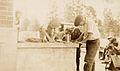 4-H farm mechanics club projects, Josephine County, ca. 1925 (5833595833).jpg 2.079×1.234; 238 kB
-
 Audubon's Warbler - Bolt Mountain, Josephine County, Oregon (14186207885).jpg 3.029×2.257; 2,45 MB
-
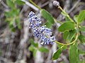 Blue wildflower - Illinois Valley Oregon.jpg 4.000×3.000; 4,54 MB
-
 Calochortus howellii (Howell's mariposa lily) (33171541356).jpg 3.375×2.436; 7,27 MB
-
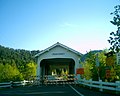 Closed for a fresh paint job - panoramio.jpg 1.280×1.024; 255 kB
-
 Darlingtonia small.jpg 200×277; 12 kB
-
 Elk in the Field - panoramio.jpg 2.048×1.360; 733 kB
-

-

-
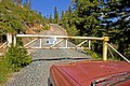 Forest Service Gate - panoramio.jpg 4.272×2.848; 5,86 MB
-
 Grayback Mountain Meadows - panoramio.jpg 4.320×3.240; 4,63 MB
-
 Grayback Mountain Meadows, Tiger Lillies - panoramio.jpg 4.320×3.240; 3,78 MB
-
 History of southern Oregon, comprising Jackson, Josephine, Douglas, Curry and Coos counties (IA historyofsouthe00wall).pdf 1.154 × 1.750, 818 trang; 75,55 MB
-
 Indian Mary 1.jpg 1.932×2.576; 1,34 MB
-
 Indian Mary 2.jpg 2.576×1.932; 1,3 MB
-
 Indian Mary 3.jpg 2.576×1.932; 1,24 MB
-
 Indian Mary Panorama.jpg 8.681×992; 4,54 MB
-
 John E. Ross - History of Southern Oregon.jpg 198×255; 53 kB
-

-
 Lake Selmac (15363886669).jpg 2.100×1.500; 3 MB
-

-
 Lewisa leeana - panoramio.jpg 1.024×682; 294 kB
-
 Oregon sheriff deputy 1939.jpg 804×605; 139 kB
-
 Pearsoll Peak.jpg 5.248×2.952; 7,69 MB
-
 Peavine Lookout.jpg 2.048×1.536; 1,58 MB
-
 Poultry, cooping chickens, Josephine County, circa 1926 (5834151686).jpg 1.814×3.180; 413 kB
-
 Raney falls fish ladder (LJ) - panoramio.jpg 1.433×966; 359 kB
-
 Raney falls fish ladder looking for a ride (LJ) - panoramio.jpg 1.433×893; 293 kB
-
 Red wildflower - Illinois Valley Oregon.jpg 4.000×3.000; 4,71 MB
-
 Road to be deactivated in years ahead - panoramio.jpg 2.144×1.424; 2,28 MB
-
 Silo, Vintage car, Josephine County (5833599521).jpg 4.284×2.466; 1,16 MB
-

-
 Stay Alive on I-5 (33420131176).jpg 978×699; 335 kB
-
 Sucker Creek channel beginning to change - panoramio.jpg 2.144×1.424; 2,03 MB
-
 Tailing pond along Sucker Creek - panoramio.jpg 2.144×1.424; 1,88 MB
-
 USA Josephine, Oregon age pyramid.svg 520×600; 7 kB
-
 Williams Country Store.jpg 3.264×2.448; 2,75 MB
-
 Zoshnaria - panoramio.jpg 4.272×2.848; 6,19 MB
.jpg)
.jpg)

_(33171541356).jpg)


_(6-14-2014)_4600-6100_ft,_fr_4812,_josephine_co,_oregon_(14413441570).jpg)


.jpg)
.jpg)


.jpg)
_-_panoramio.jpg)
_-_panoramio.jpg)


.jpg)
.jpg)
.jpg)


