Category:Kemble, Gloucestershire
Aller à la navigation
Aller à la recherche
village britannique  | |||||
| Téléverser des médias | |||||
| Nature de l’élément | |||||
|---|---|---|---|---|---|
| Lieu | Kemble and Ewen, Cotswold, Gloucestershire, Angleterre du Sud-Ouest, Angleterre | ||||
| Baigné par | |||||
| site officiel | |||||
 | |||||
Deutsch: Kemple ist ein Ort in Großbritannien in der Verwaltungseinheit (County) Gloucestershire. Der nächste größere Ort in ca. 6 Kilometer Entfernung ist Cirencester.
עברית: קמבל (Kemble) הוא כפר במחוז גלוסטרשייר, אנגליה. כפר זה נמצא מרחק של כששה קילומטרים ממוצאו של נהר התמזה.

Sous-catégories
Cette catégorie comprend 4 sous-catégories, dont les 4 ci-dessous.
K
- Kemble railway station (90 F)
- Kemble War Memorial (5 F)
M
- Kemble Methodist Church (3 F)
Média dans la catégorie « Kemble, Gloucestershire »
Cette catégorie comprend 368 fichiers, dont les 200 ci-dessous.
(page précédente) (page suivante)-
-
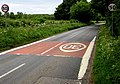
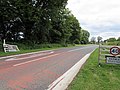
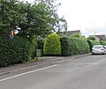
 30mph speed limit in Kemble - geograph.org.uk - 2857083.jpg 640 × 523 ; 118 kio
-
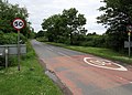
 40mph speed limit sign, Kemble - geograph.org.uk - 5503569.jpg 800 × 669 ; 117 kio
-
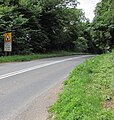
 A bend in the A429 NE of Kemble - geograph.org.uk - 3379919.jpg 640 × 480 ; 79 kio
-
 A small weir on the River Thames at Ewen - geograph.org.uk - 5345617.jpg 2 592 × 1 944 ; 2,07 Mio
-
 A train pulling out of Kemble - geograph.org.uk - 4808055.jpg 800 × 531 ; 106 kio
-
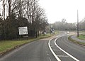
 A429 direction signs, Kemble - geograph.org.uk - 5420509.jpg 800 × 699 ; 150 kio
-

-
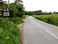
 A429 in Kemble - geograph.org.uk - 5420471.jpg 800 × 615 ; 92 kio
-
 A429 NE of Kemble - geograph.org.uk - 3379929.jpg 640 × 480 ; 91 kio
-
 A429 towards Kemble - geograph.org.uk - 6319495.jpg 800 × 600 ; 162 kio
-
 A429 towards Kemble - geograph.org.uk - 6319497.jpg 800 × 600 ; 106 kio
-
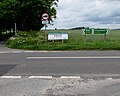 A433 direction signs near Cirencester - geograph.org.uk - 5618936.jpg 800 × 638 ; 126 kio
-
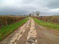
 Access road to Field Barn Farm near Kemble - geograph.org.uk - 5418099.jpg 800 × 546 ; 112 kio
-
-
 Aircraft at Cotswold Airport - geograph.org.uk - 4811000.jpg 800 × 531 ; 63 kio
-
 All Saints, Kemble - geograph.org.uk - 5458063.jpg 360 × 640 ; 52 kio
-
 All Saints, Kemble - geograph.org.uk - 5458153.jpg 640 × 360 ; 50 kio
-
 Appearances can be deceptive, Ewen - geograph.org.uk - 4525253.jpg 800 × 480 ; 101 kio
-
 Approaching a road junction - geograph.org.uk - 4808044.jpg 800 × 531 ; 97 kio
-
 Approaching Ewen on the Thames Path - geograph.org.uk - 5345591.jpg 2 592 × 1 944 ; 2,29 Mio
-
 Approaching Field Farm Barn - geograph.org.uk - 5749788.jpg 4 000 × 3 000 ; 4,66 Mio
-
 Approaching Kemble from the south - geograph.org.uk - 5091347.jpg 2 592 × 1 944 ; 1,85 Mio
-
 Arable field - geograph.org.uk - 4811063.jpg 800 × 531 ; 123 kio
-
 Arable land at Kemble Wick - geograph.org.uk - 5091352.jpg 2 592 × 1 944 ; 2,14 Mio
-
 Arable land near Kemble - geograph.org.uk - 2845357.jpg 1 024 × 680 ; 181 kio
-

-
 Barn at Home Farm Kemble - geograph.org.uk - 132480.jpg 640 × 480 ; 102 kio
-
 Bicycle racks on Kemble railway station - geograph.org.uk - 4526828.jpg 800 × 593 ; 205 kio
-
 Bridge over railway line near Jackaments Bottom - geograph.org.uk - 3815129.jpg 1 280 × 960 ; 1,11 Mio
-
 Bridge over railway line near Jackaments Bottom - geograph.org.uk - 3815131.jpg 1 280 × 960 ; 1,1 Mio
-
 Brooklands Farm barn, Ewen - geograph.org.uk - 4527480.jpg 800 × 447 ; 95 kio
-
 Brooklands Farm, Ewen - geograph.org.uk - 4527485.jpg 800 × 488 ; 90 kio
-
 Bungalow near Purlieu Farm - geograph.org.uk - 6319509.jpg 800 × 600 ; 178 kio
-
 Bus shelter, phonebox and litter bin, Kemble - geograph.org.uk - 5420526.jpg 800 × 600 ; 169 kio
-
 Cereal crop north of Ewen - geograph.org.uk - 6319507.jpg 800 × 600 ; 114 kio
-
 Chestnut horses grazing in a Kemble field - geograph.org.uk - 4527088.jpg 800 × 602 ; 165 kio
-
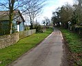
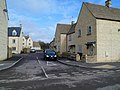
 Church Road, Kemble - geograph.org.uk - 3028626.jpg 1 600 × 1 200 ; 607 kio
-
 Church Road, Kemble - geograph.org.uk - 4526207.jpg 800 × 650 ; 117 kio
-
 Church Road, Kemble - geograph.org.uk - 5458164.jpg 640 × 360 ; 77 kio
-
 Churchyard view, Kemble - geograph.org.uk - 5458158.jpg 640 × 360 ; 88 kio
-
 Clayfurlong Barns, Kemble - geograph.org.uk - 5503565.jpg 800 × 541 ; 96 kio
-
 Clayfurlong Grove, Kemble - geograph.org.uk - 3379978.jpg 640 × 442 ; 64 kio
-
 Clayfurlong Grove, Kemble - geograph.org.uk - 4525306.jpg 800 × 521 ; 80 kio
-
 Clayfurlong House, Kemble - geograph.org.uk - 5503563.jpg 800 × 733 ; 180 kio
-
 Converted barn near Purlieu Farm - geograph.org.uk - 6319513.jpg 800 × 600 ; 203 kio
-
-
 Corner signpost in Kemble - geograph.org.uk - 4525985.jpg 800 × 512 ; 98 kio
-
 Cotswold Airport - geograph.org.uk - 4882916.jpg 1 600 × 1 066 ; 234 kio
-
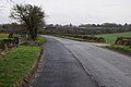
 Country road off the Fosse Way - geograph.org.uk - 4811442.jpg 1 024 × 680 ; 232 kio
-
 Countryside near Cirencester - geograph.org.uk - 5709204.jpg 640 × 427 ; 193 kio
-
 Course of Thames ^ Severn Canal near Smerrill Farm - geograph.org.uk - 5770026.jpg 4 000 × 3 000 ; 5,03 Mio
-
 Crocodile teeth markings on the A429, Kemble - geograph.org.uk - 5503571.jpg 800 × 752 ; 178 kio
-
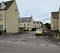
 Cross roads near Kemble (2) - geograph.org.uk - 3028577.jpg 1 600 × 1 200 ; 545 kio
-
 Crossroads in Kemble - geograph.org.uk - 3416738.jpg 640 × 460 ; 72 kio
-
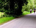
 Cycling out of Kemble - geograph.org.uk - 5417970.jpg 798 × 800 ; 169 kio
-
 Defibrillator in a former phonebox, Ewen - geograph.org.uk - 4525004.jpg 781 × 800 ; 274 kio
-

-
 Directions sign facing the A429 in Kemble - geograph.org.uk - 5420495.jpg 800 × 639 ; 100 kio
-
 Directions sign, Windmill Road, Kemble - geograph.org.uk - 4525387.jpg 800 × 652 ; 119 kio
-
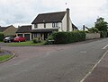
 Distinctive detached house in Kemble - geograph.org.uk - 4526173.jpg 800 × 745 ; 154 kio
-
 Disused railway bridge, Ewen Wharf - geograph.org.uk - 6319506.jpg 800 × 600 ; 155 kio
-
 Early 21st century houses, Kemble - geograph.org.uk - 5417043.jpg 800 × 757 ; 123 kio
-
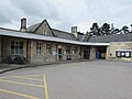 East entrance to Kemble railway station - geograph.org.uk - 5417221.jpg 800 × 600 ; 89 kio
-

-
 Eastern boundary of Kemble - geograph.org.uk - 4527085.jpg 800 × 761 ; 152 kio
-
 Eastern end of Clayfurlong Grove, Kemble - geograph.org.uk - 5420502.jpg 800 × 421 ; 70 kio
-
 Eastern end of Washpool Lane near Kemble - geograph.org.uk - 4527559.jpg 800 × 546 ; 106 kio
-
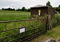 Electricity substation in a field, Ewen - geograph.org.uk - 4524853.jpg 800 × 566 ; 144 kio
-
-
 End of the Quiet Lane markers near Kemble - geograph.org.uk - 4527572.jpg 800 × 471 ; 93 kio
-
 Entering Ewen - geograph.org.uk - 6319510.jpg 800 × 600 ; 150 kio
-
 Entrance road to Field Barn Farm, Kemble - geograph.org.uk - 2856026.jpg 640 × 516 ; 87 kio
-
 Entrance to cemetery, Kemble - geograph.org.uk - 3028637.jpg 1 600 × 1 200 ; 583 kio
-
 Entrance to Kemble railway station car park - geograph.org.uk - 5417249.jpg 800 × 600 ; 97 kio
-

-
 Exit from Kemble railway station car park - geograph.org.uk - 5417243.jpg 738 × 800 ; 130 kio
-
 Farm drive at Kemble - geograph.org.uk - 4811462.jpg 800 × 531 ; 117 kio
-
 Farmland access track - geograph.org.uk - 6145471.jpg 1 024 × 683 ; 254 kio
-
 Farmland at Kemble - geograph.org.uk - 4811020.jpg 800 × 531 ; 97 kio
-
 Farmland beside Kemble Airport - geograph.org.uk - 4811014.jpg 800 × 531 ; 118 kio
-

-

-
 Fields and woods north of Kemble - geograph.org.uk - 5091317.jpg 2 592 × 1 944 ; 2,37 Mio
-
 Fields near Kemble - geograph.org.uk - 3008347.jpg 640 × 480 ; 99 kio
-
 Fields off the A429 - geograph.org.uk - 6319496.jpg 800 × 600 ; 93 kio
-
 Flooded road at Jackaments Bottom - geograph.org.uk - 3815139.jpg 1 280 × 960 ; 939 kio
-
 Footpath to Kemble - geograph.org.uk - 2200358.jpg 640 × 480 ; 66 kio
-
 Ford across the infant River Thames, near Kemble - geograph.org.uk - 3028099.jpg 1 600 × 1 200 ; 819 kio
-

-

-
 Former Methodist Church, Kemble - geograph.org.uk - 4527816.jpg 800 × 604 ; 198 kio
-
 Former railway line between Jackaments Bottom and Kemble - geograph.org.uk - 3814295.jpg 1 280 × 960 ; 1,19 Mio
-
 Former Telephone Exchange, Kemble - geograph.org.uk - 6108013.jpg 2 592 × 1 944 ; 1,41 Mio
-
-
 From 30 to 50 on the road to Ewen, Kemble - geograph.org.uk - 4527072.jpg 800 × 562 ; 132 kio
-
 From 30 to 50 west of Ewen - geograph.org.uk - 4524724.jpg 800 × 573 ; 128 kio
-
 G.W.R Jackaments Bottom Railway Bridge - geograph.org.uk - 3794970.jpg 1 280 × 960 ; 1 015 kio
-

-
 Gate to two way marked trails - geograph.org.uk - 4962627.jpg 1 024 × 768 ; 307 kio
-
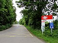
 Gateway to Kemble - geograph.org.uk - 3416733.jpg 640 × 452 ; 57 kio
-

-
 Gloucester train leaves Kemble station - geograph.org.uk - 5417204.jpg 800 × 659 ; 184 kio
-
 Grade II listed Kemble House, Kemble - geograph.org.uk - 2856980.jpg 640 × 464 ; 81 kio
-

-
 Grassland near Smerrill Farm - geograph.org.uk - 6319500.jpg 640 × 480 ; 67 kio
-
 Halfway Bridge, Thames ^ Severn Canal - geograph.org.uk - 5749021.jpg 640 × 480 ; 210 kio
-
 Hazardous route for a walker west of Kemble - geograph.org.uk - 4524525.jpg 800 × 789 ; 241 kio
-
 Hedge between two fields east of Kemble - geograph.org.uk - 2857150.jpg 640 × 426 ; 69 kio
-
 Horse-riding towards Ewen - geograph.org.uk - 4527417.jpg 800 × 636 ; 184 kio
-

-
 Infant River Thames near Thames Head Gloucestershire - geograph.org.uk - 3815177.jpg 1 280 × 960 ; 910 kio
-
 Infant River Thames, Ewen - geograph.org.uk - 4527346.jpg 800 × 598 ; 155 kio
-
 Infant Thames near Ewen - geograph.org.uk - 4527138.jpg 800 × 600 ; 276 kio
-
 Jackaments Bottom railway bridge - geograph.org.uk - 3794976.jpg 1 280 × 960 ; 1,04 Mio
-
 Jumbo Jet at Kemble - geograph.org.uk - 2154882.jpg 1 024 × 686 ; 155 kio
-
 Junction of the A429 and West Lane, Kemble - geograph.org.uk - 5420501.jpg 800 × 639 ; 117 kio
-
 Juvenile Thames near Kemble - geograph.org.uk - 706196.jpg 640 × 480 ; 143 kio
-
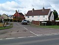
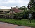
 Overlooking Kemble Village - geograph.org.uk - 150190.jpg 640 × 426 ; 85 kio
-
 Kemble , Washpool Lane is a Quiet Lane - geograph.org.uk - 2857047.jpg 612 × 640 ; 110 kio
-
 Kemble - geograph.org.uk - 2144156.jpg 640 × 428 ; 74 kio
-
 Kemble - Goodbye Kiss - geograph.org.uk - 3766774.jpg 1 600 × 688 ; 196 kio
-
-
 Kemble Airport - geograph.org.uk - 4066793.jpg 3 648 × 2 736 ; 3,61 Mio
-
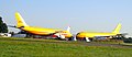
 Kemble airport - old airliners for scrapping - geograph.org.uk - 5333892.jpg 1 600 × 1 067 ; 230 kio
-
 Kemble and District playgroup - geograph.org.uk - 4526231.jpg 800 × 727 ; 153 kio
-
 Kemble direction signs - geograph.org.uk - 4525885.jpg 800 × 634 ; 119 kio
-
 Kemble graveyard - geograph.org.uk - 2856942.jpg 640 × 480 ; 90 kio
-
 Kemble graveyard lych gate - geograph.org.uk - 2856948.jpg 640 × 480 ; 78 kio
-
 Kemble Overbridge, Kemble - geograph.org.uk - 5417140.jpg 800 × 709 ; 138 kio
-
 Kemble Primary School - geograph.org.uk - 2856533.jpg 640 × 453 ; 75 kio
-
 Kemble rail tunnel - geograph.org.uk - 368401.jpg 640 × 480 ; 82 kio
-
-
 Kemble railway station approach - geograph.org.uk - 4526889.jpg 800 × 468 ; 96 kio
-
 Kemble railway station car park ahead - geograph.org.uk - 4525933.jpg 800 × 498 ; 84 kio
-

-
 Kemble railway station from Station Road bridge - geograph.org.uk - 4528097.jpg 800 × 669 ; 191 kio
-
 Kemble railway station garden - geograph.org.uk - 4526841.jpg 800 × 618 ; 201 kio
-
 Kemble railway station main car park - geograph.org.uk - 4526896.jpg 800 × 600 ; 136 kio
-

-
 Kemble railway station platform 1 - geograph.org.uk - 4528100.jpg 800 × 655 ; 148 kio
-
 Kemble railway station taxis - geograph.org.uk - 4526887.jpg 800 × 519 ; 122 kio
-
 Kemble Sewage Pumping Station - geograph.org.uk - 4527169.jpg 800 × 565 ; 180 kio
-
 Kemble Station - geograph.org.uk - 5955854.jpg 640 × 480 ; 97 kio
-
 Kemble Station and Footbridge - geograph.org.uk - 5955855.jpg 640 × 480 ; 85 kio
-
 Kemble Station Looking Northwards - geograph.org.uk - 5955853.jpg 640 × 480 ; 69 kio
-
 Kemble Stores and post office, Kemble - geograph.org.uk - 4525310.jpg 800 × 500 ; 97 kio
-
 Kemble Telephone Exchange - geograph.org.uk - 4524438.jpg 800 × 511 ; 86 kio
-
 Kemble Telephone Exchange, Glos - geograph.org.uk - 6108033.jpg 2 592 × 1 944 ; 1,4 Mio
-
 Kemble Tunnel - geograph.org.uk - 1566381.jpg 640 × 416 ; 65 kio
-
 Kemble Tunnel - geograph.org.uk - 1566382.jpg 640 × 427 ; 68 kio
-
 Kemble Tunnel - geograph.org.uk - 4528096.jpg 613 × 800 ; 191 kio
-
 Kemble Tunnel Entrance - geograph.org.uk - 5955858.jpg 640 × 480 ; 80 kio
-
 Kemble Village Hall - geograph.org.uk - 2856936.jpg 640 × 442 ; 70 kio
-
 Kemble Village Hall - geograph.org.uk - 4525449.jpg 800 × 701 ; 143 kio
-
 Kemble Wick - geograph.org.uk - 4808568.jpg 1 024 × 680 ; 277 kio
-
 Kemble, farm entrance - geograph.org.uk - 2098299.jpg 1 024 × 768 ; 310 kio
-
 Kemble, Jackaments Bottom - geograph.org.uk - 2098311.jpg 1 024 × 768 ; 163 kio
-
 Kemble, postbox № GL7 85, Windmill Road - geograph.org.uk - 3268859.jpg 480 × 640 ; 120 kio
-
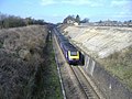
 Kemble, railway lines - geograph.org.uk - 2097574.jpg 1 024 × 768 ; 227 kio
-
 Kemble, the stores and post office - geograph.org.uk - 3268855.jpg 640 × 480 ; 61 kio
-
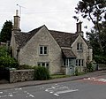
 Kemble, The Tavern - geograph.org.uk - 2097368.jpg 1 024 × 758 ; 137 kio
-
 Kemblewood House, Kemble - geograph.org.uk - 2856997.jpg 640 × 406 ; 67 kio
-
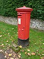
 King George V pillarbox, Windmill Road, Kemble - geograph.org.uk - 5416972.jpg 656 × 800 ; 155 kio
-

-

-
-
-

-
 Mill Farm, Ewen - geograph.org.uk - 4524735.jpg 800 × 546 ; 133 kio
-
 Millennium Seat, Ewen - geograph.org.uk - 4524718.jpg 800 × 646 ; 132 kio
-
 Minor road from Kemble reaches the A433 - geograph.org.uk - 5618927.jpg 800 × 606 ; 117 kio
-
 Minor road to Ewen under disused Cirencester branch rail overbridge - geograph.org.uk - 5748931.jpg 4 000 × 3 000 ; 5,24 Mio
-
 Minor road to Kemble, Gloucestershire - geograph.org.uk - 5619019.jpg 800 × 549 ; 82 kio
-
 Minor road to Smerrill Farm - geograph.org.uk - 4955588.jpg 4 000 × 3 000 ; 4,75 Mio
-
 Minor road towards Ewen - geograph.org.uk - 6319508.jpg 800 × 600 ; 120 kio
-
 Minor road towards South Cerney - geograph.org.uk - 6319515.jpg 800 × 600 ; 87 kio
-
 Modern houses in Station Road, Kemble - geograph.org.uk - 4525864.jpg 800 × 752 ; 128 kio
-
 Nave and chancel in All Saints, Kemble - geograph.org.uk - 5458029.jpg 640 × 360 ; 68 kio
-
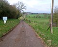
 NE boundary of Kemble - geograph.org.uk - 3379937.jpg 640 × 423 ; 89 kio
-
 No cold calling area, Windmill Road, Kemble - geograph.org.uk - 4525314.jpg 800 × 632 ; 199 kio
-
 No parking zone, Station Road, Kemble - geograph.org.uk - 4524646.jpg 791 × 800 ; 143 kio
-
 No pavements for half a mile ahead near Kemble - geograph.org.uk - 4527103.jpg 800 × 600 ; 120 kio
-
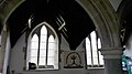 North aisle in All Saints, Kemble - geograph.org.uk - 5458084.jpg 640 × 360 ; 44 kio
-
 North side of All Saints, Kemble - geograph.org.uk - 5458134.jpg 640 × 360 ; 106 kio
-
 North transept chapel in All Saints, Kemble - geograph.org.uk - 5458093.jpg 360 × 640 ; 43 kio
-
 Northern boundary of Kemble - geograph.org.uk - 4524378.jpg 800 × 676 ; 148 kio
-
 Old Manor Gardens, Kemble - geograph.org.uk - 2856243.jpg 640 × 480 ; 69 kio
-
 Old Manor Gardens, Kemble - geograph.org.uk - 5417027.jpg 800 × 715 ; 115 kio
-
 Old Vicarage Lane, Kemble - geograph.org.uk - 2856975.jpg 640 × 579 ; 125 kio
-
 Older part of Kemble Primary School - geograph.org.uk - 4526247.jpg 800 × 621 ; 113 kio
-
 On the upper Thames - geograph.org.uk - 5091302.jpg 2 592 × 1 944 ; 1,85 Mio
-
-
 One-way system near Kemble railway station - geograph.org.uk - 4526912.jpg 800 × 538 ; 101 kio
-
 Oops you missed us, Tavern Inn, Kemble - geograph.org.uk - 4524541.jpg 695 × 800 ; 166 kio
-

-
 Ordnance Survey Cut Mark - geograph.org.uk - 4548855.jpg 480 × 640 ; 110 kio
-
 Ordnance Survey Flush Bracket S8367 - geograph.org.uk - 3373160.jpg 4 000 × 3 000 ; 3,52 Mio
-

-
 Patchy surface on Station Road, Kemble - geograph.org.uk - 4524659.jpg 800 × 697 ; 193 kio


_-_geograph.org.uk_-_3028577.jpg)


