Category:Kerkstraat 76, Cadier en Keer
Jump to navigation
Jump to search
| Object location | | View all coordinates using: OpenStreetMap |
|---|
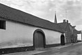
building in Cadier en Keer, Netherlands  | |||||
| Upload media | |||||
| Instance of | |||||
|---|---|---|---|---|---|
| Location | Cadier en Keer, Eijsden-Margraten, Limburg, Netherlands | ||||
| Street address |
| ||||
| Located on street |
| ||||
| Heritage designation |
| ||||
 | |||||
|
This is a category about rijksmonument number 34654
|
| Address |
|
Media in category "Kerkstraat 76, Cadier en Keer"
The following 2 files are in this category, out of 2 total.
-
 Aanzicht - Cadier en Keer - 20046352 - RCE.jpg 1,200 × 810; 137 KB
-
 Cadier en Keer-Kerkstraat 76.JPG 4,000 × 3,000; 4.84 MB
