Category:King's Lynn
Pergi ke pandu arah
Pergi ke carian
market town in the county of Norfolk, England  | |||||
| Muat naik media | |||||
| Contoh |
| ||||
|---|---|---|---|---|---|
| Lokasi | King's Lynn and West Norfolk, Norfolk, East of England, England | ||||
| Terletak di atau berdekatan dengan jasad air | |||||
| Jumlah penduduk |
| ||||
| Keluasan |
| ||||
| tapak web rasmi | |||||
 | |||||
English: King's Lynn is a town and port in the English county of Norfolk. Over the years, the town has been known variously as Bishop's Lynn and Lynn Regis; to local people it is simply Lynn.
Subkategori
Yang berikut ialah 24 daripada 24 buah subkategori dalam kategori ini.
*
- Fairstead, Norfolk (4 F)
A
B
C
- Coats of arms of King's Lynn (2 F)
E
- Environs of King's Lynn (50 F)
M
N
O
P
R
S
T
U
- Urban decay in King's Lynn (4 F)
V
- Views of King's Lynn (27 F)
Media-media dalam kategori "King's Lynn"
Yang berikut ialah 108 daripada 108 buah fail dalam kategori ini.
-
 Air raid shelter - geograph.org.uk - 4296851.jpg 1,200 × 1,600; 842 KB
-
 Bawsey Drain in North Lynn - geograph.org.uk - 4276967.jpg 1,600 × 1,208; 549 KB
-
 Between the bridges over West Lynn Drain - geograph.org.uk - 1605527.jpg 640 × 480; 110 KB
-
 Bus on Wisbech Road - geograph.org.uk - 4727689.jpg 640 × 480; 51 KB
-

-
 Chemical works and solar panels - geograph.org.uk - 4254836.jpg 1,600 × 1,109; 406 KB
-
 Edward Benefer Way in King's Lynn - geograph.org.uk - 4277158.jpg 1,600 × 1,228; 379 KB
-
 Edward Benefer Way looking north - geograph.org.uk - 3616470.jpg 640 × 480; 46 KB
-
 Greeting Card (8528448535).jpg 1,160 × 1,402; 741 KB
-
 Hanseatic chest, King's Lynn Minster - geograph.org.uk - 5288100.jpg 4,272 × 2,848; 4.55 MB
-
 Hatch, King's Lynn.jpg 2,502 × 1,811; 2.18 MB
-
 Horses next to Bawsey Drain in North Lynn - geograph.org.uk - 4276982.jpg 1,600 × 1,275; 630 KB
-
 Horseshoe Hole Farm track - geograph.org.uk - 1506450.jpg 640 × 480; 49 KB
-
 Horsley's Fields, King's Lynn - geograph.org.uk - 4627622.jpg 640 × 480; 343 KB
-
 Information Board, King's Lynn Minster, Norfolk - geograph.org.uk - 3724003.jpg 1,024 × 683; 834 KB
-

-

-
 King's Lynn 01.jpg 2,048 × 1,536; 1.43 MB
-
 King's Lynn 02.jpg 2,048 × 1,536; 1.51 MB
-
 King's Lynn 03.jpg 2,048 × 1,536; 1.54 MB
-
 King's Lynn 04.jpg 2,048 × 1,536; 1.49 MB
-
 King's Lynn 07.jpg 2,048 × 1,536; 1.3 MB
-
 King's Lynn 08.jpg 2,048 × 1,536; 1.25 MB
-
 King's Lynn 11.jpg 2,048 × 1,536; 1.5 MB
-
 King's Lynn 13.jpg 1,536 × 2,048; 1.68 MB
-
 King's Lynn 17.jpg 2,048 × 1,536; 1.43 MB
-
 King's Lynn 18.jpg 2,048 × 1,536; 1.56 MB
-
 King's Lynn 19.jpg 2,048 × 1,536; 1.5 MB
-
 King's Lynn 20.jpg 1,479 × 1,536; 471 KB
-
 King's Lynn 21.jpg 1,536 × 2,048; 1.59 MB
-
 King's Lynn 22.jpg 1,536 × 2,048; 1.54 MB
-
 King's Lynn 23.jpg 1,522 × 1,526; 481 KB
-
 King's Lynn 24.jpg 2,048 × 1,536; 1.56 MB
-
 King's Lynn 25.jpg 2,048 × 1,536; 1.32 MB
-
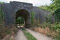
 King's Lynn to Dereham Railway Bridge Between Narborough and Swaffham 1.jpg 7,360 × 4,912; 10.18 MB
-
 King's Lynn to Dereham Railway Bridge Between Narborough and Swaffham 2.jpg 7,360 × 4,912; 10.67 MB
-
 King's Lynn to Dereham Railway Bridge Between Narborough and Swaffham 3.jpg 7,360 × 4,912; 11.79 MB
-
 King's Lynn to Dereham Railway Bridge Between Narborough and Swaffham 4.jpg 7,360 × 4,912; 9.99 MB
-
 King's Lynn to Dereham Railway Bridge Between Narborough and Swaffham 5.jpg 7,360 × 4,912; 9.79 MB
-
 King's Lynn to Dereham Railway Bridge Between Narborough and Swaffham 6.jpg 7,360 × 4,912; 12.45 MB
-
 King's Lynn to Dereham Railway Bridge Between Narborough and Swaffham 7.jpg 7,360 × 4,912; 12.15 MB
-
 King's Lynn to Dereham Railway Bridge Between Narborough and Swaffham 8.jpg 7,360 × 4,912; 9.76 MB
-
 King's Lynn to Dereham Railway Bridge Between Narborough and Swaffham 9.jpg 7,360 × 4,912; 9.77 MB
-
 King's Lynn to Dereham Railway Bridge, Narborough Walk 3.jpg 7,360 × 4,912; 11.99 MB
-
 King's Lynn to Dereham Railway Bridge, Narborough Walk 4.jpg 7,360 × 4,912; 10.77 MB
-
 King's Lynn to Dereham Railway Bridge, Narborough Walk 5.jpg 6,640 × 4,431; 7.31 MB
-
 King's Lynn to Dereham Railway Bridge, Narborough Walk.jpg 7,360 × 4,912; 12 MB
-
 King's Lynn to Dereham Railway Bridge,Narborough Walk 2.jpg 7,360 × 4,912; 9.32 MB
-
 King's Lynn to Dereham Railway Bridge,Narborough Walk 6.jpg 7,360 × 4,912; 10.13 MB
-
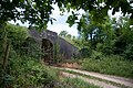
 King's Lynn To Dereham Railway Buttress & Track Bed.jpg 7,360 × 4,912; 15.15 MB
-
 King's Lynn To Dereham Railway Buttress Narborough railway walk 2.jpg 7,360 × 4,912; 14.42 MB
-
 King's Lynn To Dereham Railway Buttress Narborough railway walk.jpg 7,360 × 4,912; 14.34 MB
-
 King's Lynn To Dereham Railway Track Bed and Bridge Buttress.jpg 7,360 × 4,912; 8.89 MB
-
 King's Lynn, Loke Road - geograph.org.uk - 4627177.jpg 640 × 480; 407 KB
-
 King's Lynn, Norfolk Street - geograph.org.uk - 4627341.jpg 640 × 480; 424 KB
-
 King's Lynn, Norfolk, 1981 - 49923269118.jpg 1,024 × 683; 239 KB
-
 King's Lynn, Norfolk, 1981 - 49923269503.jpg 981 × 655; 241 KB
-
 King's Lynn, Norfolk, 1981 - 49923269548.jpg 1,024 × 683; 221 KB
-
 King's Lynn, Norfolk, 1981 - 49923269623.jpg 991 × 661; 273 KB
-
 King's Lynn, Norfolk, 1981 - 49923269708.jpg 683 × 1,024; 226 KB
-
 King's Lynn, Norfolk, 1981 - 49923787911.jpg 1,024 × 683; 341 KB
-
 King's Lynn, Norfolk, 1981 - 49923788366.jpg 1,024 × 683; 224 KB
-
 King's Lynn, Norfolk, 1981 - 49923788461.jpg 1,024 × 683; 274 KB
-
 King's Lynn, Norfolk, 1981 - 49924094922.jpg 1,024 × 683; 315 KB
-
 King's Lynn, Norfolk, 1981 - 49924094947.jpg 1,024 × 683; 323 KB
-
 King's Lynn, Norfolk, 1981 - 49924095337.jpg 1,024 × 699; 232 KB
-
 King's Lynn, Norfolk, 1981 - 49924095367.jpg 683 × 1,024; 277 KB
-
 King's Lynn, Norfolk, 1981 - 49924095667.jpg 1,024 × 683; 231 KB
-
 King's Lynn, Norfolk, 1981 - 49924095687.jpg 1,024 × 683; 241 KB
-
 King's Lynn, Norfolk, 1981.jpg 1,024 × 683; 255 KB
-
 King's Lynn, Purfleet Street and the Custom House - geograph.org.uk - 3689521.jpg 1,024 × 1,024; 1.24 MB
-
 Kings Lynn Biosolids Treatment Centre - geograph.org.uk - 3598405.jpg 3,060 × 2,208; 2.29 MB
-
 Kings Lynn Wastewater Treatment Works - geograph.org.uk - 3598401.jpg 4,000 × 3,000; 4.07 MB
-
 Looking into Purfleet Place - geograph.org.uk - 4659865.jpg 1,600 × 1,200; 356 KB
-
 Losinga Road in North Lynn - geograph.org.uk - 4277091.jpg 1,600 × 1,200; 377 KB
-
 Low Road west of West Winch - geograph.org.uk - 2229644.jpg 640 × 480; 92 KB
-
 Lynnsport station - geograph.org.uk - 1998802.jpg 2,848 × 2,136; 3.17 MB
-
 Mail office, King's Lynn - geograph.org.uk - 3835904.jpg 3,872 × 2,592; 3.53 MB
-
 Market Street, King's Lynn - geograph.org.uk - 4670376.jpg 2,560 × 1,920; 966 KB
-
 Marketplace sign - geograph.org.uk - 4296894.jpg 1,200 × 1,600; 433 KB
-
 Museum and bus station - geograph.org.uk - 480144.jpg 640 × 549; 98 KB
-
 Narrowboat Kings Lynn.jpg 3,648 × 2,736; 4.68 MB
-
 Norfolk County Council grit store - geograph.org.uk - 3643601.jpg 3,108 × 2,392; 1.85 MB
-
 North Lynn Industrial Estate - geograph.org.uk - 4627166.jpg 640 × 427; 348 KB
-
 Park, King's Lynn - geograph.org.uk - 4727780.jpg 640 × 480; 75 KB
-
 Peddlars Hall, King's Lynn bus station - geograph.org.uk - 4670380.jpg 2,560 × 1,920; 1.12 MB
-
 Petroleum depot, King's Lynn. - geograph.org.uk - 188371.jpg 640 × 480; 60 KB
-
 Pond at Lynnsport - geograph.org.uk - 1998707.jpg 2,848 × 2,136; 3.06 MB
-
 Postbox along Gayton Road in King's Lynn - geograph.org.uk - 4255161.jpg 1,600 × 1,211; 725 KB
-
 Purfleet Place, King's Lynn - geograph.org.uk - 3076485.jpg 640 × 427; 63 KB
-
 Purfleet Place, King's Lynn - geograph.org.uk - 3076508.jpg 640 × 427; 76 KB
-
 Rusty buoy on the quay, King's Lynn - geograph.org.uk - 3573964.jpg 4,320 × 3,240; 5.2 MB
-
 Savage's Gallopers - geograph.org.uk - 4658967.jpg 1,600 × 1,064; 441 KB
-
 The Globe Hotel on Ferry Street - geograph.org.uk - 3064549.jpg 1,500 × 1,000; 142 KB
-
 The Military Museum - Millfleet - geograph.org.uk - 4659269.jpg 1,600 × 1,200; 367 KB
-
 Towards King's Lynn Minster, Norfolk - geograph.org.uk - 5368443.jpg 3,000 × 4,000; 2.84 MB
-
 Towards St Nicholas, King's Lynn, Norfolk - geograph.org.uk - 1921651.jpg 1,000 × 709; 282 KB
-
 Vintage Mobile Cinema - geograph.org.uk - 4658853.jpg 1,600 × 1,200; 379 KB
-
 Waterloo Street, King's Lynn - geograph.org.uk - 4670409.jpg 2,560 × 1,920; 1,015 KB
-
 Waterloo Street, King's Lynn - geograph.org.uk - 4727796.jpg 640 × 480; 56 KB
-
 West along Gayton Road in Gaywood - geograph.org.uk - 4259432.jpg 1,600 × 1,346; 406 KB
-

-
 Fen End Garage - geograph.org.uk - 146825.jpg 640 × 425; 57 KB
-
 King's Staithe Square - geograph.org.uk - 480186.jpg 640 × 337; 91 KB
-
 King's Staithe Square, King's Lynn - geograph.org.uk - 965706.jpg 640 × 400; 138 KB
-
 New Buildings with radio masts - geograph.org.uk - 283564.jpg 640 × 427; 48 KB
-
 North Lynn Pumping Station - geograph.org.uk - 565001.jpg 640 × 480; 93 KB
-
 Pumping station waterway - geograph.org.uk - 680359.jpg 480 × 640; 97 KB


.jpg)


